Subtropical Storm Alberto Nears the Panhandle

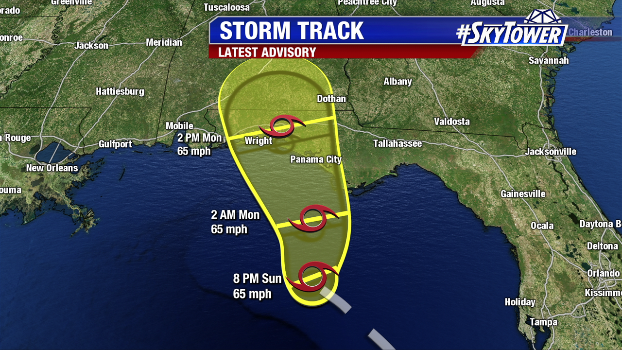
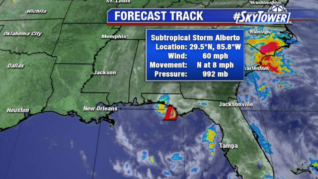
Subtropical storm Alberto is nearing the coast of the Florida Panhandle. The storm has sustained winds of 60mph and will steadily weaken as it moves inland. It will track north through Alabama Tuesday and move into the Tennessee Valley as a remnant low.

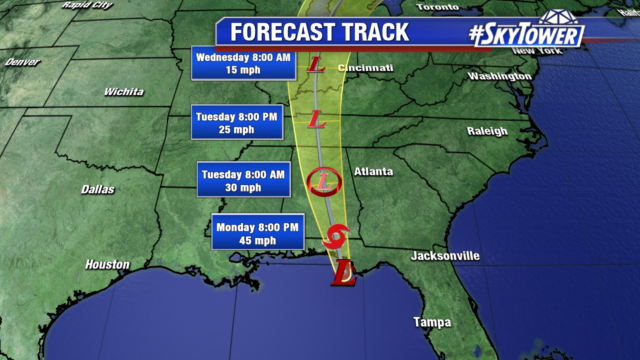
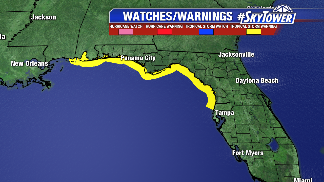
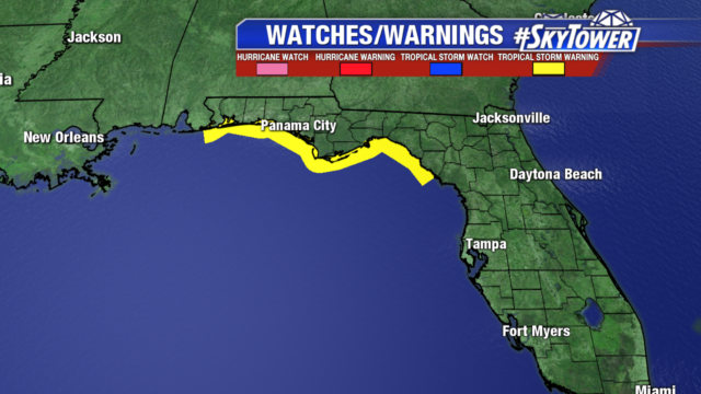
Convection has already moved inland so strengthening is not expected. Tropical Storm Warnings are in effect along the northern Gulf Coast. Heavy rainfall as Alberto moves north could cause flash flooding along its path.

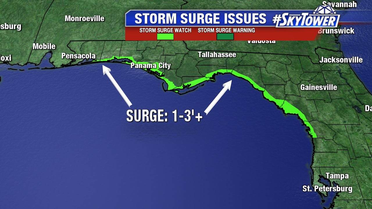
Drier air has briefly moved in aloft over Tampa and will keep rain scattered in nature for the rest of our Memorial Day. Alberto continues to generate rough seas, a small craft advisory is in effect and boating is discouraged. Use caution on area beaches as the danger of rip currents remains high through Tuesday.

Alberto Set To Make Landfall In Florida Panhandle On Monday

At 8pm Sunday, the center of Alberto was located about 100 miles south-southwest of Apalachicola, FL. Max sustained winds were at 65 mph, with gusts up to hurricane-force (74 mph). The National Hurricane Center expects Alberto to stay near its current intensity all the way through landfall on Monday morning.

WIND: Tropical Storm force winds can be expected across nearly the entire Florida Panhandle late Sunday night through Monday afternoon.

RAINFALL: The Florida Panhandle into much Alabama and western Georgia… 4-8″, isolated amounts up to 12″.

STORM SURGE: Along the North Florida Gulf Coast, storm surge will be on the order of 1-3’+. A storm surge watch is in effect from Crystal River to Navarre, FL.

TORNADOES: A few tornadoes are possible across the Florida Panhandle, SE Alabama, and SW Georgia late Sunday night through Monday afternoon.