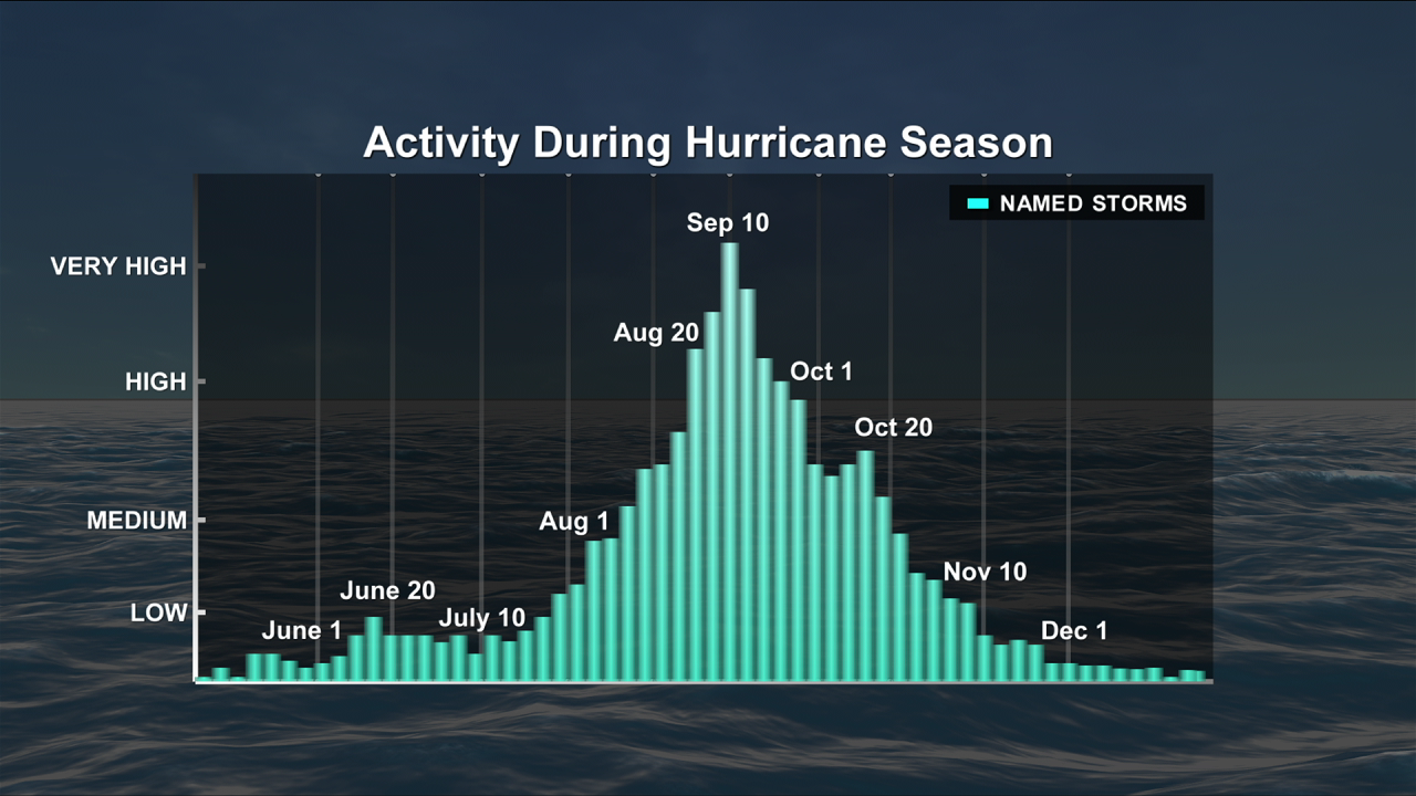
Hurricane season is on the downswing. You never want to let your guard down, but the end is in sight. In terms of tropical activity, only about 11% of named storms have formed after October 20th.
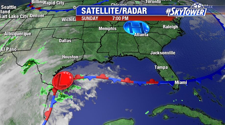
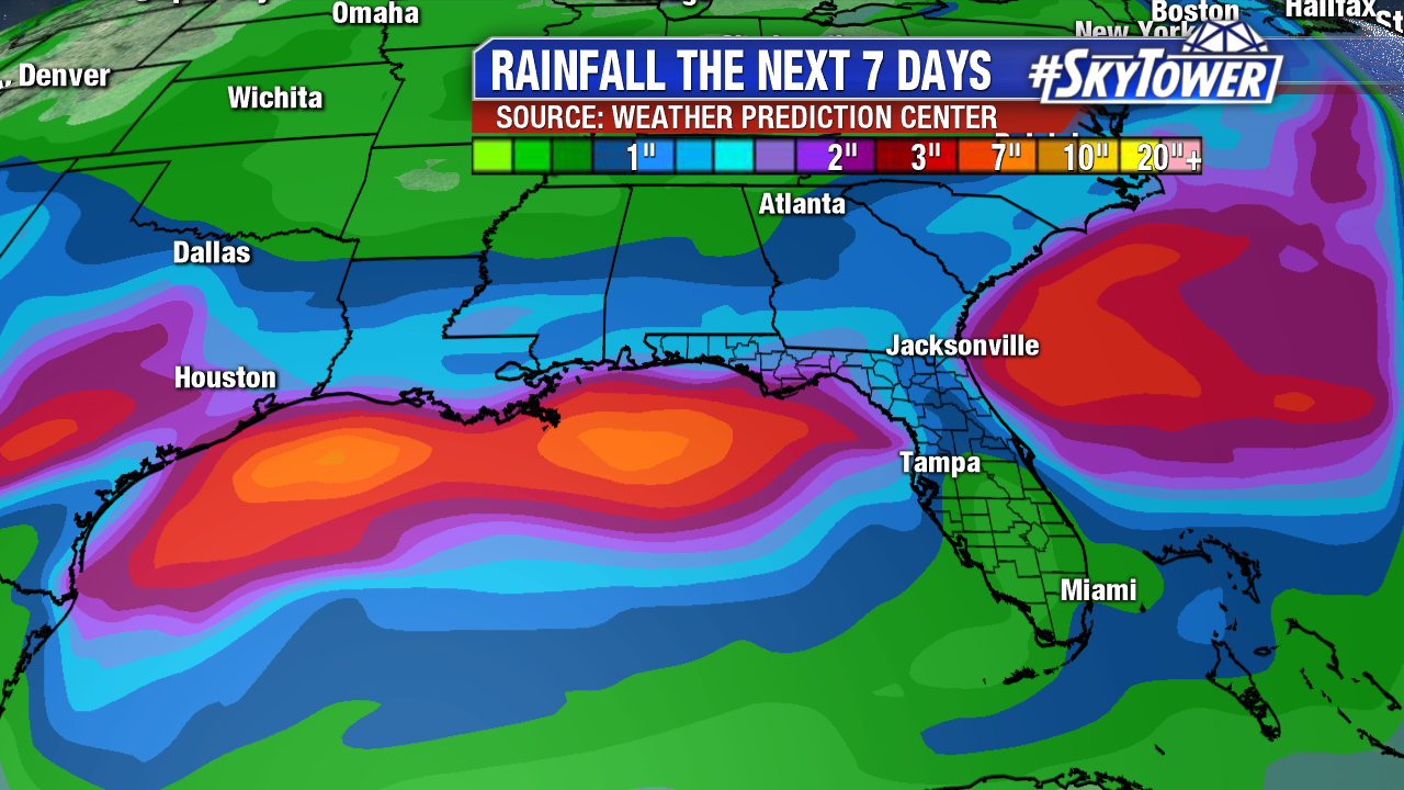
There isn’t much to speak of across the Atlantic basin right now. If there is one area to watch this week, it’ll be the western Gulf of Mexico. There is a non-tropical area of low pressure developing on the tail end of a cold front that has moved through the Southeast this weekend. This will be heading east this week bringing increased rain chances to parts of the Southeast and Florida late in the week into next weekend. This is of most concern for areas hard hit by Hurricane Michael, where recovery efforts are still ongoing. However it plays out, things will be clearing up across the region later next weekend.