Barry a Possibility in the Bay of Campeche; Heavy Rain Threat for Eastern Mexico

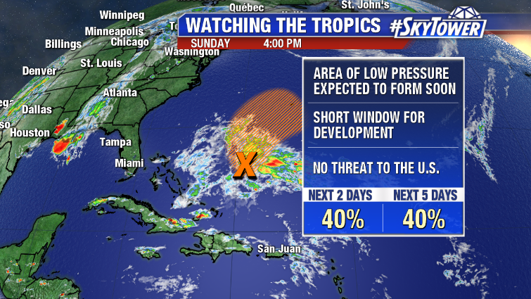
The 2019 Hurricane season is off to quick start. First a short-lived Andrea a little over a week ago, and now the possibility of Barry forming right as the season officially gets underway.

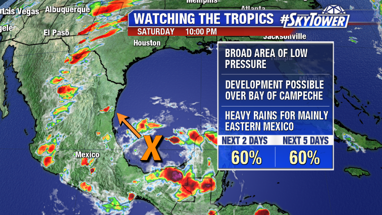
What we’re watching is a disorganized area of showers and storms in the Bay of Campeche. Thanks to the ridge parked over the Gulf, this really isn’t a threat to the U.S. However, it will bring periods of heavy rain to eastern Mexico over the next few days regardless of whether or not a storm forms. Some of this rain may spill over into southern Texas by mid-week – which could actually be beneficial in areas with a minor drought ongoing.

Hurricane hunters will be investigating this area on Sunday, if necessary.

Early Start to Hurricane Season? Perhaps, but no Threat to U.S.

We’ve been watching an area of disturbed weather east of the Bahamas over the last few days. This area is actually being caused by the remnants of a cold front that moved through Florida last week. A weak low should form over the next 24 hours, but the window for tropical or sub-tropical development will be very short – not more than a day or two – before environmental conditions become unfavorable. Limited development, if any, is expected.

Expect a north-northeast motion toward Bermuda early in the week. There is no threat to the U.S., but Bermuda will have some wind and rain around Tuesday into Wednesday.

The Atlantic hurricane season will officially start on June 1. The National Hurricane Center will release their outlook for the season this coming Thursday, May 23.