One Month Down: Staying Quiet In The Atlantic For Now

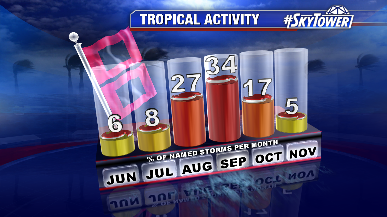
The Atlantic has been quiet ever since hurricane season began on June 1, and it looks to be staying that way as we head into July.

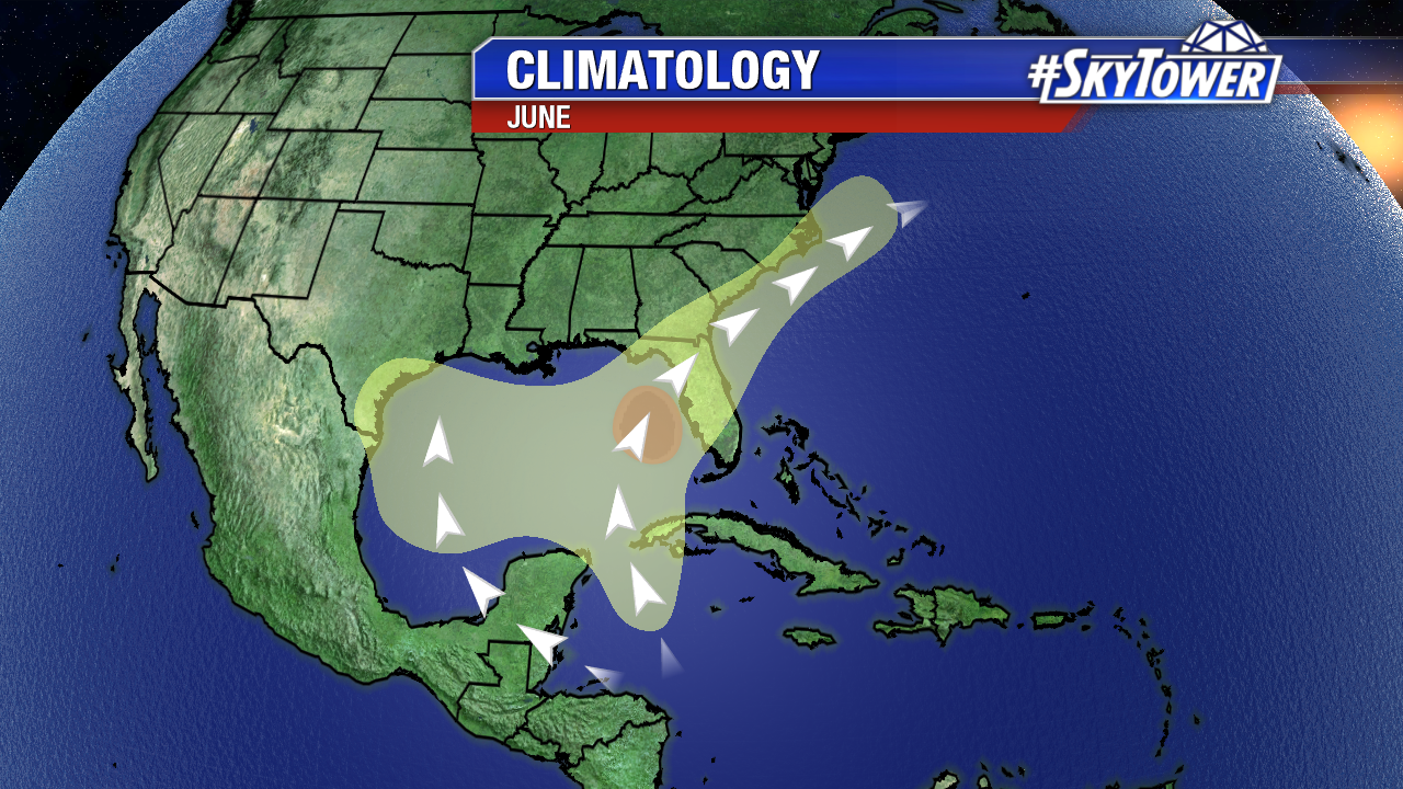
The typical breeding ground early in the season is the Gulf of Mexico and Western Caribbean. It’s usually a quiet month, but activity has been even further suppressed by persistent moderate to high levels of wind shear (25-50 kts) across these areas – making it tough for anything to get organized.

Courtesy: TropicalTidbits.com

There has also been a vast Saharan Air Layer (Dust off Northern Africa) in place across the Atlantic. At times we’ve had pockets of this dust and dry airĀ  move over the Caribbean and Gulf. It makes for some vibrant sunsets, but creates a hostile environment for tropical development.

Courtesy: CIMSS / University of Wisconsin – Madison

Long-range model runs are showing no areas of concern in the Atlantic for at least the next 7-10 days.

One Week Down: Early-Season Check on the Atlantic

A couple blips on the radar so to speak in the young 2019 hurricane season. A short-lived Andrea back in mid-May, and a minimal threat in the western Gulf this past week that never materialized. So far, so good.

June is usually a quiet month for us. In fact, about half of all Junes since modern weather records began (1950) have not had any named storms form. Overall, June has accounted for only 6% of named storms on record.

Storms that do form early in the season are usually weaker, but there have been four June hurricanes to make landfall in the U.S. since 1950 – the most recent being Hurricane Bonnie in 1986. The takeaway? June hurricanes are rare, but not unprecedented. There’s a reason we want you to be prepared before the start of hurricane season.

While things are quiet at the moment, below is a look at the regular June formation zones. As usual, we’ll be here with you all season long.