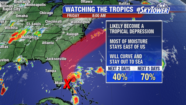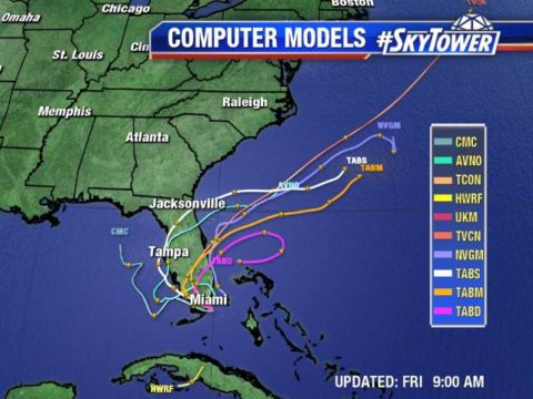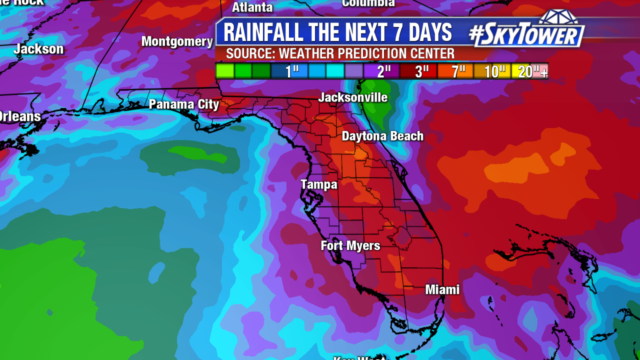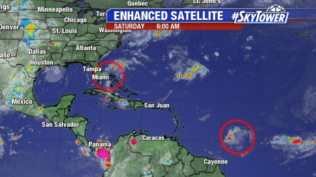
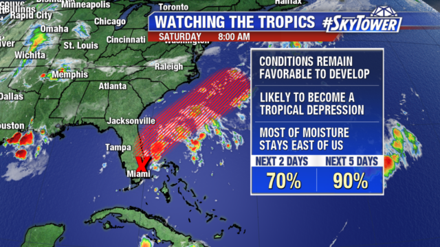
The tropics are waking up and we are now watching 2 waves. The first tropical low sits in southern Florida, bringing heavy rain to the Northwest Bahamas & parts of Florida’s east coast. You can see the convection associated with the low is disorganized and focused on its east side.
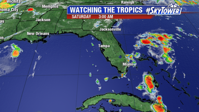
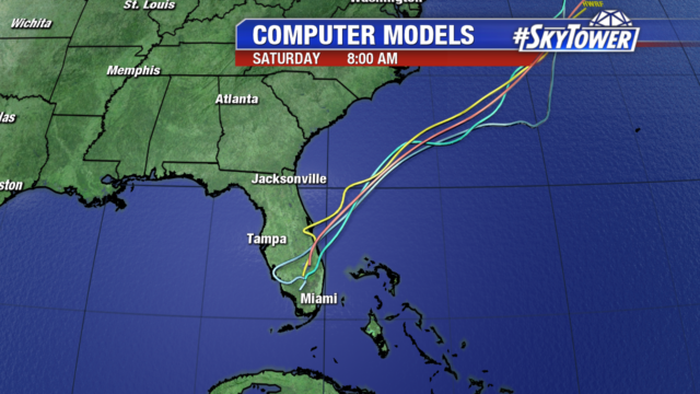
The low will move north over the Florida peninsula through today, limiting its development. By Sunday into Monday it turns northeast out into the Atlantic and has a 90% chance of becoming a tropical or subtropical depression early next week.
Models are in good agreement taking the low out over the Atlantic as a front moves off the East Coast. Since the system is on the other side of the state, Tampa sees minimal impacts from it. In fact, we are getting drier conditions as dry air is pulled in on northeasterly winds.
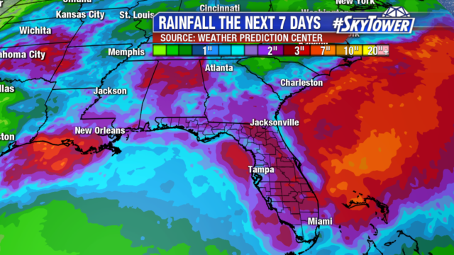
The immediate impacts are continued heavy rain in parts of the Bahamas and Florida’s east coast. Surf will also likely increase on the other side of the state. Hurricane Hunter will fly out when the system moves out over the ocean, likely on Sunday.
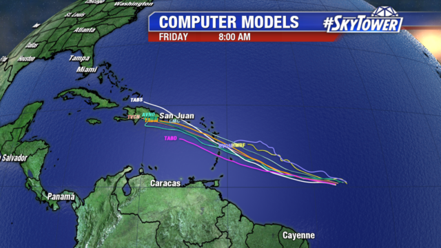
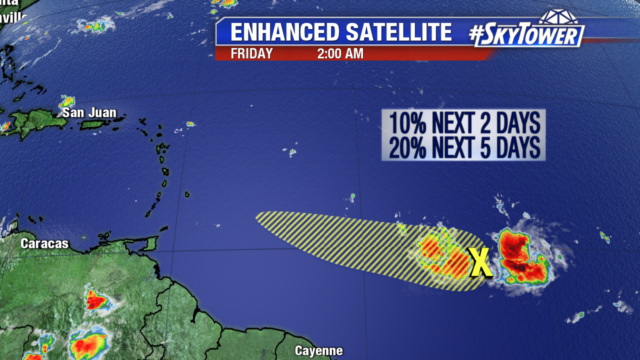
The other tropical wave we are monitoring sits about 1000 miles east of the Windward Islands and is moving west 10-15 mph. It is getting better organized and will likely become a tropical depression in the next day or so. Its best window for development is before it moves over the islands as it will encounter stronger wind shear and drier air in the Caribbean.
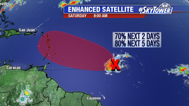
We still have several days to watch this disturbance before it interacts with any land areas.