Dorian Moving Through Puerto Rico And Virgin Islands Today; Southeastern U.S. Watching Closely

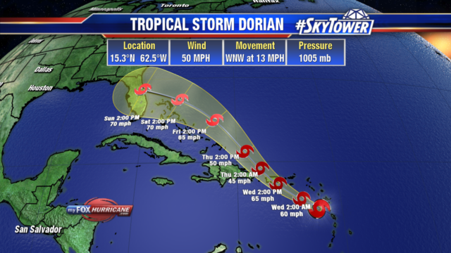
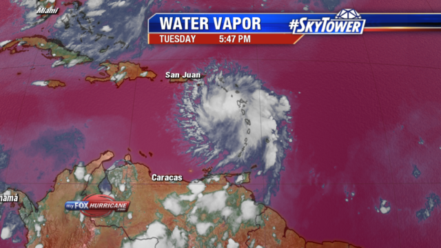
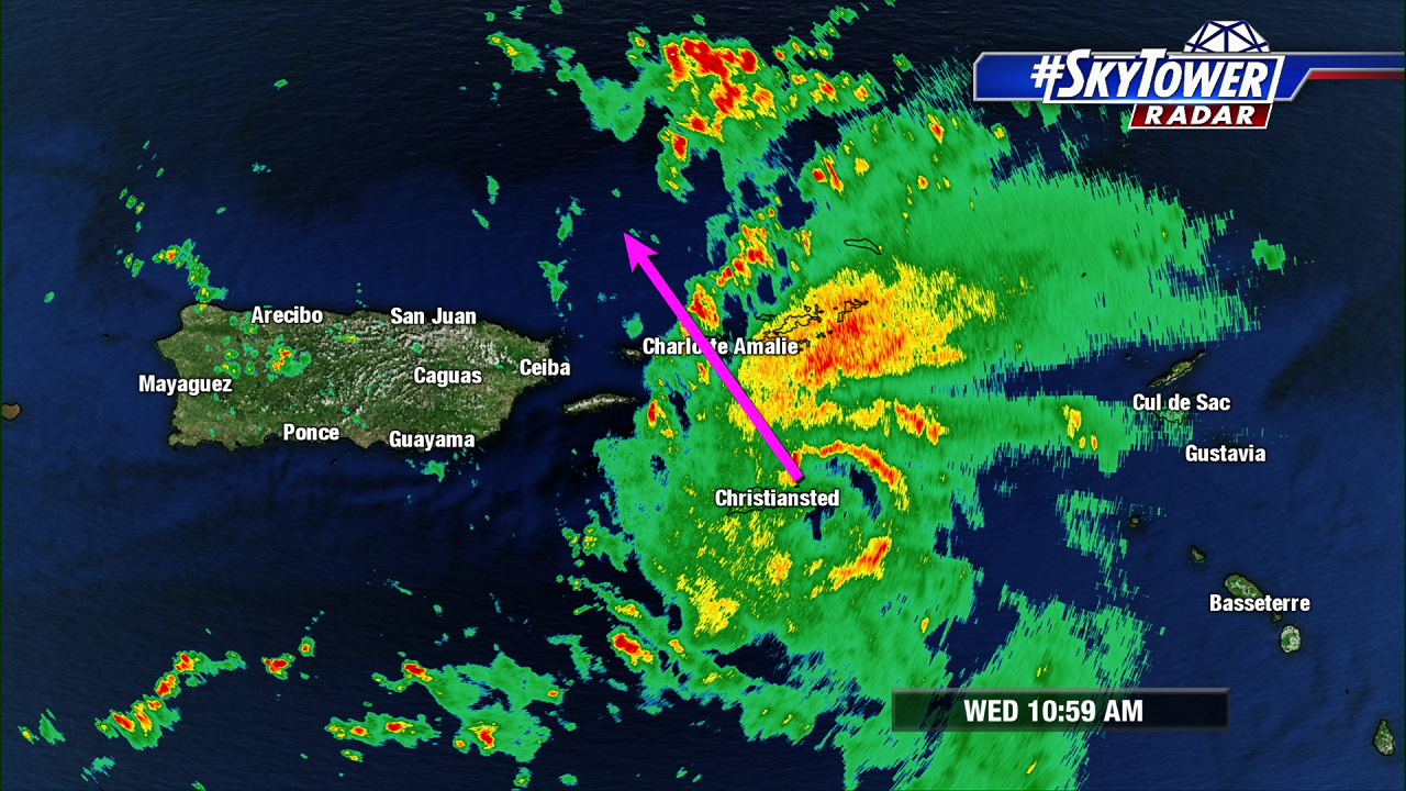
At 11am Wednesday, Tropical Storm Dorian was located about 25 miles SE of St. Croix. Max sustained winds have increased to 70 mph.

Dorian will continue to bring tropical storm-force winds and heavy rain to Puerto Rico and the Virgin Islands through Wednesday night. The good news for Puerto Rico is that the storm should pass just to its east, so most of the island should avoid the brunt of the weather.

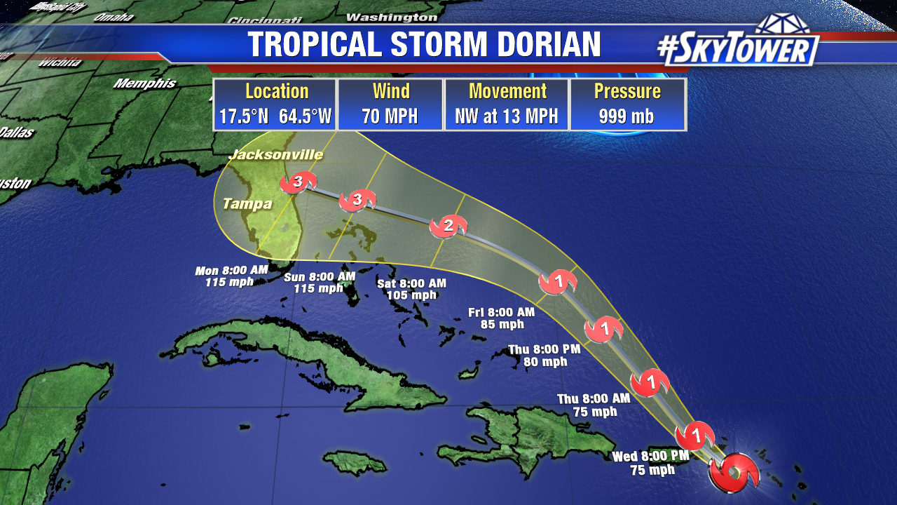
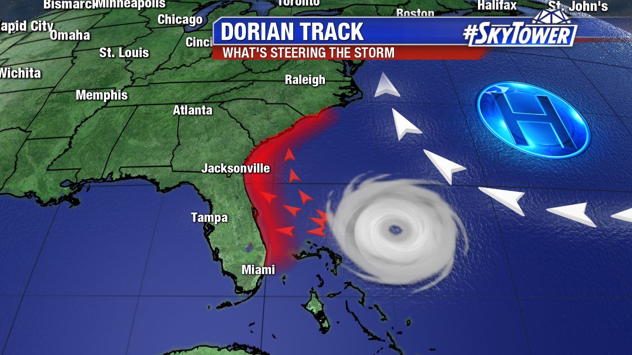
Once the storm moves north of these islands, it’ll be over open water, with low levels of wind shear and much less dry air around. This favorable environment should lead to strengthening as the storm moves toward the Bahamas. At this point, it seems likely that there will be a strong, if not major hurricane, near the Bahamas this weekend. That track after point remains a big question.

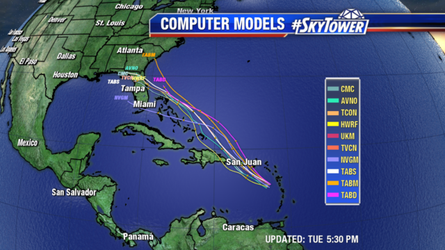
Wednesday morning models runs still have solutions that range from a storm plowing through Central Florida, to a landfall in the Carolinas. Until we get some more clarity, it’s tough to talk specific impacts. We’ll be updating you frequently with new blog posts over the next few days.

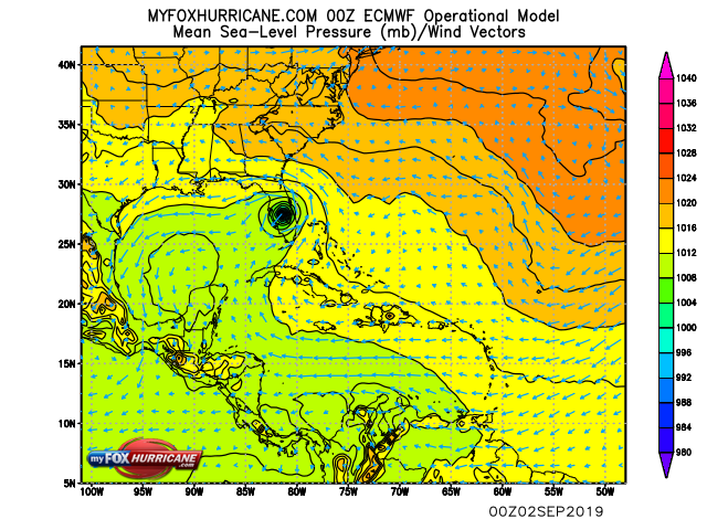
Above: 0Z Euro model run valid for Labor Day.

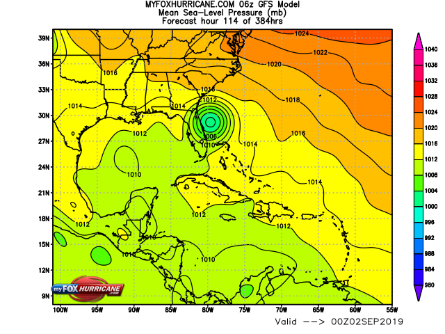
Above: 6Z GFS model run valid for Labor Day.


Dorian’s Track Shifts Closer to Puerto Rico

As of the 5pm update, Tropical Storm Dorian’s track has shifted a bit more to the northeast. This brings the storm through the northeastern Caribbean Sea tonight and then over or near western and central Puerto Rico on Wednesday. The center would pass just east of the Dominican Republic Wednesday night. Heading into Friday, Dorian would near the Turks and Caicos and then the Bahamas. It currently has 50 mph winds and is moving WNW at 13 mph. A shift more to the northwest is expected tonight.

Dorian is expected to slowly strengthen as it nears Puerto Rico, nearing hurricane strength. Heavy rain of 4-6″ with locally 8″ totals could lead to flash flooding. The storm is currently battling dry air which is being pulled into mid levels, this is keeping the storm from quickly intensifying. After interacting with the higher elevations of Puerto Rico, it is expected to briefly weaken before conditions become favorable once again for restrengthening. It will be moving into more moisture, warmer water and lower wind shear as it nears the Bahamas.

There is low confidence in the intensity forecast once it passes Puerto Rico as the models are showing a range of possibilities. A turn towards Florida’s east coast is looking more likely, but it is still several days out. The average margin of error with a 5 day forecast is over 200 miles. Even though the path and intensity could change, residents in the Turks and Caicos, Bahamas and Florida’s east coast should have a hurricane plan in place and monitor the storm closely.