Dorian Will Become A Major Hurricane Later Today

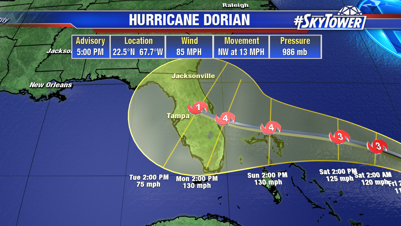
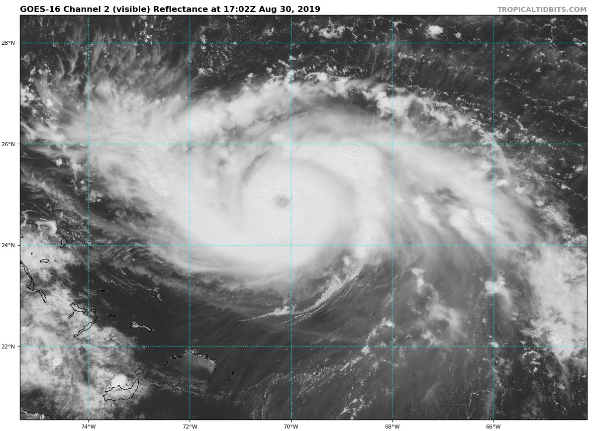
As of the 11am advisory from the National Hurricane Center, Hurricane Dorian had winds max winds of 110 mph – nearly a category 3 storm. A small eye is now visible. Intensification should continue over the next few days.

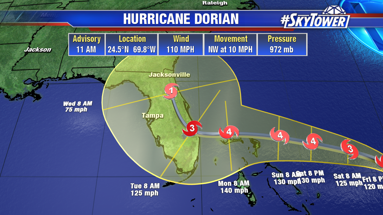
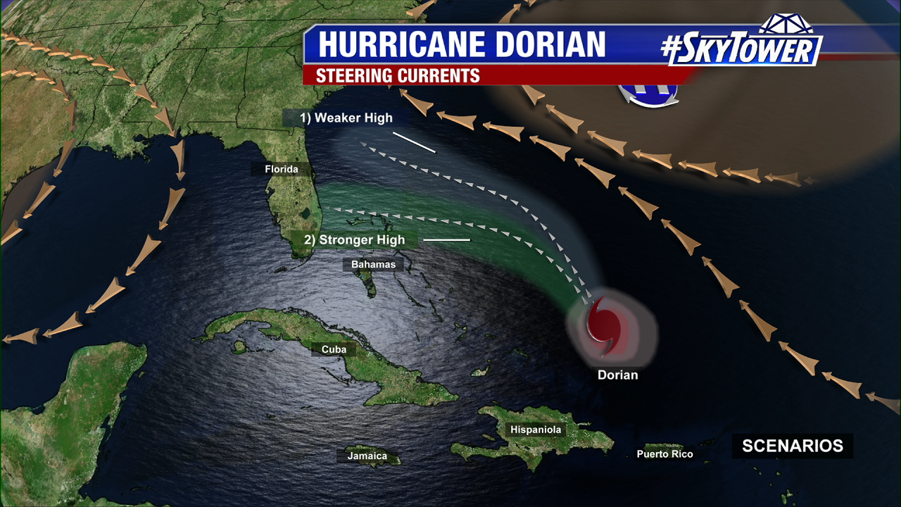
Dorian should start take on more of a WNW motion through the weekend as it moves toward the Bahamas and Florida. Latest runs of the GFS and Euro are in much better agreement in regards to track, with landfall in South Florida on Tuesday somewhere between Vero Beach and West Palm Beach.

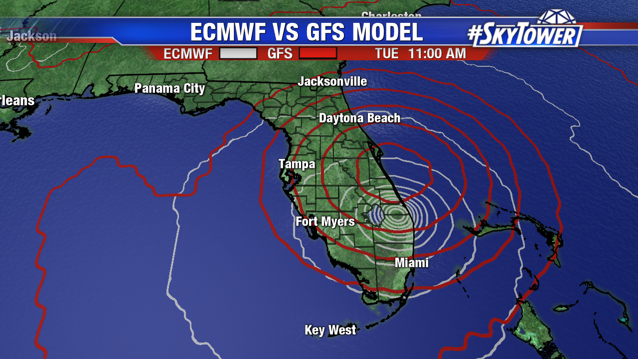
Keep in mind, while we have some agreement now, these are simply two singular model runs. The takeaway for now is that we expect a turn toward the Bahamas and Florida this weekend, followed by a turn to the north on Monday or Tuesday. That will end up being the difference between Dorian moving up I-95 and the storm staying offshore and paralleling the coast, and as a result a huge difference in regard to impacts.


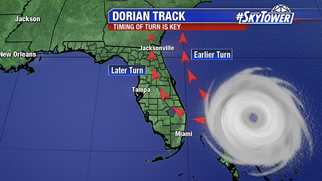
We’ll be looking for continued agreement and consistency as we go forward, and when our confidence rises in that numerical guidance we can start talking about specific impacts. For now, as we’ve said that last couple days, all of Florida’s east coast needs to be preparing for a major hurricane.

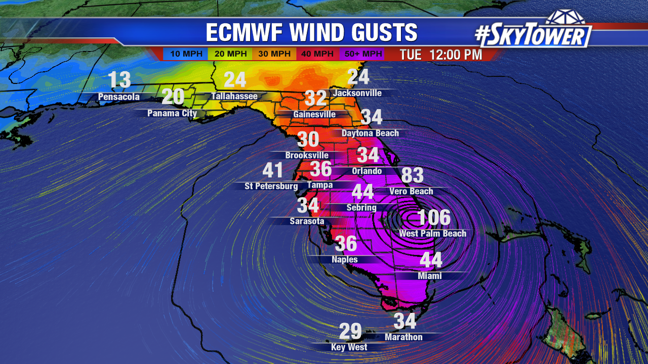
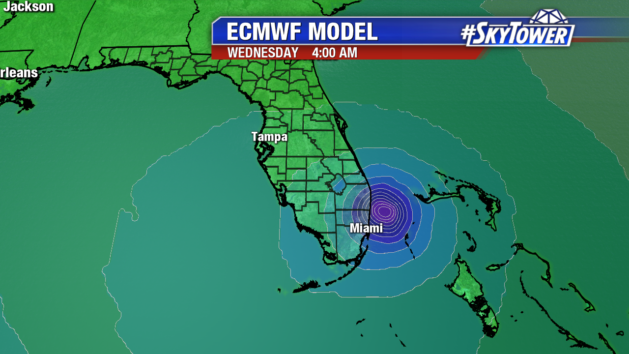
Below: 00Z ECMWF model run valid at 12pm Tuesday.


Dorian Continues To Strengthen; Exact Track Still Uncertain

As of 5pm Thursday, max winds are sustained at 85 mph. The storm was moving northwest at 13 mph. Hurricane Dorian will be steadily strengthening going forward as it moves over very warm water, and takes advantage of low wind shear and a lack of dry air.

This afternoon’s model runs have unfortunately provided us with more questions than answers. In particular, the latest ECMWF run take the storm further south, slows it to a crawl with landfall in South Florida before riding up the East Coast of the state.

Forward speed is really a big factor. The slower Dorian moves toward Florida, the more likely it is to find a weakness in the ridge and turn north. If it moves faster, the ridge will likely keep it on a westerly track into Florida.

The one thing we have to understand here is that the atmosphere behaves like a fluid. There’s a lot of cause and effect, in regards to several different variables, that will ultimately decide where Dorian will end up and when. Until models get a better handle on things and more consensus on a particular solution, which should happen over the next 48 hours or so, we can’t nail down local impacts. Right now, especially along Florida’s East Coast, folks need to be preparing for the possibility of a major hurricane landfall some time early next week.