Dorian Now a Category 5 Hurricane with 160 mph winds

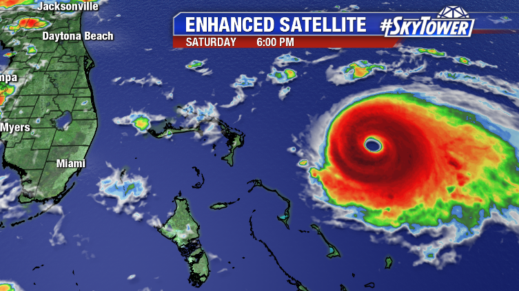
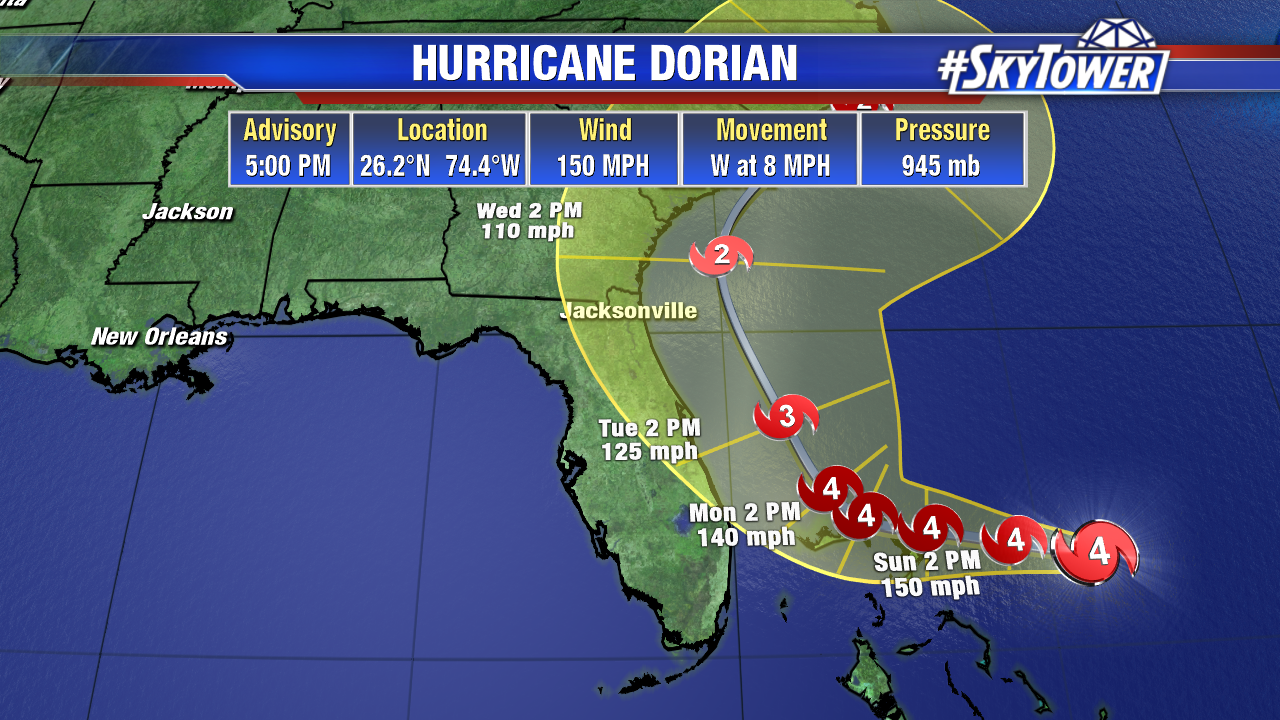
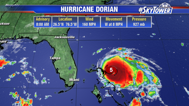
As of the 8am update, Dorian has strengthened to a category 5 storm with 160 mph winds. Hurricane force winds extend 30 miles out from the center, tropical storm force winds out 105 miles from the center, with wind gusts up to 185 mph.

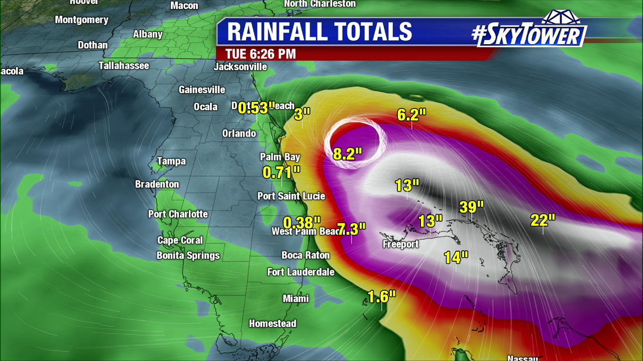
Dorian will move over Abaco today and continue west over or very near Grand Bahama tonight into tomorrow. Not only are the islands looking at devastating winds, 12-24″ of rain with isolated 30″ totals are possible, and storm surge 15-20 ft with onshore winds is possible.

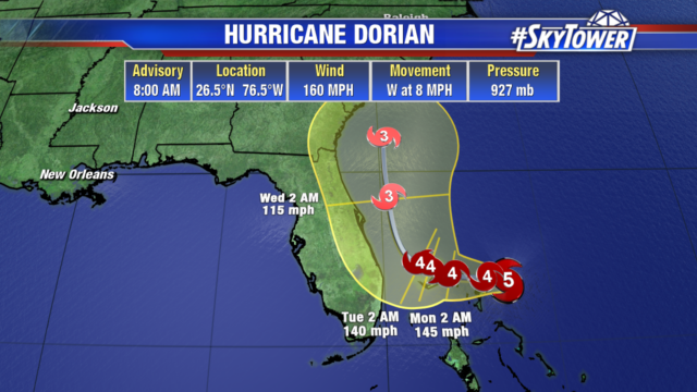
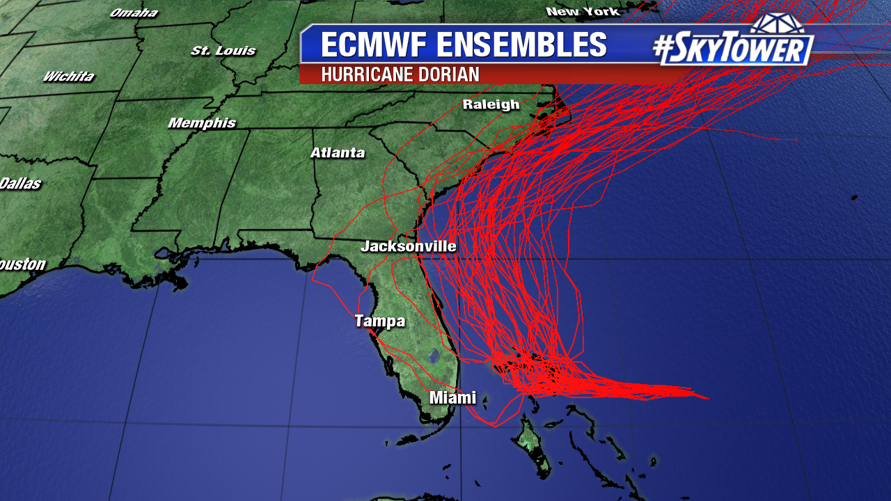
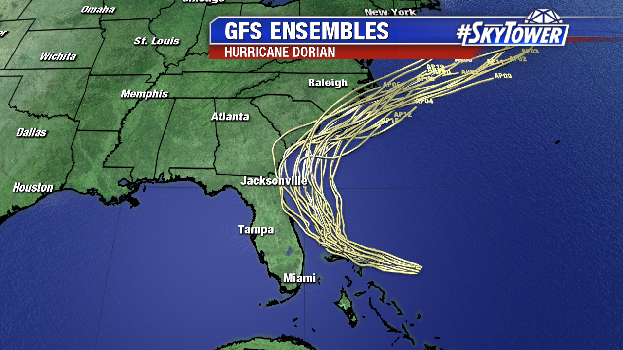
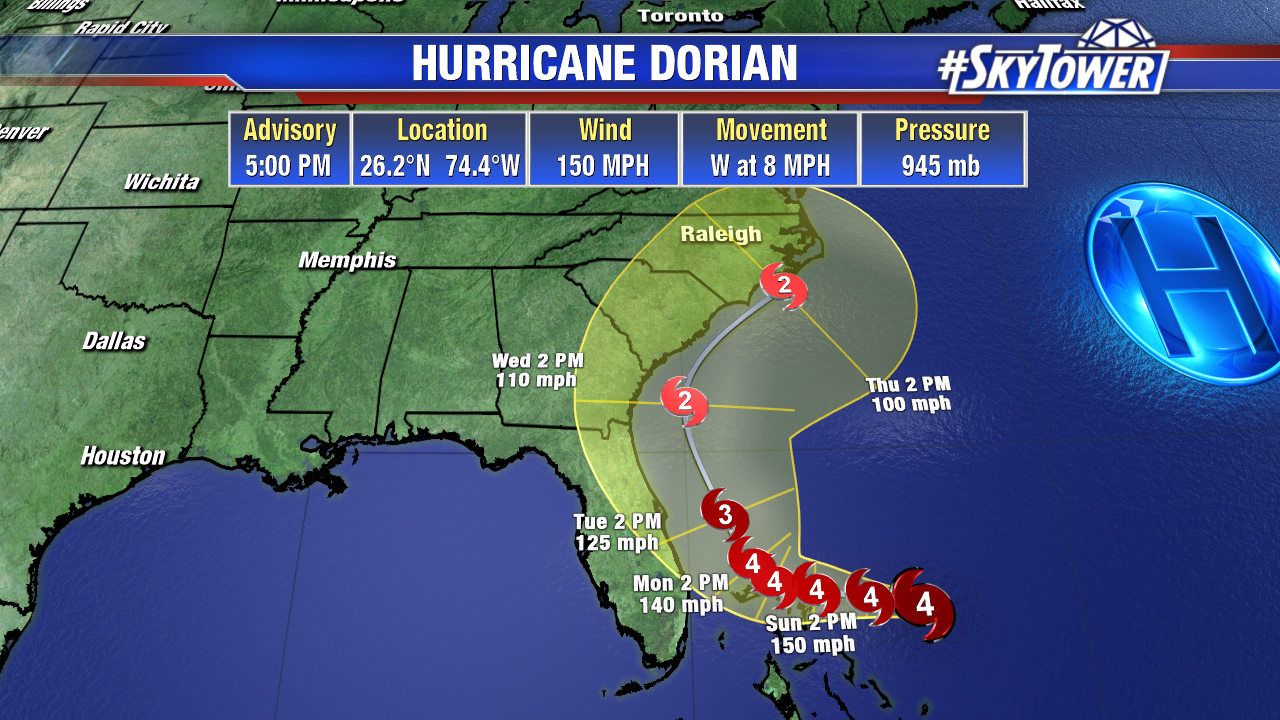
The storm is only moving at 8 mph and will slow down even more as the steering high to the north breaks down. On this path, it will be just west of Grand Bahama early Tuesday morning. Dorian will slowly weaken as it makes the turn to the north on Tuesday. Models have been trending towards Dorian’s center remaining offshore, but a few still make landfall on Florida’s east coast and that is still a possibility.

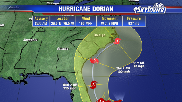
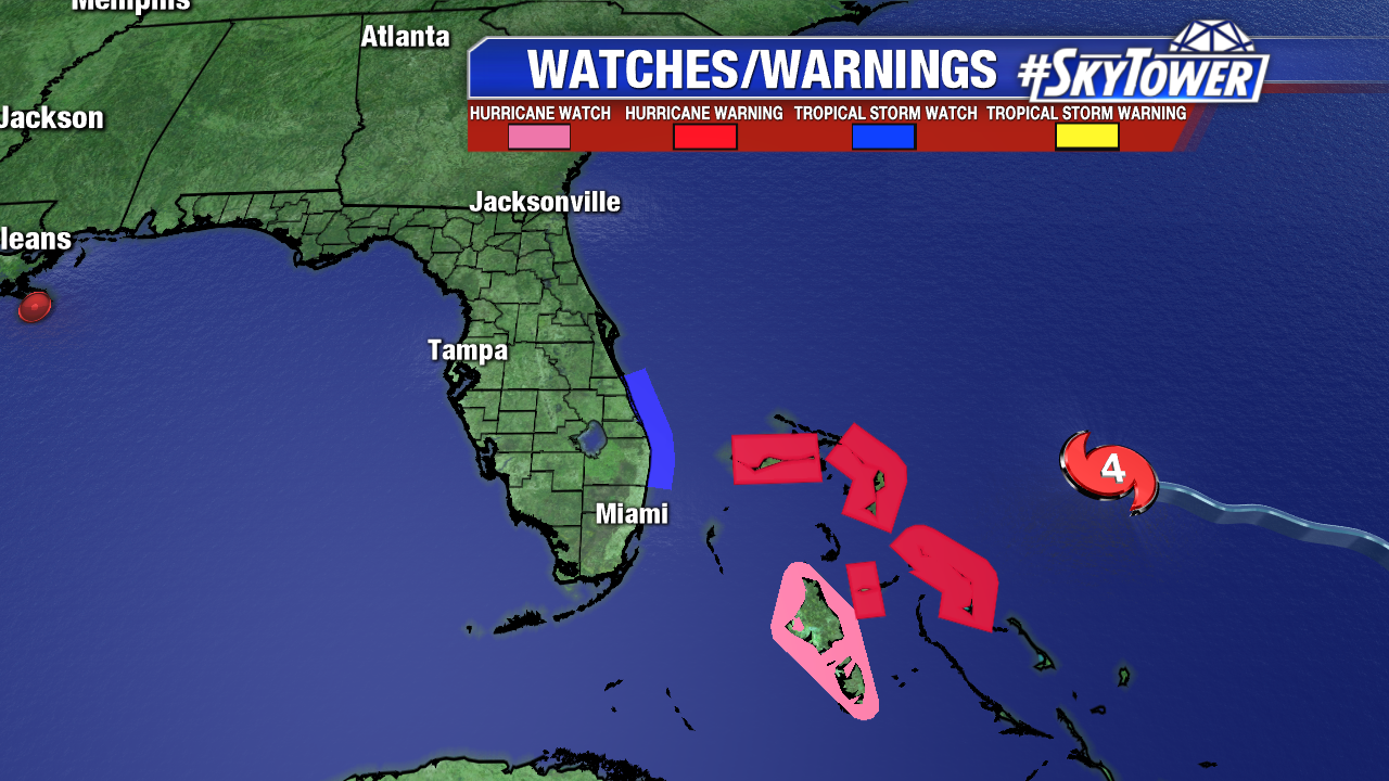
The cone of uncertainty includes the Georgia and Carolina coastlines as well. Residents in these areas should monitor the progression of the storm closely.

Life-Threatening Hurricane Dorian Nearing Northwestern Bahamas

As of 5pm Saturday, Hurricane Dorian was located about 170 miles east of Great Abaco Island in the Bahamas. Max sustained winds are at 150 mph, with gusts to 185 mph. Hurricane-force winds extend out up to 30 miles from the center. Dorian should be nearing the northwestern Bahamas on Sunday afternoon.

Not only is this a life-threatening hurricane, but it will be moving painfully slow once it reaches the islands. It’s quite possible, some of the northwestern Bahamas will be dealing major hurricane conditions for up to 48 straight hours, before Dorian finally picks up speed again and makes the turn north (Tuesday into Wednesday). Catastrophic damage from wind and surge, in addition to potential for up to 3 feet of rain, is becoming more and more likely in the Northwestern Bahamas.

Our confidence in Dorian’s track has continued to increase today. Nearly all reliable model guidance continues to show a turn north after reaching the Bahamas, with many keeping the storm 100+ miles off of Florida’s East Coast. In this scenario, tropical storm force wind gusts and some coastal flooding would still be possible along the coast. Obviously, with a storm a powerful as Dorian there is no margin for error. At this point, we are cautiously optimistic that a Florida landfall will be avoided. However, until we see the northward turn happen, folks along the East Coast of Florida, especially from West Palm Beach northward, need to stay prepared.

Further north, along the coast of Georgia, South Carolina, and North Carolina, there is the possibility of significant impacts from Dorian later in the week. A track offshore is possible here as well, but there is a little less model consensus at this point. Folks in these areas need to be monitoring the progress of Dorian closely in the coming days.