Dorian Stationary Over Grand Bahama; Move To The North Begins Tonight

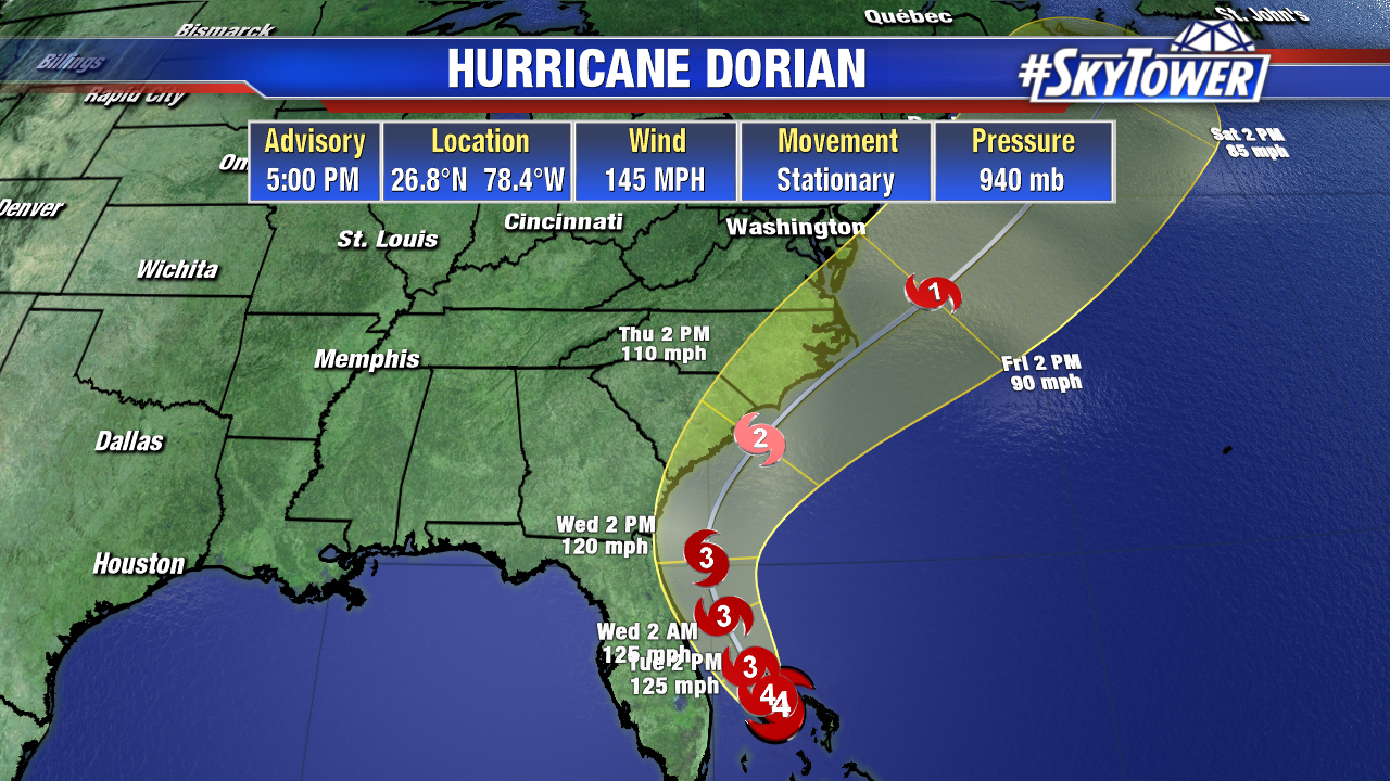
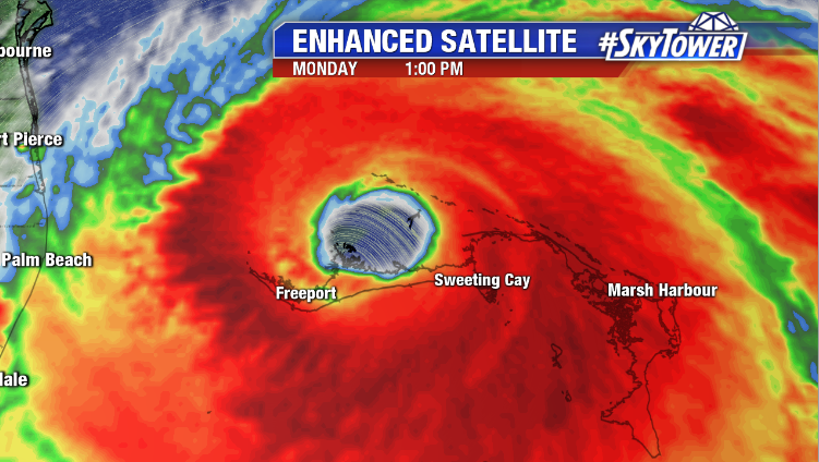
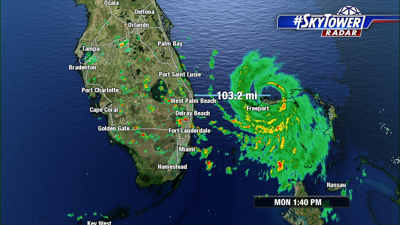
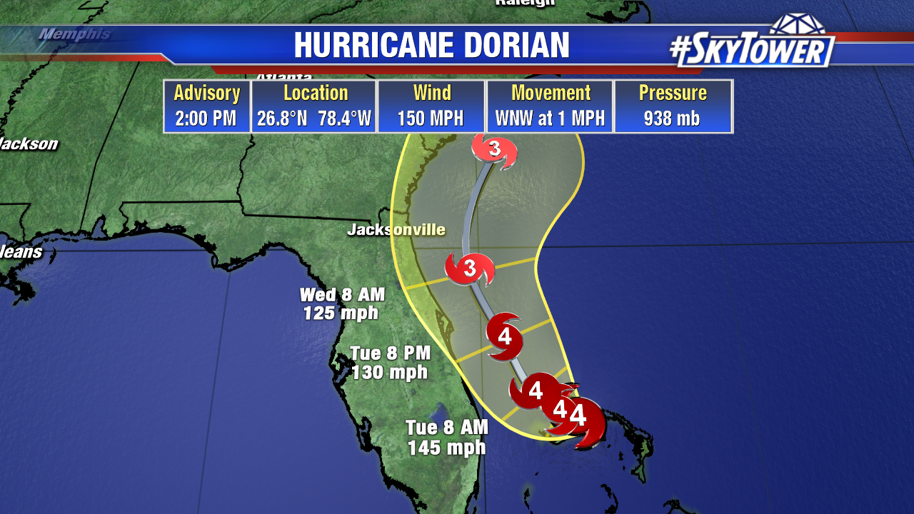
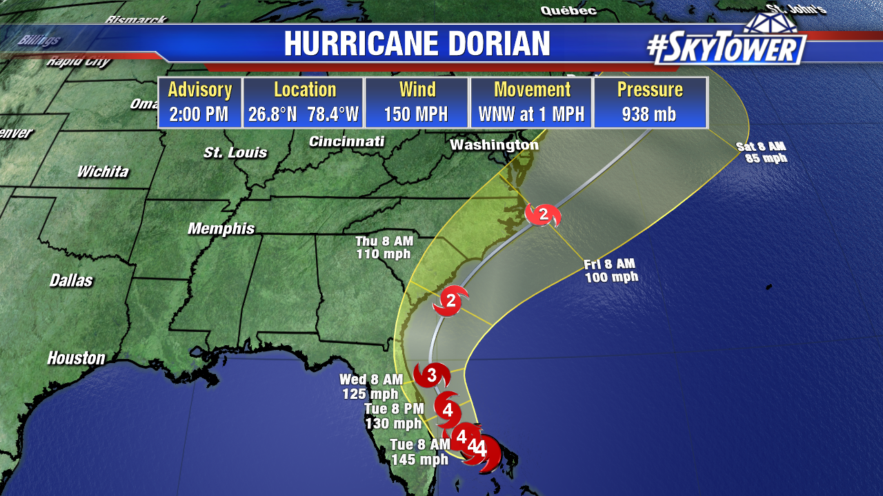
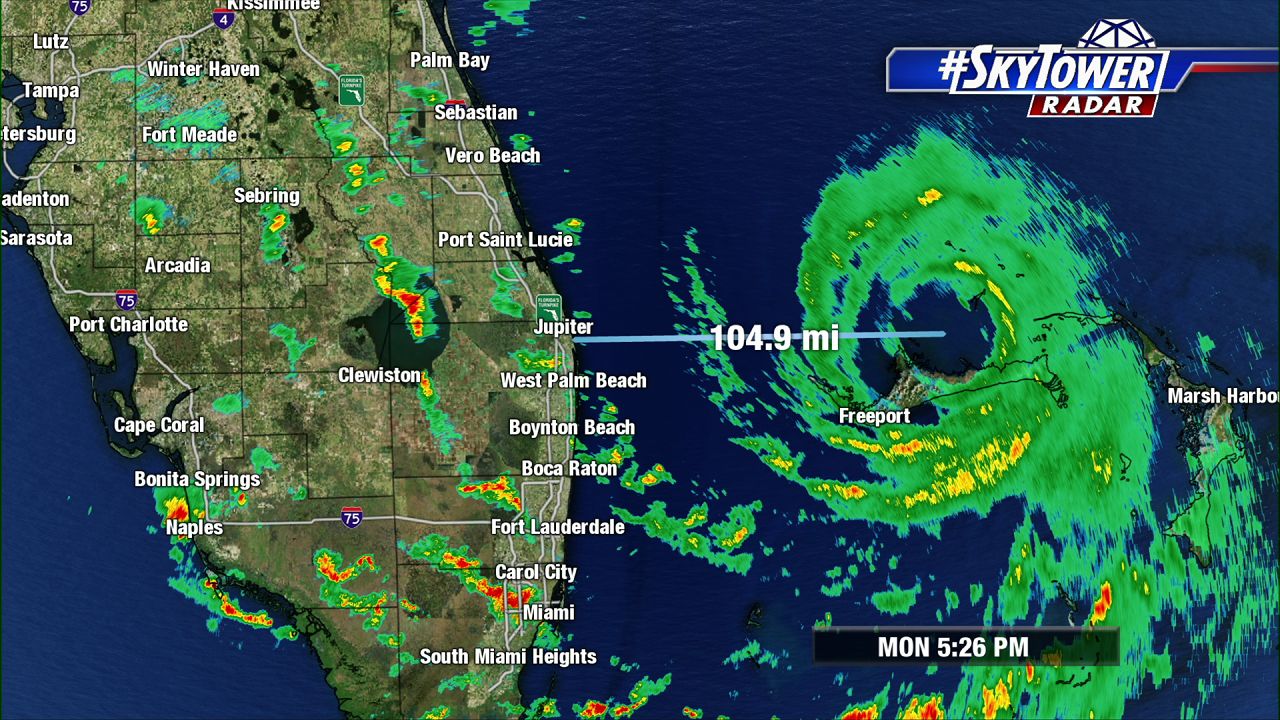
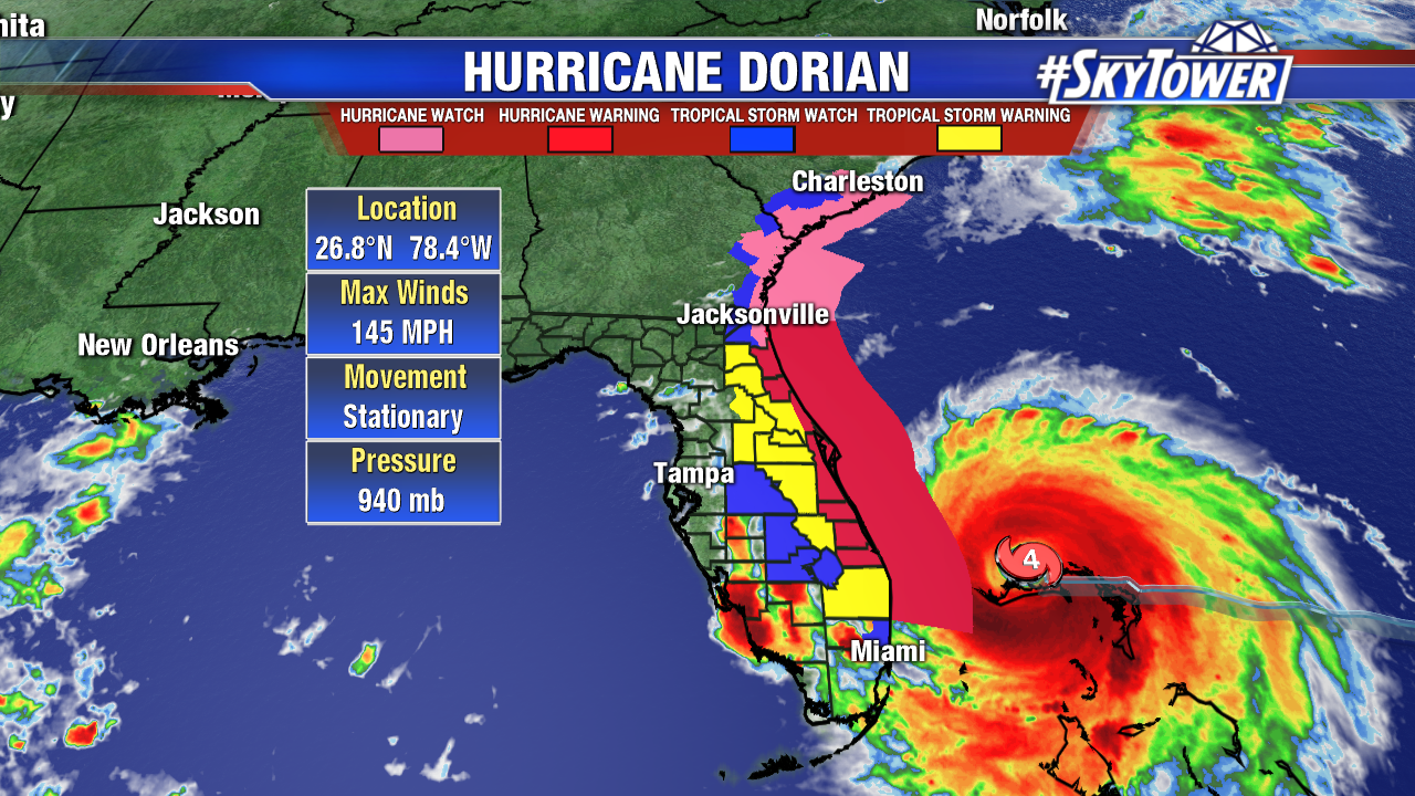
At 5pm Monday, Dorian was located about 105 miles east of West Palm Beach, and sitting stationary over the Island of Grand Bahama. Complete storm surge inundation continues for most of that island, along with max sustained winds of up to 145 mph.

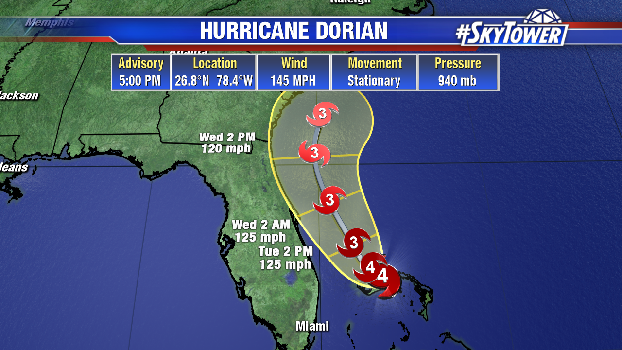
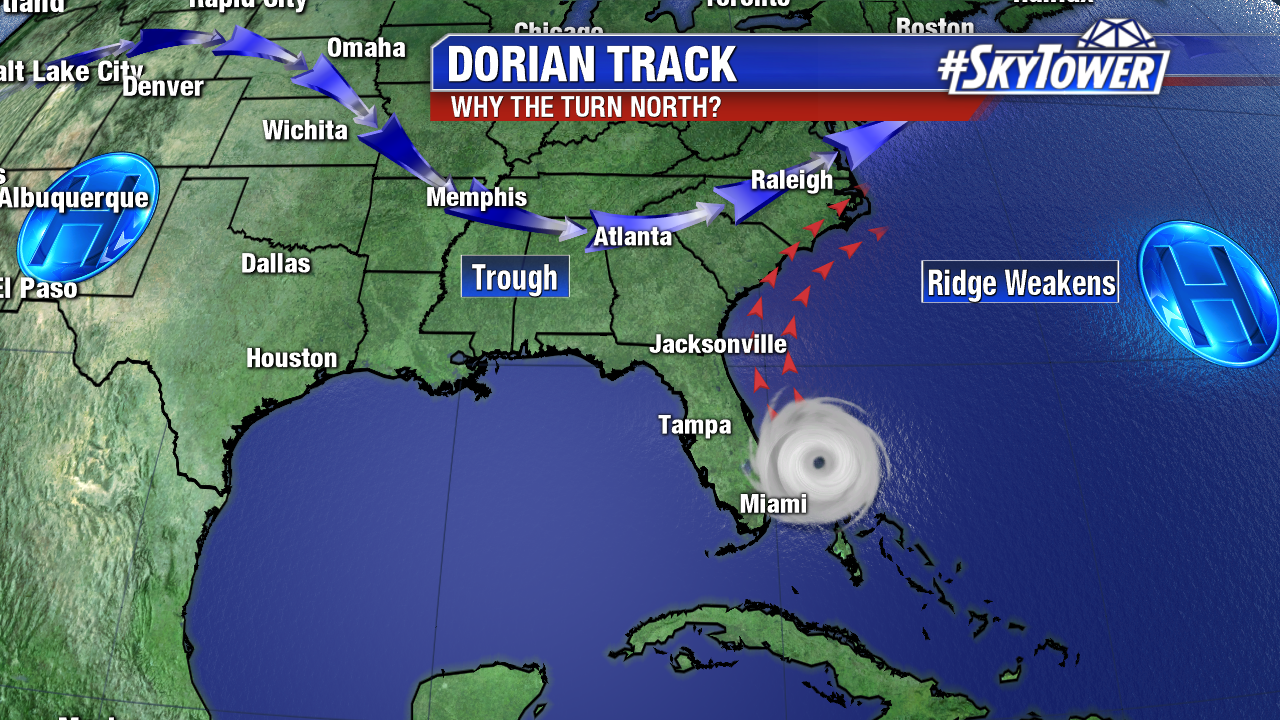
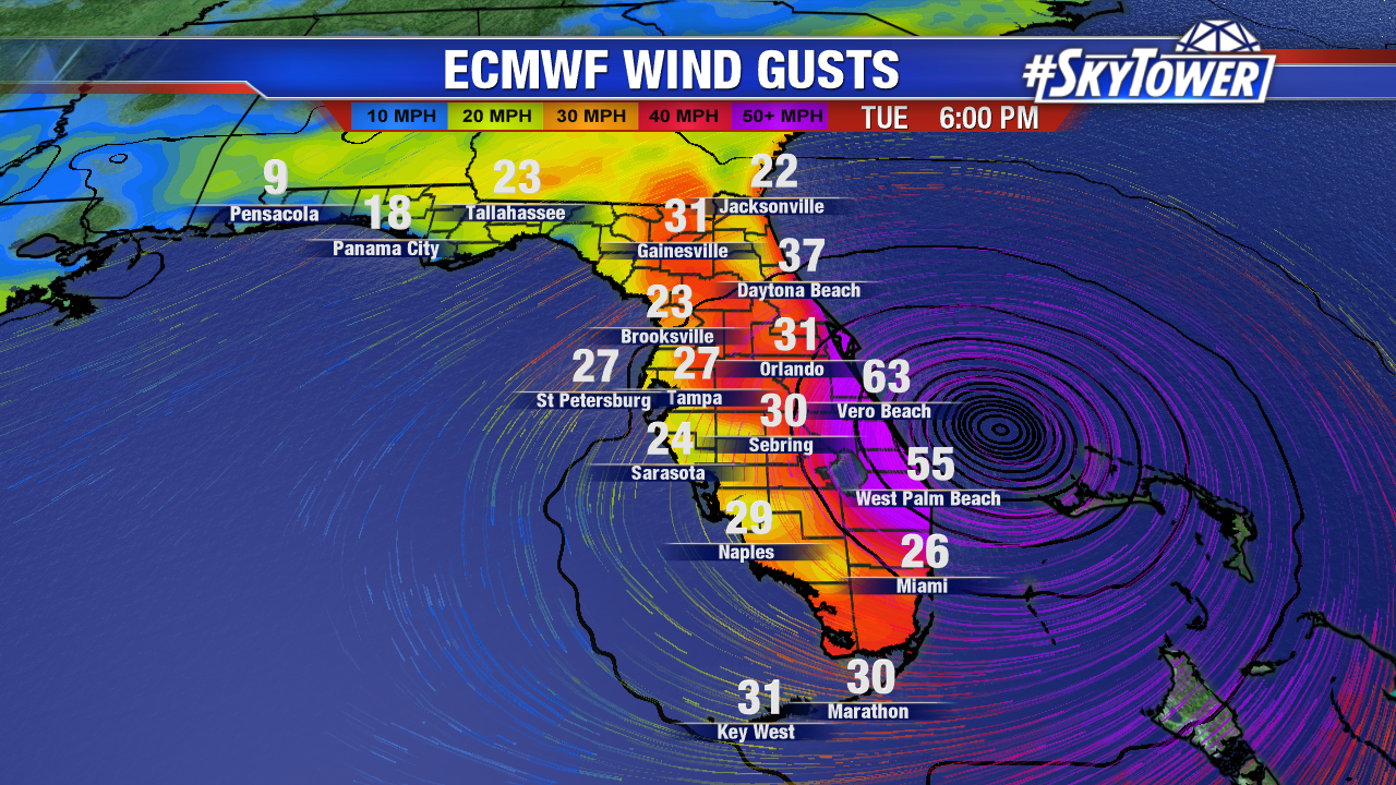
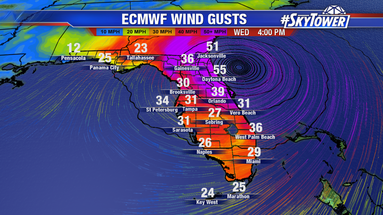
A motion to the north-northwest will begin tonight into tomorrow morning. Confidence continues to increase that the center of the storm will stay off of Florida’s east coast. However, that does not mean there won’t be impacts. Hurricane-force wind gusts will still be possible along the coast, especially north of the Treasure Coast, even if the storm stays 50 miles offshore.

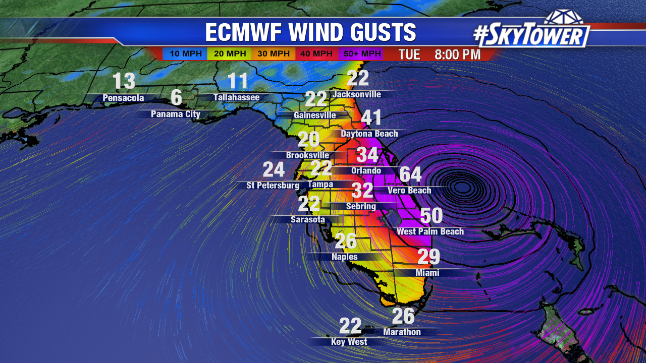
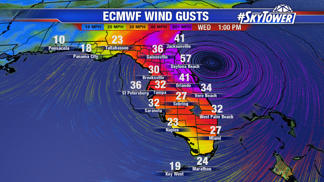
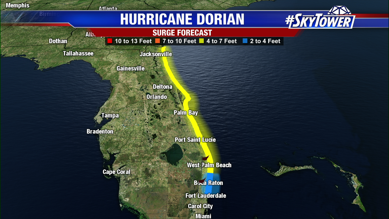
In addition, several feet of storm surge will be likely in many areas Tuesday afternoon through the day on Wednesday as strong onshore flow pushes water onshore as the storm passes.

Dorian will no longer be a problem for Florida by Thursday. However, folks along the coast of Georgia, South Carolina, and North Carolina need to be monitoring the progress of the storm very closely the rest of the week, as significant impacts will be possible if it hugs the coast. Dorian will be safely out to sea by the weekend.


Dorian Continues To Pound Grand Bahama Island; Storm Nearly Stationary

Dorian has only moved about 35 miles in the last 15 hours. To put that into perspective, you could walk the same distance in less time. The island of Grand Bahama has been getting absolutely pounded, and it will continue through the rest of the day before the storm finally starts to move north tonight.

Max sustained winds have weakened to 150 mph for the time being, but Dorian is still an incredibly powerful and dangerous hurricane.

For Florida, Dorian’s nearly stationary motion is a good sign. It signifies the breakdown of the ridge to the north, and means that the storm will start to lift northwest, and eventually north, as it gets picked up by the trough digging into the Southeastern U.S. While a landfall along the East Coast is still a possibility as Dorian moves north, the most likely scenario is the storm paralleling the coast just offshore. It’s going to be a very close call.

Hurricane-force winds currently extend out only about 30 miles to the west from the center of the storm. So, the ‘safe zone’ so-to-speak would be Dorian staying about 50 miles off the coast. While the chances of that happening are good, residents along Florida’s east coast, especially north of the Jupiter Inlet, need to be prepared for the worst, but hope for the best.

Above: 00Z ECMWF model run wind gust speeds. Subject to change based on Dorian’s proximity to the coastline.

It should be noted that even if the core of Dorian stays safely offshore, storm surge will still be a problem along the coast Tuesday evening through the day Wednesday as Dorian’s slow movement to the north will keep many areas in strong onshore flow for at least a few hours.

The storm will no longer be a problem for Florida by Thursday. However, folks along the coast of Georgia, South Carolina, and North Carolina need to be monitoring the progress of the storm very closely the rest of the week, as significant impacts will be possible if it hugs the coast. Dorian will be safely out to sea by the weekend.