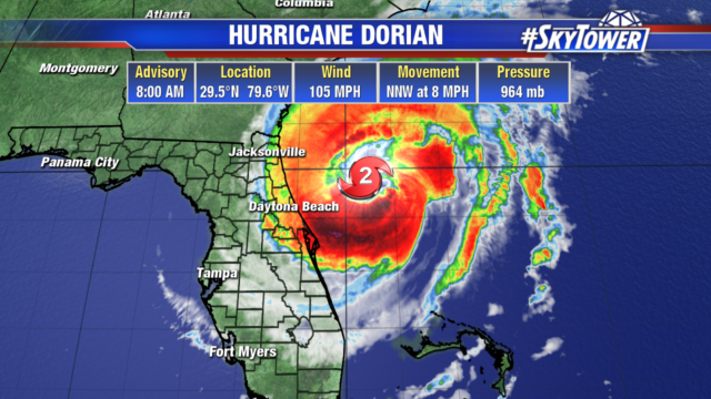
Hurricane Dorian now has winds of 105 mph and is a category 2 hurricane. It is skirting Florida’s east coast keeping the strongest hurricane force winds offshore. But tropical storm force winds are still being felt along the coast.
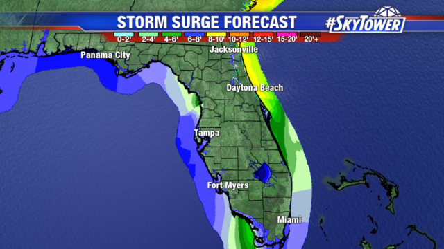
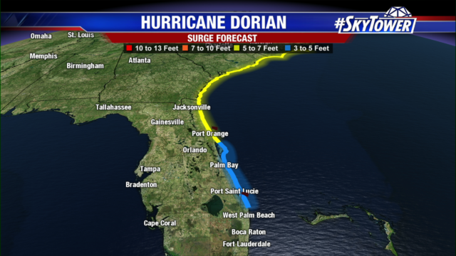
Even though the hurricane force winds are staying offshore in Florida, water is still a concern. Storm surge and big waves are impacting Florida’s east coast, with 5-7ft surge possible from Port Orange to Jacksonville. And 5-7ft surge is possible along the Georgia and Carolina coastlines as well. These areas are also looking at 3-10″ of rain. The Carolina’s should closely monitor Dorian’s progress as the center and strongest winds will get very close to the coastline as the storm moves northeast.
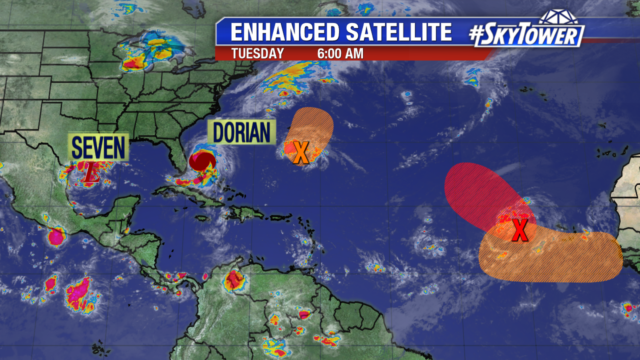
We are in the peak of hurricane season with 3 named storms in the Atlantic, a disturbance and another tropical wave is forecast to come off Africa’s coast that needs to be watched.
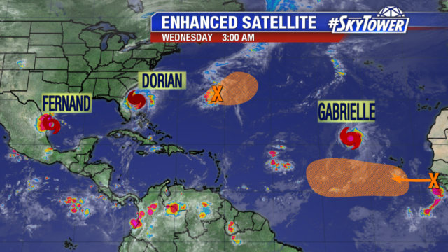
The tropical wave (in orange) is expected to emerge later today between Africa and the Cabo Verde Islands. It will be entering a favorable environment for development and a tropical depression is likely to form late this week or over the weekend. This area needs to be watched, but it will be 7-10 days before it potentially reaches the Caribbean. The other area in orange northeast of Dorian, is a disorganized disturbance but it could strengthen into a depression over the next couple days as it moves northeastward away from Bermuda. Interests in Bermuda should monitor the progress of the disturbance.
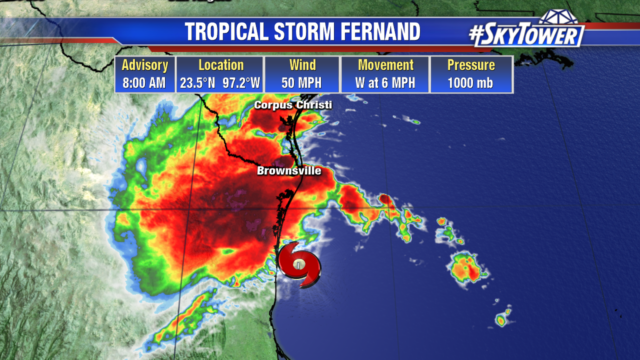
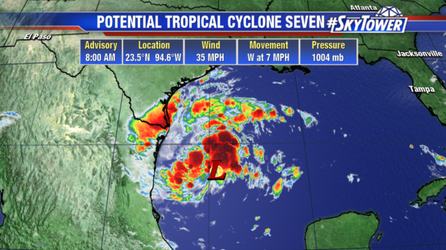
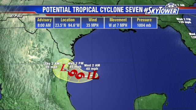
Tropical Storm Fernand is sitting in the western Gulf and headed west into Mexico. It has 50 mph and will weaken as it moves inland later today. South Texas could see 2-4″ of rain with isolated 6″ totals.

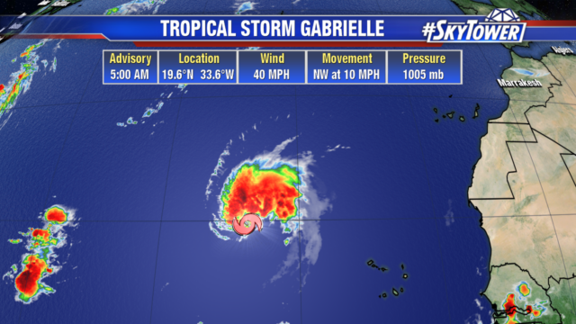
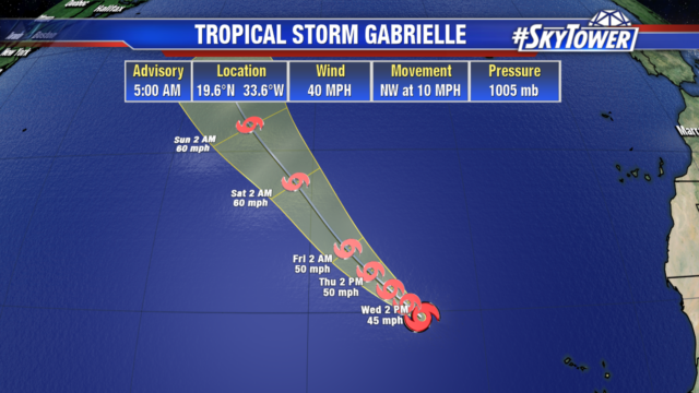
Tropical Storm Gabrielle is sitting out in the Atlantic with 40 mph winds. It will continue to move northwest over the Atlantic into early next week with no threat to the United States.
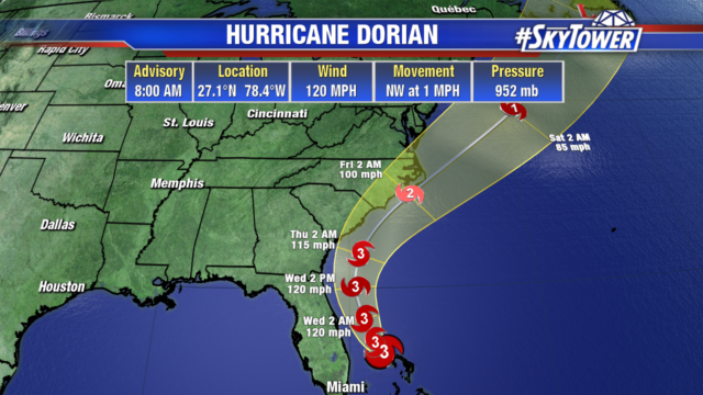
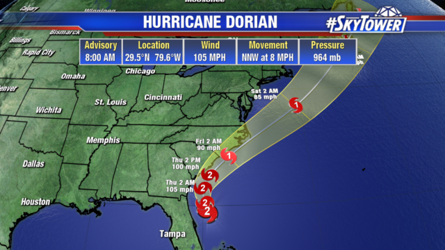
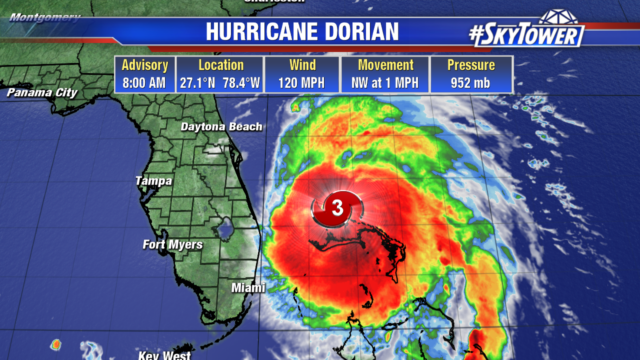 After a day sitting over Grand Bahama Island, Dorian is expected to make its northwestward turn today and begin moving. A trough heading to the east coast will steer Dorian to the north, paralleling Florida’s east coast. There is the potential for the Dorian to not make landfall in the lower 48, but there will still be storm surge along the east coast of Florida, Georgia, and the Carolinas.