Tropical Storm Cristobal Headed For Landfall In Louisiana On Sunday; Impacts Being Felt Well To The East

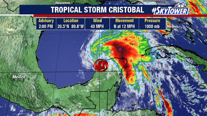
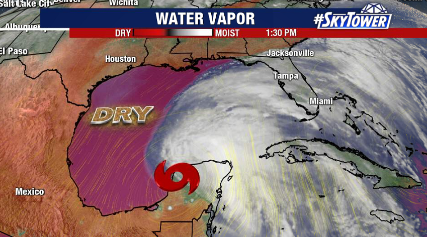
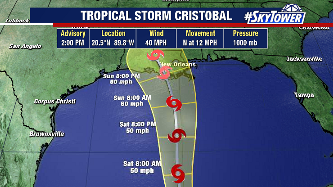
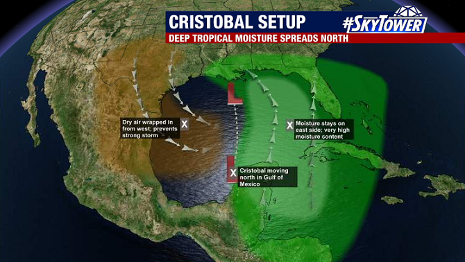
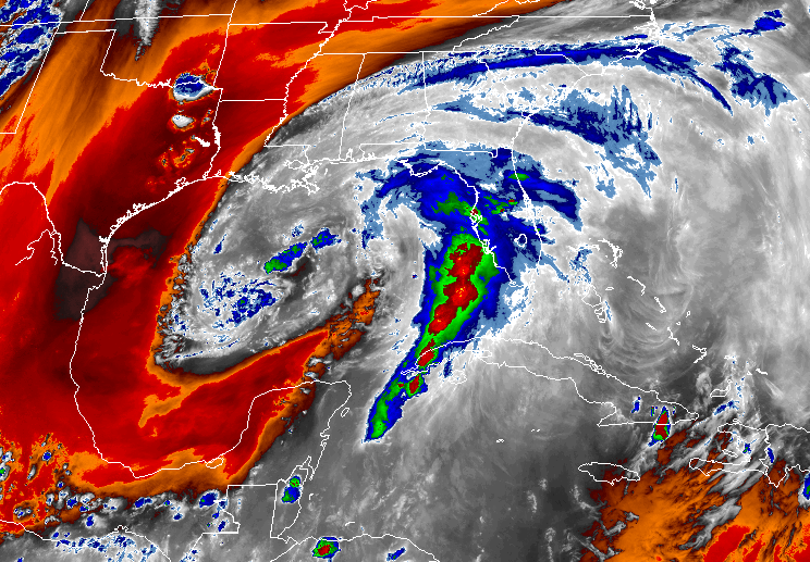
As of 5pm Saturday, the center of Tropical Storm Cristobal was located about 280 miles SSW of the mouth of the Mississippi River. It certainly doesn’t have the typical appearance of a tropical cyclone. As expected, the majority of convection and strongest winds are displaced well east of the center.

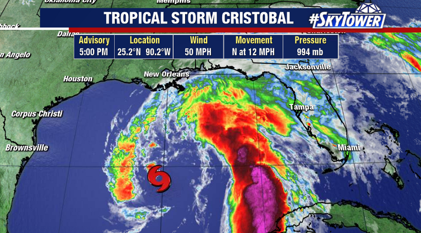
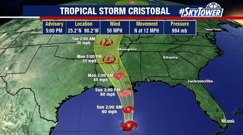
With only about 24 hours left until landfall in Louisiana, very little strengthening is anticipated as dry air continues to be ingested into the circulation.

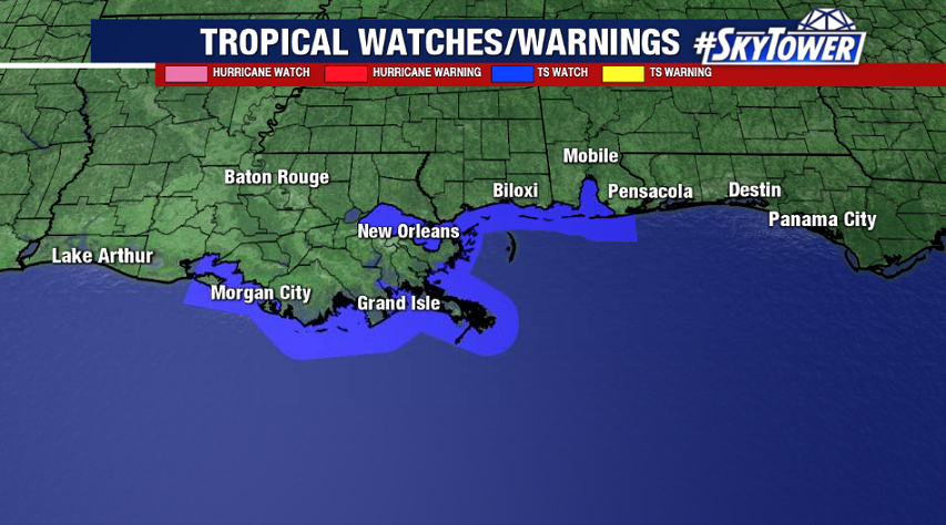
Due to the storm’s lopsided structure, impacts will be felt all along the central and eastern Gulf coast, not just near the center of the storm. A tropical storm warning is in effect from Intracoastal City, LA to the Okaloosa/Walton Co. border in the Florida Panhandle. In this area, a period of tropical storm-force winds is likely on Sunday.

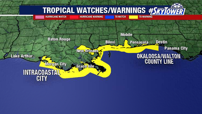
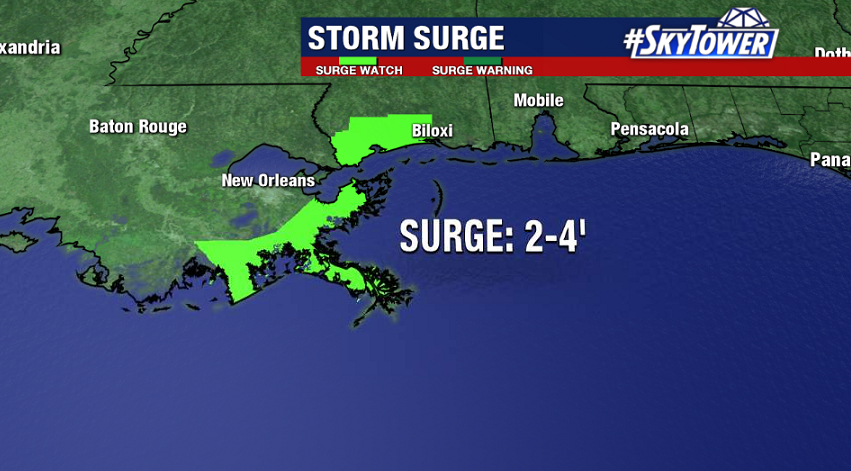
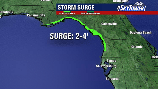
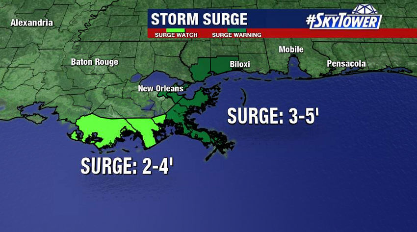
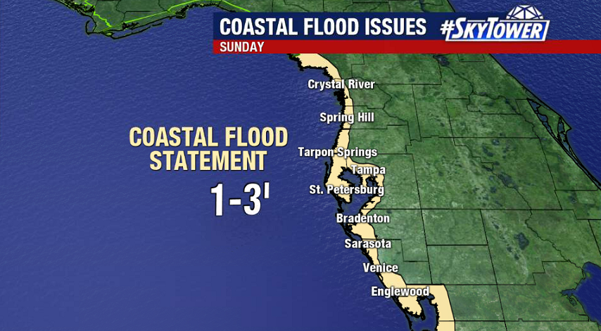
Storm surge will be an issue primarily near the mouth of the Mississippi River, where 3-5′ of surge is possible. Further east along the Gulf Coast, all the way down through Tampa Bay, 1-3′ feet of coastal flooding is a possibility.

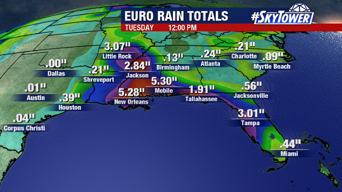
Numerous tropical downpours will continue on Sunday from Central Florida all the way over to Louisiana. Localized flooding will remain a concern for many. As is usually the case with land-falling tropical systems, brief tornadoes are possible as rain bands move through.

Cristobal Moving Back Into The Gulf Tonight; Will Strengthen And Head North This Weekend

AS of 2pm ET Friday afternoon, Cristobal is once again a tropical storm. It’ll be moving into the Southern Gulf this evening.

It’s a lopsided system, with an abundance of dry air over the western Gulf, as well as some wind shear, working against it. That being said, we’re still expecting a slow and steady strengthening up until landfall along the central Gulf Coast late in the weekend.

Models continue to be consistent in Cristobal’s track, showing a likely landfall along the Louisiana coast Sunday night. A tropical storm watch is now in effect from Intracoastal City, LA to the AL/FL border.

Despite some expected strengthening, Cristobal should remain a lopsided storm – consisting of a broad and asymmetric wind field. Wind and surge issues will be present well east of the center of the storm. Storm surge watches are currently in effect near the mouth of the Mississippi River, and also through the Big Bend region of Florida.

On top of coastal flood issues, an additional 3-5″+ of rain is expected along the central and eastern Gulf Coast through early next week as deep tropical moisture spreads north. This will come on top 2-6″ of rain that has already fallen across the Florida Peninsula over the last 48 hours.