We are beginning to see life in the tropics once again. A small compact disturbance moving westward in the central Atlantic became Tropical Depression #7 on Tuesday afternoon. This morning it had gained enough wind speed to become Tropical Story Gonzalo and becoming the earliest 7th named storm on record, beating Gert of 2005 by 2 days. Models have not been very impressed with this system and have shown little strengthening and it being overwhelmed with dry air.
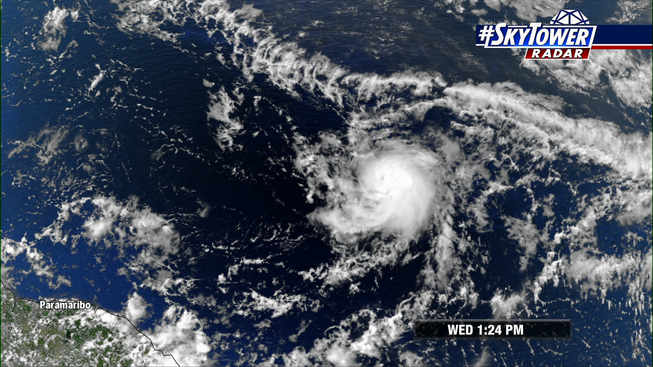
Despite what the models have been predicting, this has become Tropical Storm Gonzalo with additional strengthening expected. This is a very compact system with tropical storm force winds only extending out 25 miles from the center. This in the short term may very well help this system out. With the small size it will have an easier time spinning up and intensifying. The current forecast track does bring this up to hurricane status by Thursday.
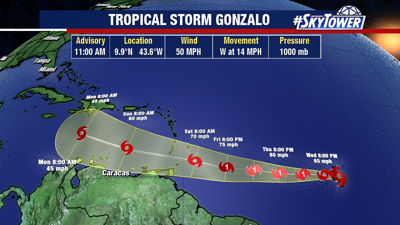
The latter part of the track still remains a question. As with nearly every tropical system, the intensity forecast remains a challenge. The models are in good consensus of a continuation of the westerly movement into the Caribbean. The question is when it arrives into the Caribbean, what exactly will it look like? There is a large plume of Saharan Air Layer that will be moving into the eastern Caribbean at the same time. This is where the small size of Gonzalo will likely work against it. This dry air could easily weaken the storm and potentially dissipate it all together.
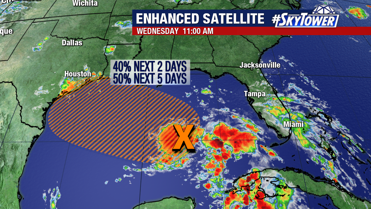
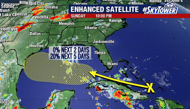
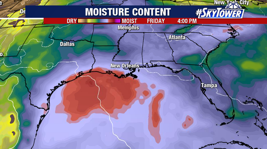
The other area we are watching is the tropical wave that moved over Florida and into the Gulf of Mexico. This has been classified as Invest 91L and could gradually develop into a tropical depression as it continues moving westward. Interest along the Texas coast line should monitor this system which could bring heavy rains across SE Texas by Friday.