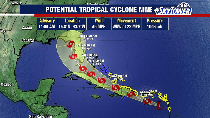
Isaias was officially named late Wednesday evening, becoming the earliest ‘I’ named storm on record (beating Irene on August 7, 2005).
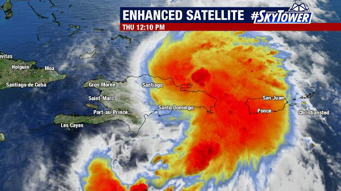
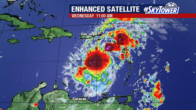
The storm is moving over the Dominican Republic today. We’ll see how that land interaction affects the storm, and what kind of shape it’s in when it moves back over the water.
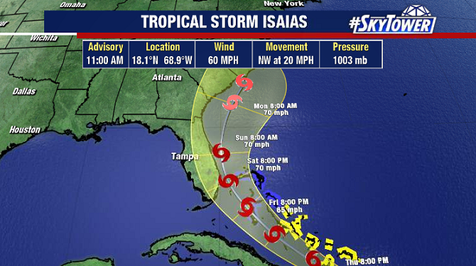
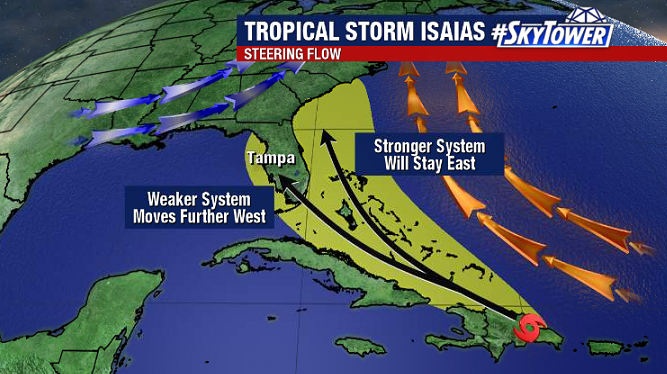
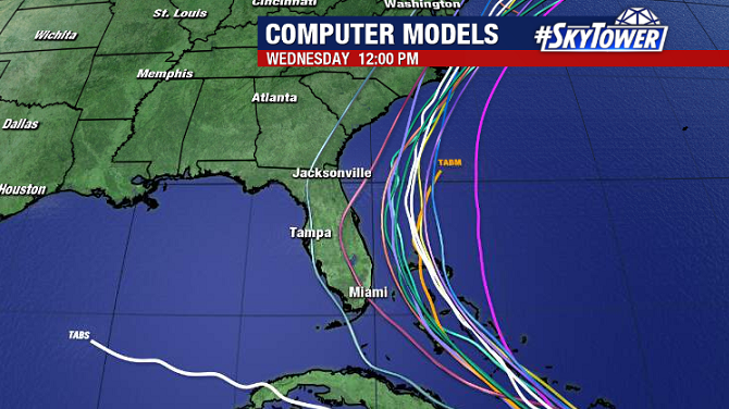
The track is far from locked in, but the options are narrowing. A weaker storm is more likely to take a track a little further west over the state of Florida. A stronger storm would be influenced more by the trough over the eastern U.S. and turn north sooner, keeping majority of impacts offshore. Recent model runs have been hinting at the latter.
Things will become clearer over the next 24 hours. Those in Florida, and up the Southeast coast still need to be keeping an eye on the progress of Isaias.