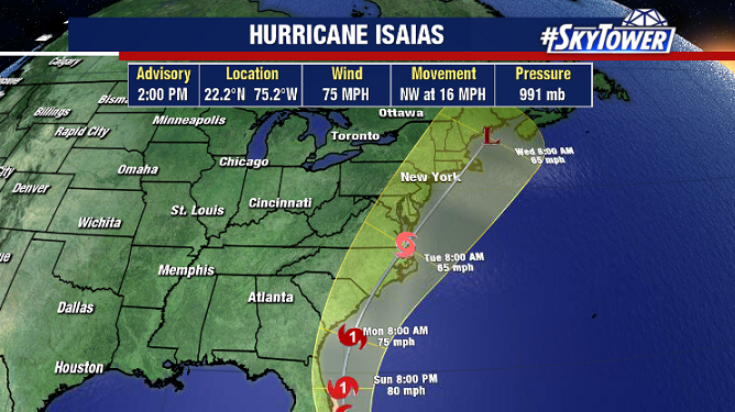
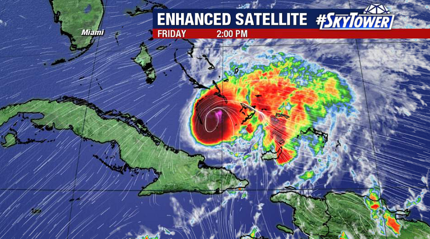
Isaías remains a hurricane despite battling some higher wind shear today. As of 2pm, max sustained winds were at 75 mph and the storm was moving northwest at 16 mph.
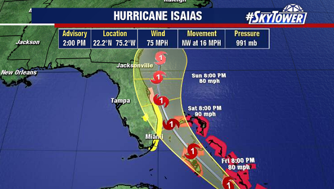
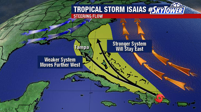
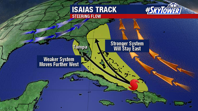
An increasingly more favorable environment lies ahead, which should lead to at least some strengthening over the next 36 hours or so. The intensity forecast is really the key to the track forecast for this storm. With the atmospheric steering flow setup how it is, a stronger storm is likely to track further east. While a weaker storm is likely to track further west. While a stronger storm moving near or just off the East Coast is the most likely scenario right now, a weaker storm moving over the state is still a possibility.
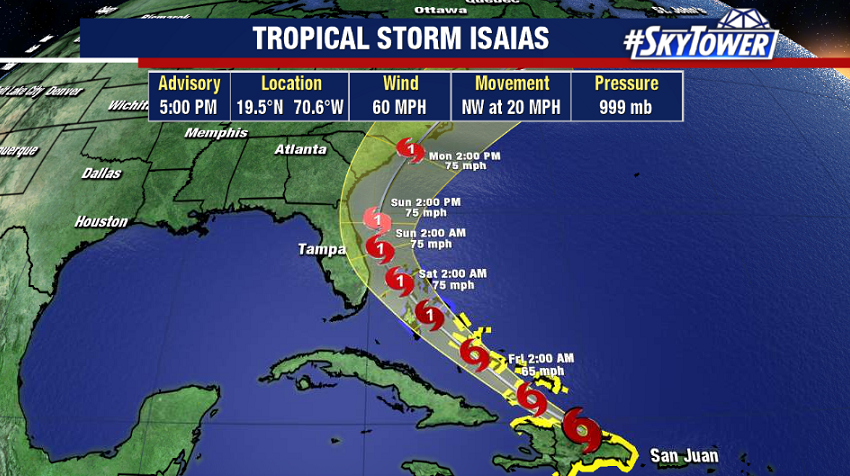
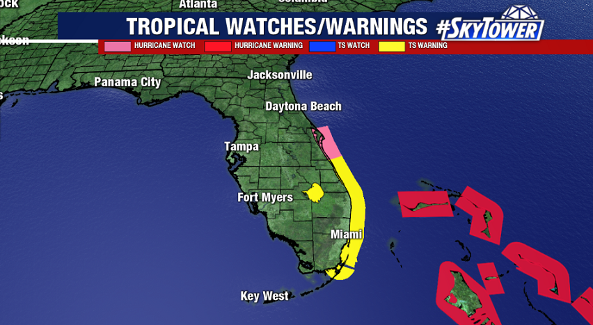
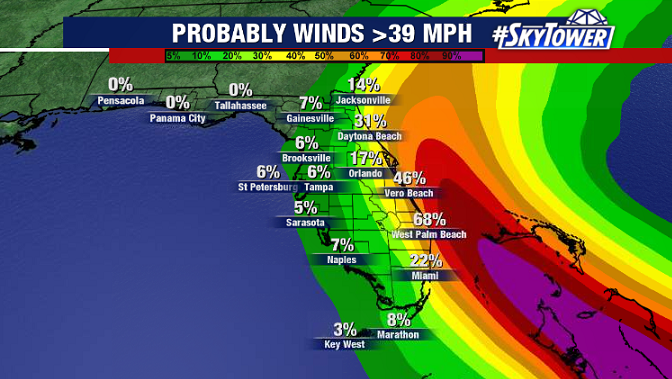
A hurricane watch is currently in effect from near Deerfield Beach, FL north to the Volusia-Brevard Co. Line. Folks in those areas need to be prepared for possible hurricane-force winds, coastal surge, and heavy rain late Saturday night and Sunday.
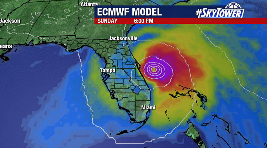
The severity of impacts will be dictated by how close to shore the center of the storm ultimately tracks – the further offshore the better. A difference of 50-100 miles either way makes a big difference in the degree of impacts, not only at the coast, but for areas further inland across Central and South Florida as well.
Next week, Isaías will make its way up the East Coast, with possible impacts from the coast of the Carolinas up through New England.