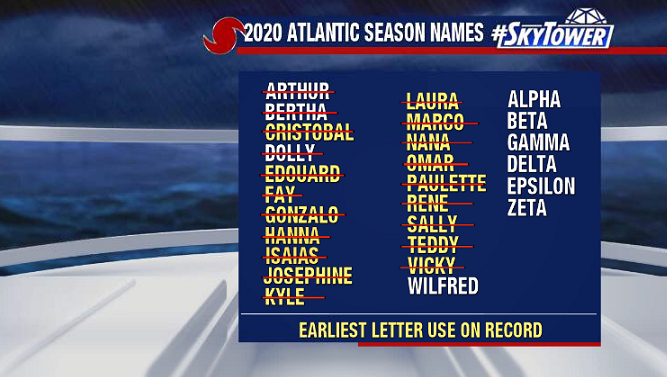
In the span of six hours on Friday afternoon, three new named storms formed in the Atlantic – Wilfred, Alpha, and Beta. The only other time on record that three named storms formed in a single calendar day was August 15, 1893. And yes, we are now into the Greek Alphabet with 23 named storms so far – fast approaching the record of 27 (2005).
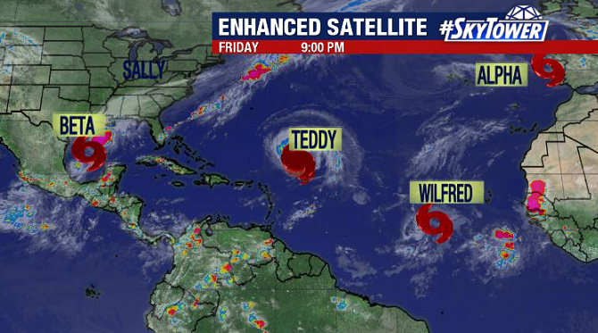
Wilfred is in the middle of the central Atlantic and shouldn’t be a concern for anyone. Subtropical Storm Alpha will be short-lived, as it has already made landfall in Portugal. The only storm currently that will be a threat to the U.S. is Tropical Storm Beta in the western Gulf.
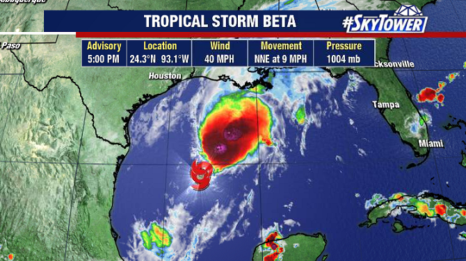
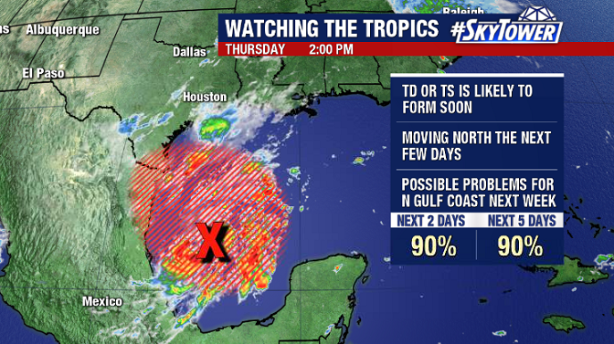
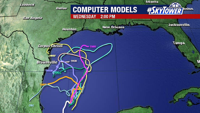
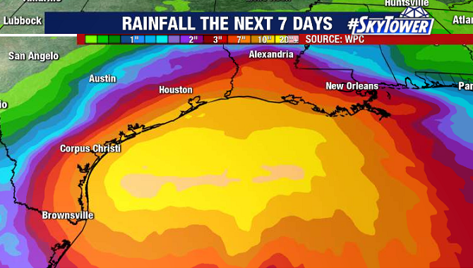
Beta will be slow-moving, meandering its way toward the Texas through the weekend. Southwesterly shear has the circulation a bit elongated right now, but this shear should start to relax, and the storm should slowly become better organized over the next few days.
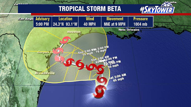
A blocking ridge over the central U.S. is likely to keep the storm in the vicinity of South Texas for at least a couple days early next week before the next trough scoops it up. With this being the case, heavy rainfall looks to be the biggest potential threat right now. We’ll keep you updated over the weekend.
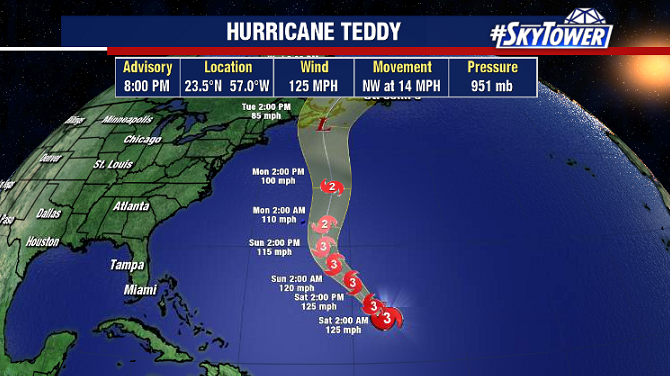
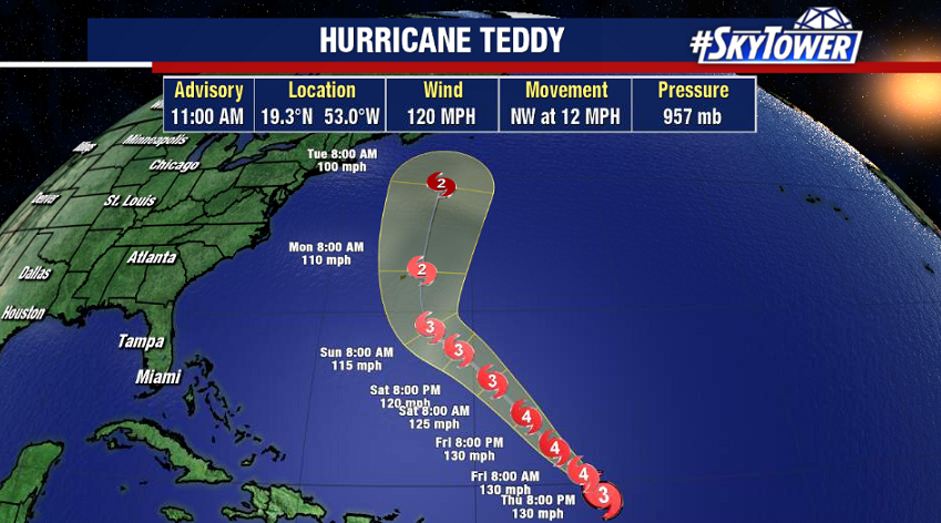
Not to be forgotten, Hurricane Teddy is category 4 storm with max winds of 125 mph. It should gradually weaken as it passes Bermuda and heads toward the Canadian Maritimes early next week.