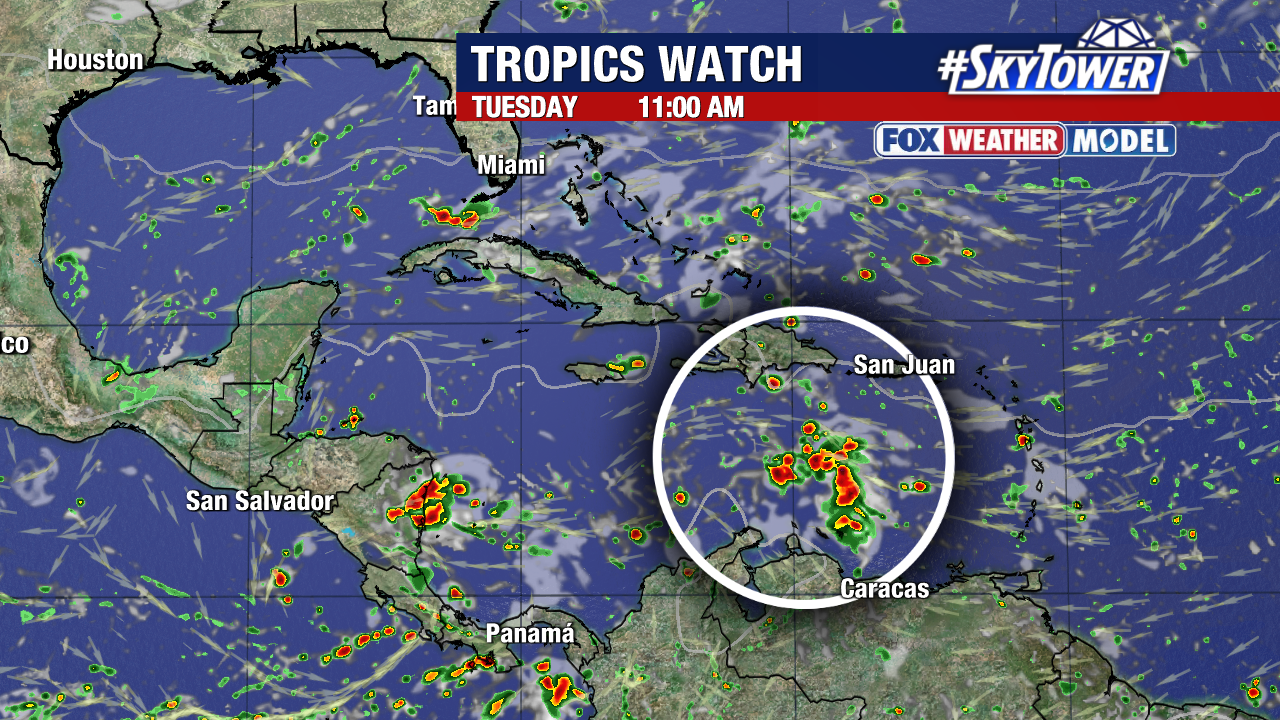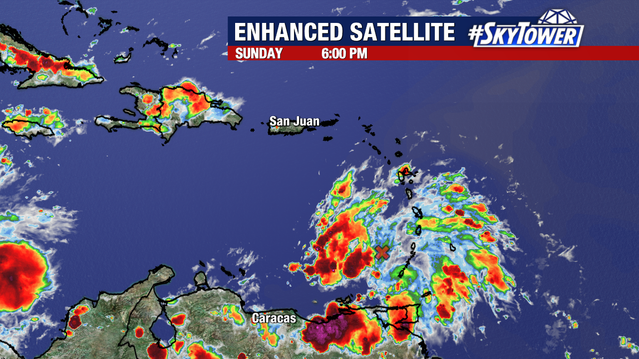
We are currently monitoring only one disturbance in the Atlantic.
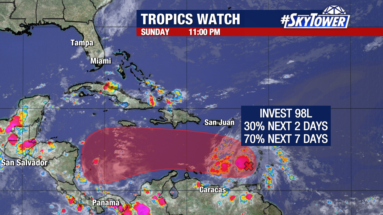
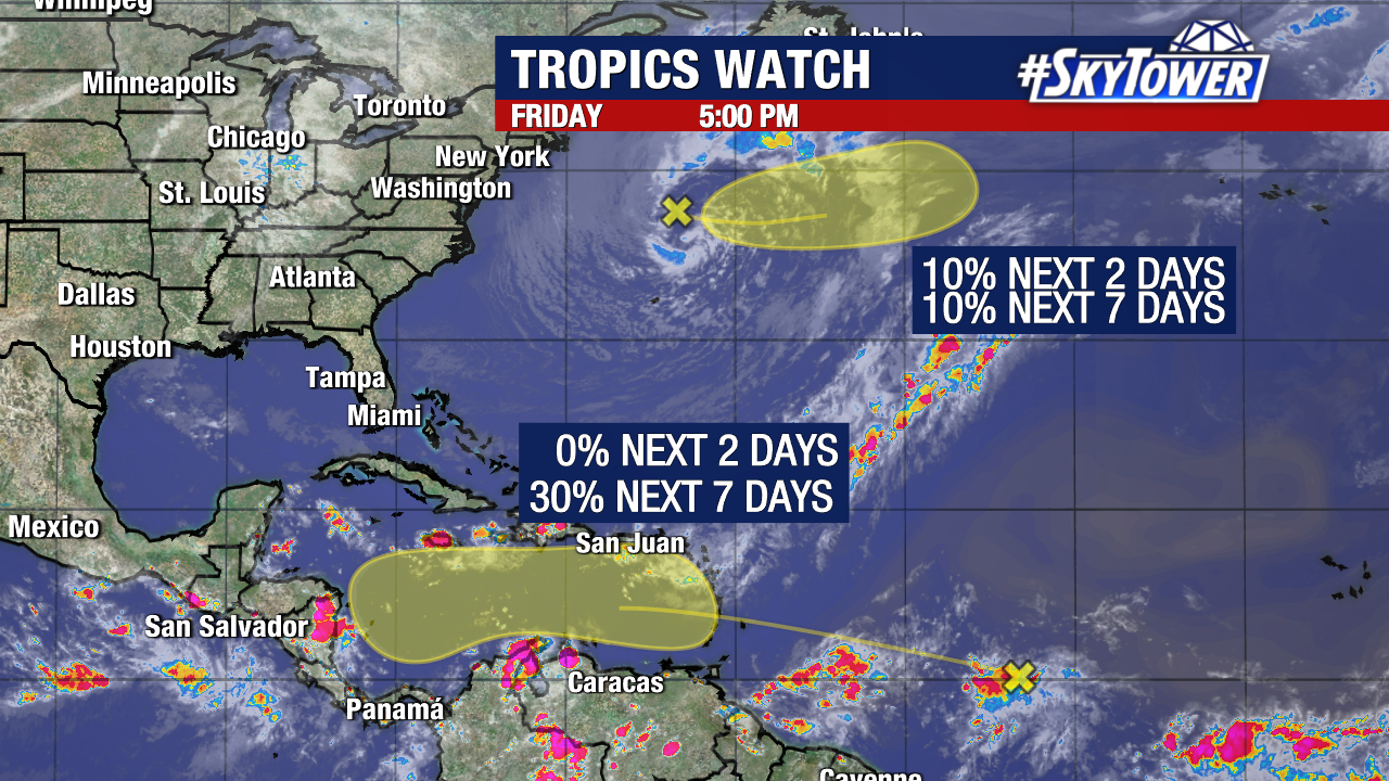
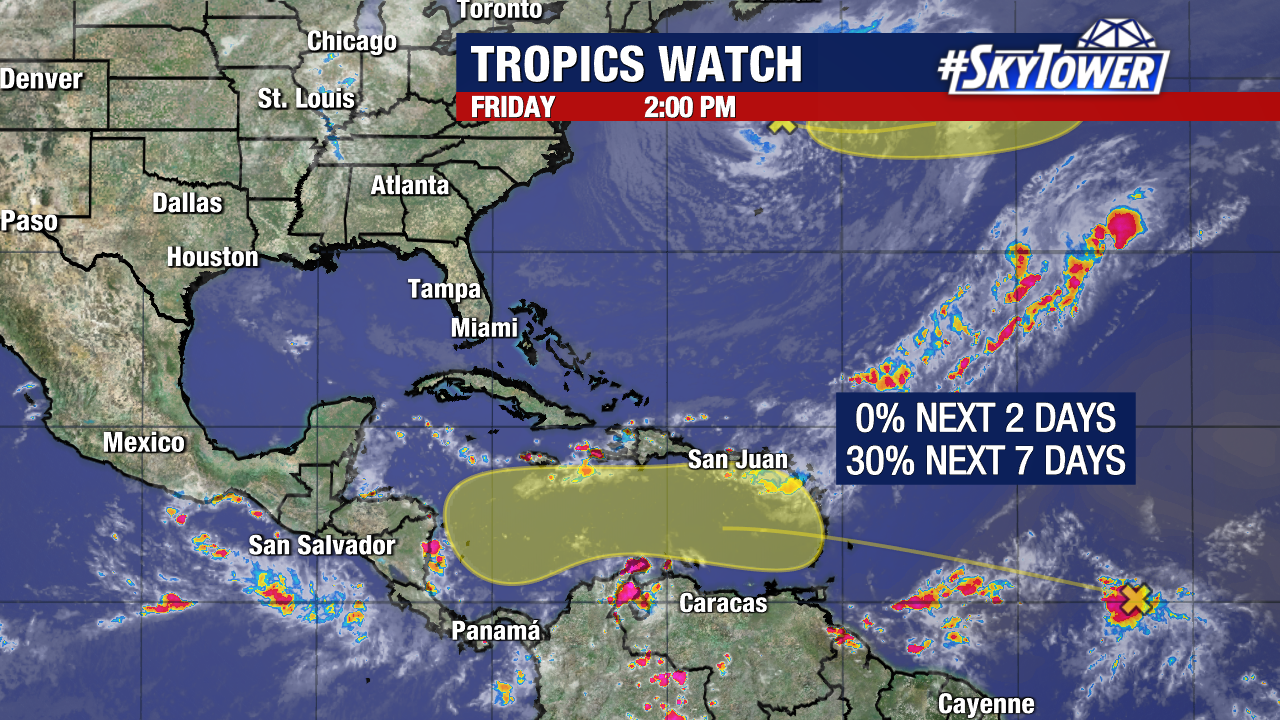
Invest 98L now has a 70% (high) chance of developing into a named storm in the Caribbean within the next seven days.
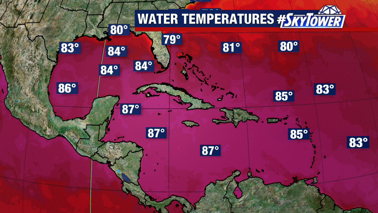
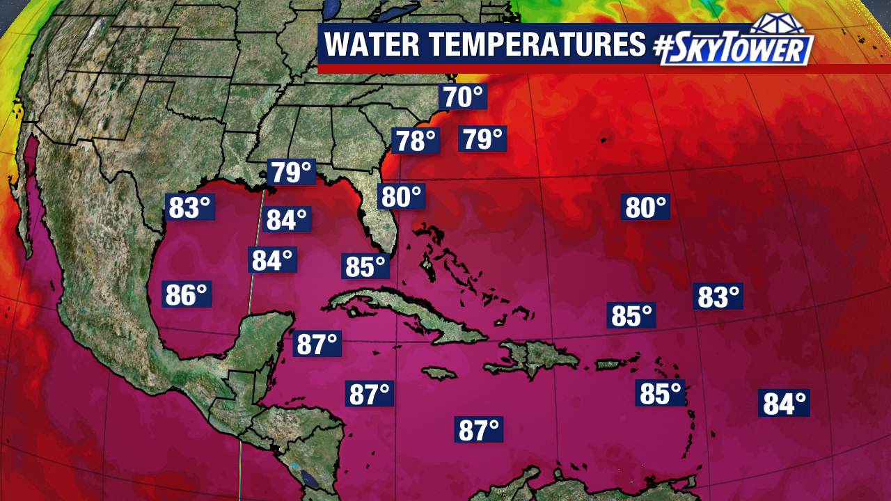
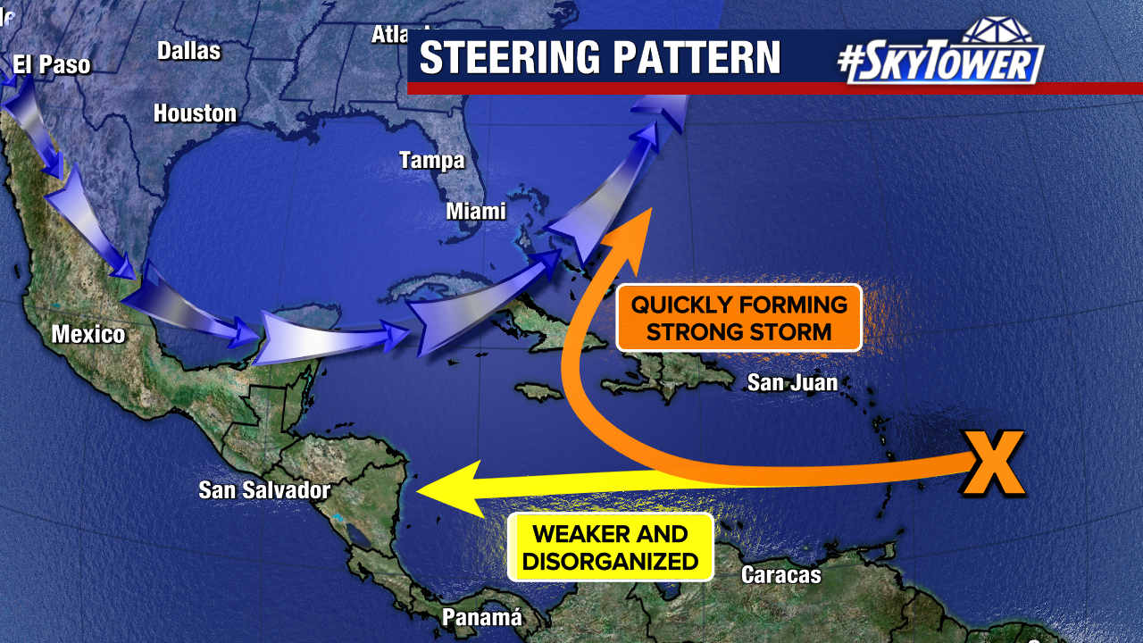
Short-term development is less likely. Conditions will become more ideal for formation in the warmer waters of the central and western Caribbean Sea.
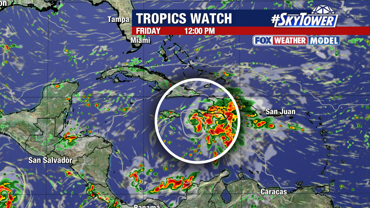
There is significant uncertainty regarding where this would go if it were to become a tropical storm or tropical depression.
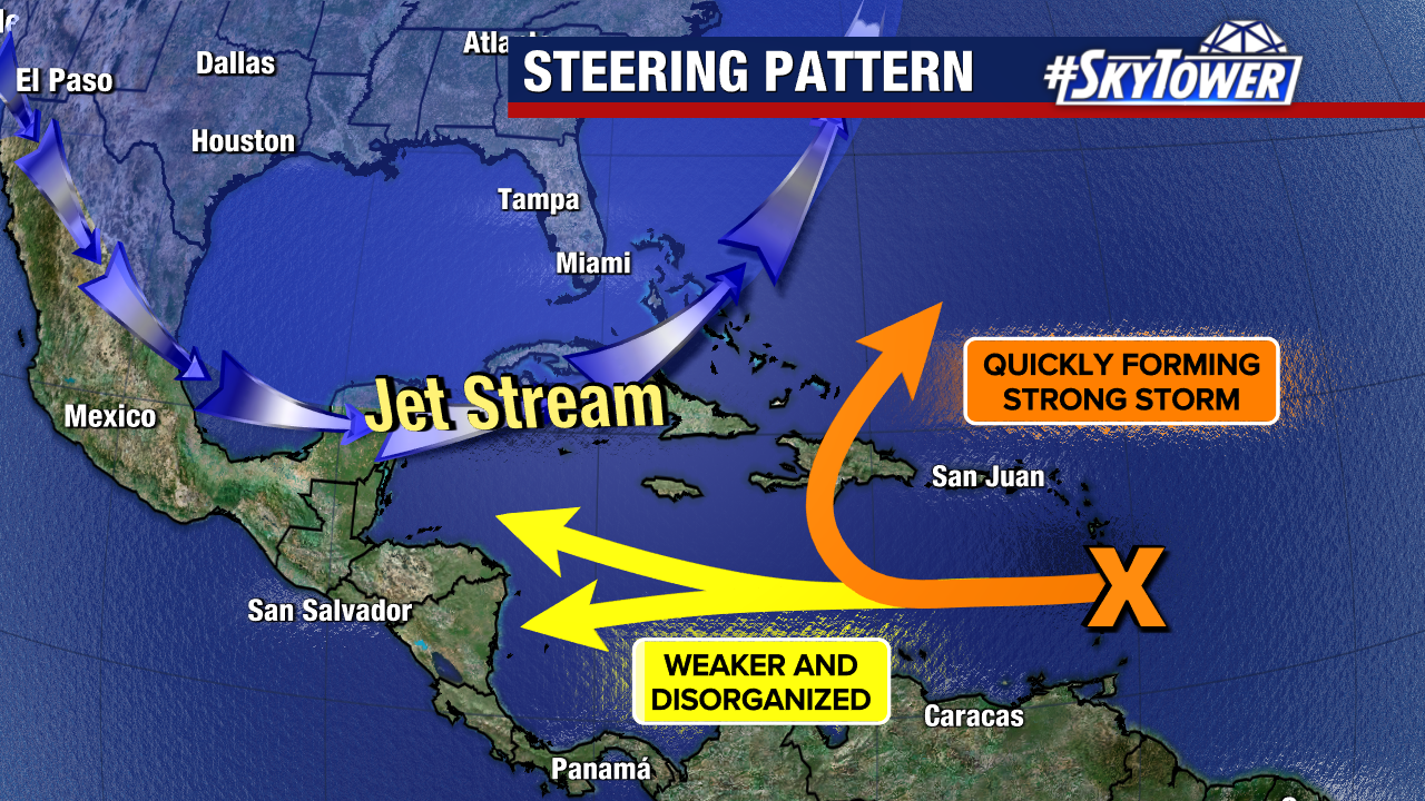
Two ideas have gained increasing traction within our weather models in the last few days. Some models take it into the western Caribbean, initially as a weaker system. Many now show an early curve north and northeast as a more organized storm.
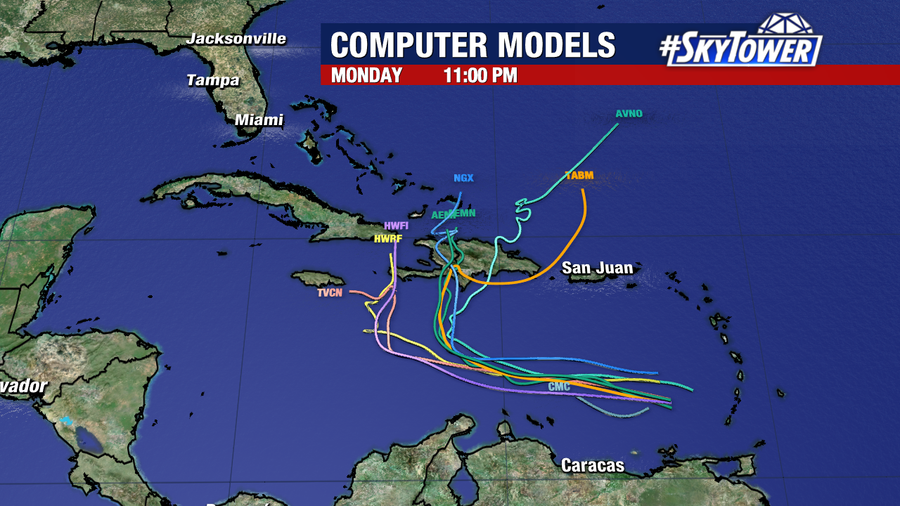
That path would bring impacts to the northern islands of the Caribbean. This is all assuming that something forms in the first place, which may not happen.
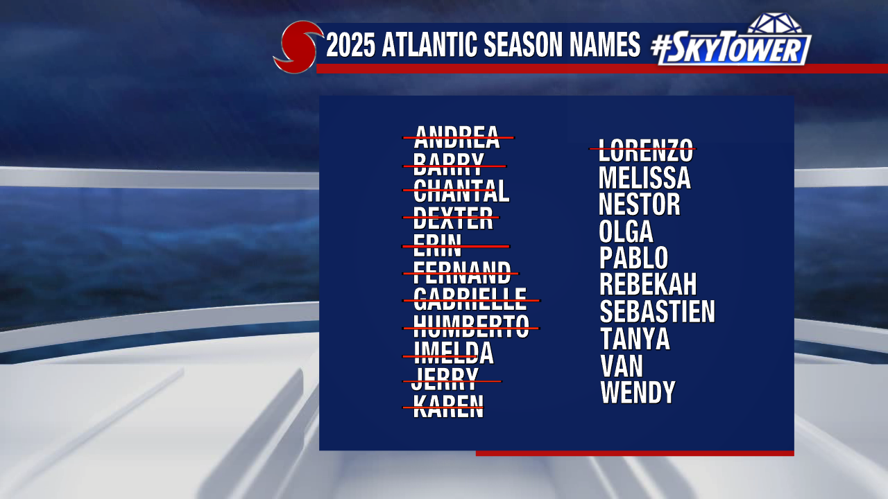
There should be much more agreement among our weather models in the coming days. If named, the next storm would be called Melissa.