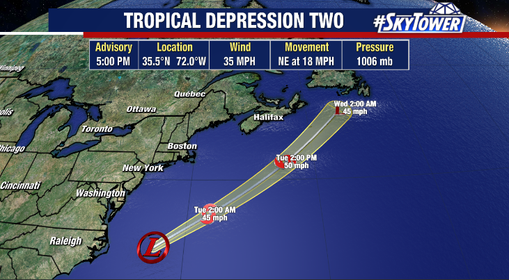
On Monday, a spinup along an old frontal boundary off the coast of North Carolina took on some tropical characteristics and has now been designated as Tropical Depression Two. This will likely become Tropical Storm Bill as it moves away from the U.S. over the next couple days.
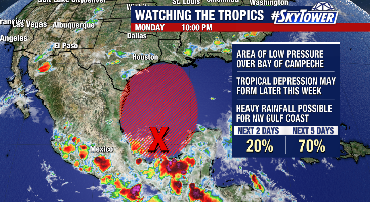
The main focus continues to be the disturbance in the southwestern Gulf. The National Hurricane center has increased development odds to 70% over the next 5 days. It’s becoming increasingly more likely that we’ll have either a tropical depression or weak tropical storm (Claudette) moving toward the northern Gulf Coast for the weekend. Regardless of development though, the main issue will be heavy rainfall. Pinpointing where the heaviest rain will be the goal over the next few days, but models have been honing in on parts of Louisiana, Mississippi, and Alabama for the potential of several inches.