As of 8pm EDT Sunday evening, a loosely organized area of showers and storms was located about 425 miles ESE of Charleston, SC. At times on Sunday it has shown signs of getting better organized, but strong upper-level winds have been working against so far Sunday evening.
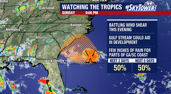
It is moving fairly quickly to the northwest at 15-20 mph. This leaves only about 24 hours until it comes ashore along the GA/SC coast. What could provide a bit of a boost, and elevate this to a tropical depression or weak tropical storm between now and then, is the energy that will be provided as it moves over the warm waters of the Gulf Stream. For now, the National Hurricane Center has put development odds at 50%.
Regardless of development, localized 1-3″ rainfall totals will be possible along the immediate coasts of Georgia and South Carolina through Monday night.