We’ve been tracking this tropical wave across the Atlantic for the better part of a week now. Showers and storms have become more organized over the last 24 hours, but it’s still lacking a center of circulation at the moment. This could become Tropical Storm Elsa at any time in the next day or two. If Elsa does form, it would be earliest 5th named storm on record in the Atlantic.
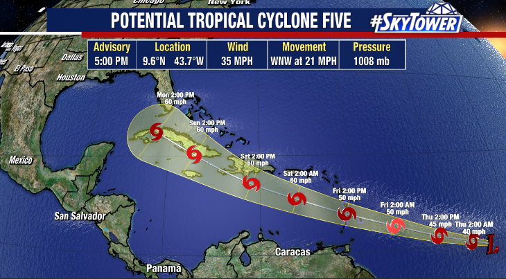
As is usually the case when a storm has yet to form, there is quite a bit of forecast uncertainty. There are going to be a lot of factors in play down the road, including possible land interaction. So, for the U.S., this is simply something to keep an eye on in the coming days and check back in with us for any updates.
A tropical storm watch is currently in effect for St. Vincent and the Grenadines, St. Lucia, Barbados, and Martinique where tropical storm conditions could arrive as early as Friday morning.