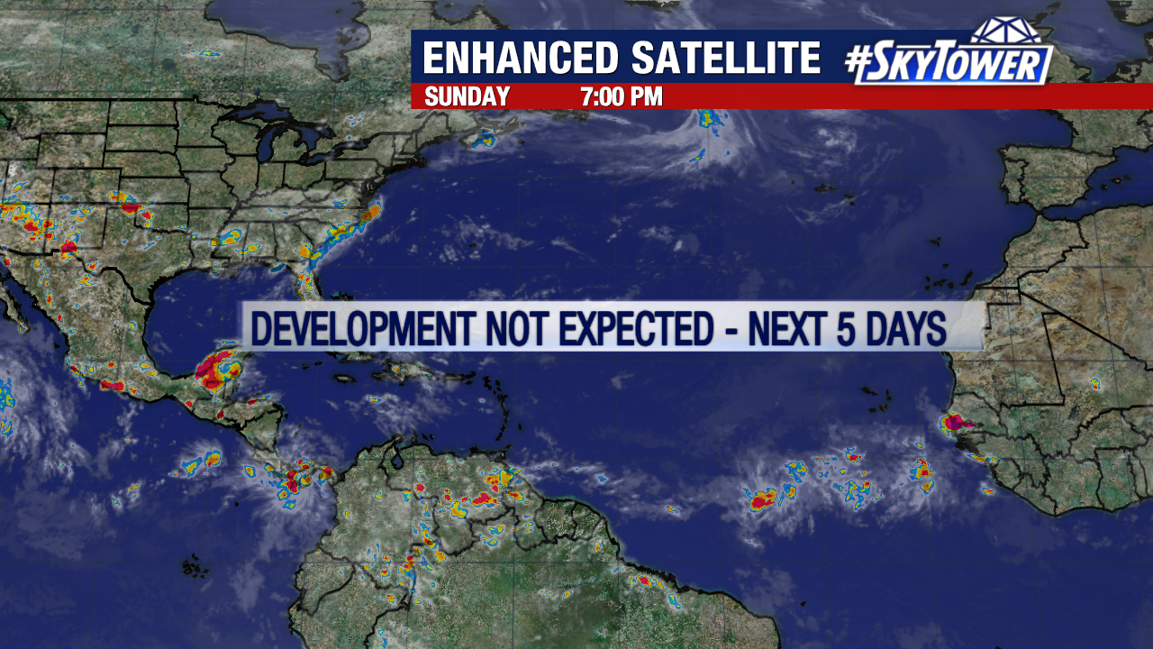
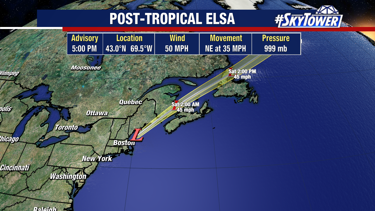
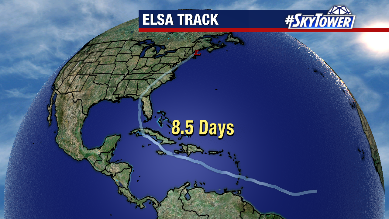
Ever since Elsa moved up the East Coast of the U.S. about a week and a half ago, things have been quiet all across the Atlantic basin; and there shouldn’t be much happening over the next 5-7 days.
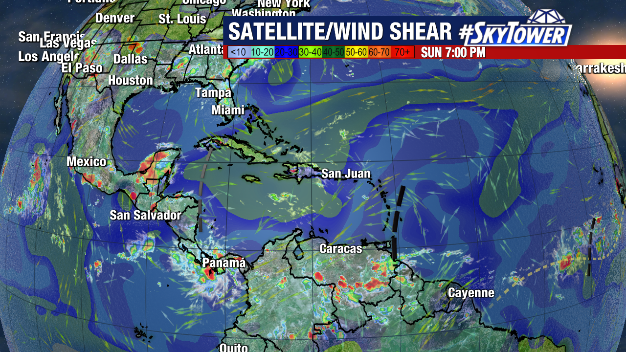
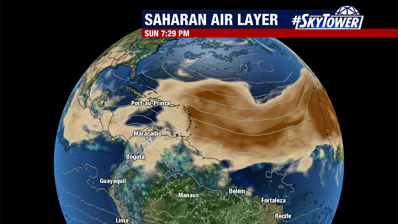
A few areas of increased wind shear, as well as an abundance of dry air and Saharan dust are the primary reasons behind this quiet stretch.
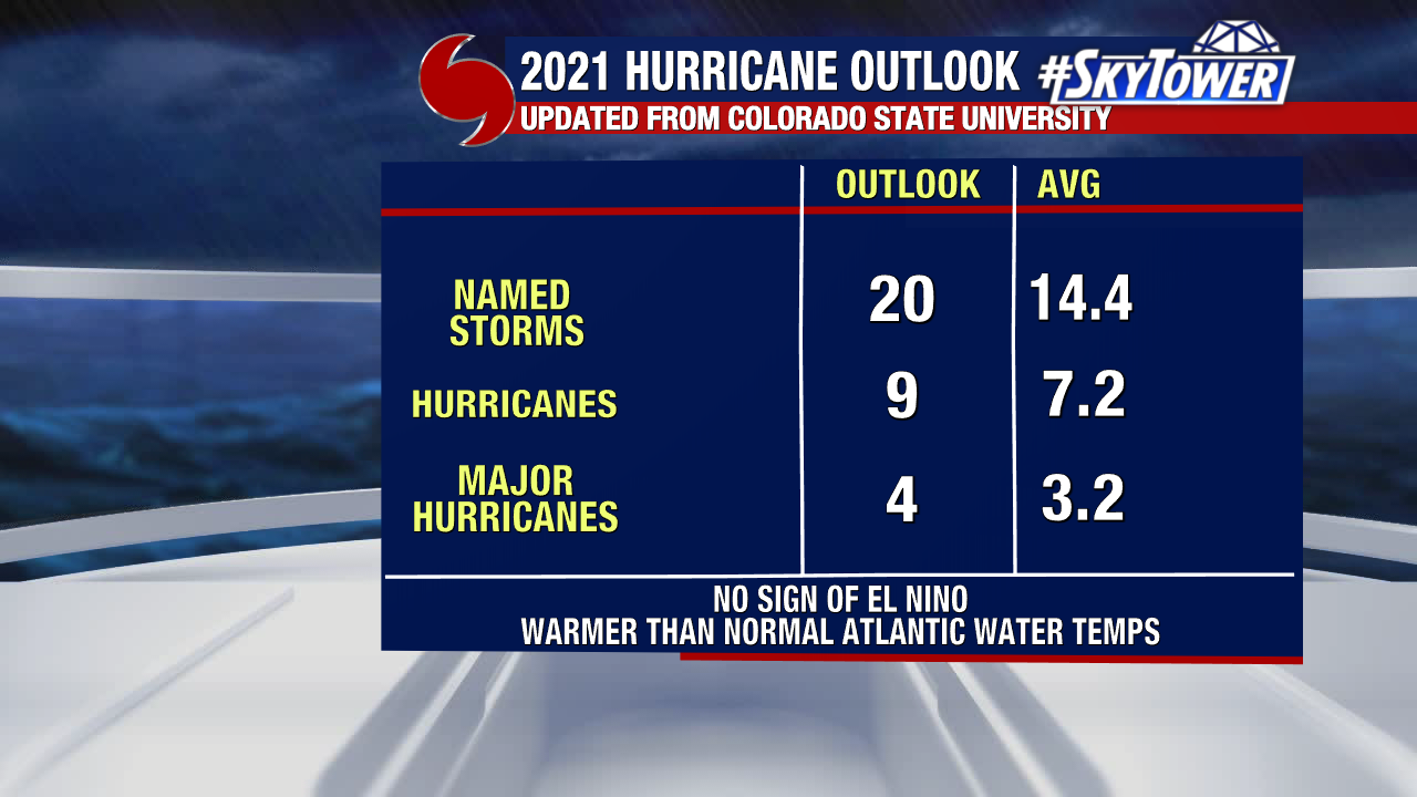
Despite the lack of activity right now, the 2021 hurricane season is still running well above normal, and the peak of the season still lies ahead. So, stay prepared as always, but for now kick back, relax , and we’ll let you when things start to heat up again.