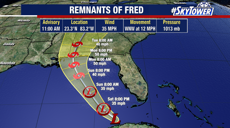
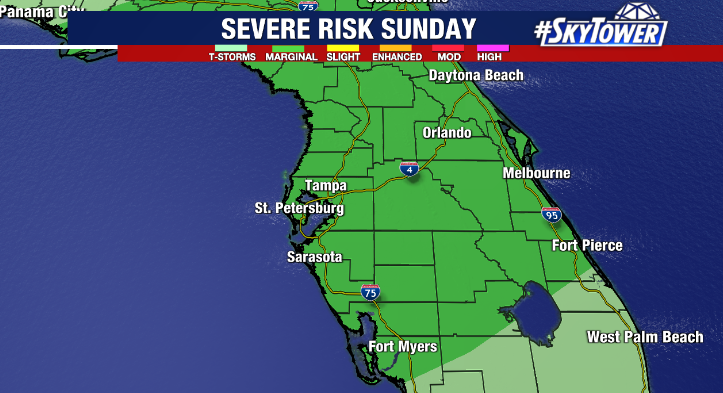
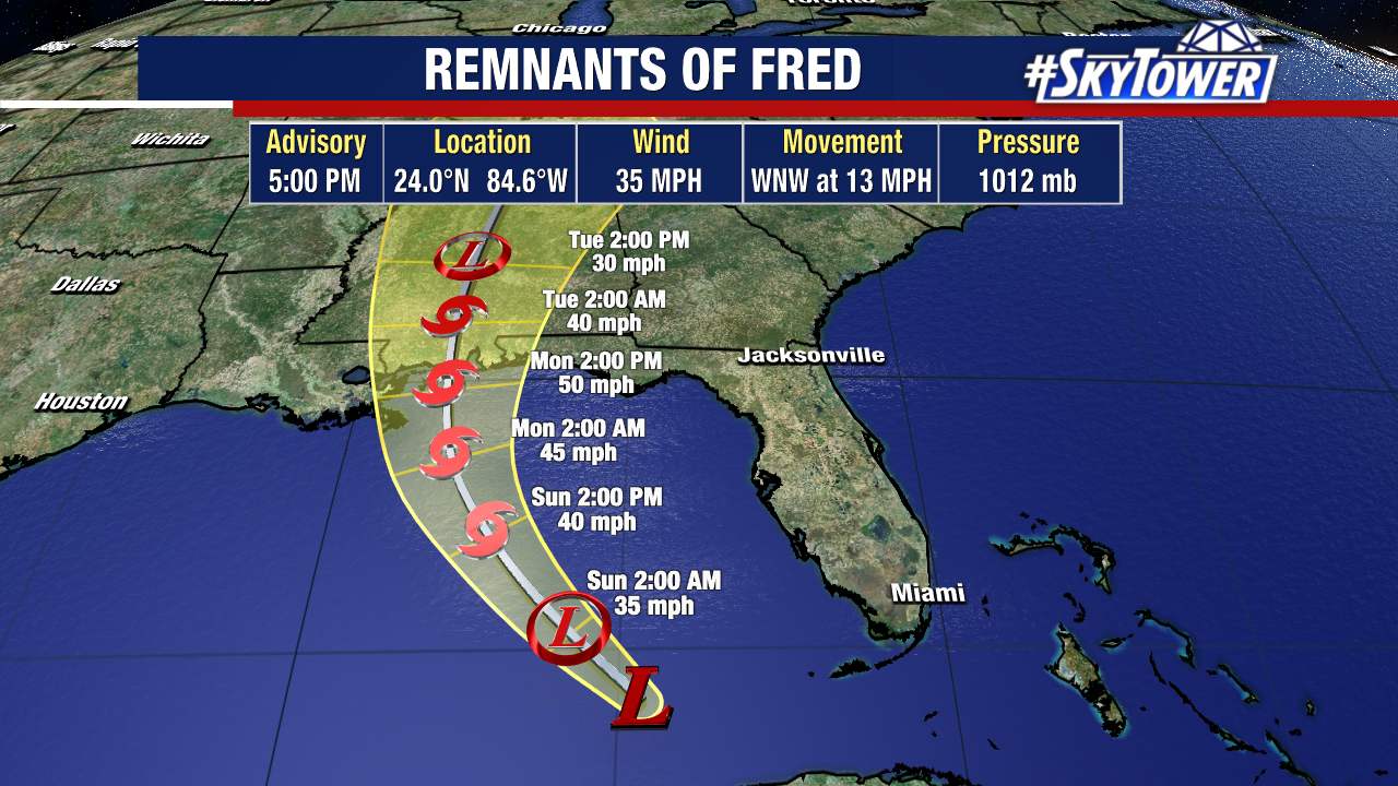
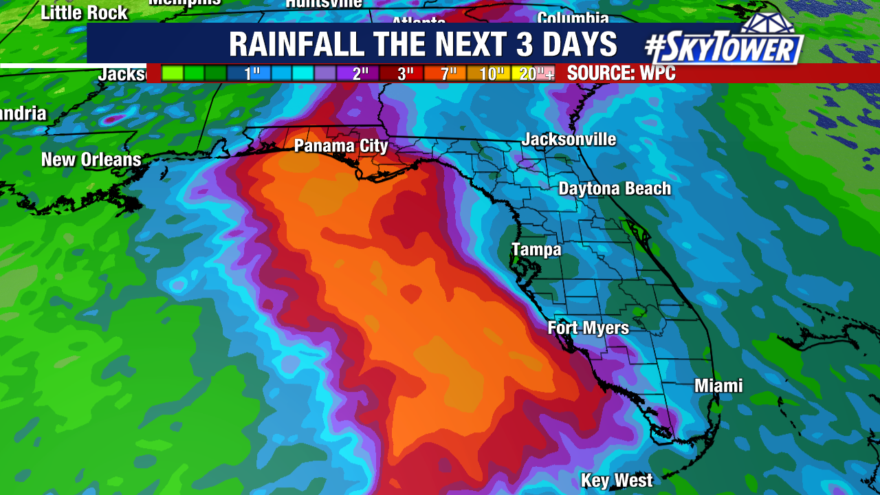
Fred lost its center of circulation early Saturday, but there are signs the storm’s remnants are trying to reorganize. As shear continues to lessen, there is a window for Fred to reform between now and Monday afternoon when it comes ashore along the northern Gulf Coast. Either way, periods of heavy rain will move through northwest Florida and south Alabama on Monday with widespread rain totals of 3-7″ and isolated amounts up to 10″. A few, brief weak tornadoes will also be possible.
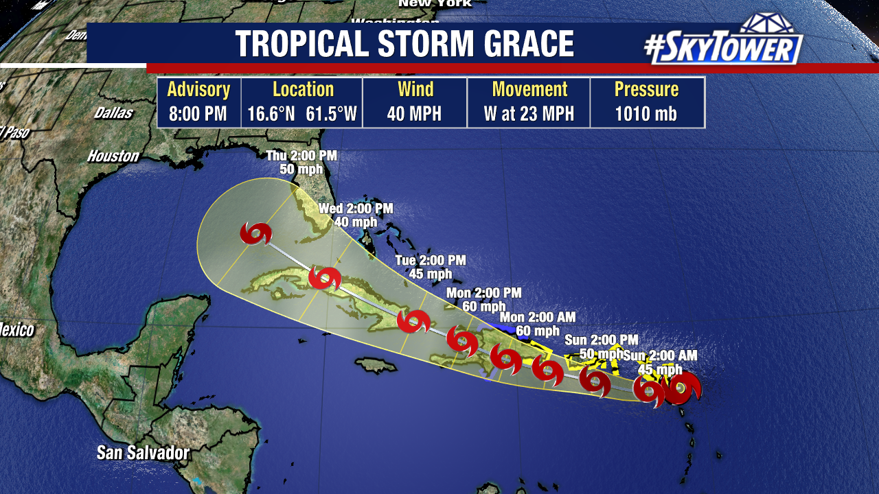
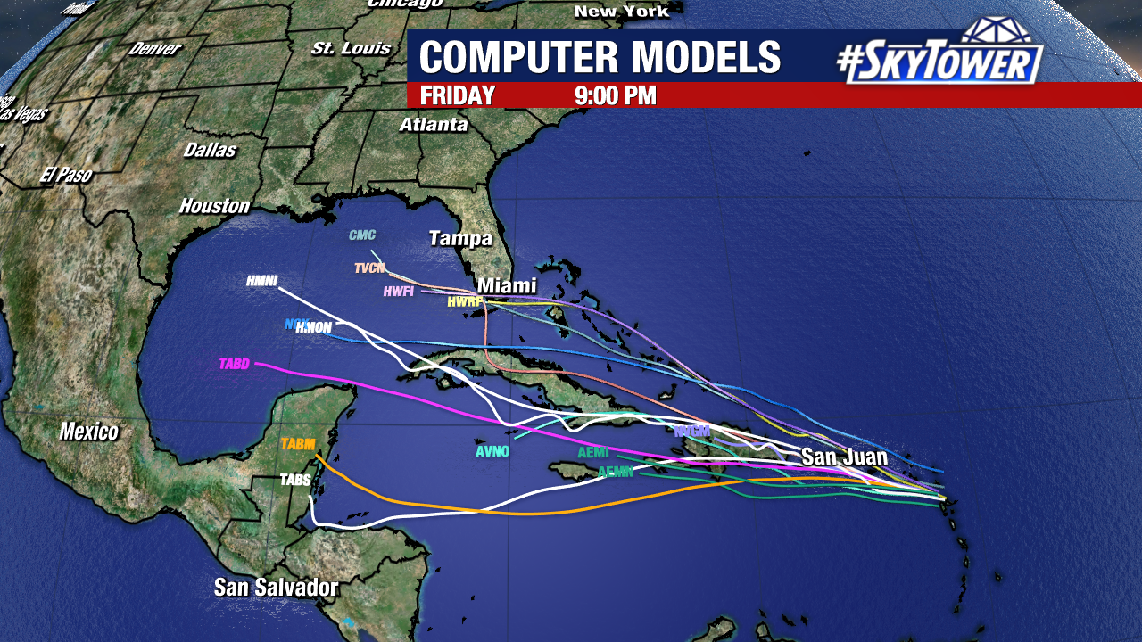
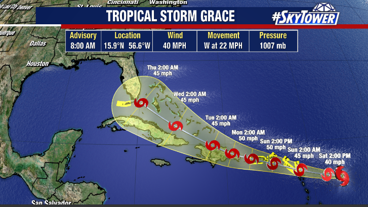
Tropical Storm Grace is moving into the northern Caribbean this evening. This is following a very similar track to the one Fred took, which will bring a lot of land interaction into play in the coming days. For now, it’s just something to watch. We’ll keep you posted.