It took nearly four full days for Potential Tropical Cyclone Two to develop a center of circulation, but Friday morning it finally did so, and we now have Tropical Storm Bonnie about 100 miles off the coast of Nicaragua.
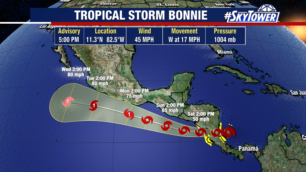
Often times, tropical systems in this region cause widespread flash flooding and landslides. Not to say that won’t be threat this time around, but with Bonnie moving fairly quickly at around around 20 mph to the west, those concerns will be eased a bit. Rainfall totals are still expected to be on the order of 4-8″ across much of Nicaragua and Costa Rica, with isolated amounts of up to 12″.
Bonnie should be able to retain its circulation as it crosses into the Pacific. Some strengthening is likely as it moves back out over open water.