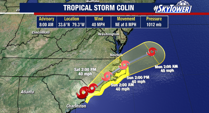
It’s still pretty early early in the hurricane season – and tropical development this time of year often times happens close to home in the Gulf of Mexico or off the Southeastern Atlantic coast of the US. We’re looking at one such scenario later this week. They’ll be a decaying frontal boundary dropping down to the northern Gulf Coast in a few days. Convergence along these fronts often cause a weak area of low pressure to spin up, and with very warm Gulf waters it doesn’t take much for a tropical disturbance to quickly form.
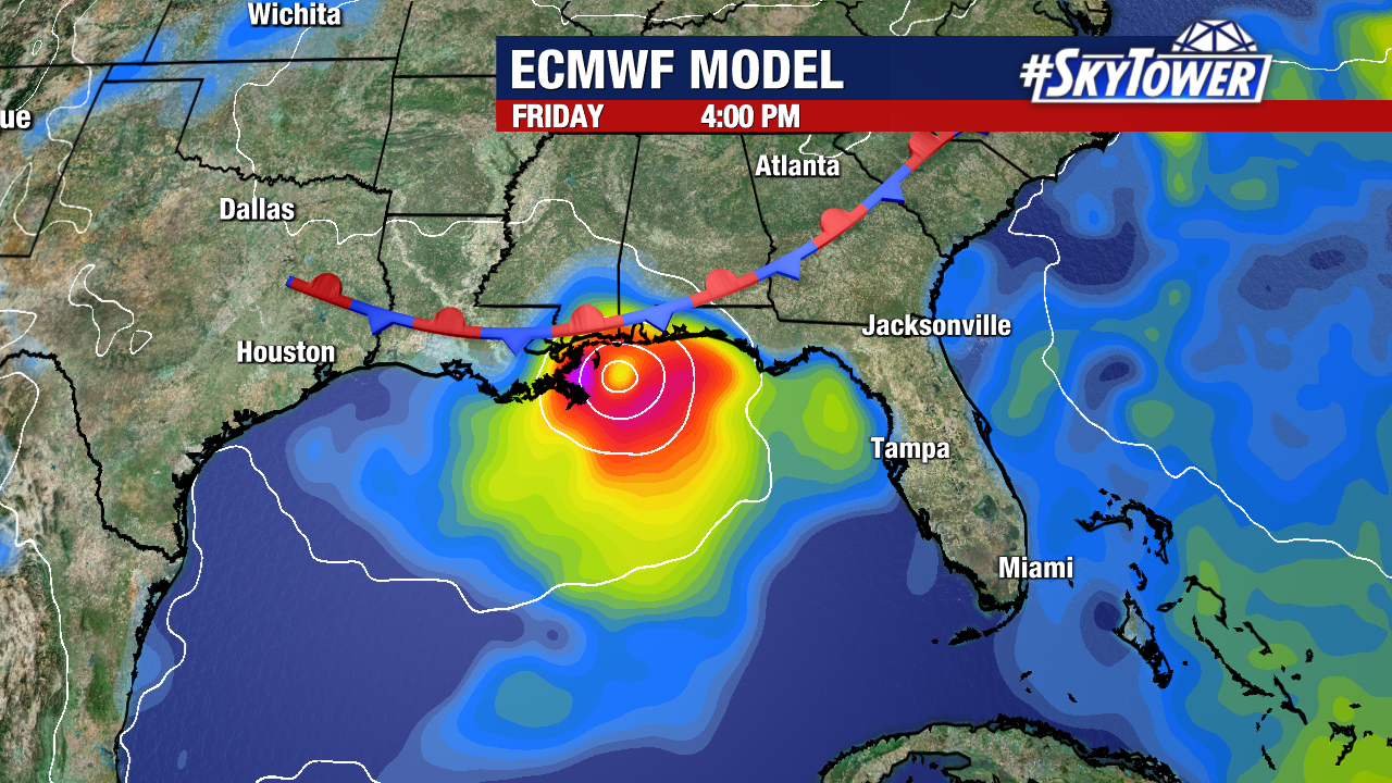
It’s always a tricky forecast several days out, and we don’t have much model consensus at all at this point. Folks along the northern Gulf Coast should monitor this closely through the week. Storm or no storm, this is likely to widespread heavy rain for many areas during the second half of the week into next weekend.