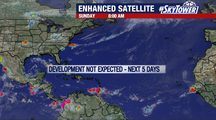
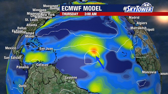
It’s been more than a month since we last had any activity to monitor in the Atlantic basin, and that stretch will continue at least through the weekend. That being said, things have to pick up sooner or later as we head into the peak of hurricane season, and there have been some indications that a robust tropical coming off the coast of Africa next week could bear watching.
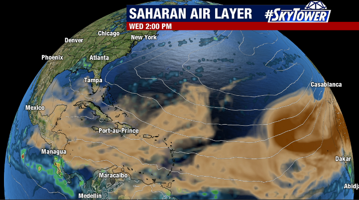
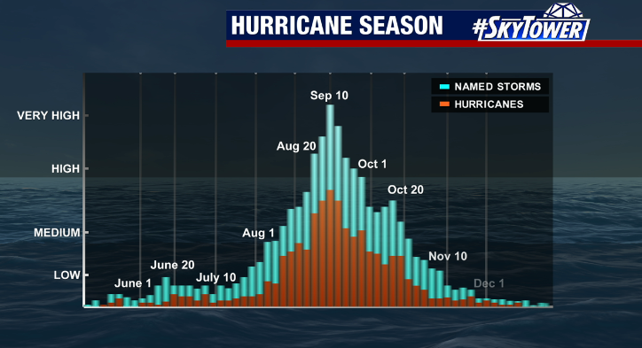
This time of year, winds are typically becoming more favorable for development and the extent of Saharan dust begins to lessen. As this happens, tropical activity tends to ramp up quickly, and we have to remind ourselves that the bulk of the hurricane season still lies ahead.
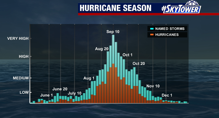
On Thursday, NOAA released an update to their 2022 hurricane season outlook. The numbers are essentially unchanged, with a 60% of an above normal season when all is said and done. At the end of the day, regardless of what any outlook says, we stay prepared as always. It doesn’t matter how many or how few storms we end up having – all it takes is one.