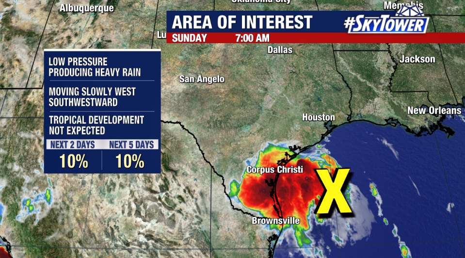
We continue to monitor an area of disturbed weather over Central America and northwestern Caribbean Sea. No development is expected for the next couple days thanks to land interaction, however a weak area of low pressure may form as drifts northwest and moves over the Bay of Campeche/western Gulf by Friday night or Saturday.
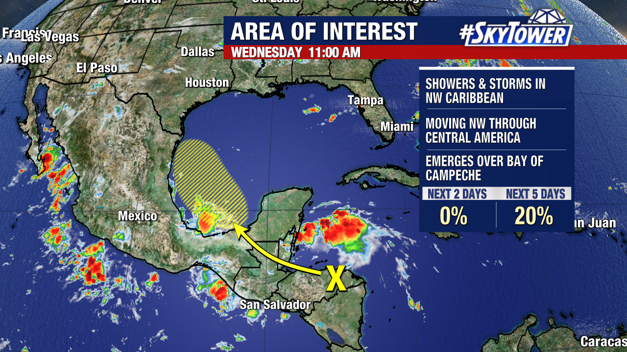
Any development will be gradual, and this shouldn’t end up having much of an impact outside of aggravating existing flood concerns for areas that just received 6-12″+ of rain last weekend across south Texas. We’ll keep you posted.
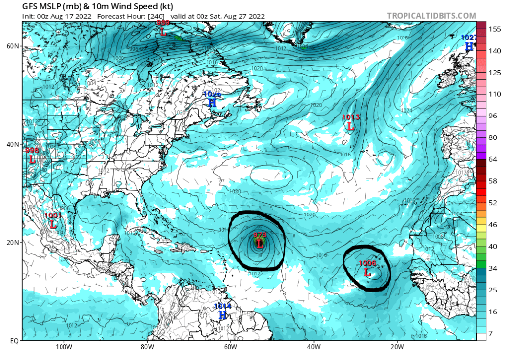
So, here we sit in the middle of August with a relatively quiet season thus far. The question has always been when, not if, Atlantic tropical activity is going to ‘flip the switch’. We’re getting some signs that it could be soon – within the next 6-10 days.
Lately, the GFS and it’s ensemble members have been quite persistent and bullish on development of the the tropical wave rolling off the coast of Africa later this week. Not to mention the wave behind it, as well as additional development elsewhere in the Atlantic. Outside of the GFS, there isn’t a whole lot of model support for this, so for now we just watch the trends. That being said, if there’s going to be an uptick in activity, historically it happens over the next 3-4 weeks.