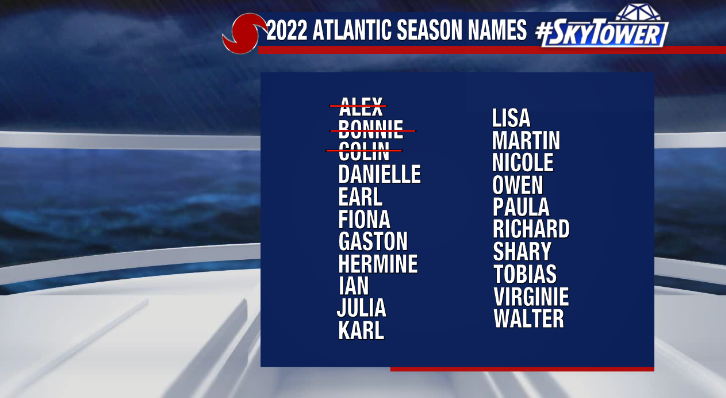
While climatology would tell us hurricane season ramps up during the month of August, that hasn’t really been the case this year. Saharan Dust has largely overpowered tropical waves rolling off the coast of Africa. Meanwhile, the Caribbean and Gulf of Mexico have largely been in a slumber. Despite recent Gulf disturbances which initially showed some promise, Danielle has yet to develop. On average, the 4th named storm of the season occurs on August 15th so things are a bit behind schedule.
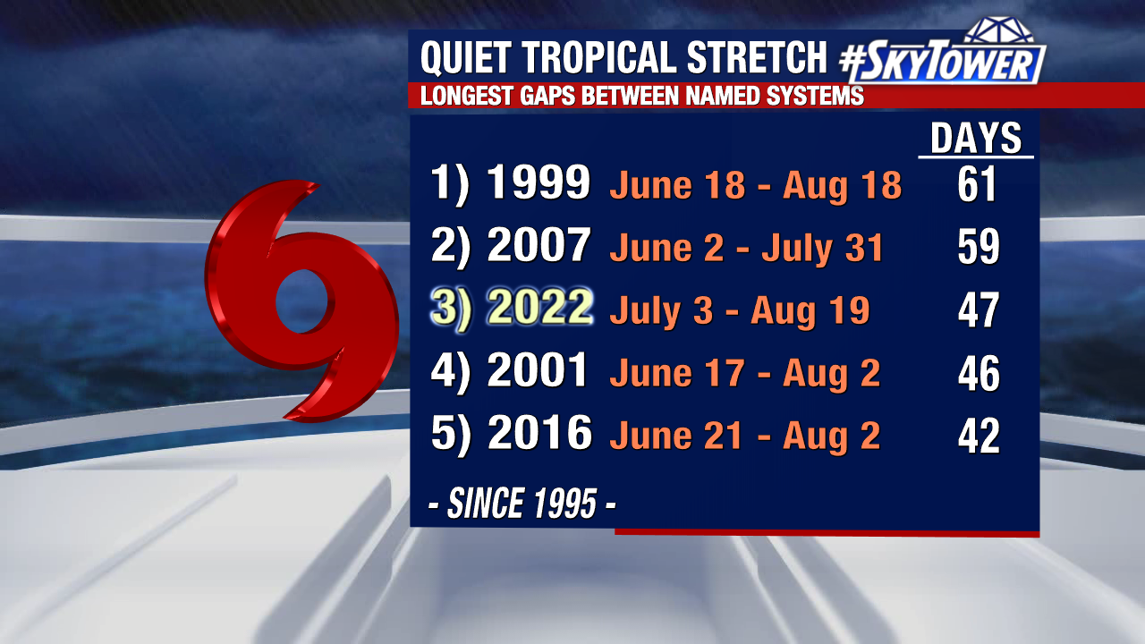
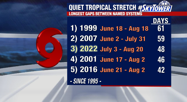
We’ve now gone 48 days since our last named storm, Colin, making it the third longest gap between named systems dating back since 1995. And we’ve yet to see our first hurricane of the season too despite the average first hurricane occurring on August 11th.
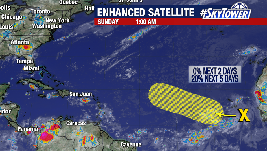
However, recent years have shown things can ramp up in a hurry, especially considering the La Niña conditions. Long range models also support the idea of seeing the tropics starting to wake up. We’re currently monitoring a tropical wave near the Cape Verde Islands that will continue to move westward in the coming days. While it’ll battle some dry air, tropical development is possible. The National Hurricane Center is now giving it a 20% chance of formation over the next 5 days. Stay tuned.