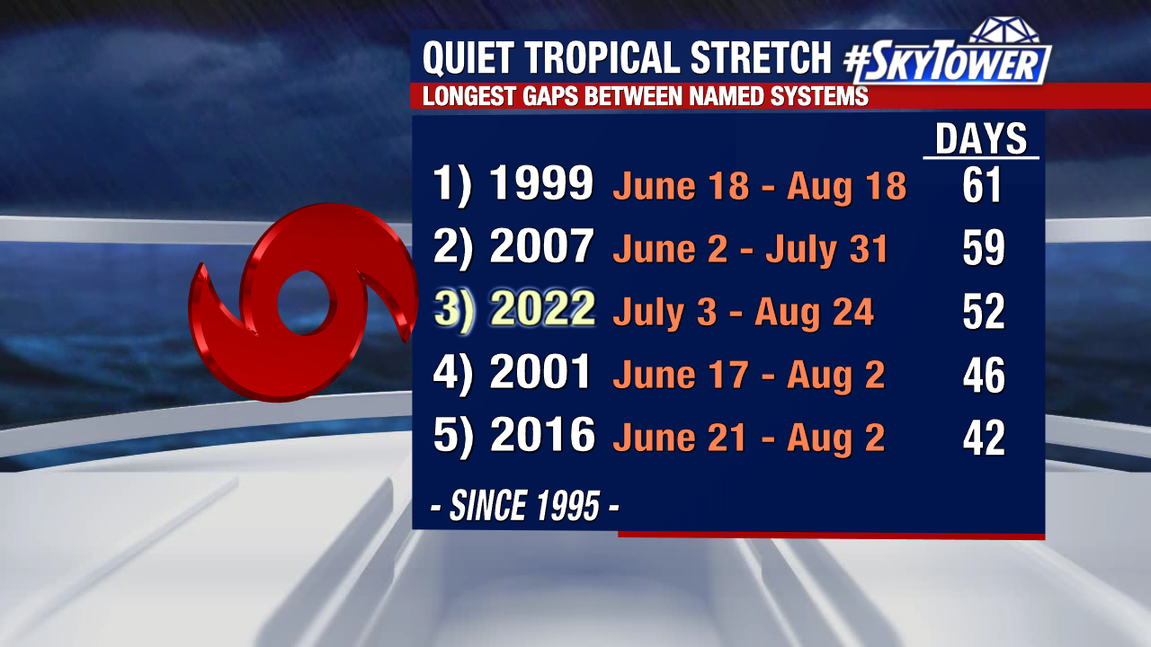
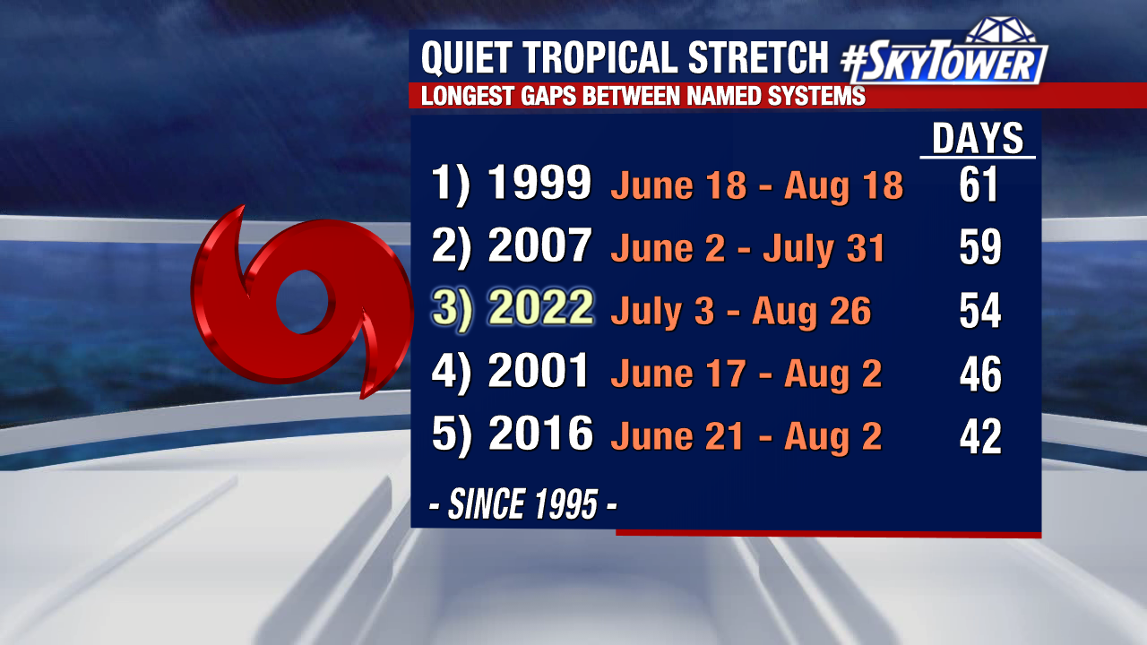
For now, it looks like we’ll tack on at least a few more days to our nearly two month-long streak with no named systems in the Atlantic. All good things must come to end though, and signs point toward an uptick in tropical activity as we roll into September.
The environment in the Atlantic should become more favor in the coming weeks, as the Madden-Julian Oscillation (MJO) returns to the Atlantic basin. The MJO basically does two things, it lowers wind shear and introduces rising motion which enhances thunderstorm activity. These are two ingredients that we need for tropical development.
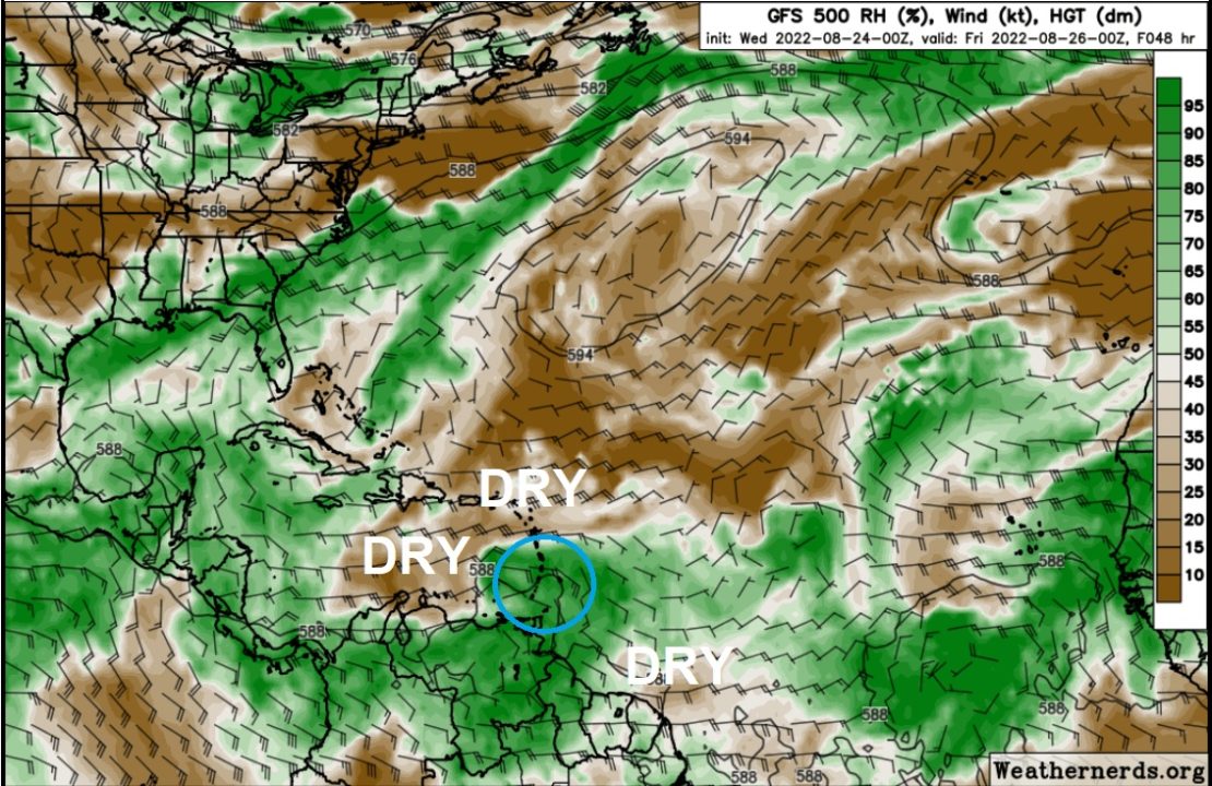
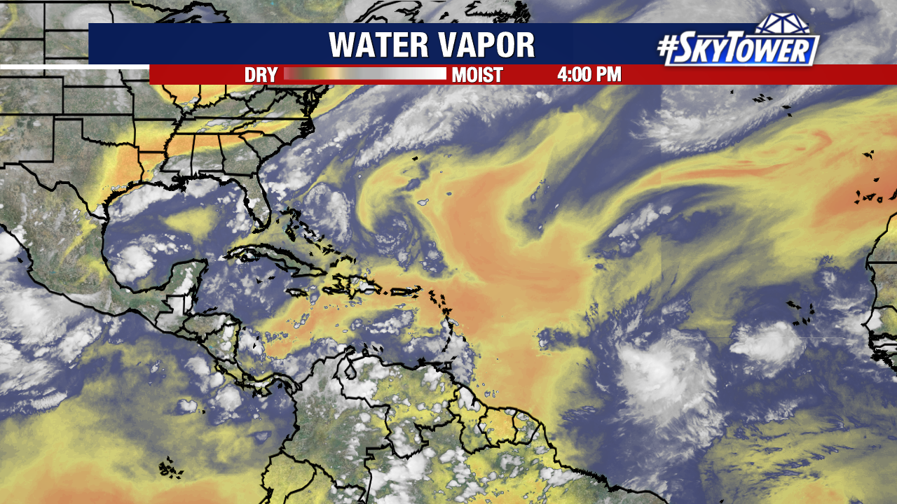
Dry air has been a big hindrance for development during this quiet stretch. While that dry air is likely to remain quite prevalent, increase thunderstorm activity and frequent tropical waves rolling off the coast of Africa tend to slowly eat away at it.
So what areas are we going to be watching over the next week or so?
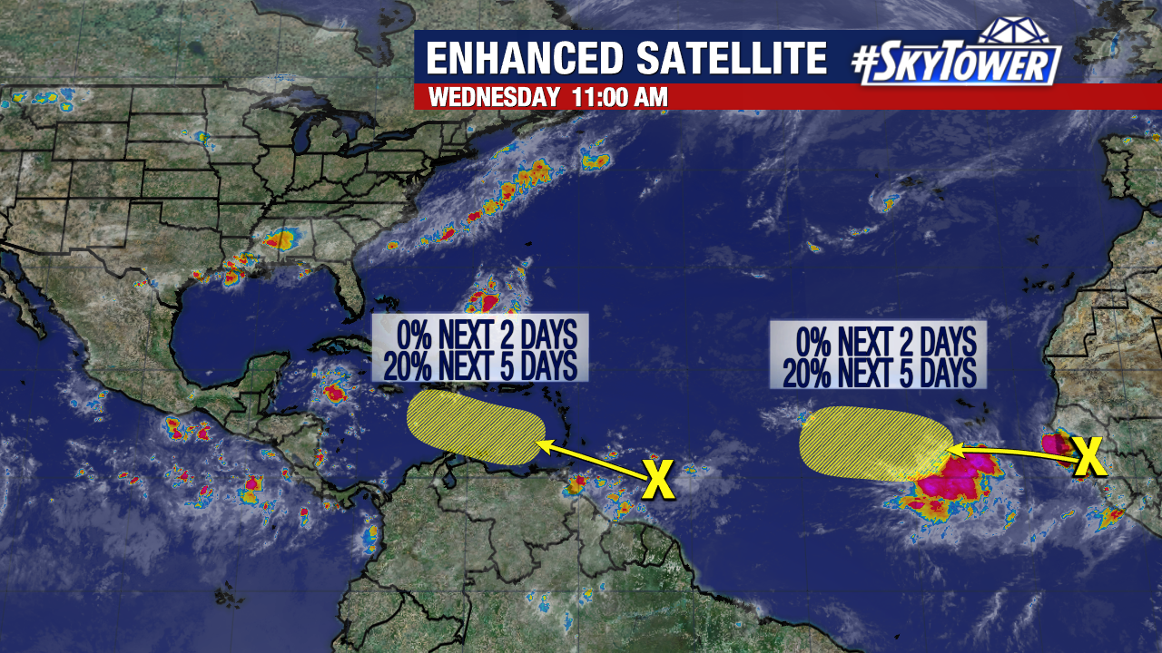
For starters, the wave that has now moved into the Caribbean Sea could begin to gradually organize in the coming days, but there isn’t a whole lot of agreement in our suite of model guidance. And those that do develop the wave have been pretty inconsistent run-to-run. For now, it’s just something we’ll keep tabs on.
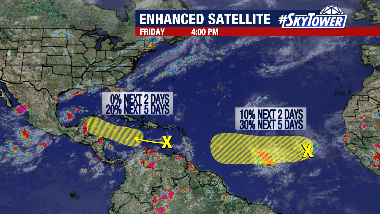
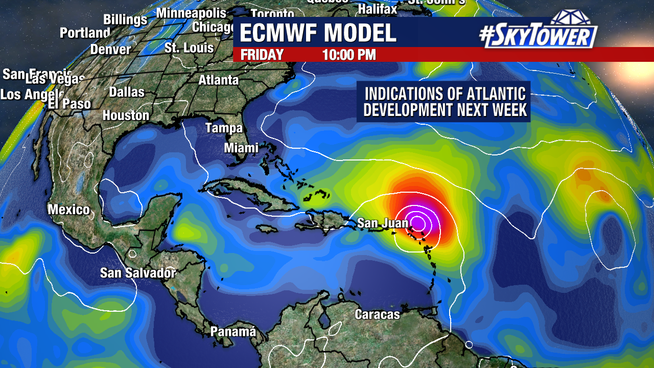
Focusing now on the wave in the central Atlantic. It would appear this has a better chance for development as it continues to move west next week, and interacts with a broad area of disorganized showers and storms. Both the Euro and GFS have supported this idea with some consistency in recent runs. If this were to impact any land areas in the Caribbean, it wouldn’t be until late next week. It’s also far, far to early to determine whether or not this could have any impact on the U.S.