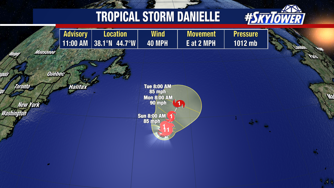
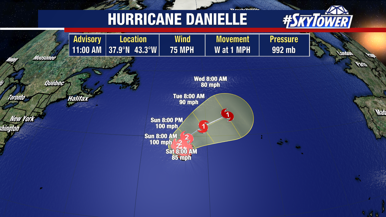
Danielle has strengthened into a hurricane – the first of the 2022 season. The first hurricane forms by August 11th on average in the Atlantic, so this is well behind schedule. No worries with Danielle, it’s just a North Atlantic fish storm.
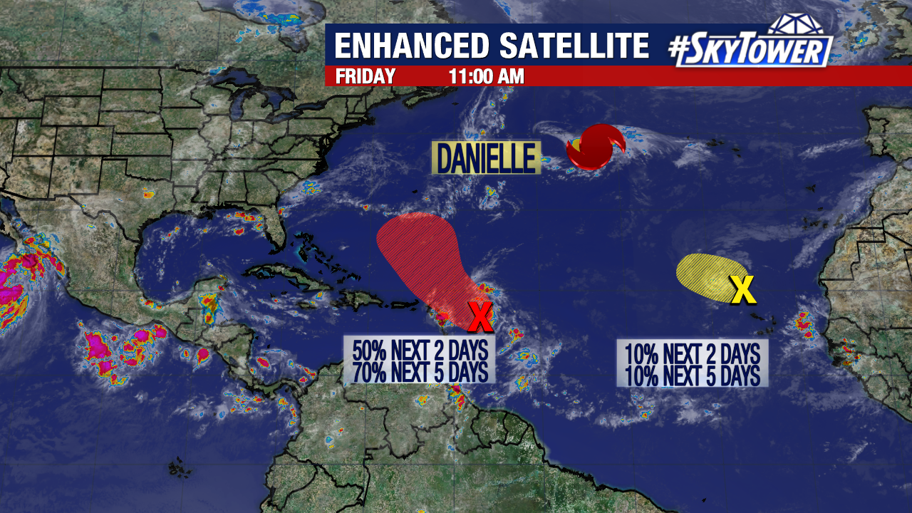
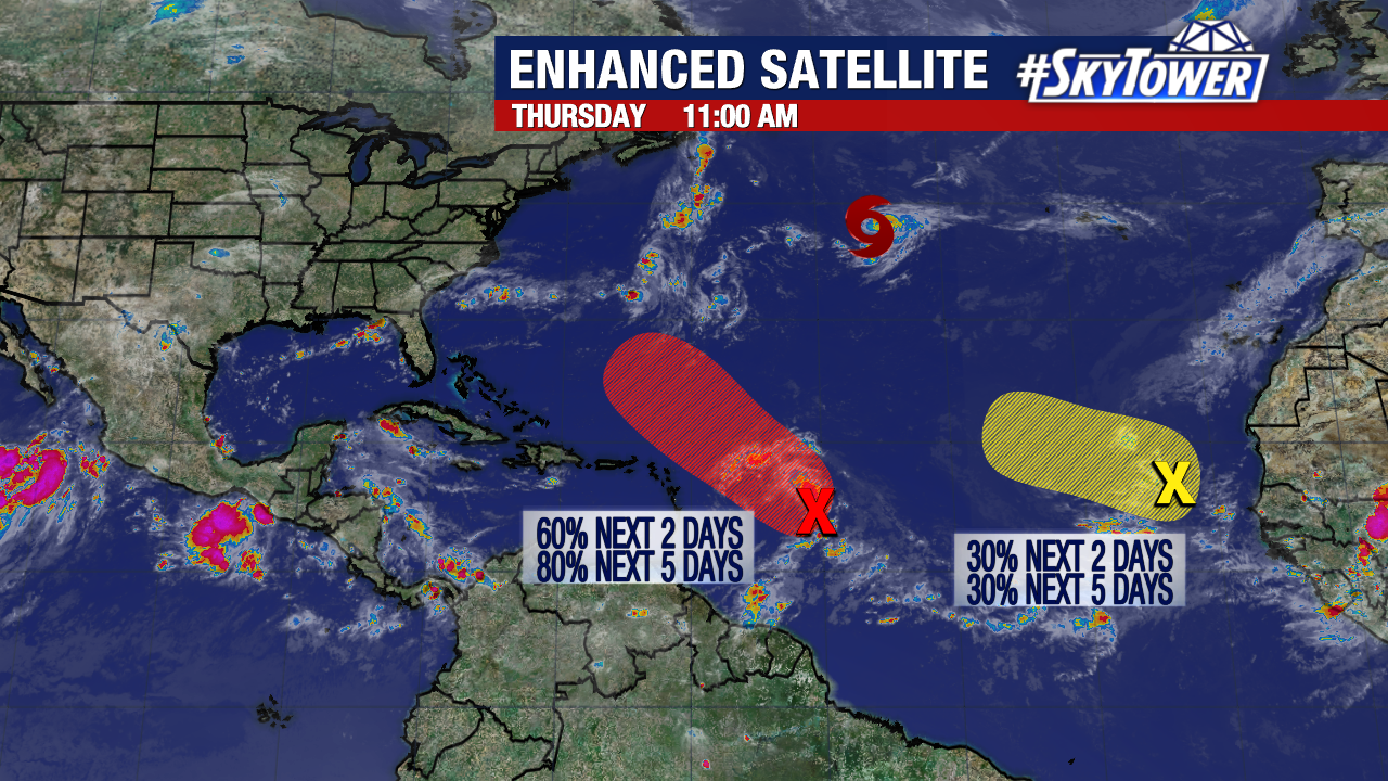
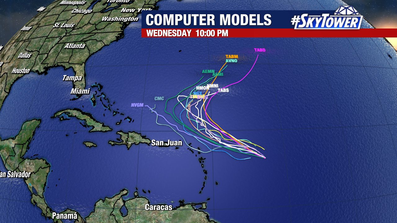
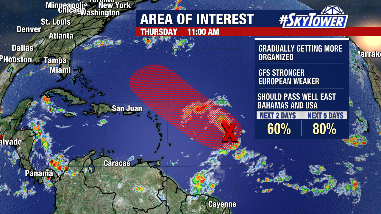
We still have a couple other areas we’re watching, but neither of which appear to pose any threat to the U.S. or really any land areas at all. Invest 91L a few hundred miles east of the Leeward Islands has the higher likelihood of development at this point, but there is really no model consensus at this point. Again, regardless of development, this does not pose any threat. Enjoy your Labor Day weekend!