Danielle and Earl formed last week, ending our streak of nearly two months with no named storms in the Atlantic. Danielle remains no threat to land as it loops around North Atlantic shipping lanes in the coming days.
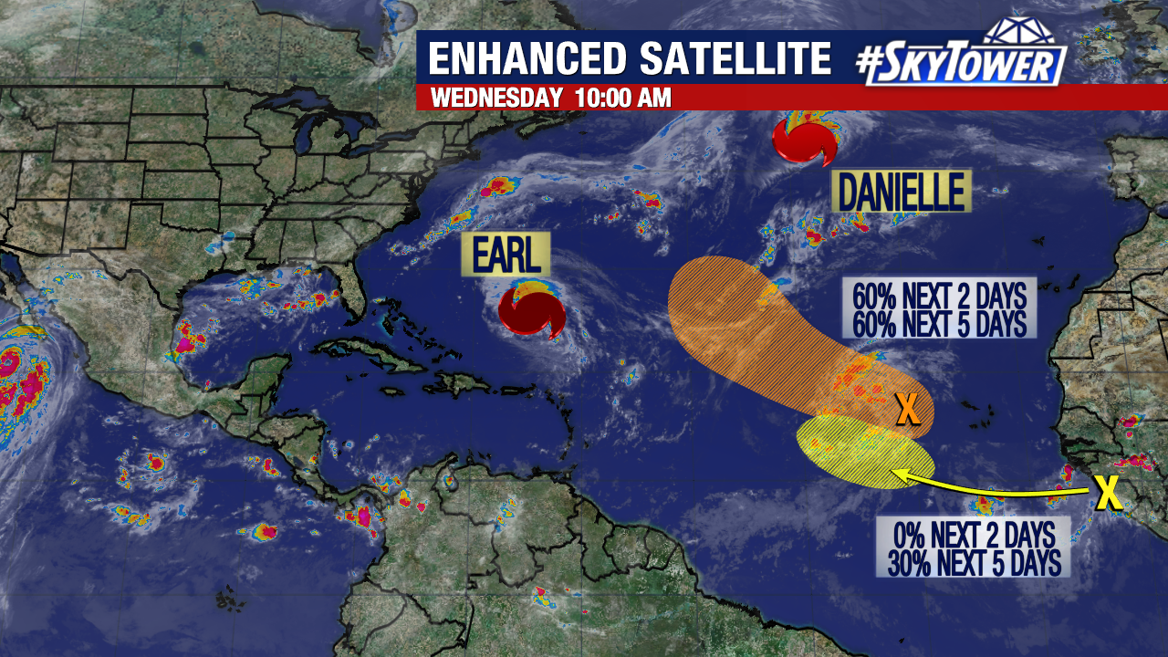
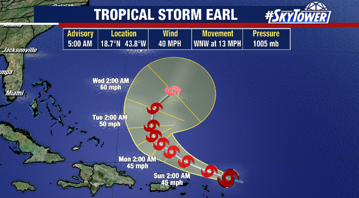
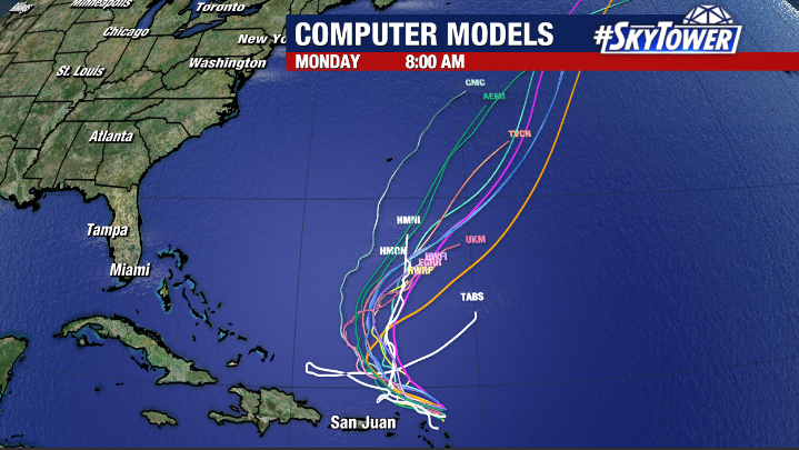
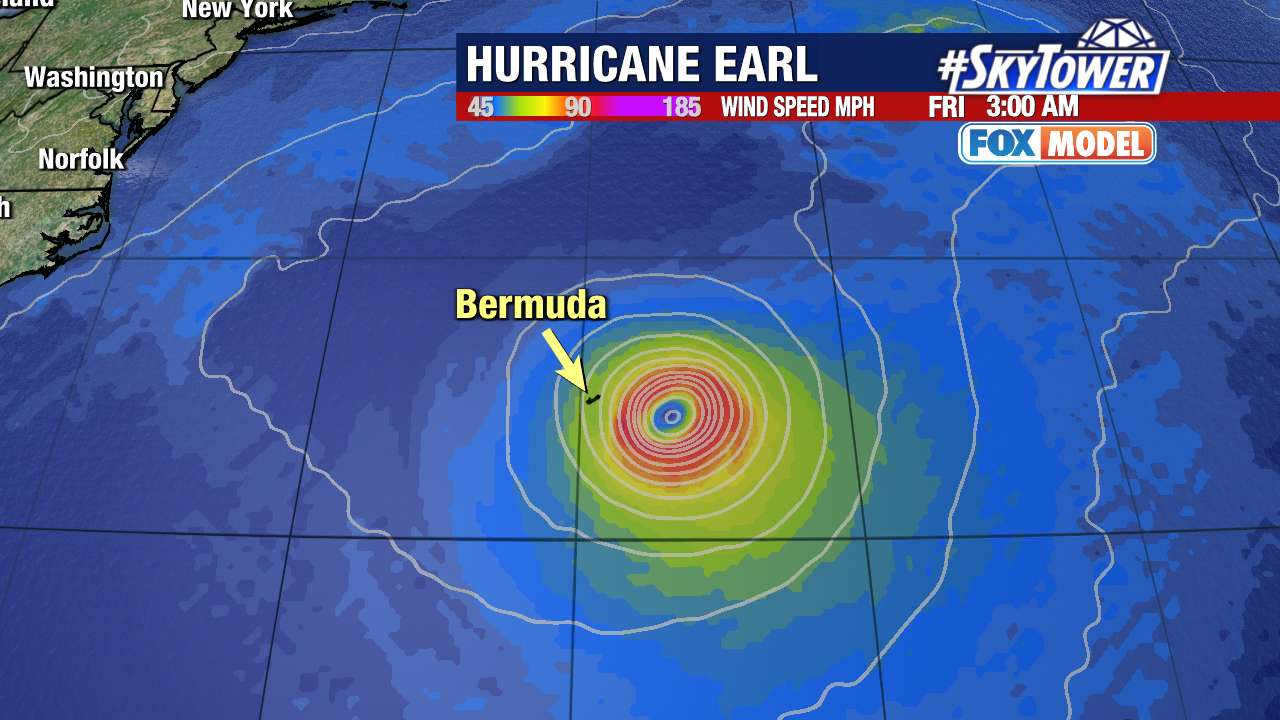
Meanwhile, Earl has made it’s turn to the north, and is could strengthen into a major hurricane by the end of the week. The only area of land remotely in its path is Bermuda, but there is a large consensus among model guidance that it will miss the island to the east.
There a couple additional areas we’re watching closer to Africa. While it’s possible we get an additional named storm or two the bottom line is that steering currents are really working in our favor right now and aren’t set up to bring anything toward the Caribbean or U.S. for at least the next 1-2 weeks.
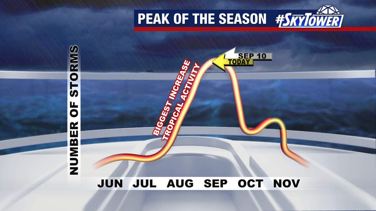
The statistical peak of the season is coming up this Saturday, September 10 and we still have another 6-8 weeks of what can be the most dangerous part of hurricane season. So, despite the lack of threats right now, stay prepared and we’ll be here with you the rest of the way as always!