Tropical Storm Fiona Bringing Heavy Rain To Virgin Islands, Puerto Rico, Dominican Republic This Weekend

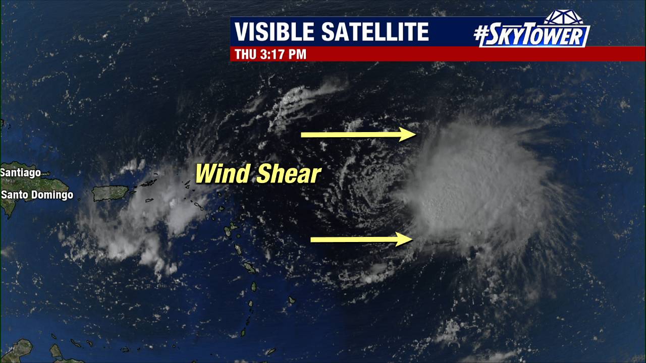
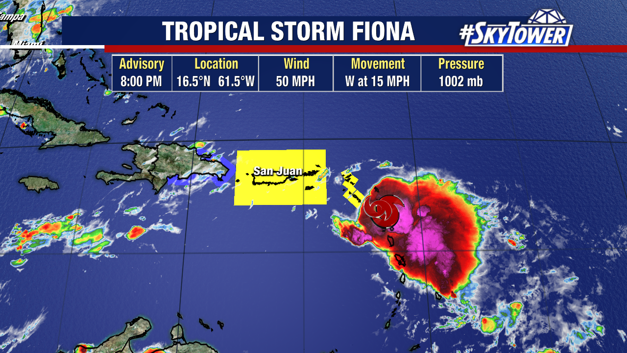
Tropical Storm Fiona is closing in on the northern Leeward Islands Friday evening. As expected the storm is struggling to strengthen due to continued westerly shear. This shear shear is displacing majority of the rain and storms east of the center of circulation. While this westerly shear should prevent strengthening for the most part over the next couple of days, Fiona is still going to present the threat of heavy rain for several Caribbean islands through the weekend. Several inches of rain could lead to flooding, and even mudslides in areas of higher terrain.

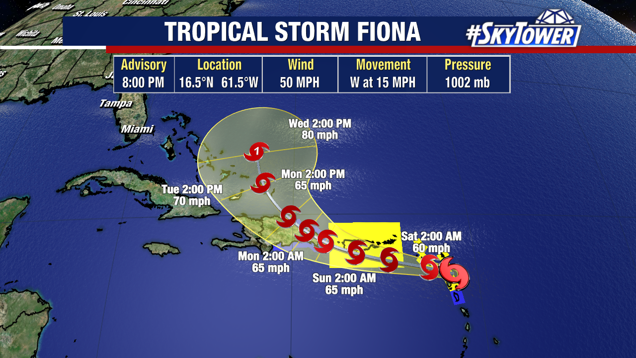
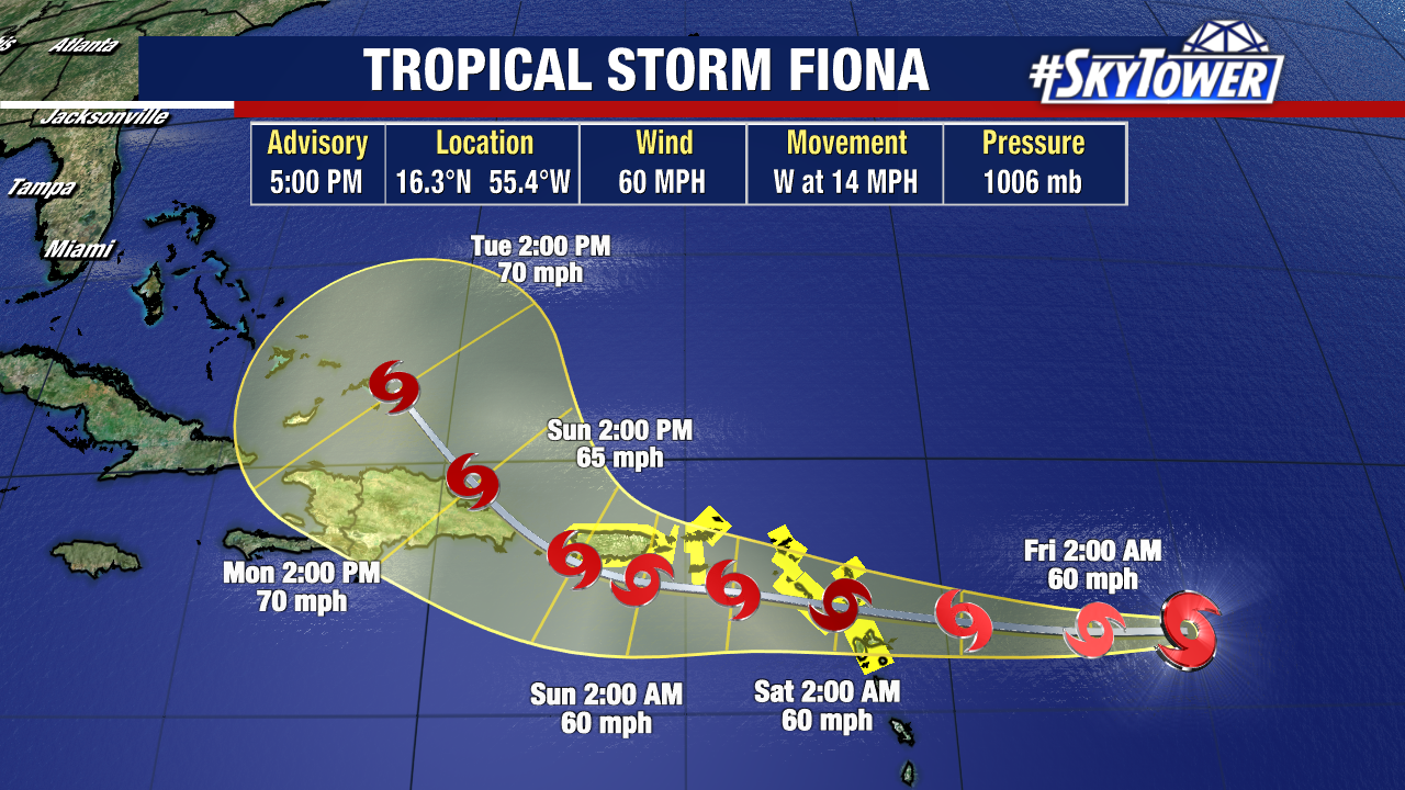
Land interaction is likely to affect the storm’s circulation to at least some degree until Fiona moves north of the Dominican Republic on Monday. Regardless of what shape it is in at that point, further organization and strengthening is likely. The National Hurricane Center forecast currently has Fiona reaching hurricane intensity near or just east of the Bahamas early next week.

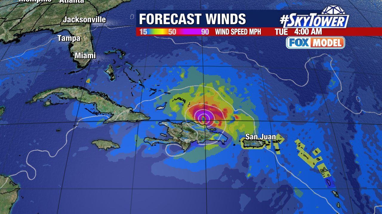
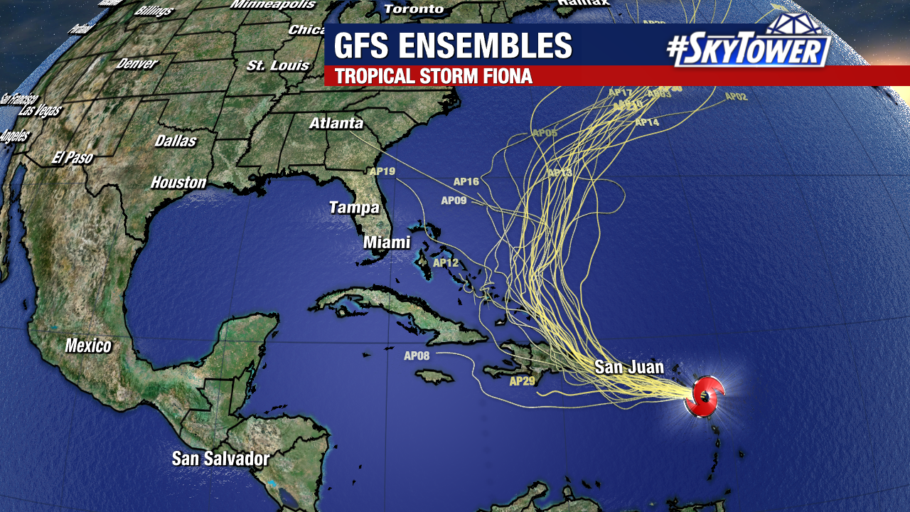
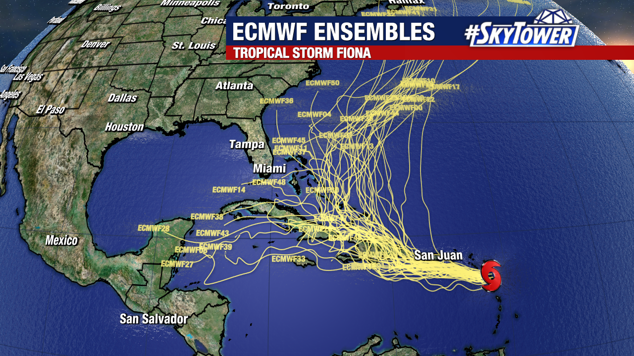
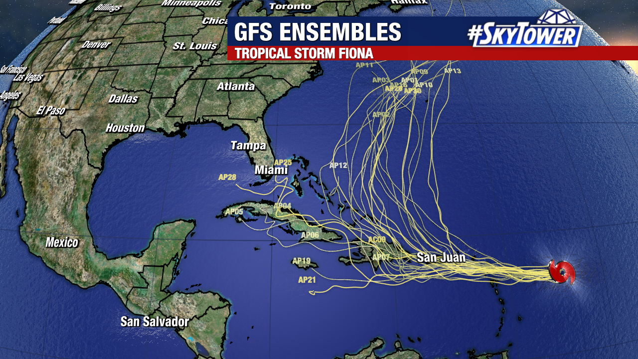
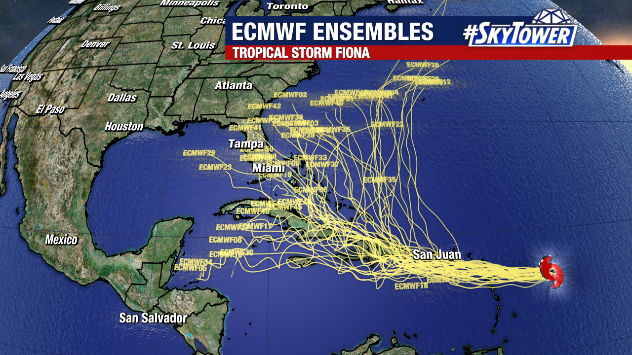
The good news is that model guidance is starting to come into better agreement that Fiona should be steered out to sea, staying well east of Florida and the U.S. East Coast. That being said, it’s still a little too early to write it off completely and it bears watching over the next few days.

Tropical Storm Fiona To Bring Heavy Rain To Leeward Islands And Puerto Rico; Future Track A Bit Uncertain

As of 5pm Thursday, Tropical Storm Fiona was located about 400 miles east of the Leeward Islands. Strong westerly shear continues to take its toll on the system, however slow strengthening has still taken place and max sustained winds are now up to 60 mph.

Any further strengthening should be limited as long as shear persists over the next few days. That being the case, forecast confidence is high with respect to both intensity and track over the next 2-3 days. The primary impacts will be gusty winds and periods of heavy rain for Puerto Rico and nearby islands – especially to the east. The Dominican Republic could very well see several inches of rain too by early next week, but that’ll be highly dependent on the track of the storm.

In regards to the future of Fiona beyond the next few days, there are a lot of factors in play. Long range models have a wide range of solution from a storm making landfall in Florida to a stronger storm staying well to the east and curving back out into the North Atlantic. Right now, any of these options are still on the table. Land interaction will play a big role with Fiona, and until we see how the storm navigates through the islands and how it fares with some extremely mountainous terrain it’ll be tough to nail down whether or not there will be any impacts for the U.S.

We’ll keep you posted!