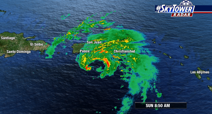
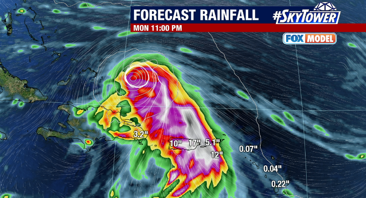
It’s been a rough Sunday for Puerto Rico. Power is out across the entire island, and the storm isn’t over yet. On top of whipping winds, heavy rain continues to come down. Some spots have already received well over a foot of rain, and downpours are expected to continue through the night. Not only that, but rain chances will likely stay high over the next couple of days. Flooding and possible mudslides are a big threat.

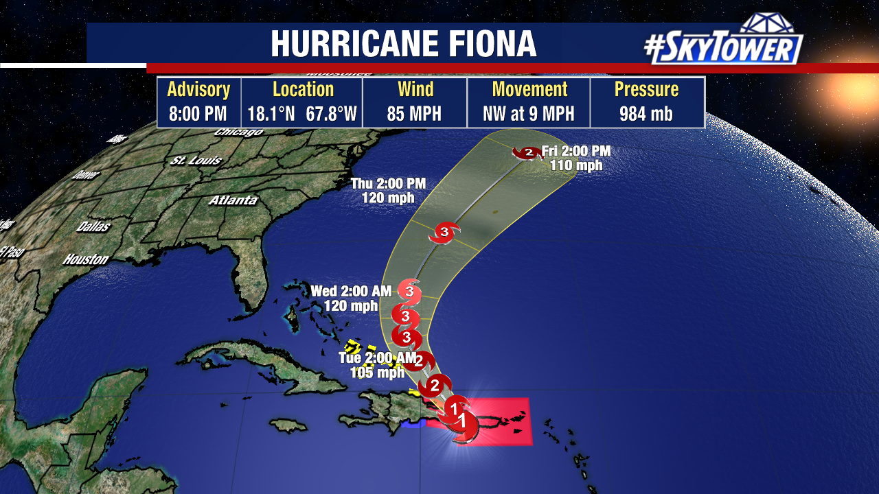
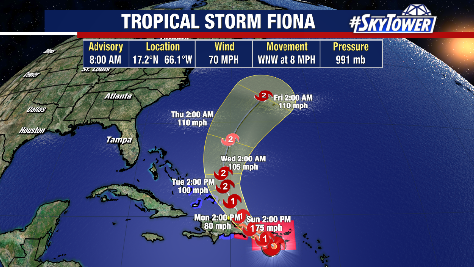
After Fiona pulls away from Puerto Rico, it will begin a turn to the north just east of the Bahamas. While some wind shear may be present, a very moist environment and warm sea-surface temperatures should lead to strengthening in the coming days. Odds are that Fiona will become a major hurricane. The good news is that this will come nowhere near the United States. The only land mass in the way as the storm makes its way into the North Atlantic is Bermuda. It’s a hearty island with a long history of weathering big storms, but significant impacts are possible there if Fiona tracks nearby.