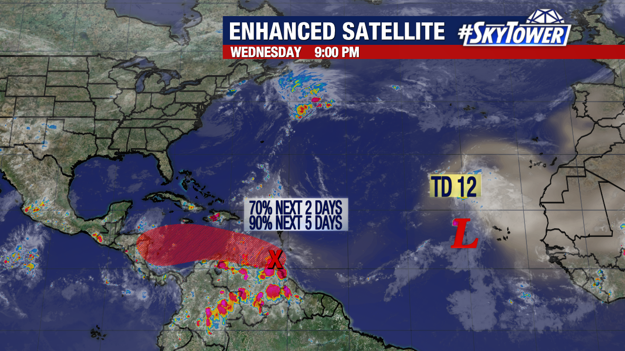
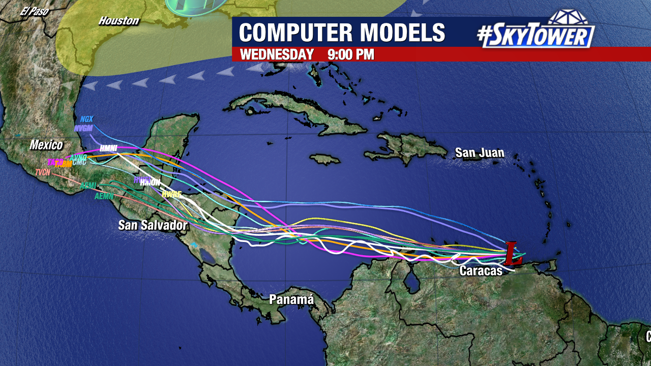
Tropical Storm Julia formed just north of Colombia early Friday. Wind shear has been keeping the storm from intensifying too much thus far, but that shear is expected to ease soon. With very warm waters ahead, strengthening is likely leading up to landfall along the coast of Nicaragua on Sunday morning.
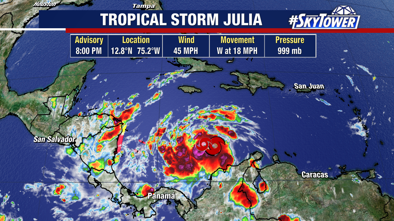
While a storm surge of 2-4 feet is expected along the coast of Nicaragua north of the landfall point, it is the heavy rain that will bring the biggest problems. Isolated rainfall totals of up to 15″ will lead to life-threatening flash flooding and mudslides.
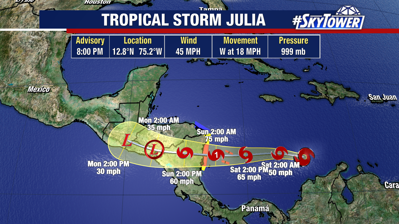
Land interaction will dissipate the storm over central America /southern Mexico early next week, but it’s possible the remnants end up in the southwestern Gulf thereafter and end up interacting with an arriving cold front. While the chances of redevelopment are slim, we’ll be keeping a close eye on it.