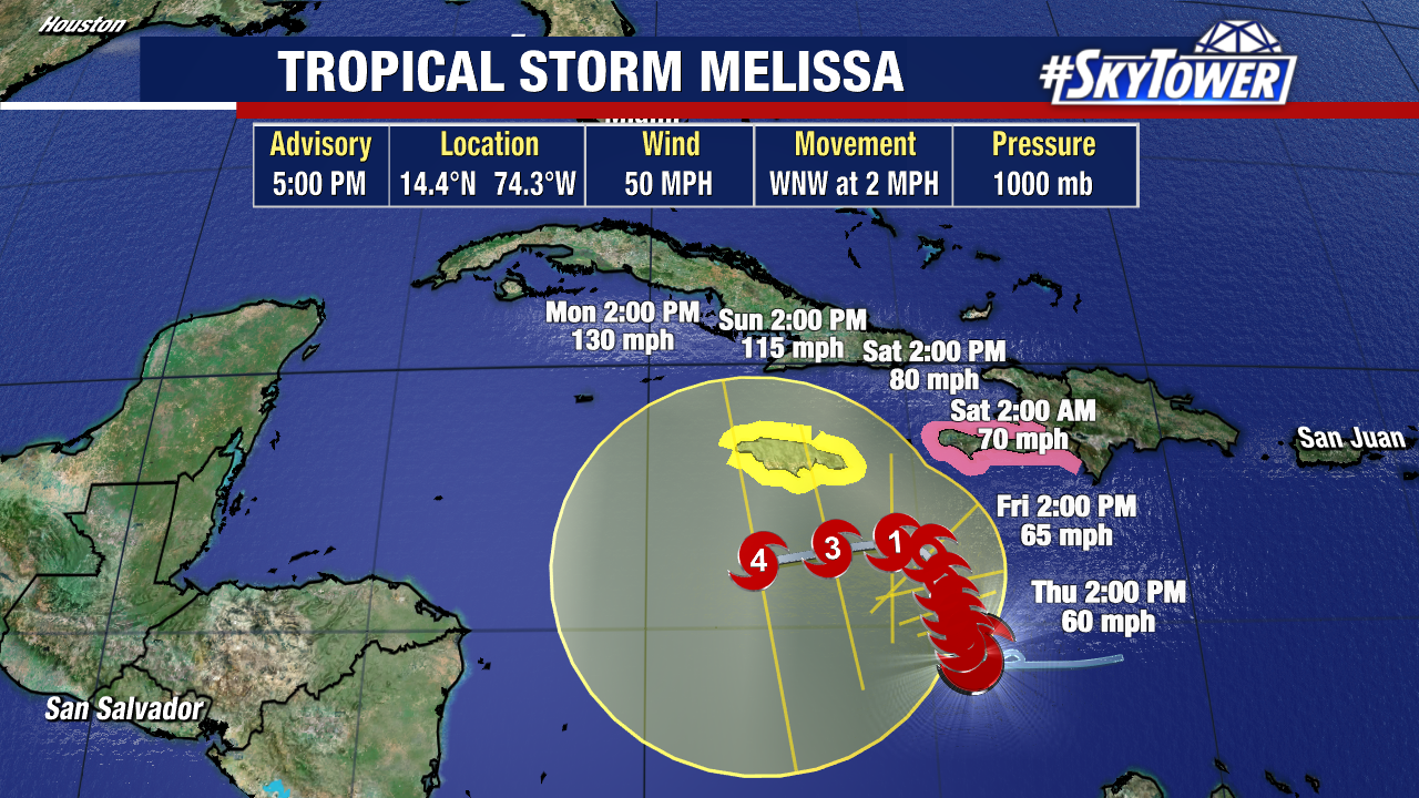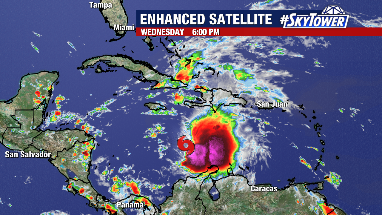
Tropical Storm Melissa is now expected to become a major hurricane in the Caribbean by the end of this weekend. It is the only active storm in the Atlantic at this time.
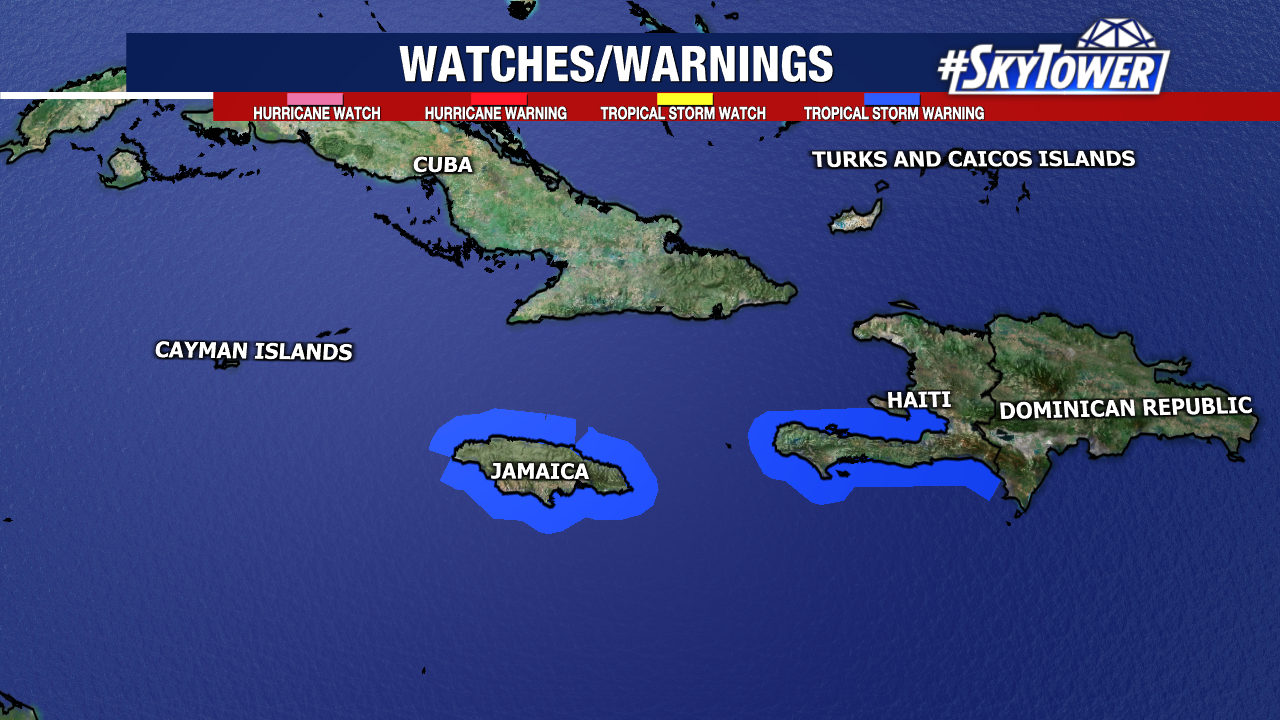
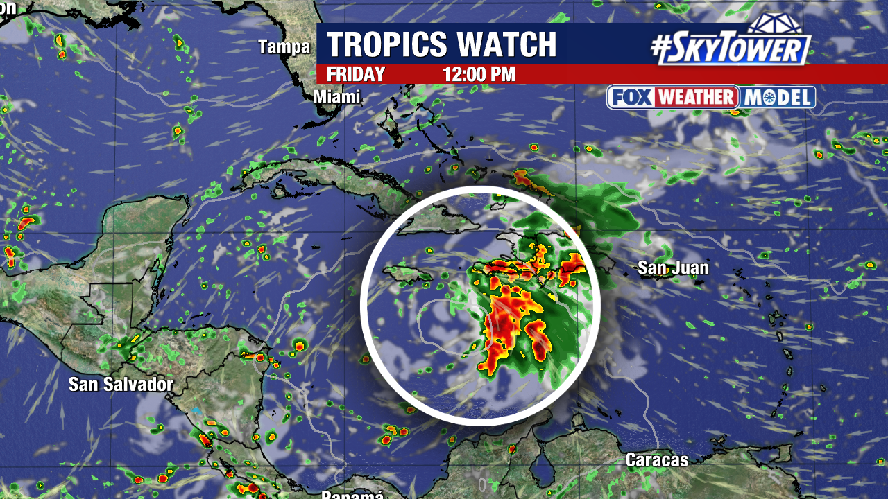
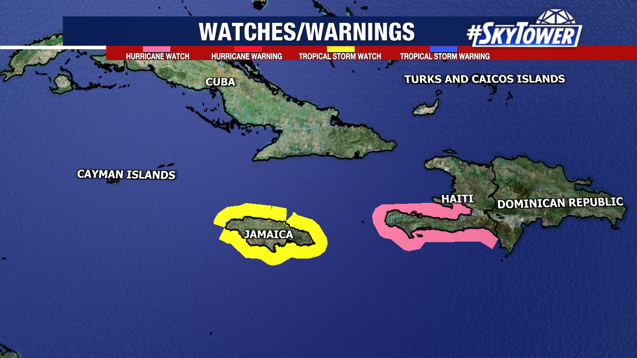
Tropical Storm Warnings and Hurricane Watches are in effect for Jamaica and Haiti, as tropical storm-force winds may arrive within the next day or so. The primary concern will be the flooding potential. Depending on the track, some Caribbean islands could see well over a foot of rain (30+ cm) by early next week. This would create an added mudslide threat given the mountainous terrain in Cuba, Hispaniola, and Jamaica.
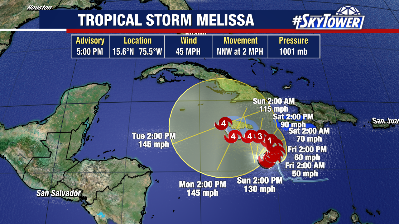
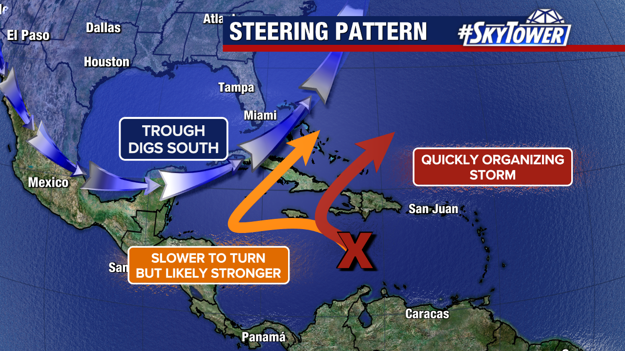
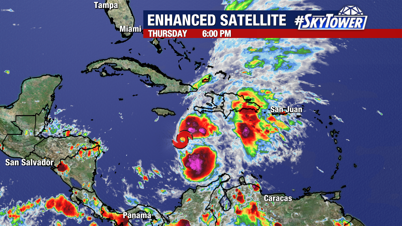
Melissa is moving very slowly (just 2mph) and has weakened today thanks to the hostile upper-level winds it is battling. The tropical storm should organize strengthen into a hurricane as it enters into a more favorable environment Friday and Saturday. A trough will eventually steer Melissa northeast – out of the Caribbean and south of Florida. We still do not know how soon will this turn occur, and where will the storm travel beforehand.
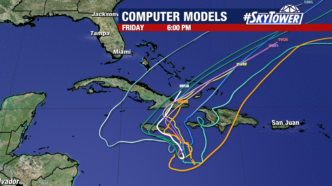
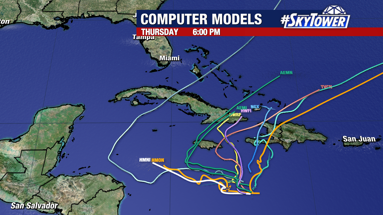
Weather models all show that eventual north-northeast turn. However, they are still shifting and not agreeing on Melissa’s precise path for the next few days.
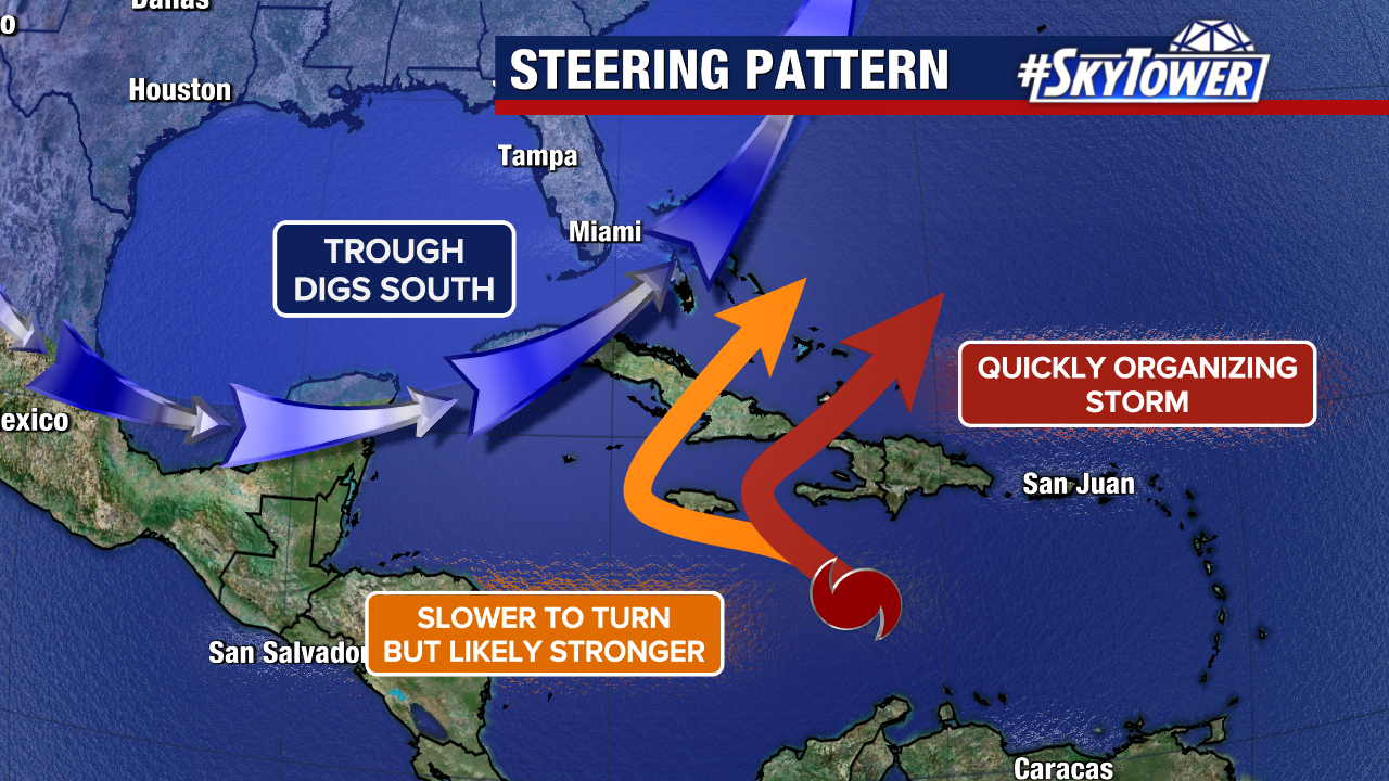
Two scenarios have gained increased traction among those weather models. If the center passes over or south of Jamaica, impacts would be maximized for the island. If Melissa travels east of Jamaica and closer to Hispaniola, it would bring Haiti and the Dominican Republic increased impacts.