Kirk Will Continue to Weaken, Leslie Likely to Become Subtropical Storm Again

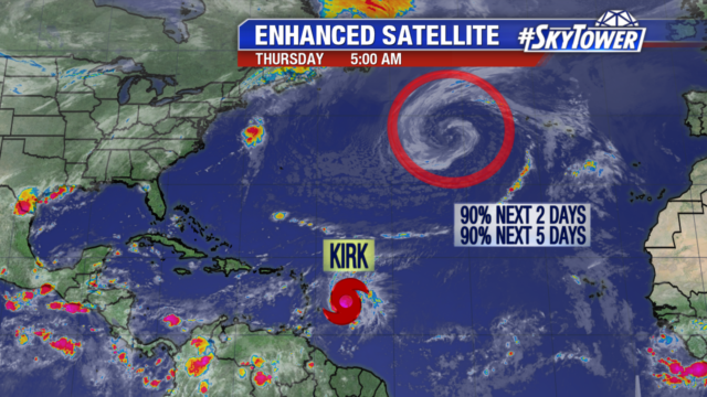
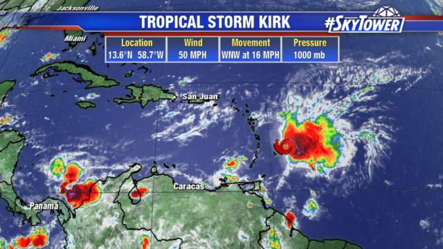
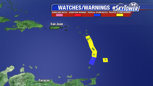
Tropical Storm Kirk has crossed into the eastern Caribbean with strong winds still impacting parts of the Lesser Antilles. Post Tropical Cyclone Leslie is generating more shower activity and will likely become a subtropical storm again later today or tomorrow.

Leslie remains several hundred miles west of the Azores with storm force winds well away from its center. Models keep Leslie over the central Atlantic for the next few days with dangerous high seas and winds.

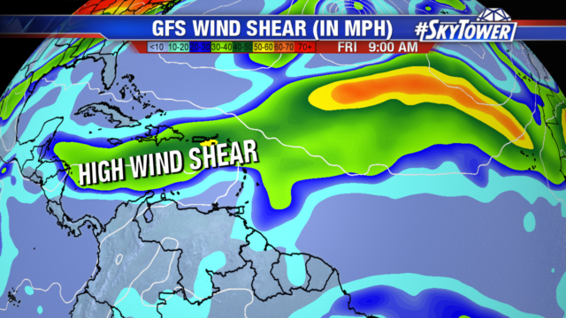
Tropical Storm Kirk is a sheared system with most of the convection focused on the east side. Even though the center has crossed the islands, squalls and tropical storm force winds remain possible in the Windward Islands and southern Leeward Islands today. Locally heavy rain and flash flooding are still a threat.

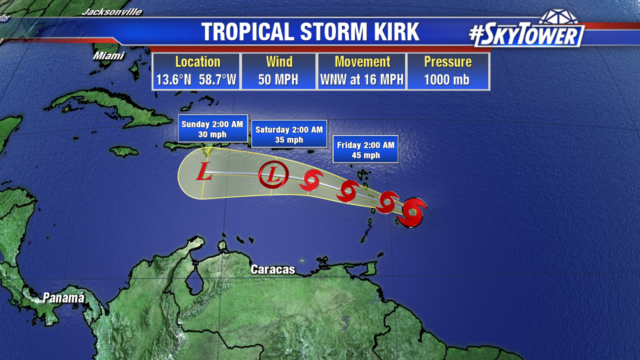
Kirk will move west and continue to be impacted by high shear over the Caribbean basin. Kirk will weaken into a depression later today or Saturday and become a trough of low pressure by late Saturday.

Leslie Likely to Strengthen Again, Tropical Storm Kirk Moving into Lesser Antilles this Evening

Post tropical Cyclone Leslie remains a powerful storm with hurricane force winds. It is a non tropical low pressure system sitting several hundred miles west of the Azores. Shower activity is organizing and Leslie will likely become a subtropical storm or tropical storm again today or Friday. The system will continue its west southwest track at 10 mph over the north-central Atlantic.

Tropical Storm Kirk has not changed much overnight and will move over the Lesser Antilles this evening with winds of 50 mph.

Tropical Storm watches and warnings have been posted for Barbados, St. Lucia, Dominica, Martinique, Guadeloupe, St. Vincent and the Grenadines. Tropical storm force winds extend outward to 140 miles, mainly north and east of the center. Tropical Storm Conditions will reach the islands this afternoon.

Rainfall totals of 4 to 6 inches are expected across parts of the Windward and Leeward Islands, with isolated 10″ totals. Life threatening flash flooding and mudslides are possible in these areas. Heading into Friday and Saturday, Puerto Rico will pick up 2 to 4 inches of rain, with isolated totals of 6″.

Strong wind shear is already impacting Kirk giving it the asymmetric cloud pattern. As Kirk moves into the eastern Caribbean it will encounter even stronger wind shear which will continue to rip the storm apart. The storm will likely dissipate over the next 3 to 4 days. But as always will continue to monitor the storm for any changes.