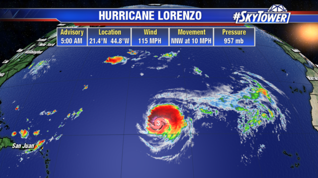
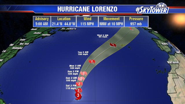
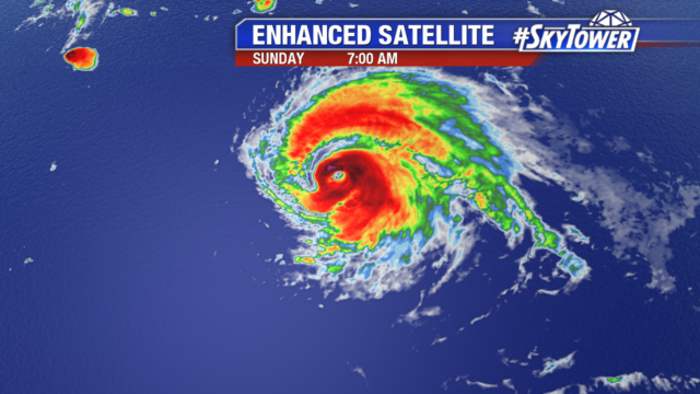
Lorenzo is still a powerful category 4 hurricane with 155 mph winds. The large storm has hurricane force winds that extend out 50 miles from the center and tropical storm force winds out 275 miles.
Lorenzo is headed northeast in the Atlantic into cooler waters, drier air and higher wind shear. Even though the hurricane is expected to steadily weaken, it could still be a category 2 hurricane as it passes near the western Azores. Those islands could see 3-6″ of rain leading to flash flooding and very strong winds.
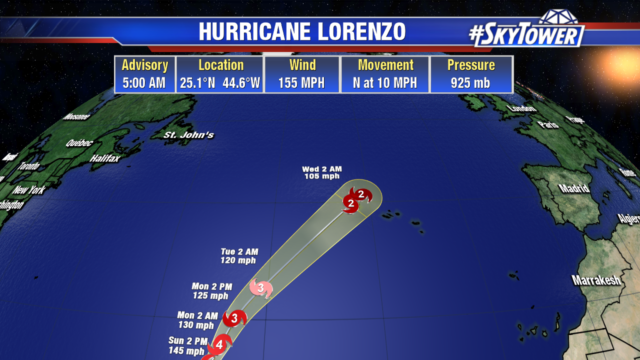
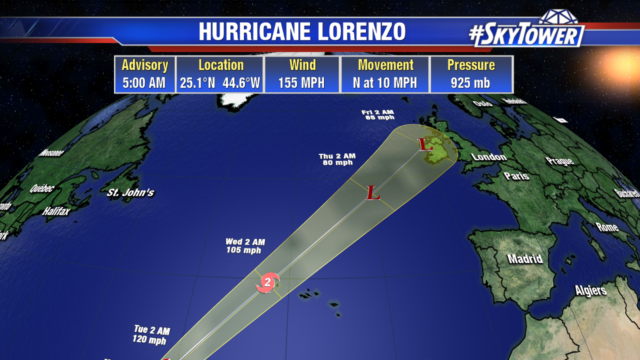
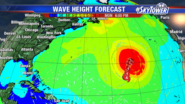
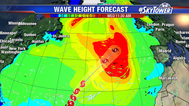
The hurricane is generating large swells and dangerous rip currents in the Lesser Antilles and along the northeastern South America coast. As it moves northeast, wave heights and the threat of rip currents will increase along the east coast of the United States.