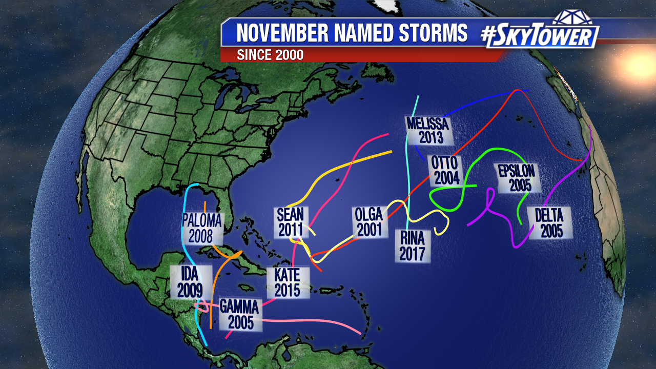
Since 1980, there have been 26 named November storms. But the last time a storm hit the U.S. was in 1985, Hurricane Kate.

Above track supplied by the National Hurricane Center.
Kate began as a tropical wave developing northeast of the Virgin Islands on November 13th and 14th. A reconnaissance aircraft was sent to investigate the storm on the 15th and by then it had already strengthened into a tropical storm. By the 16th, Kate had become a hurricane and headed west towards the southeast Bahamas.The storm maintained its strength as it passed over northern Cuba, only weakening 7 hPa. On the evening of the 19th, Kate entered the eastern Gulf of Mexico and strengthened into a major hurricane. The storm curved in response to a frontal boundary and headed into the cooler waters of the northern Gulf. It weakened into a category 2 hurricane as it made landfall in the panhandle of Florida on the evening of the 21st.

Above rainfall totals from National Climatic Data Center.
Panama city picked up over 8 inches of rain. The highest rainfall totals were focused to the left of Kate’s track, due to the frontal zone in advance of the storm.

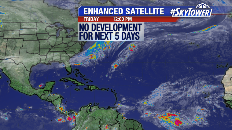
We have just 19 days left in the 2019 Atlantic Hurricane Season. At the moment, the National Hurricane Center is not expecting any tropical development for the next few days.