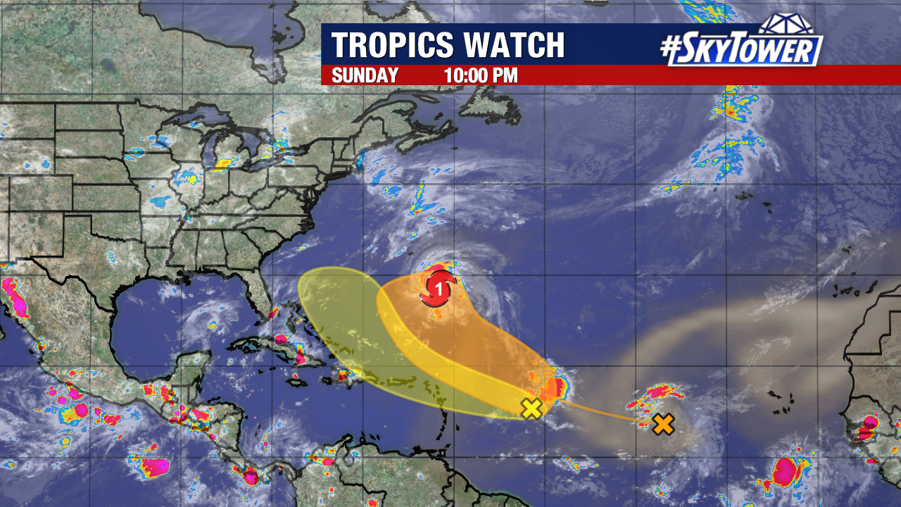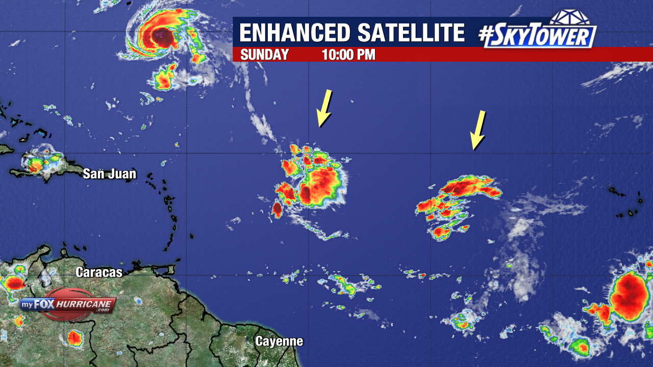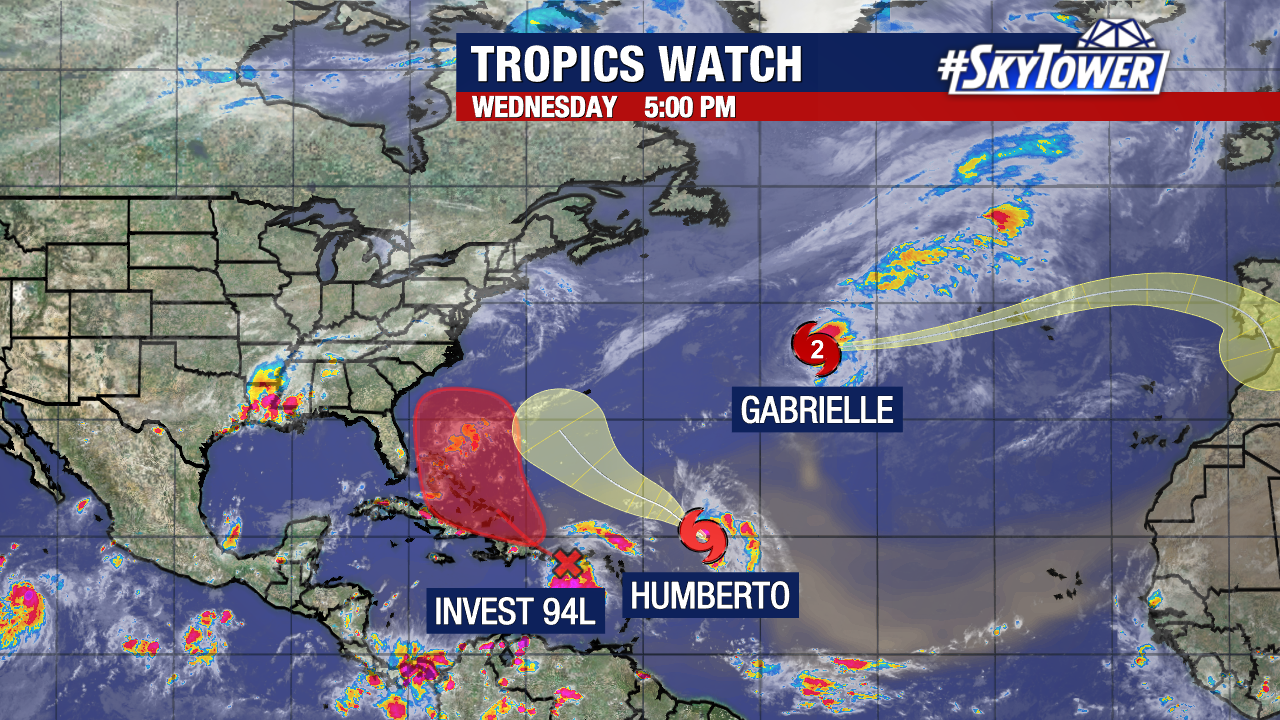
The tropics have sprung to life this week, as Humberto has formed and Invest 94L could become a named storm by the end of the weekend. Neither appears to pose any immediate issues to West Central and Southwest Florida. Humberto’s formation, while Gabrielle is in the north Atlantic, marked the first time this year we have had two active named storms at the same time.
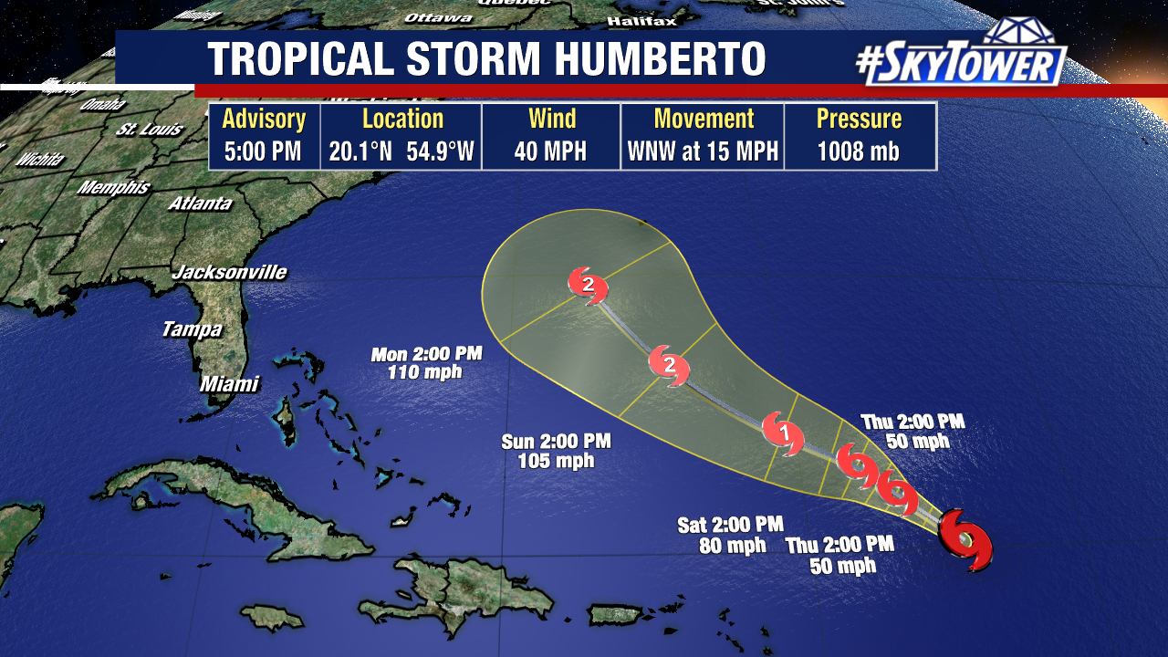
Humberto is not a threat to the U.S., but is expected to strengthen into a hurricane over the next few days. It will be moving slowly in the short term before likely curving back to the northeast and accelerating early next week. Bermuda will need to carefully monitor the progress of this system.
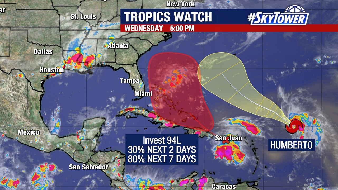
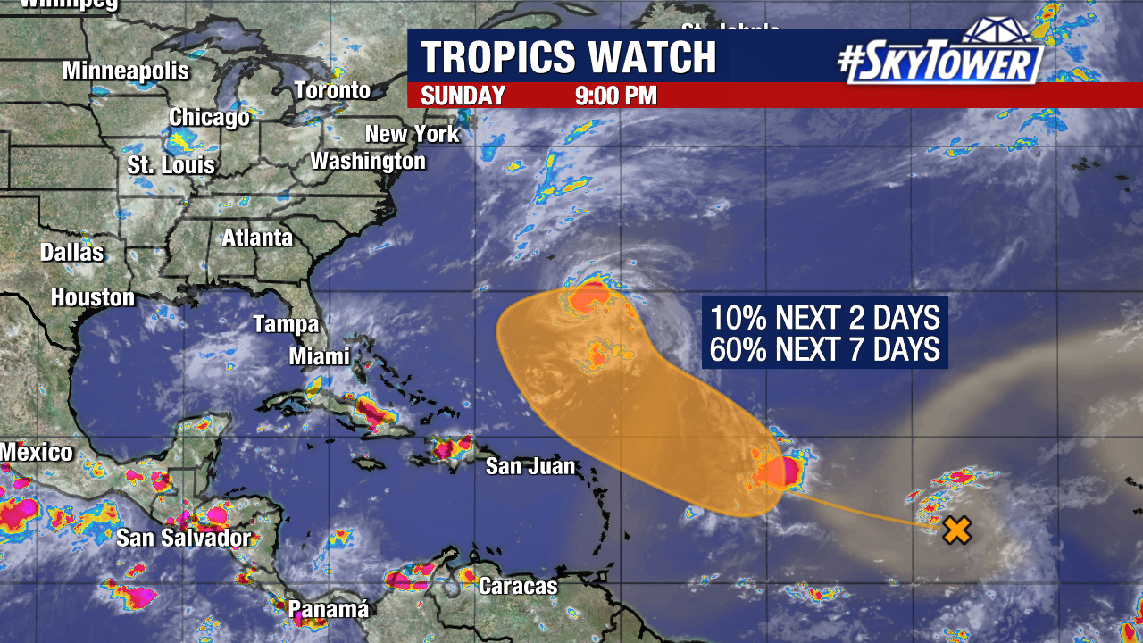
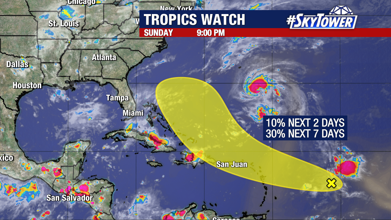
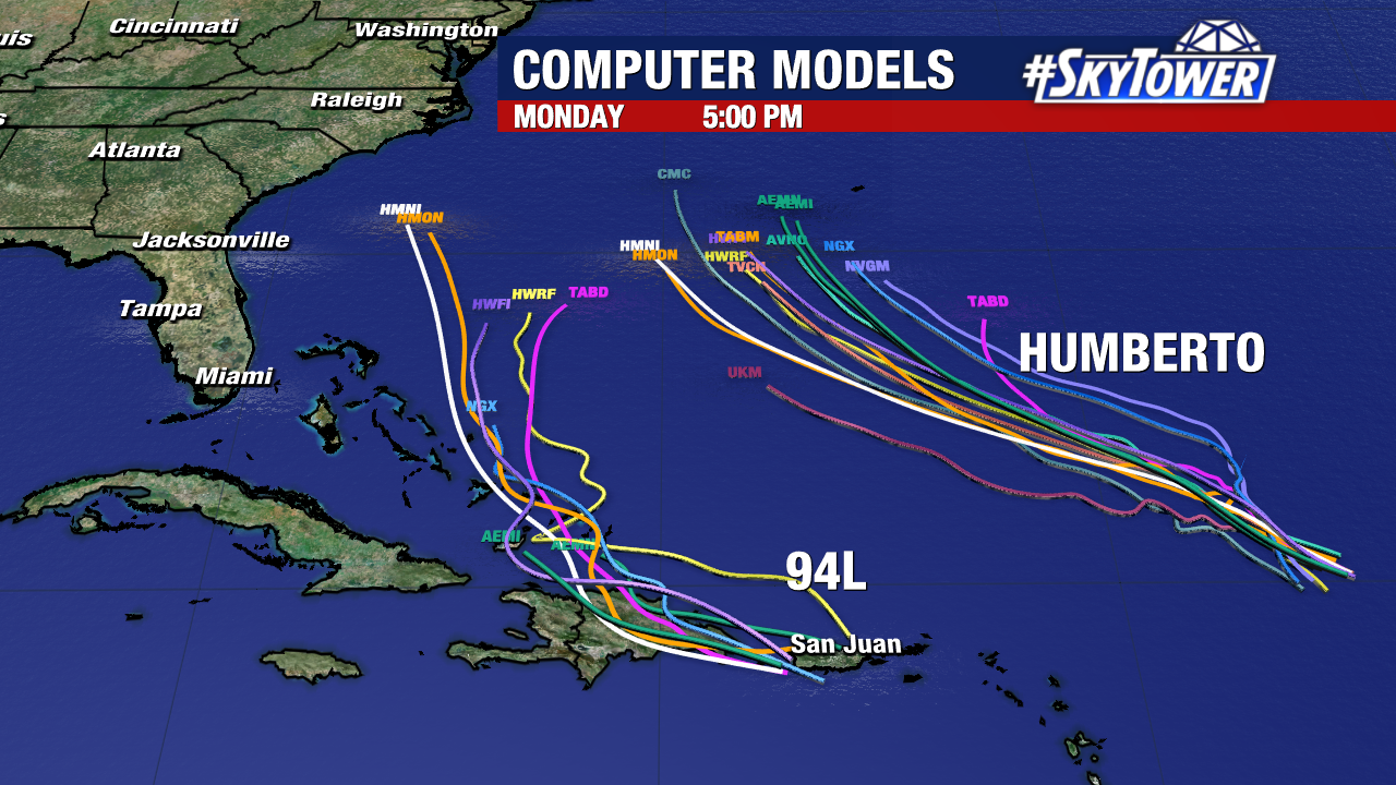
To the west of Humberto is Invest 94L.
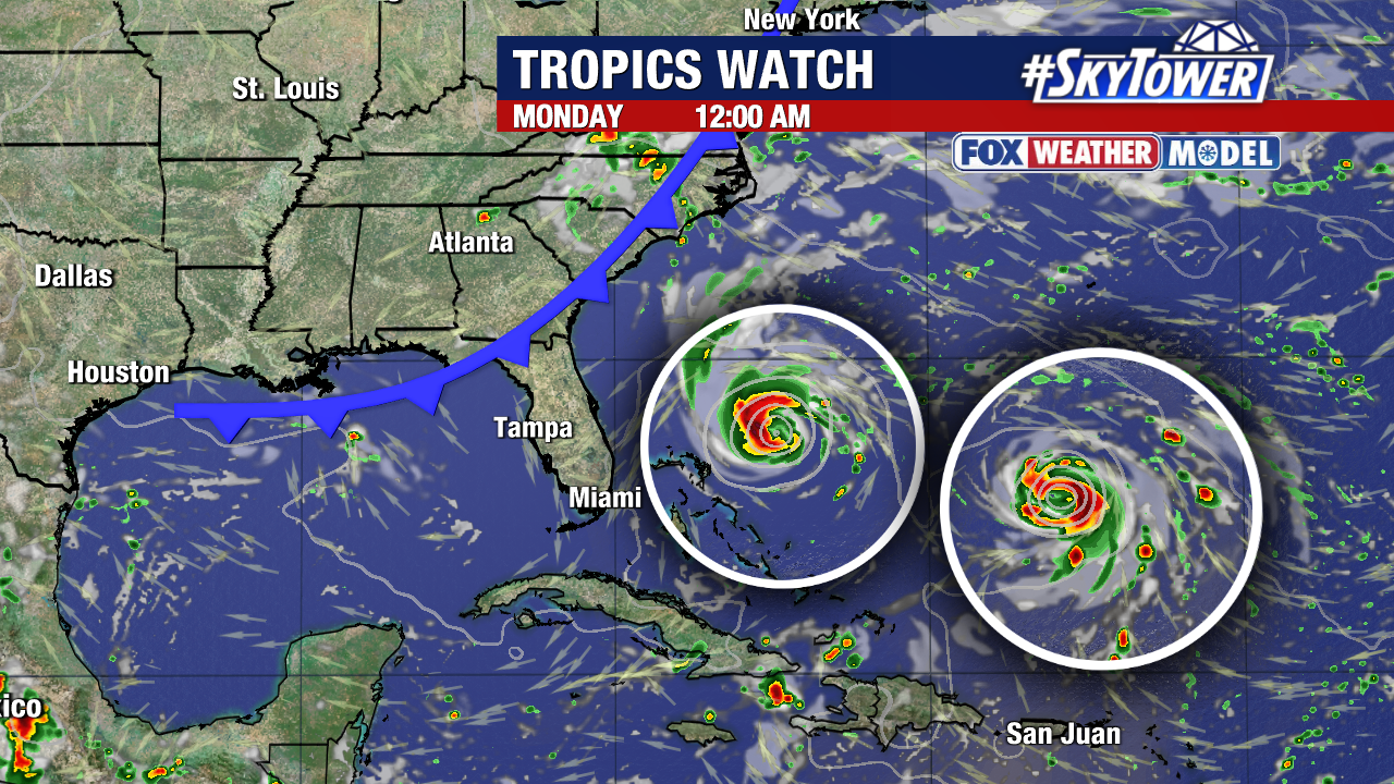
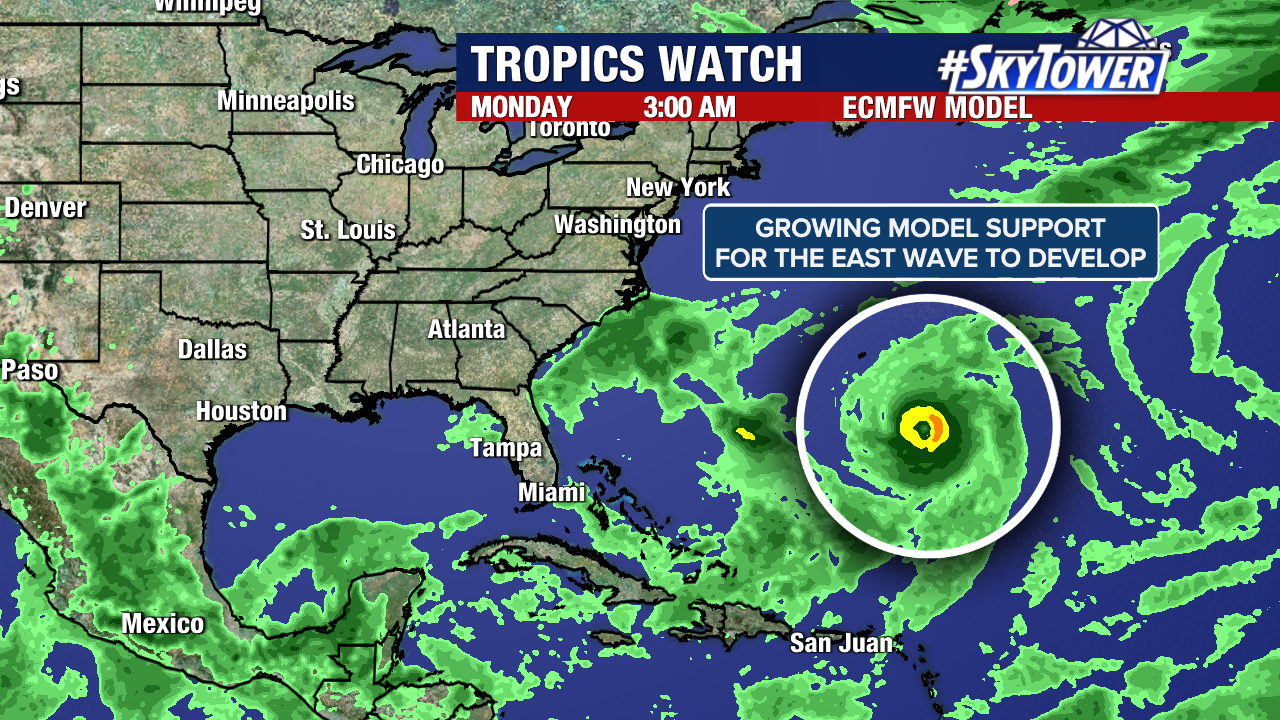
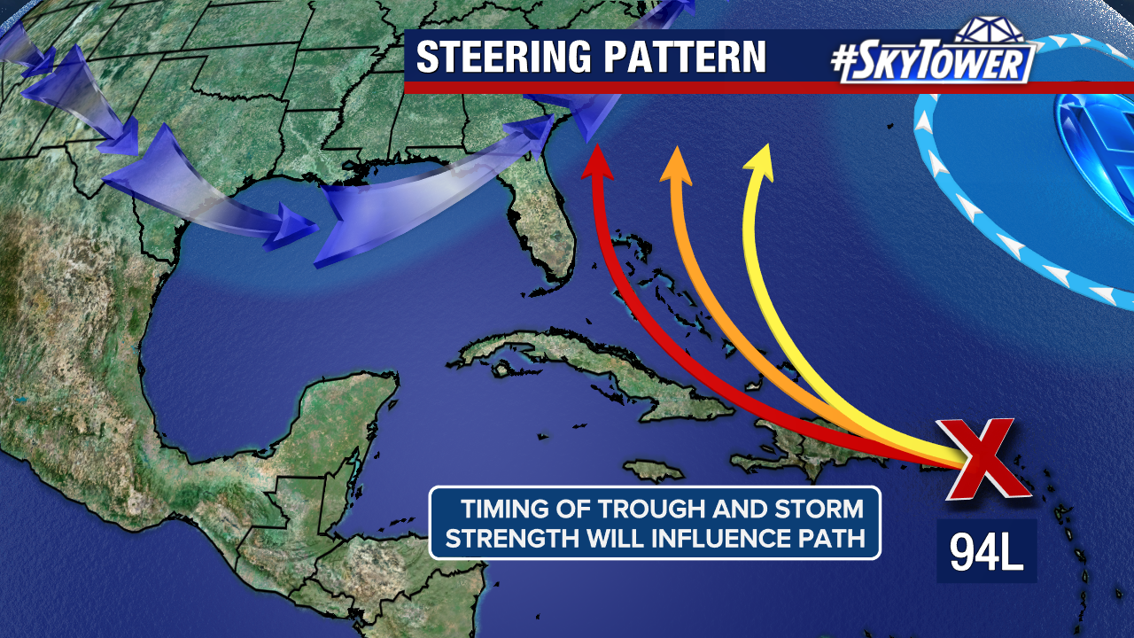
This tropical wave will likely develop into at least a tropical depression or tropical storm as it moves out of the Caribbean and into a more favorable environment to organize.
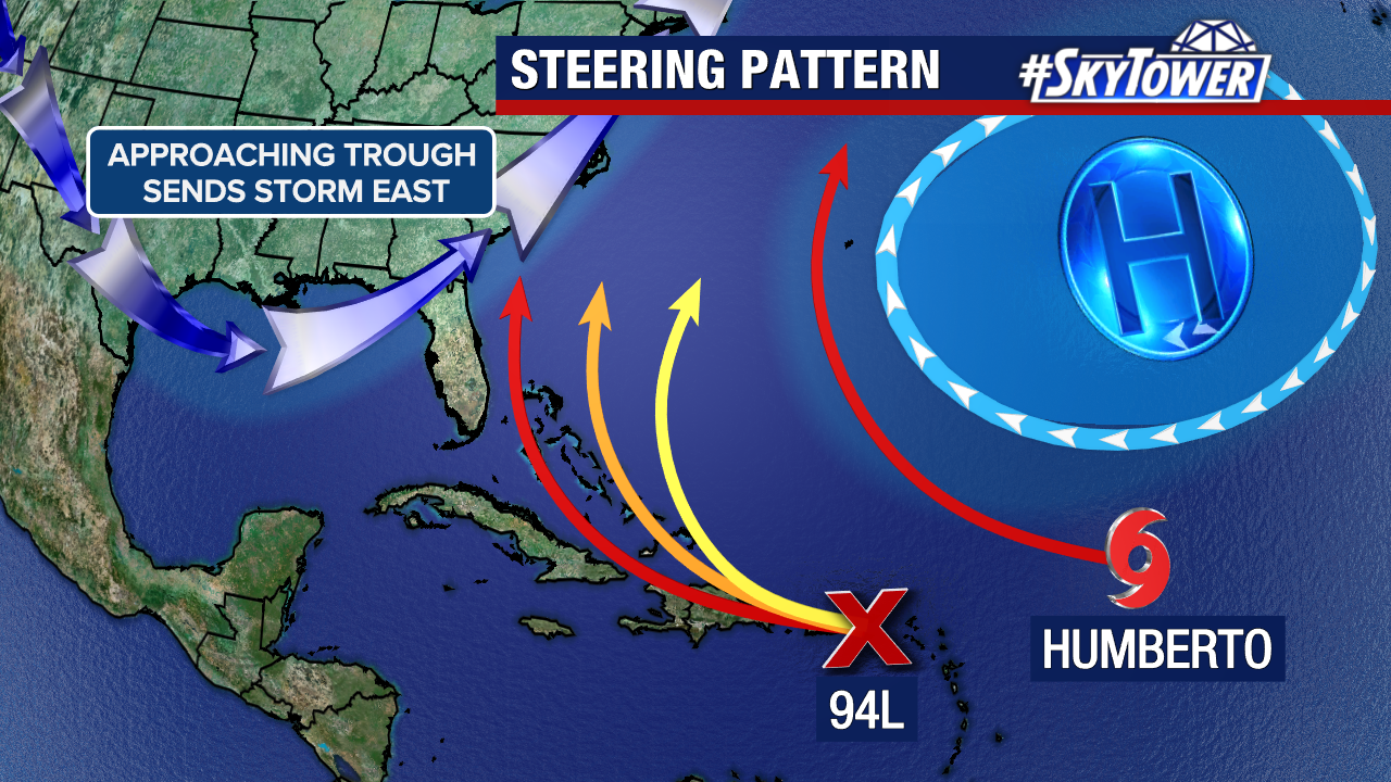
A trough should eventually steer it back to the northeast. The timing of this feature, the strength of the storm, and the influence of Humberto on it will heavily dictate the path it takes. It will be a rain-maker for the Bahamas, Turks and Caicos Islands, and Hispaniola regardless of development.
The east coast of the United States (spanning from Florida’s Atlantic coast to Virginia) will need to keep an eye on this system until there is better weather model agreement in its projected path.
Impacts for those areas cannot be determined or ruled out at this moment.
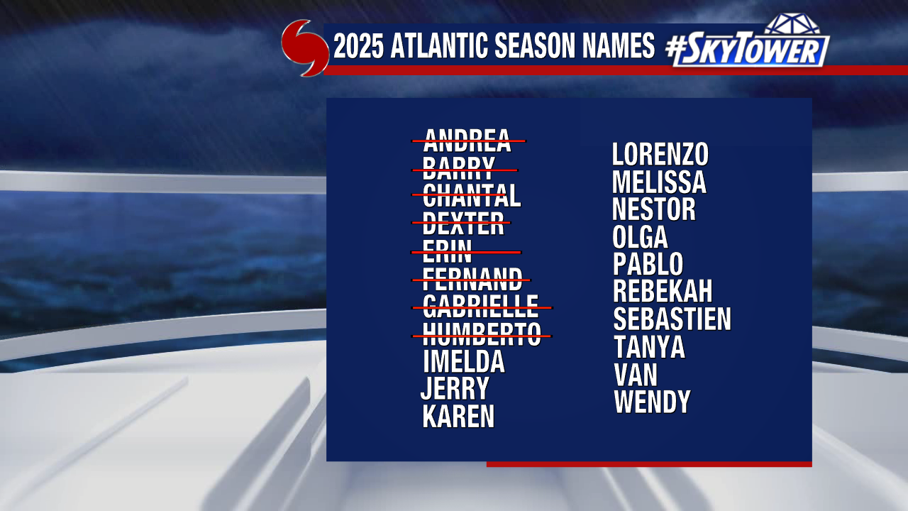
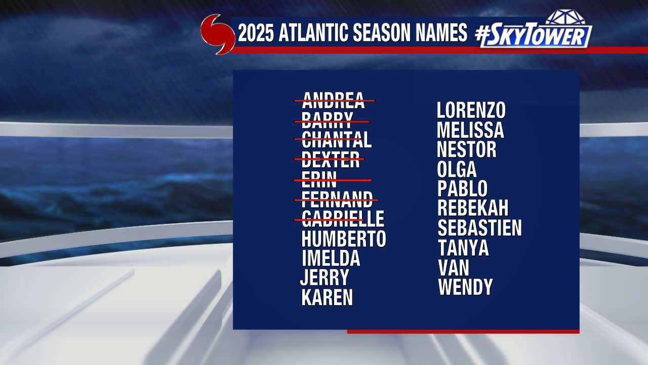
The next name assigned will be Imelda.

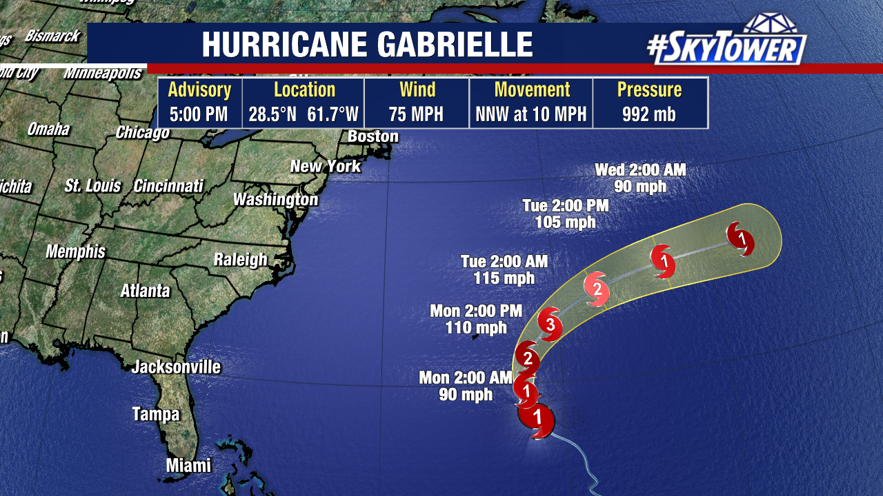
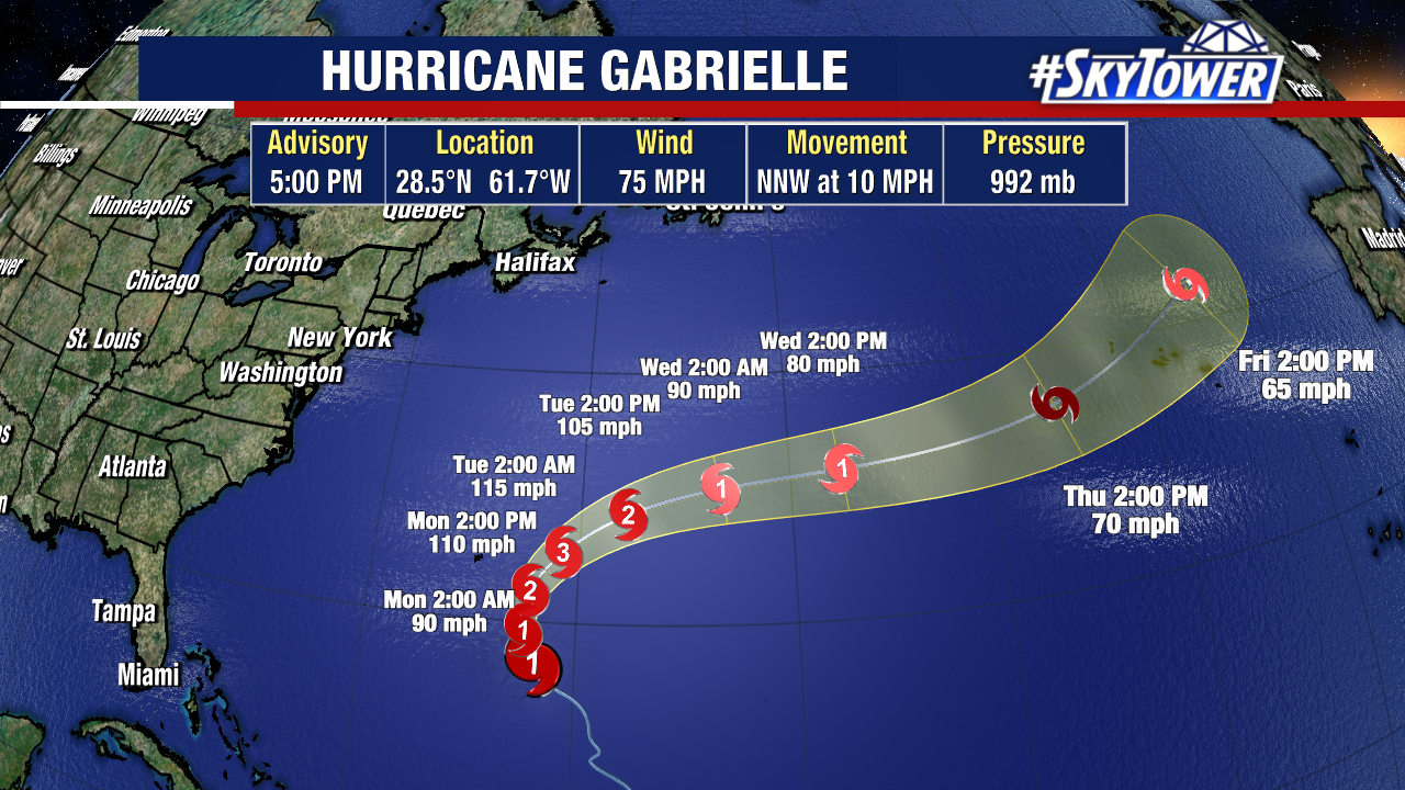
Meanwhile, Hurricane Gabrielle is expected to bring hurricane conditions to the Azores within a day or two. Hurricane warnings are up for the islands. Europe will be monitoring the post-tropical remnants of Gabrielle over the weekend.