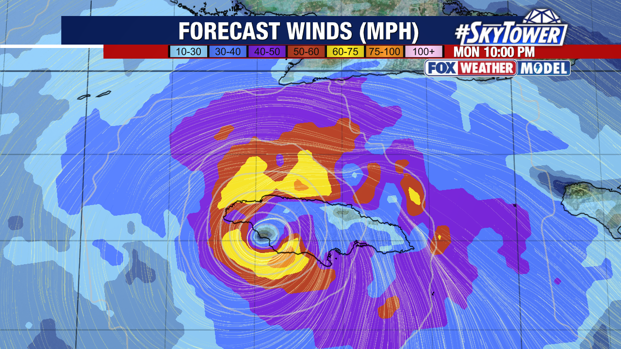
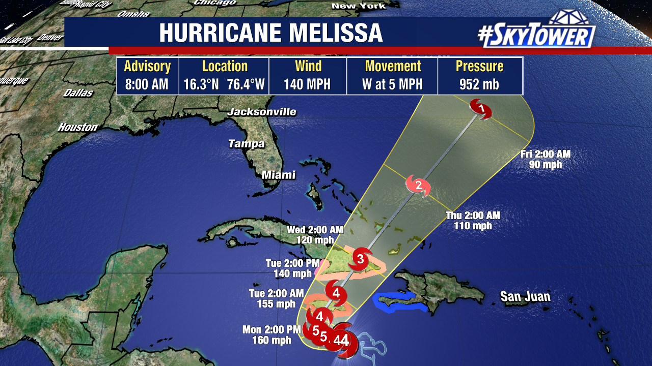
Jamaica is bracing for Hurricane Melissa, which rapidly intensified into a strong Category 4, with 140 mph maximum sustained winds.
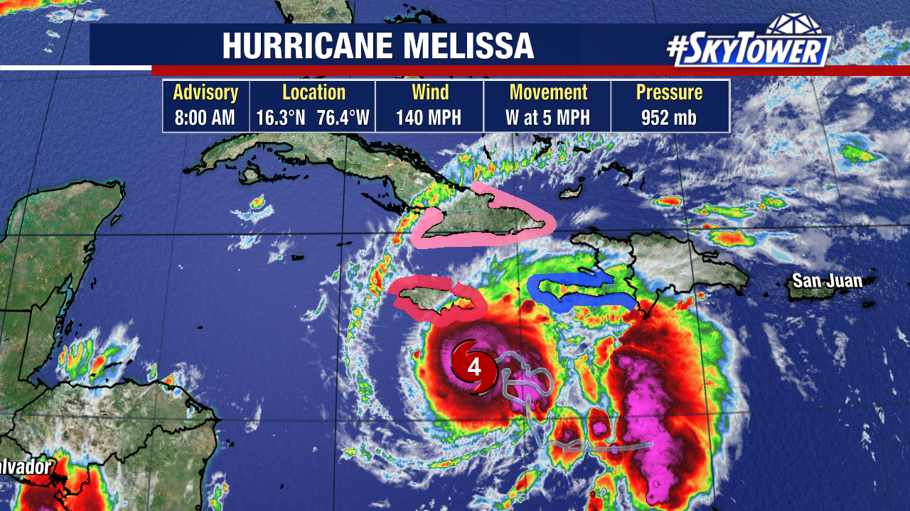
The storm is currently about 120 miles south-southeast of Kingston, Jamaica and moving at an extremely slow pace of 5 mph.
This slow movement is going to be one of the most problematic parts of Melissa as it brings days of torrential rain, flash flooding, storm surge and likely landslides due to the mountainous terrain.
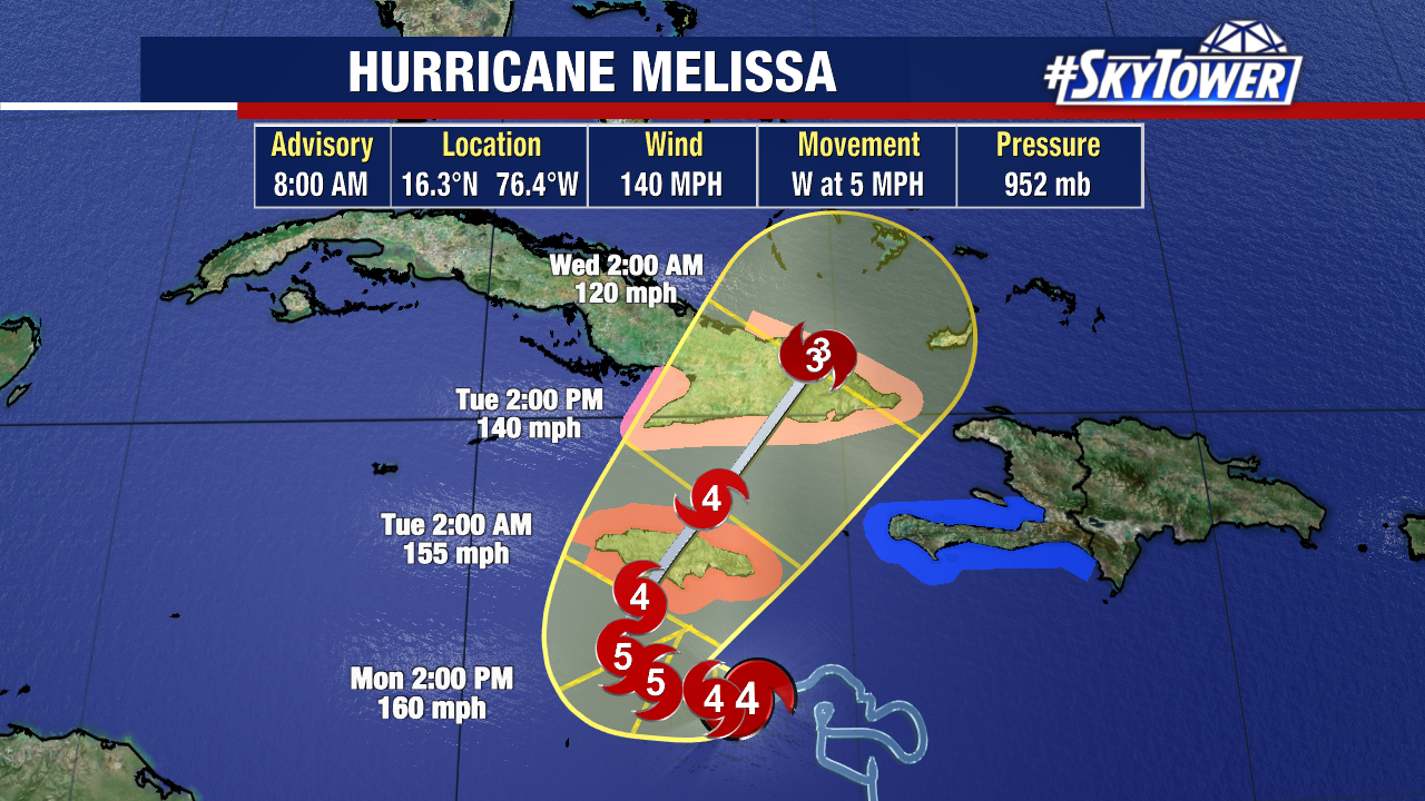
Melissa is forecast to continue to strengthen before hitting the southern coast of Jamaica late Monday – early Tuesday, with peak winds expected to be near 160 mph.
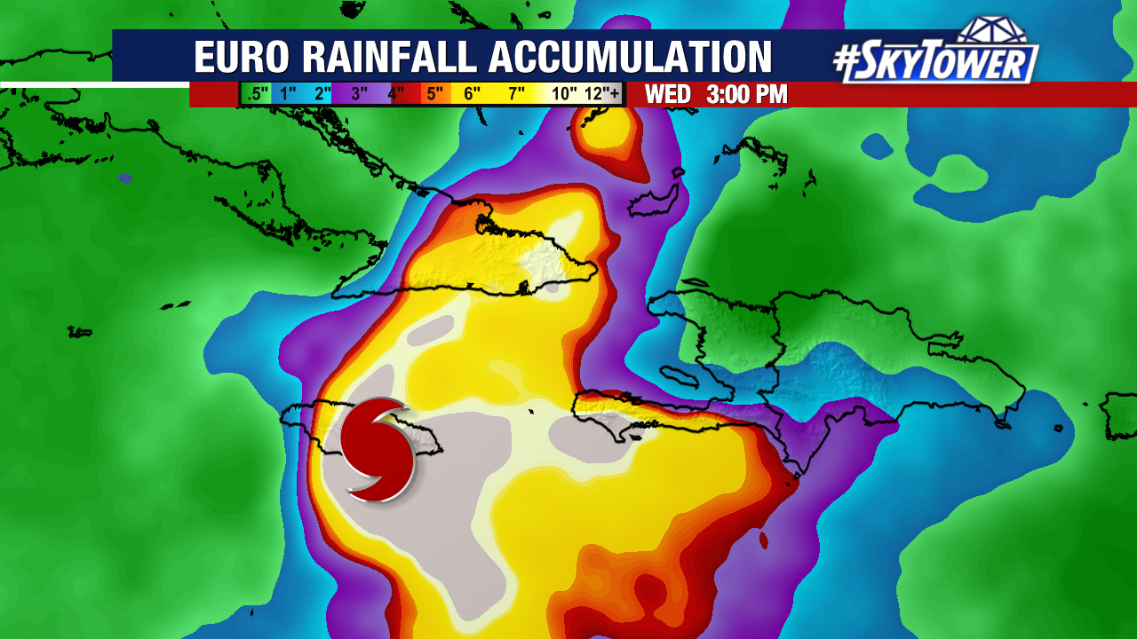
Rainfall of 15 to 30″ is forecast for portions of Jamaica and Haiti into Wednesday. Eastern Cuba will likely get 6-12″ of rain, with isolated totals up to 18″.
Life-threatening storm surge is likely along the south coast of Jamaica late Monday through Tuesday morning. Peak
storm surge heights could reach 9 to 13 feet above ground level, near and east of where the center of Melissa makes landfall. This storm surge will come with large and destructive waves.
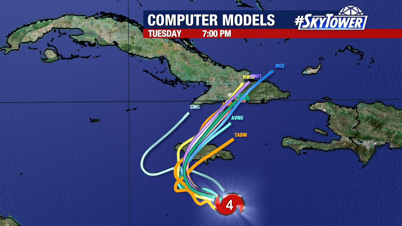
Melissa will continue moving west Sunday and will start to curve north-northeast just south of Jamaica. From there, it will pick up speed as a trough off the southeast coast of the U.S. starts to move Melissa along.
The storm’s center will cross over eastern Cuba late Tuesday or early Wednesday, the southeastern Bahamas later on Wednesday, and reaching the vicinity of Bermuda on Friday.