Powerful gusts reaching 90mph slammed parts of Texas as Hurricane Beryl made landfall in Matagorda. The storm made landfall as a Category 1 hurricane around 3:50 AM.
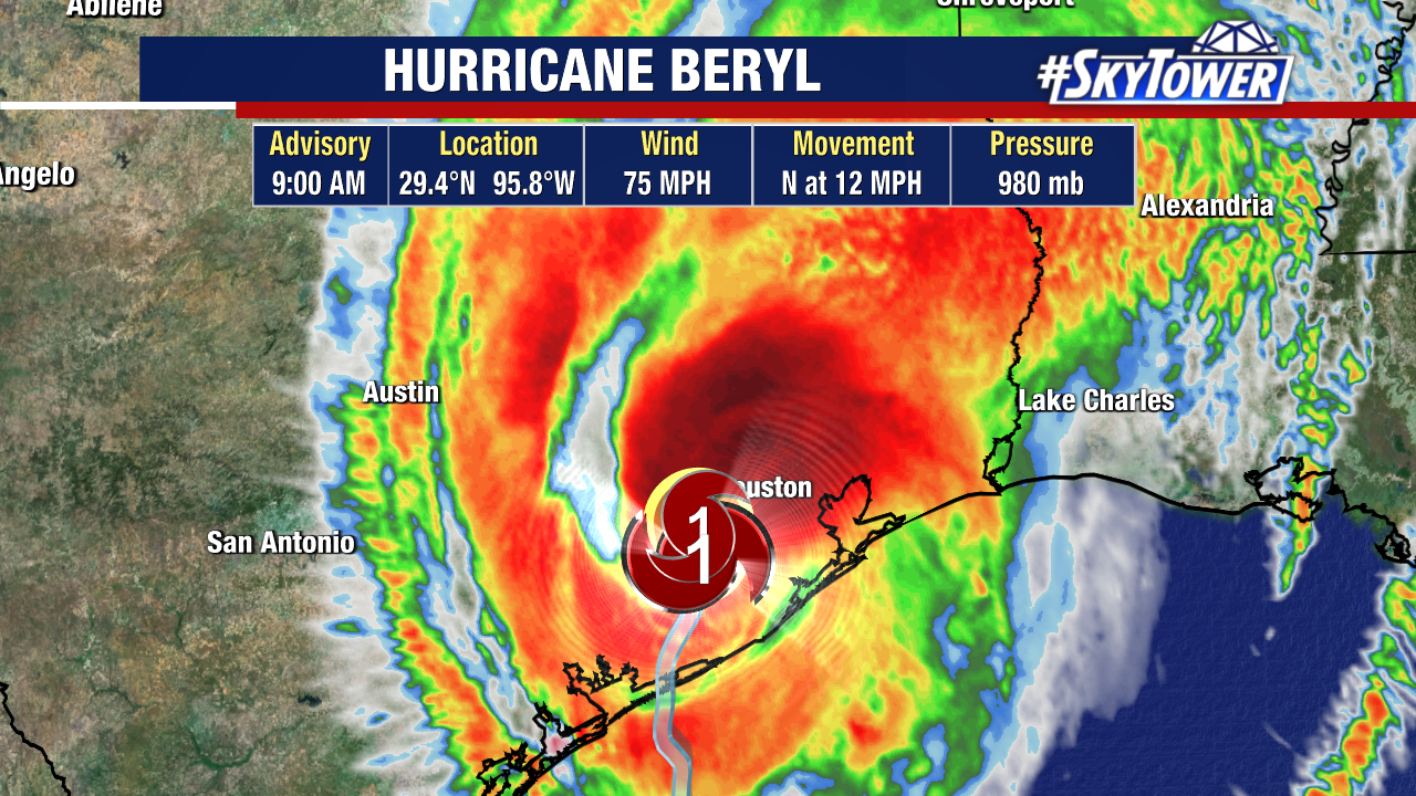
Houston and parts of East Texas have been getting slammed with hurricane-force-winds on the dirty side of the storm. Power outages show over a million people in TX without power Monday morning.
Some top wind reports from Hurricane Beryl’s Texas landfall:
- 92 mph – Freeport
- 91 mph – San Bernard
- 89 mph – Matagorda Bay
- 85 mph – Angleton
- 78 mph – Galveston
- 74 mph – Houston Hobby Airport
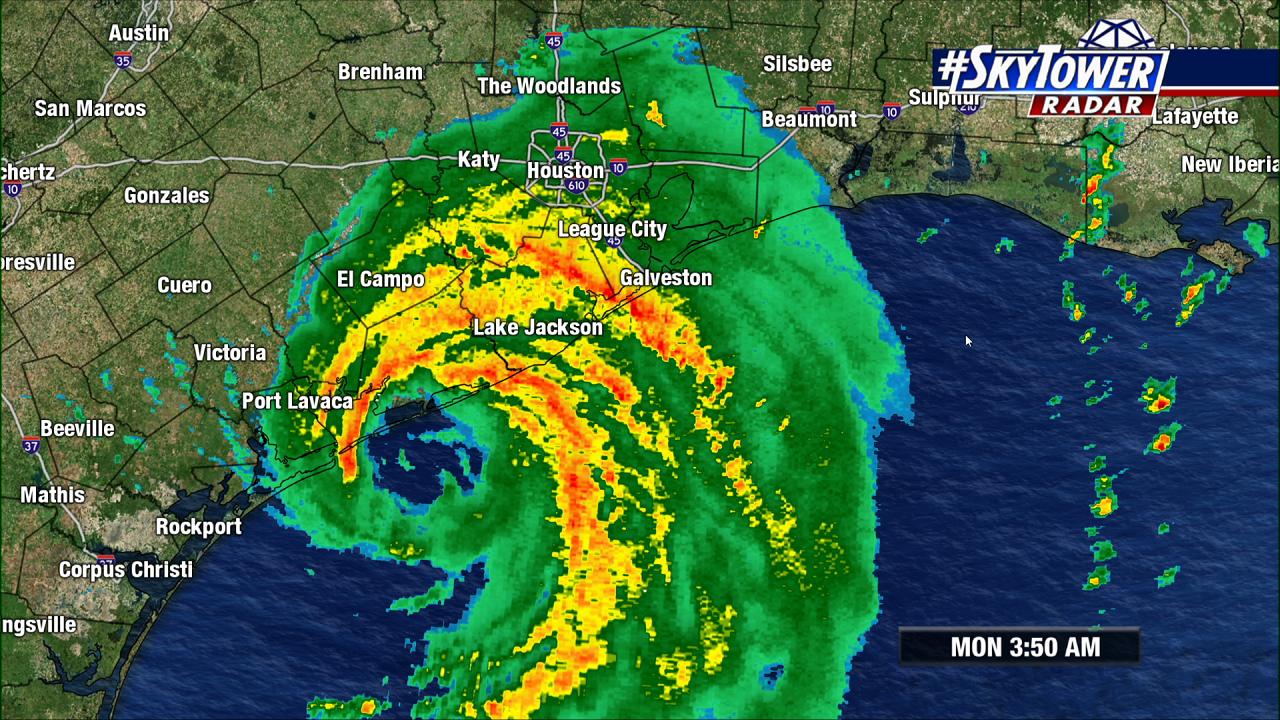
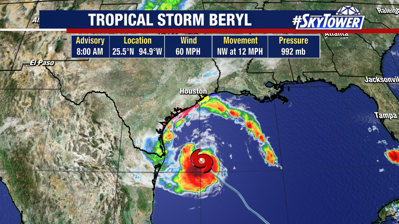
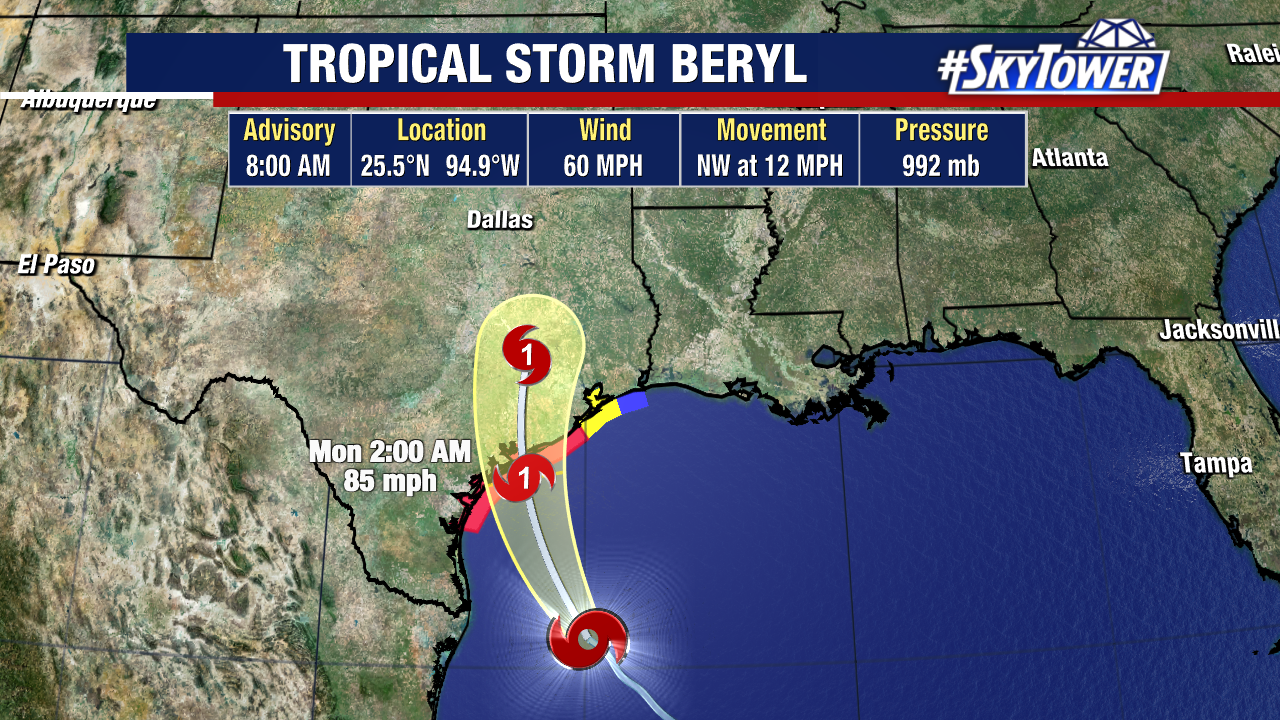
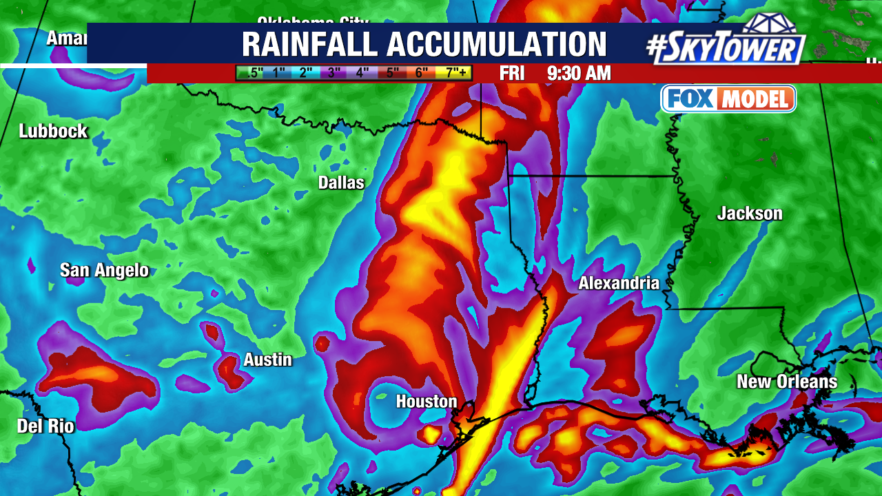
Tropical-storm-force winds still go out about 115 miles from Beryl’s center as the storm’s outer bands continue to stretch into the Gulf of Mexico. Record warm waters continue to fuel Beryl, keeping it at hurricane strength as it pounds Houston and E Texas.
Beryl’s center is currently just SW of Houston and likely moves right over the metro area late Monday morning.
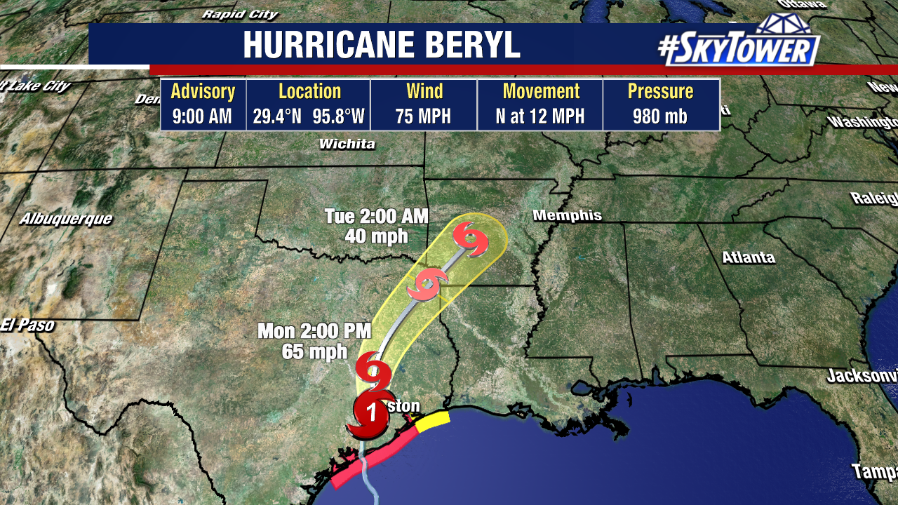
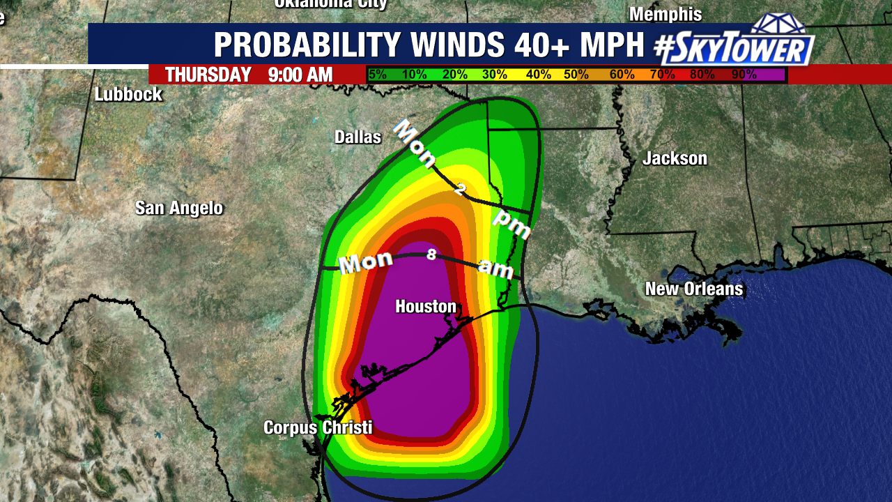
So where will Beryl go from here? The storm has turned north, and it will continue on a northward track through the day, riding along a break in the subtropical ridge.
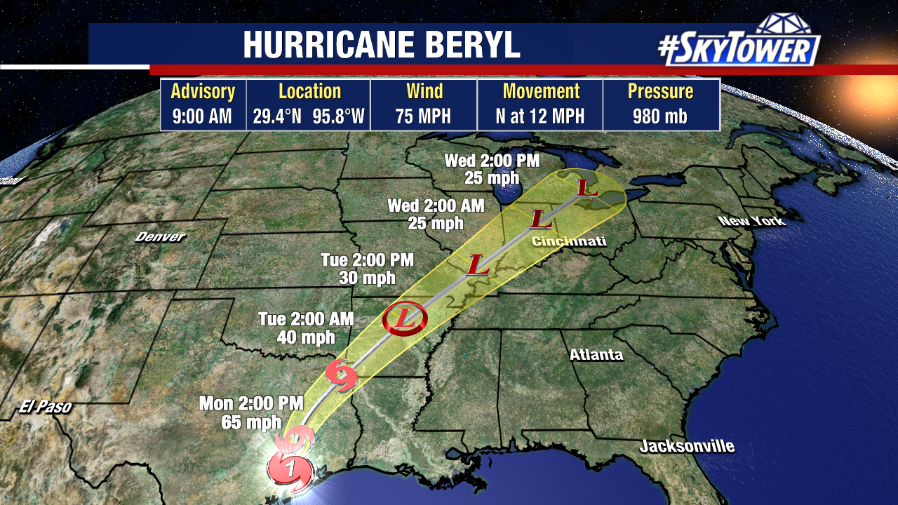
The storm’s center will move through East Texas then turn northeast and start to race through the lower Mississippi Valley and into the Ohio Valley.
Beryl will continue to weaken, becoming a tropical storm in the next few hours, as it moves inland and away from it’s warm water source.
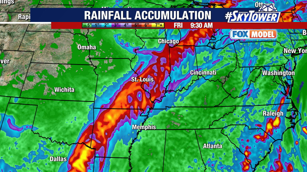
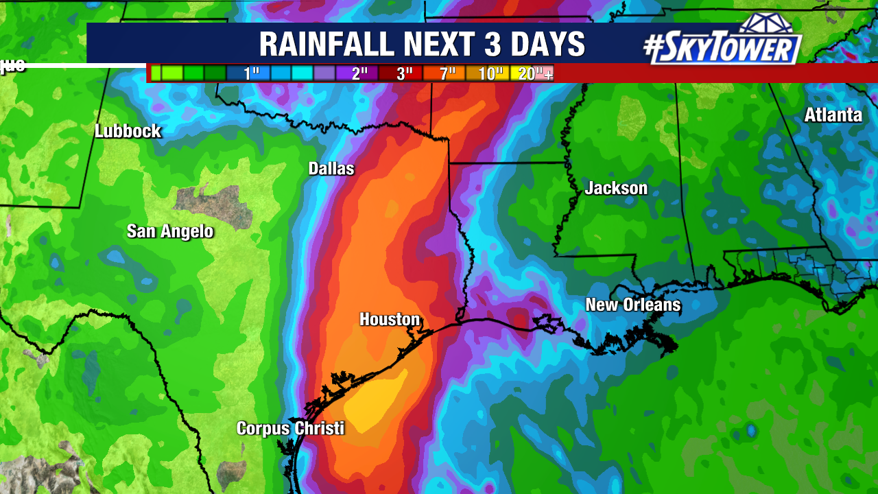
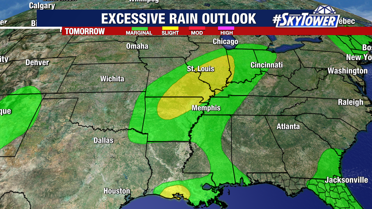
However, this storm will still pack a punch as it brings tropical rains from Arkansas to Illinois. Flash flooding concerns are outlined Tuesday – Wednesday as Beryl tracks toward the Midwest through midweek.
Hurricane Beryl has been historic from the start. This storm has traveled around 3,000 miles since developing east of the Lesser Antilles.
Beryl has made 3 landfalls: on the small island of Carriacou in the Grenadines, the Yucatan Peninsula, and in Texas.
It now takes the title as the strongest storm on record in the Atlantic basin during June and July.
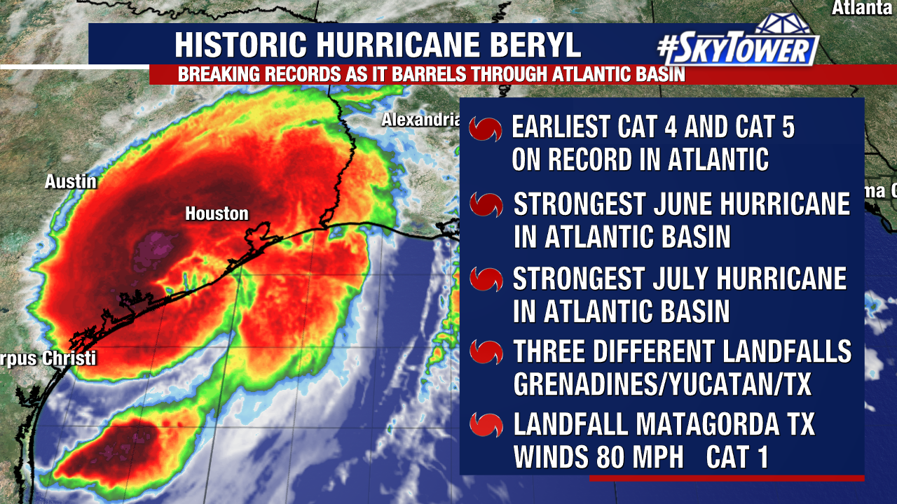
Beryl is the strongest storm on record to make landfall in the Grenadines. Not only is Beryl the first hurricane of the 2024 Atlantic hurricane season, but it’s incredibly rare for a storm of this strength this early in the season.
The first major hurricane typically forms September 1. Beryl is closer in line with a storm we’d see during August or September.