The tropical wave we’ve been watching is not yet Ernesto, but expected to reach tropical storm strength today or Tuesday.
Tropical Storm Warnings are now up for the Leeward Islands: Antigua, Barbuda, Anguilla, St. Kitts, St. Martin and Guadeloupe.
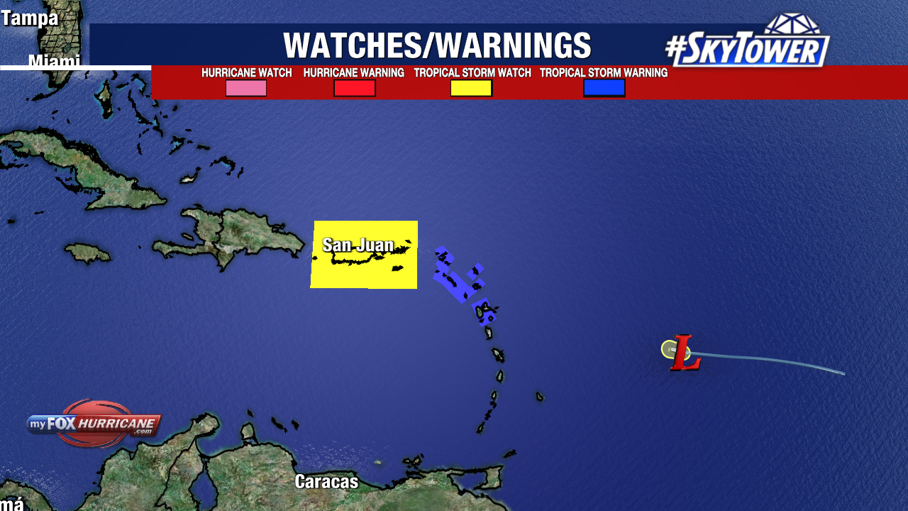
Tropical Storm Watch includes: British Virgin Islands, U.S. Virgin Islands, Puerto Rico and the small islands of Vieques and Culebra.
Impacts will start for the Leeward Islands Tuesday with tropical downpours and tropical-storm-force winds. Flash flooding and mudslides are concerns for the islands through Wednesday.
Wednesday into Thursday is when Puerto Rico and the U.S. Virgin Islands will see impacts.
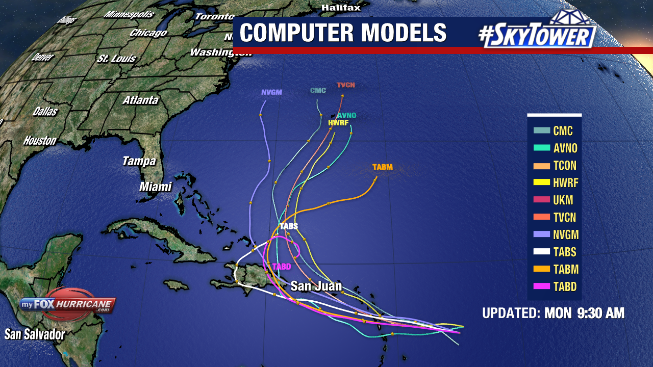
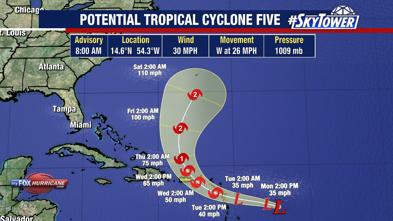
From there, the storm will take a sharp turn north. This will likely bring impacts to Bermuda but the storm will stay well east of Florida and the Atlantic Coast.
Once sustained winds reach 39mph, we will have Tropical Storm Ernesto. The NHC will likely issue more watches/warnings as PTC 5 is expected to further strengthen.
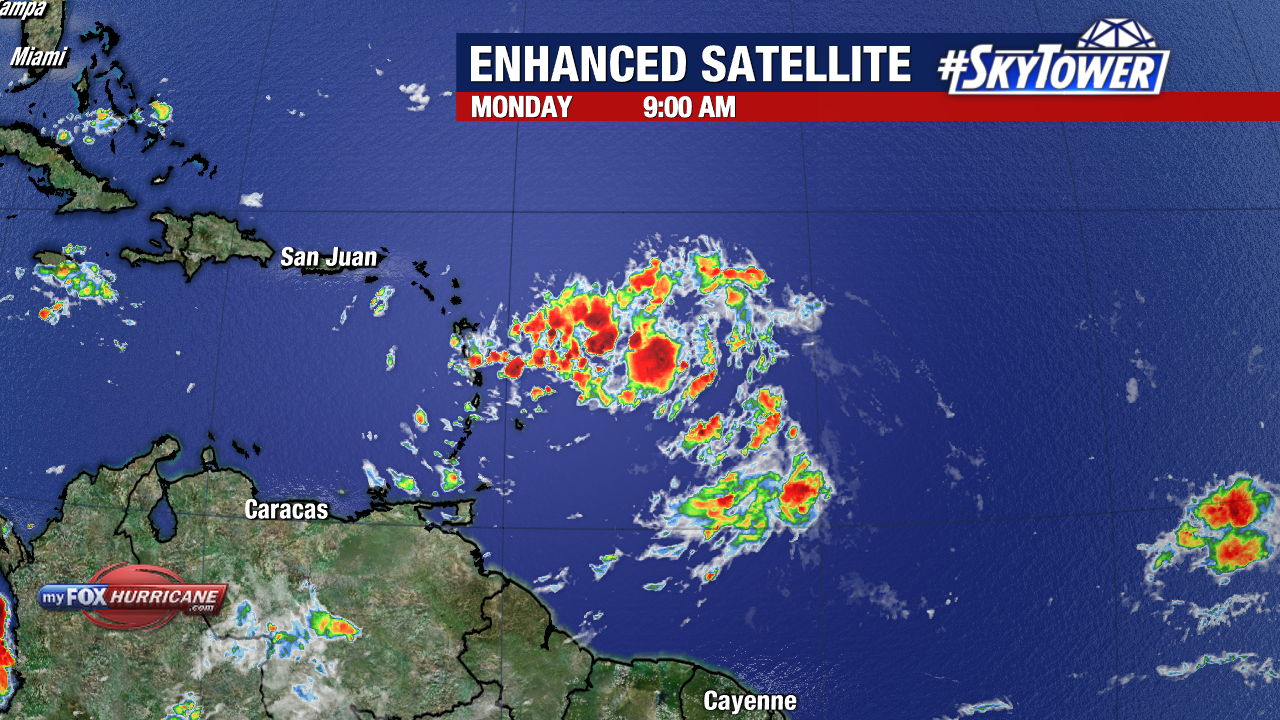
This area of interest is currently called Potential Tropical Cyclone Five. It was Invest 98L over the weekend.
The upgrade to PTC 5 means a tropical system has not formed yet, but is expected to bring impacts to land within 48 hours. It allows the National Hurricane Center to start issuing advisories, like Hurricane or Tropical Storm Watches/Warnings.
Potential Tropical Cyclone Five is currently east of the Lesser Antilles with 30mph sustained winds. It is moving west at 26 mph, but will start to track west-northwest with some decrease in forward speed over the next few days.