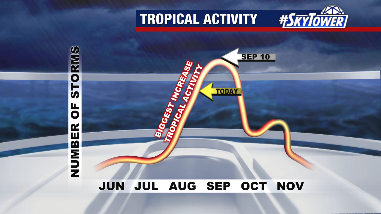
Three disturbances are being watched for tropical development in the Atlantic and Caribbean. We’re exactly one week away from what is considered the peak of hurricane season – Sept 10.
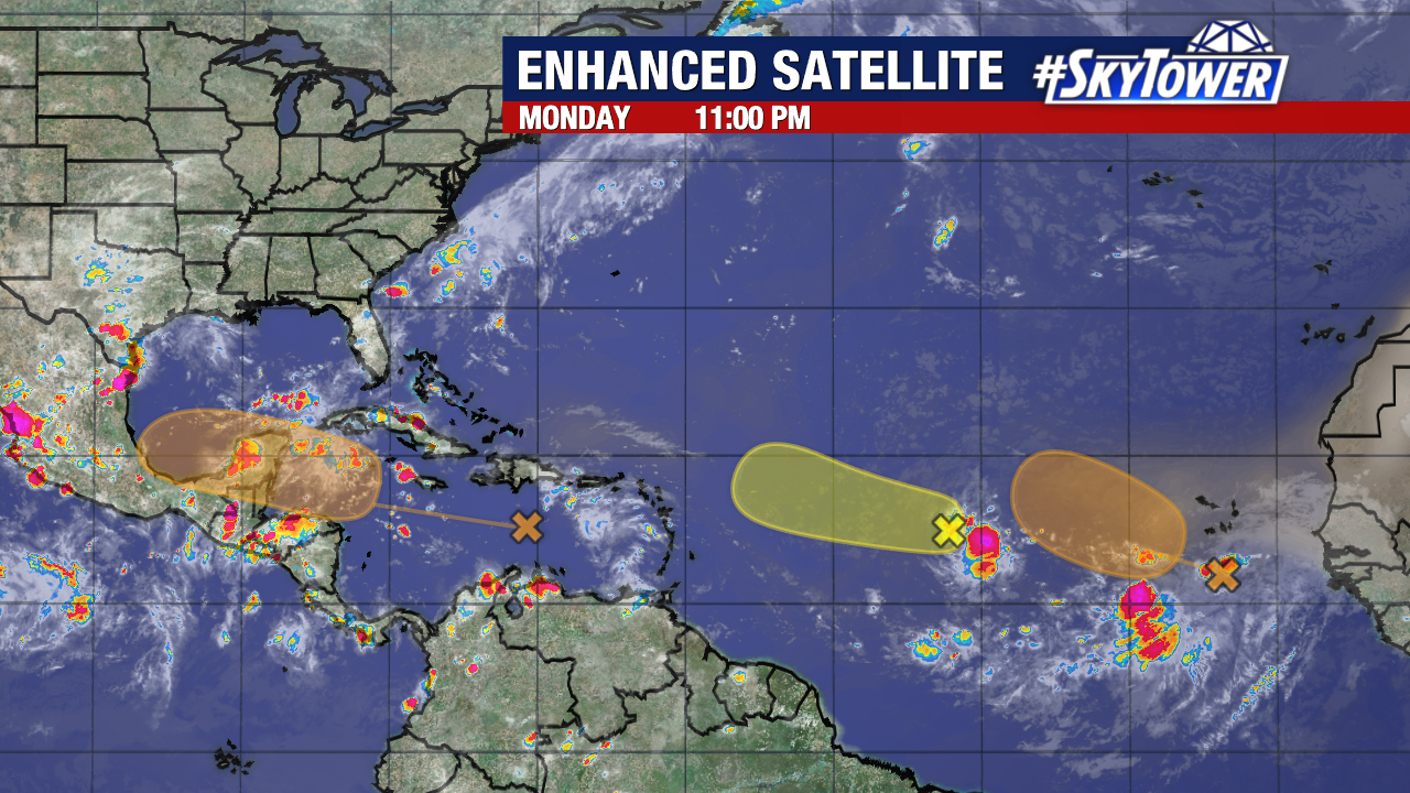
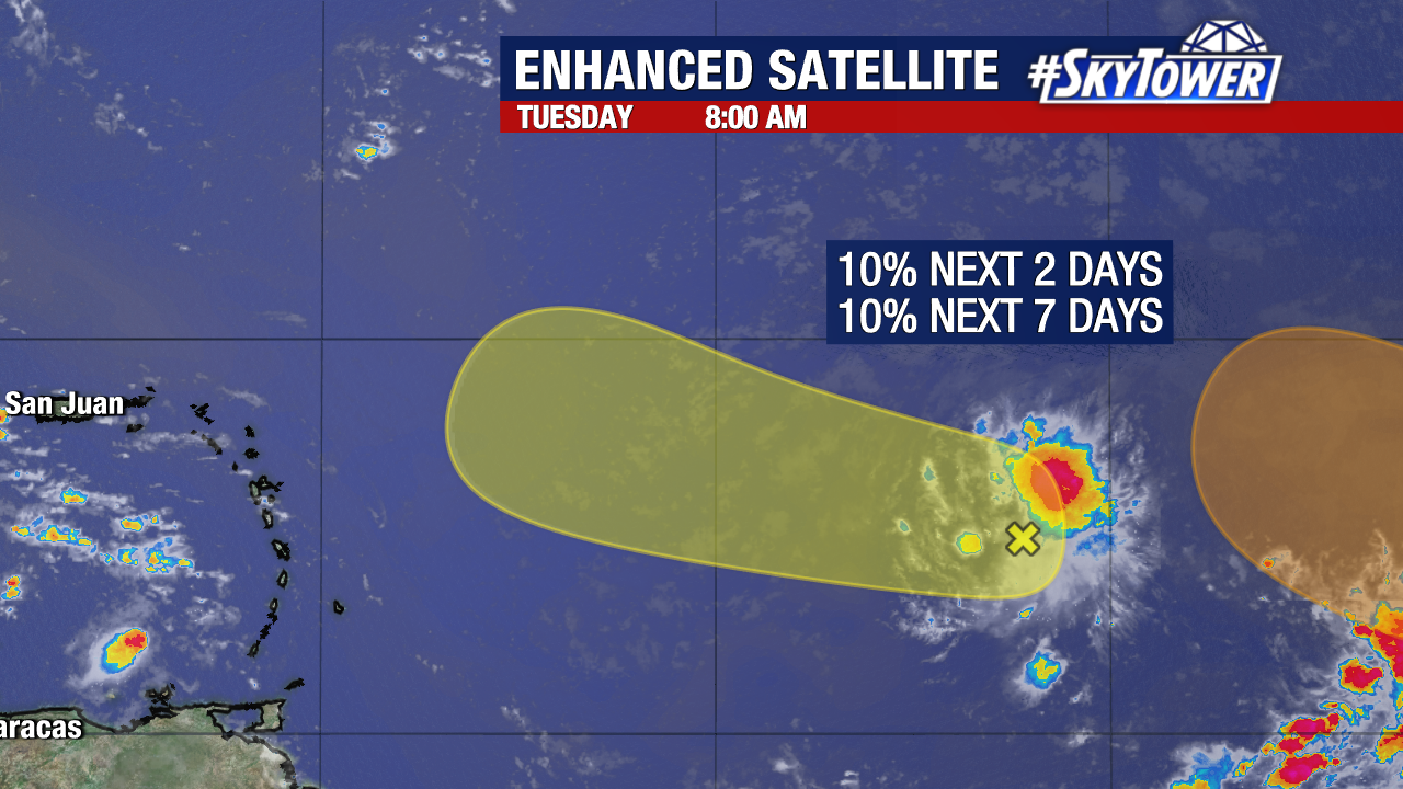
We’ll start with the area moving through the Caribbean Sea that we’ve been watching the last few days. It’s just a disorganized area that’s been producing gusty winds and tropical downpours from Puerto Rico to South America.
The odds of this developing into a tropical depression or storm is 40% over the next 7 days – near 0% over the next 2 days. It is still battling hostile wind shear and some pockets of drier air, which is keeping the system disorganized.
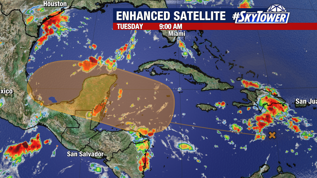
By the end of this week, the disturbance moves into the western Caribbean where conditions become more favorable for strengthening. Around the Yucatan Peninsula, there is extremely deep warm water that could allow intensification.
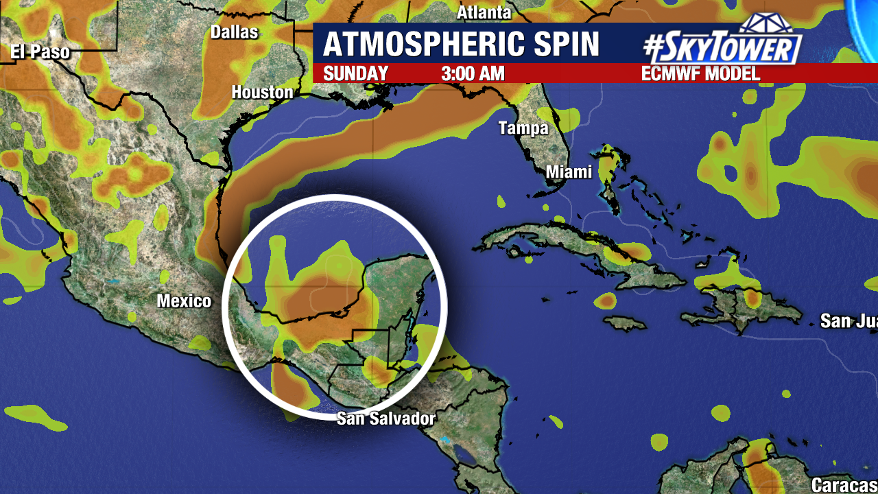
Steering currents will generally keep this area on a westward path. It’s unclear where a center of circulation could form and models are having a tough time handling long-term solutions. Until we have a defined center, models are unreliable.
Early next week is likely when this could emerge into the Gulf of Mexico. There is also the possibility this system does not organize and take enough advantage of the supportive environment in the western Caribbean.
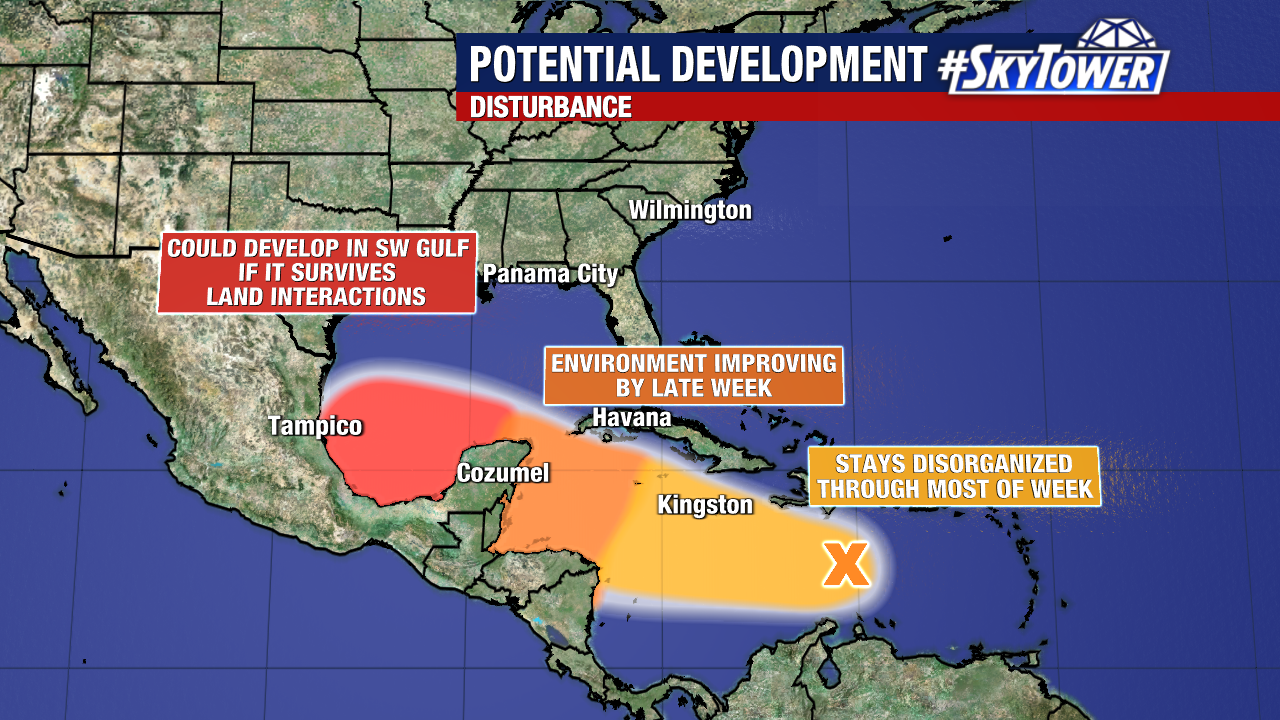
It’s a watch and wait game the next few days. We’ll keep you updated.
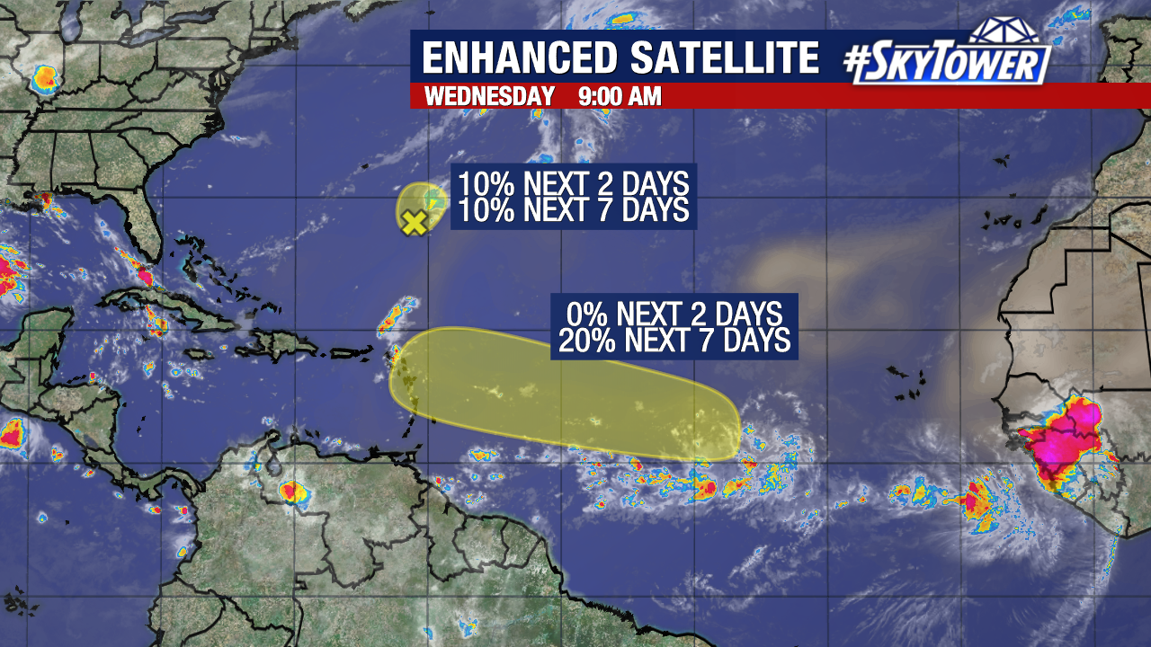
Meanwhile in the Atlantic, two tropical waves have emerged.
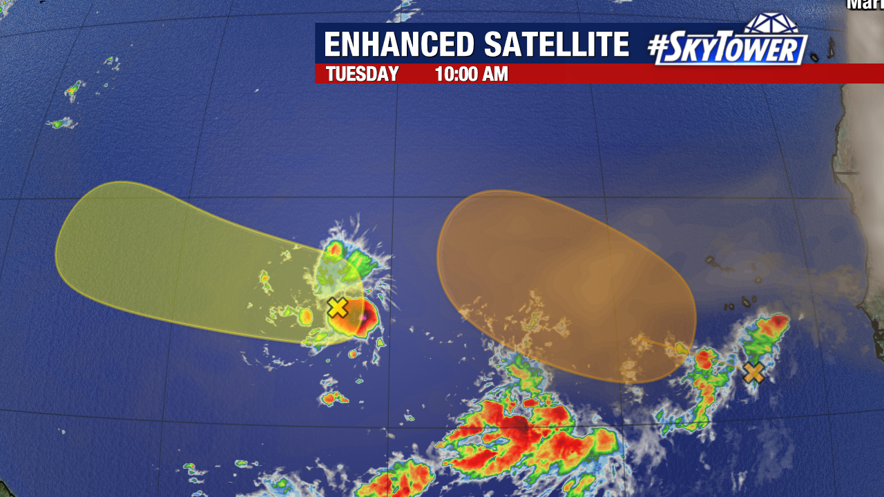
Off Africa, there is a decent looking system showing rotation as it moves through the open Atlantic waters. However, this area is going to encounter dry and dusty air the next several days, limiting development.
The odds are 10% over 2 days and 40% over 7 days. The area will slowly move west-northwest. Conditions are more favorable later this week as it scoots away from the Saharan air.
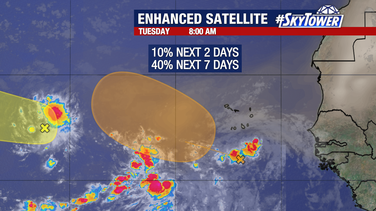
The newest wave spun up about midway between the Lesser Antilles and coast of Africa. This one has very low development odds. Some slow strengthening is possible as the system moves west-northwest.
About 70% of the hurricane season is still ahead of us. September is typically the most active month, producing 34% of named storms.
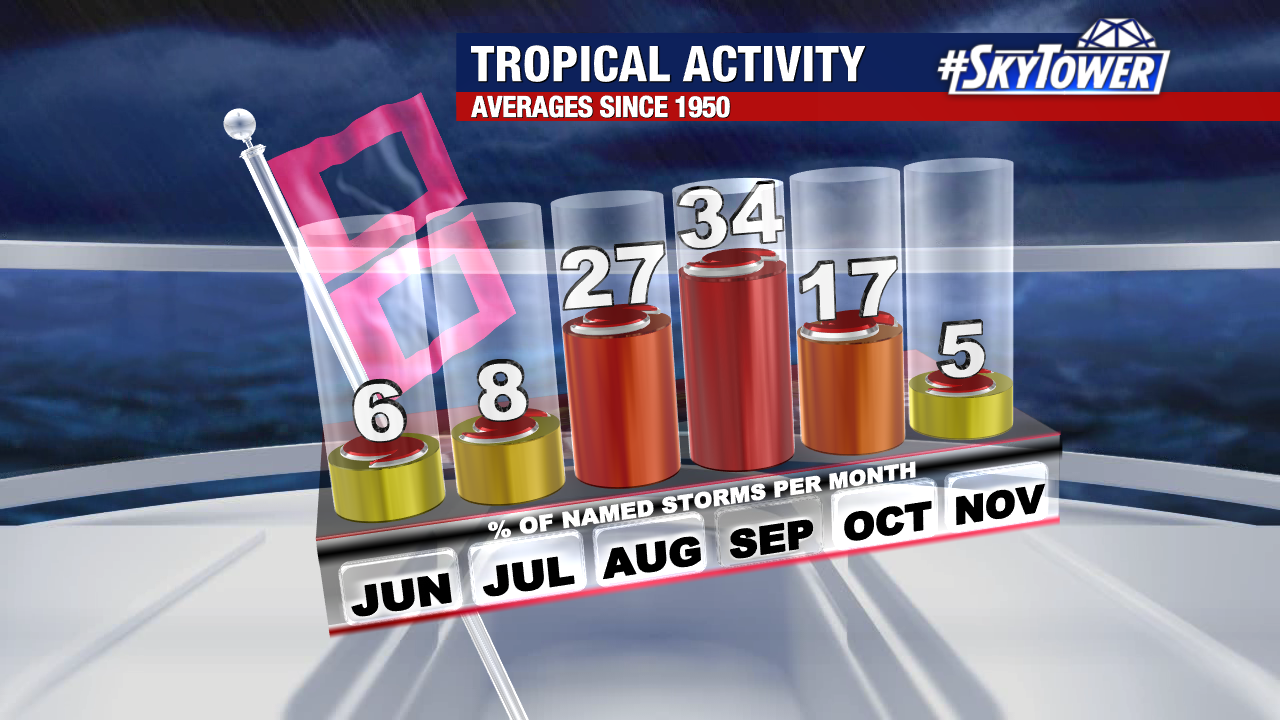
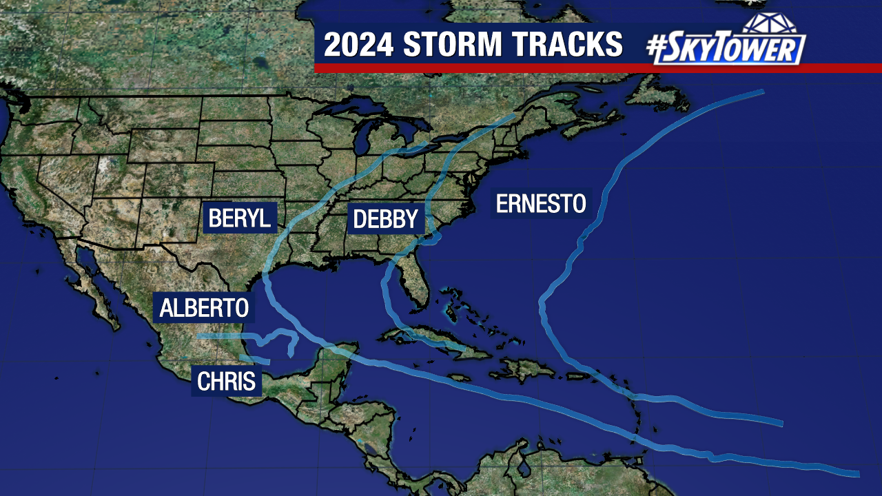
This season has been an anomaly in many ways. First things started out historically busy with Hurricane Beryl smashing several records. That was followed by an eerily quiet stretch into early September.
It’s been 56 years since the Atlantic had no named storms from Aug 13 – Sept 3. 1968 was the last time we had an unusually quiet stretch like this, during what is considered a historically busy time of the season.
Ernesto was the last named storm on Aug 12. The next name in line is Francine.