Hurricane Imelda will make a close pass to Bermuda

Hurricane Imelda has been strengthening and is now a Category 1 hurricane with 75 mph sustained winds. It has started to make the turn to more to the east and the storm will continue moving away from Florida and the SE.
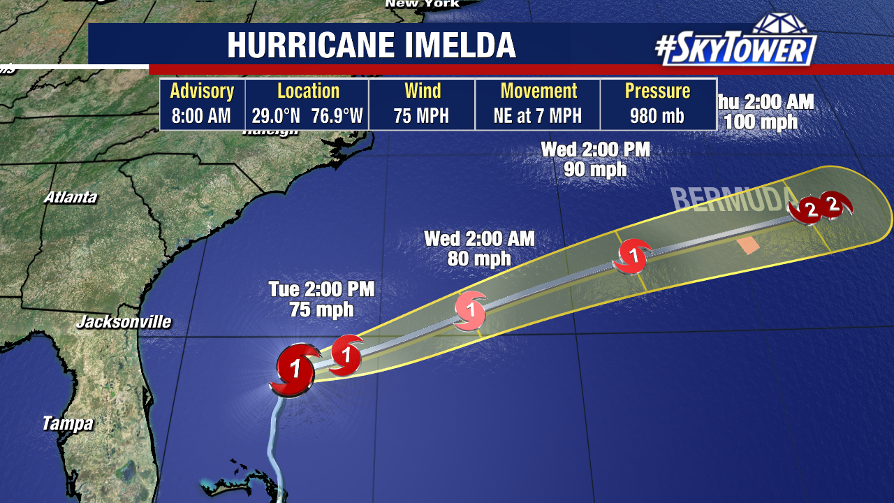
Bermuda is under a Hurricane Warning as the storm is moving northeast in the direction of the island. Imelda is forecast to strengthen into a Category 2 storm as it passes the island Wednesday – Thursday.
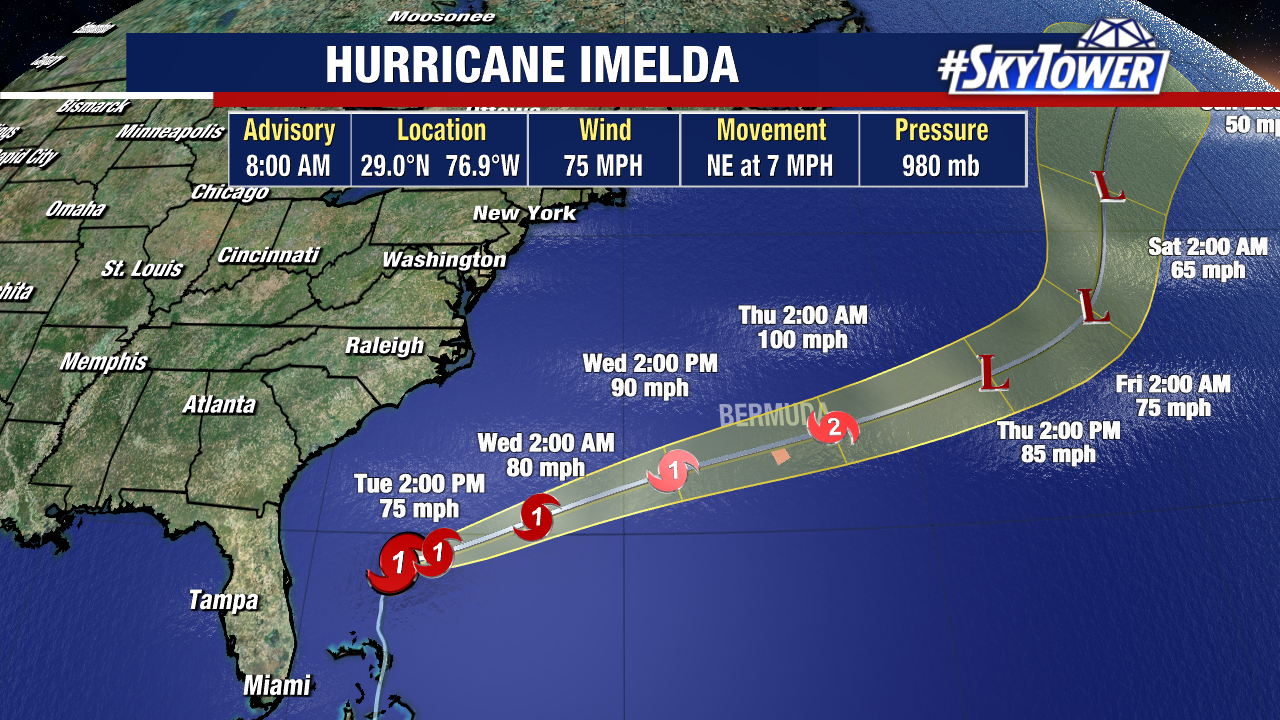
Imelda will make the closest pass that any storm has made this season with hurricane-force-winds, large waves and heavy rain starting Wednesday.
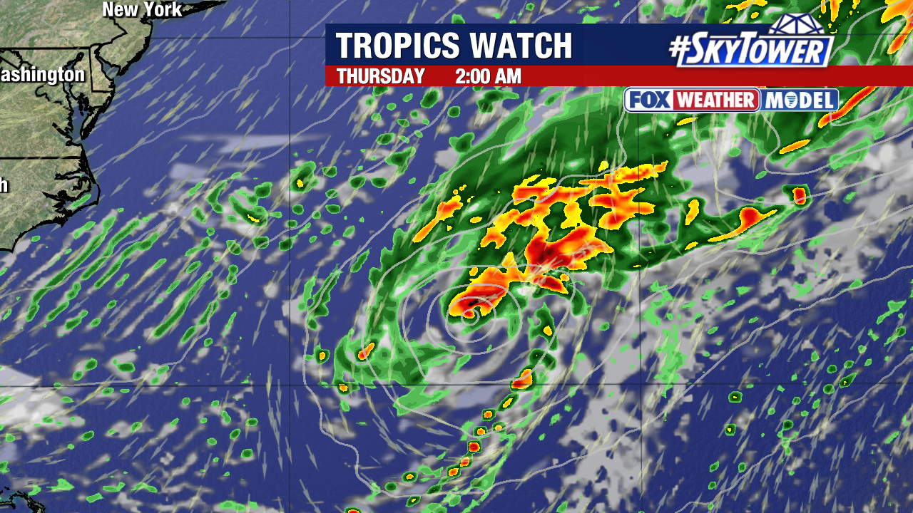
A landfall is not out of the question but impacts will be felt across Bermuda either way. Imelda’s core passing to the north would put the island on the dirty side of the storm and bring the worst of the weather.
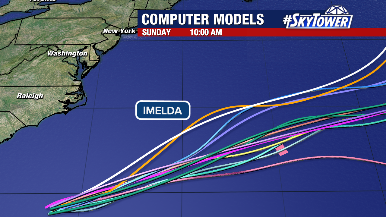
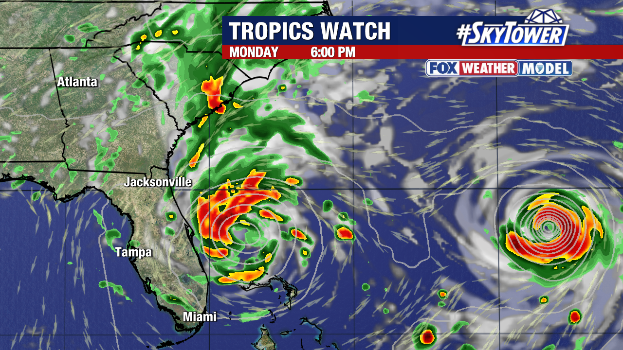
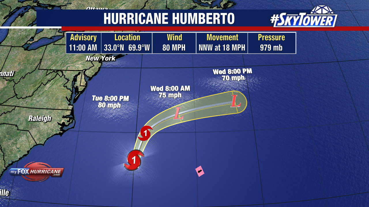
Hurricane Humberto, a stronger storm a few hundred miles to its east, is altering the steering and tugging Imelda out to sea.
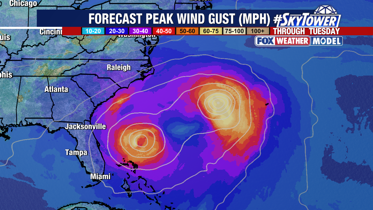
Humberto is west of Bermuda and is going to pass well north of the island with impacts limited to rough surf and marine conditions.
Tropical Storm Watch for the east coast of Florida

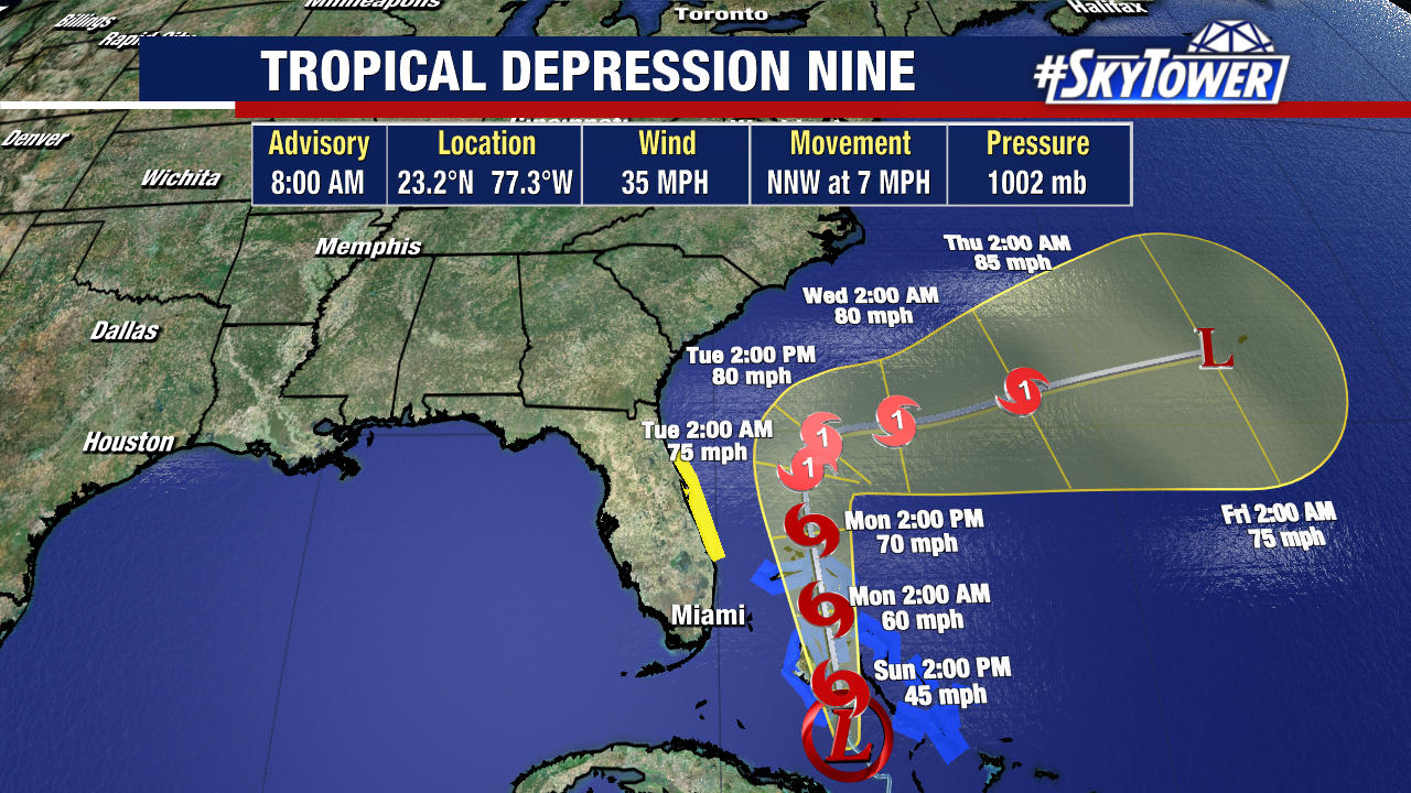
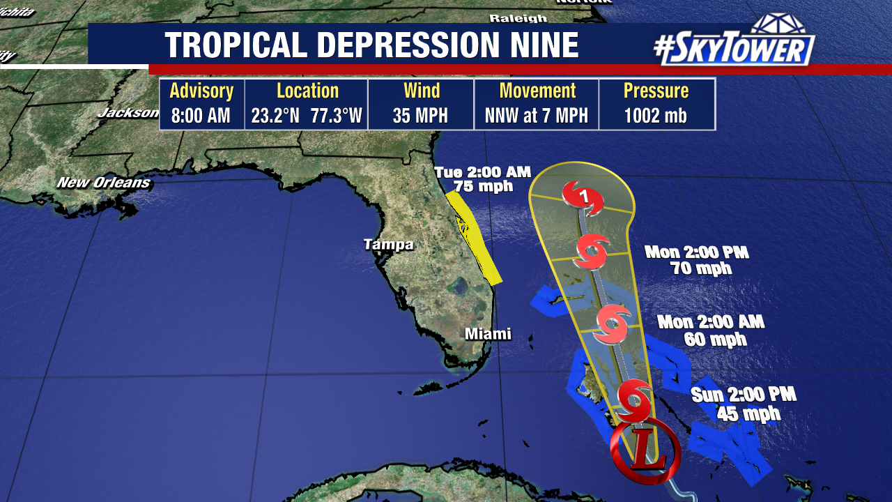
Tropical Depression Nine is just shy of becoming the next named storm of the season as it moves over the Bahamas.

This is expected to become Tropical Storm Imelda later on Sunday and a Category 1 hurricane Monday or Tuesday as it passes off Florida’s east coast.

The Watch runs from the Palm Beach/Martin County Line to Flagler/Volusia County Line, where fringe effects from the storm will be possible starting on Monday. Tropical Storm Warning is up for the Bahamas.

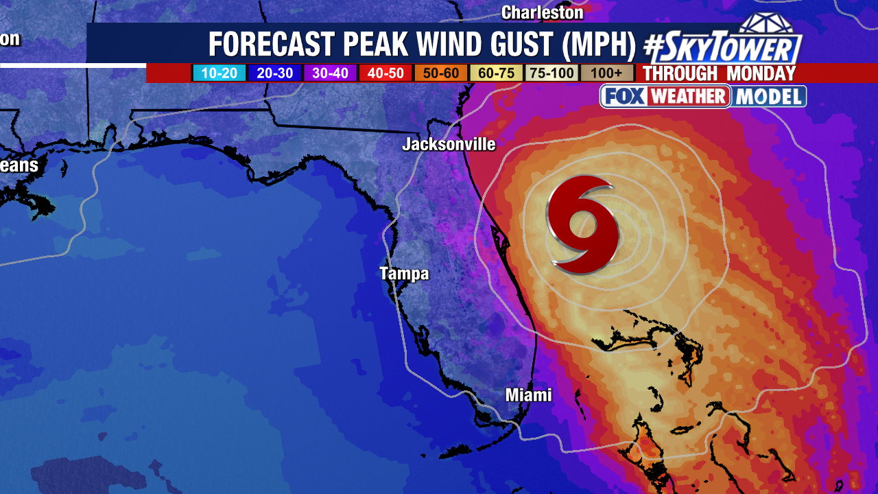
Space Coast areas could feel tropical-storm-force wind gusts, in the 40-50 mph range, but the storm stays offshore and impacts aren’t expected inland. Rough beach and boating conditions will be in place for several days on the east coast of Florida.

The latest trend is good news for the Carolinas and coastal Georgia. These areas are no longer included in the forecast cone and there is high confidence Imelda stays offshore before turning east and going out to sea.

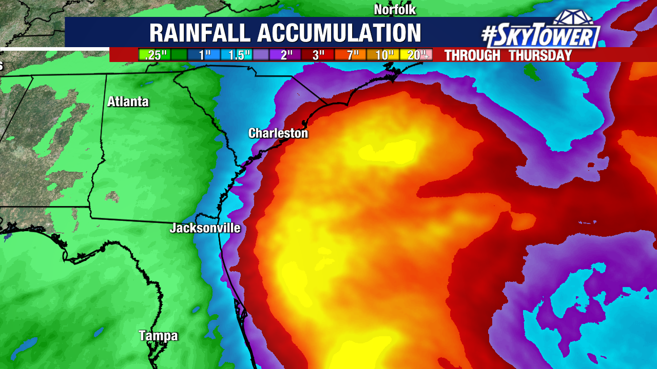
This brings rain totals down significantly with a general 2-4″ and locally high rainfall totals up to 7″ near the coast through Wednesday morning.

Part of what is helping to steer future Imelda out to sea is Hurricane Humberto, which is altering the steering currents and helping to tug the storm east.

Humberto is still a powerful Category 4 hurricane and will pass west of Bermuda Tuesday – Wednesday.