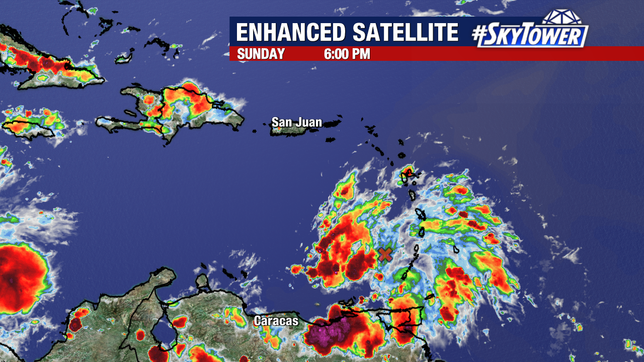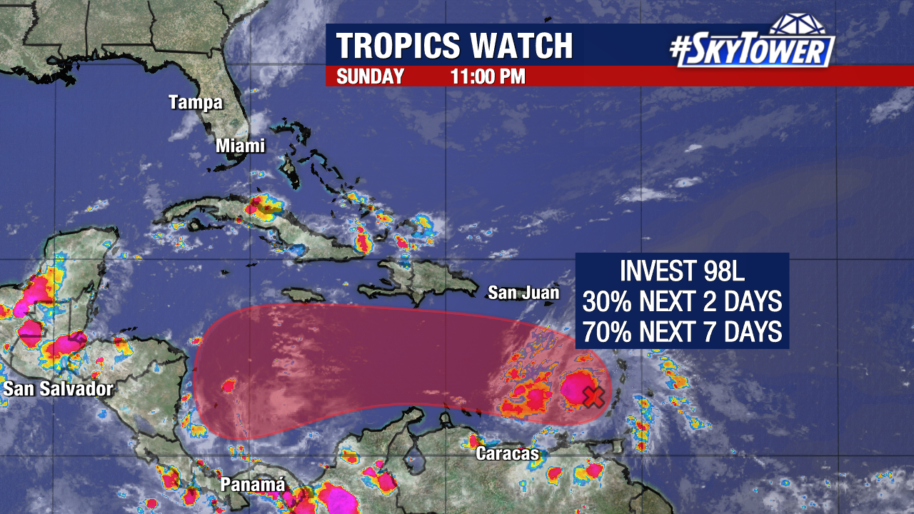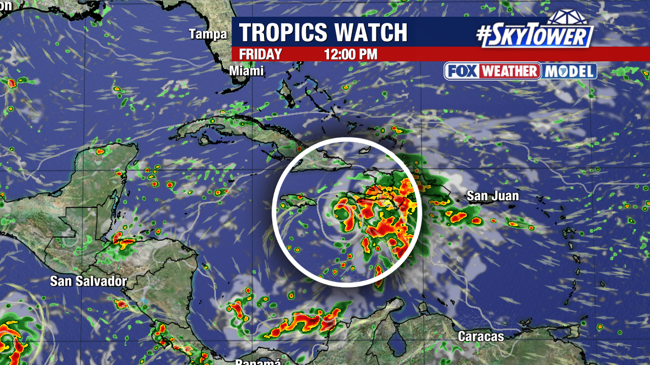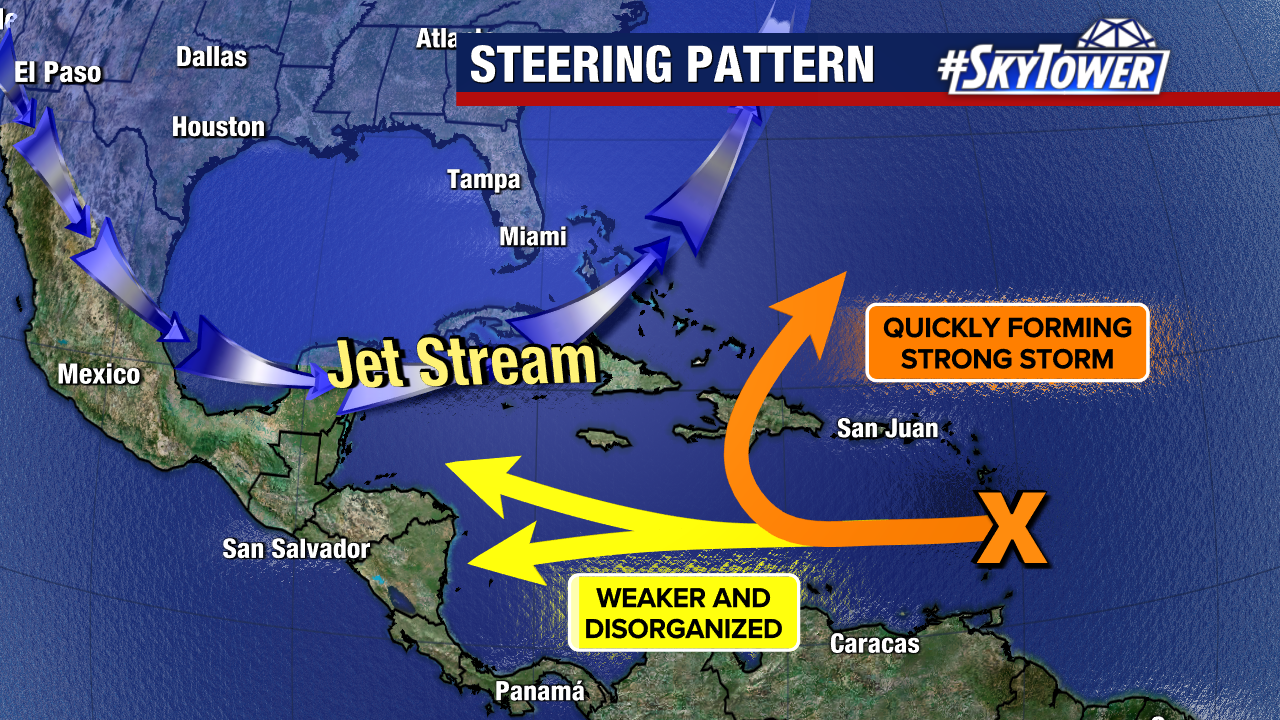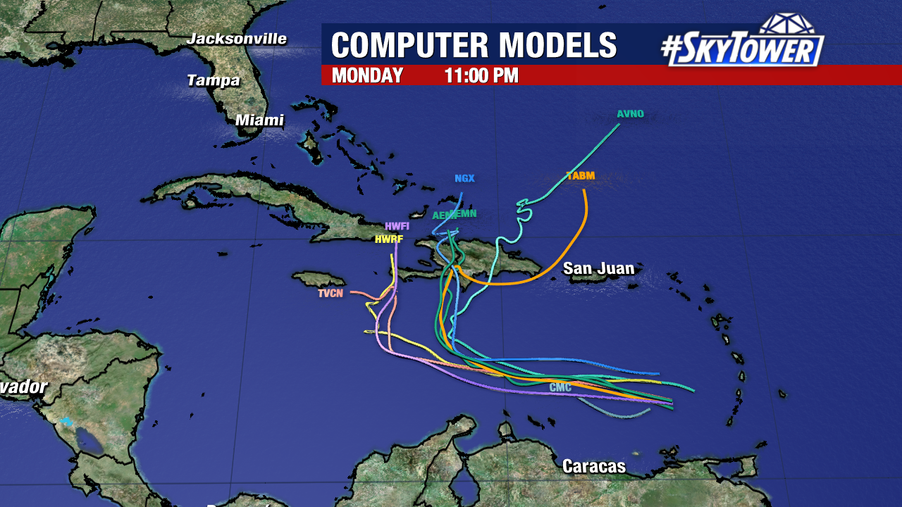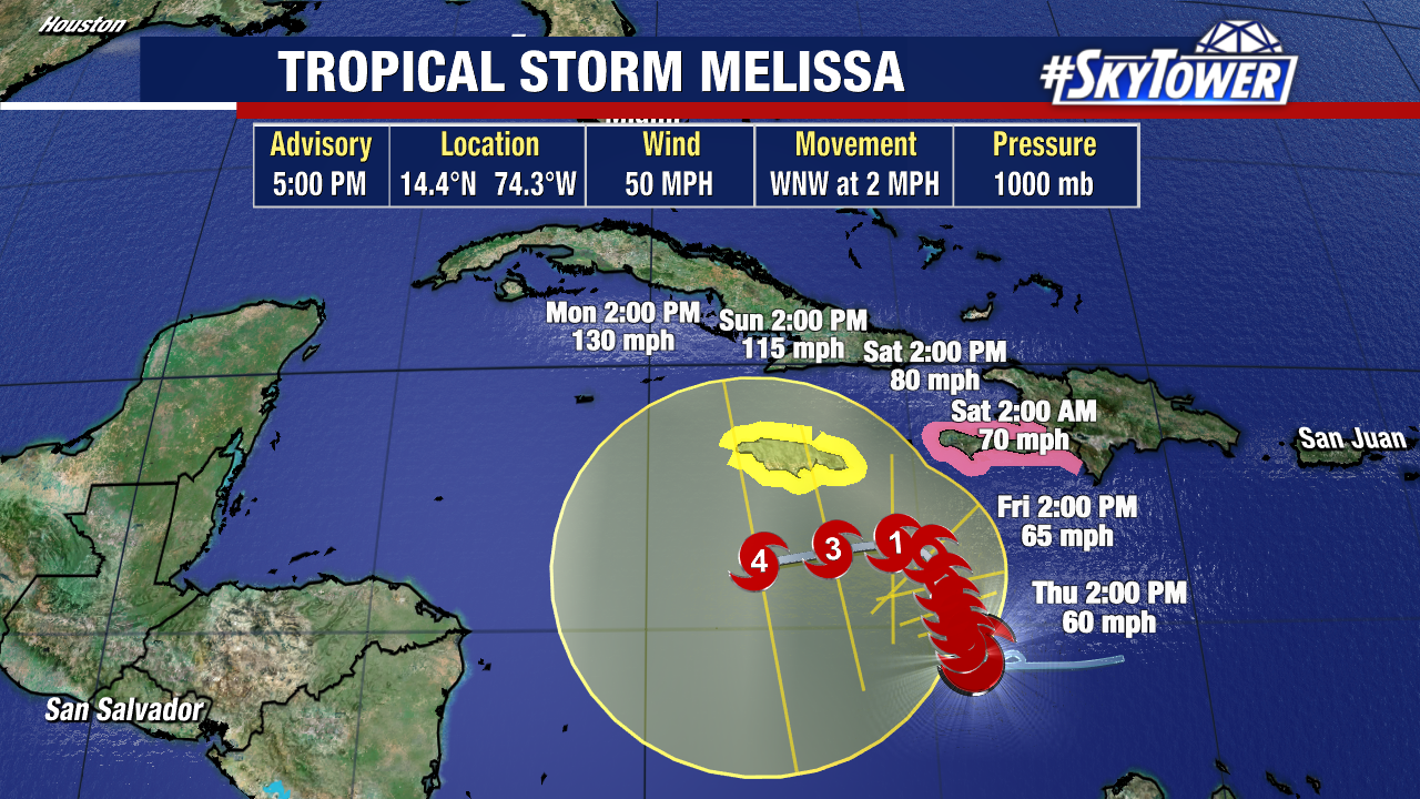
Tropical Storm Melissa is expected to strengthen into a hurricane in the Caribbean Sea by the end of this weekend. As you can tell by the cone, there is a wide range of places this storm may track over the next five days. Competing steering currents are tugging Melissa in different directions, keeping the track slow and uncertain in the short term.
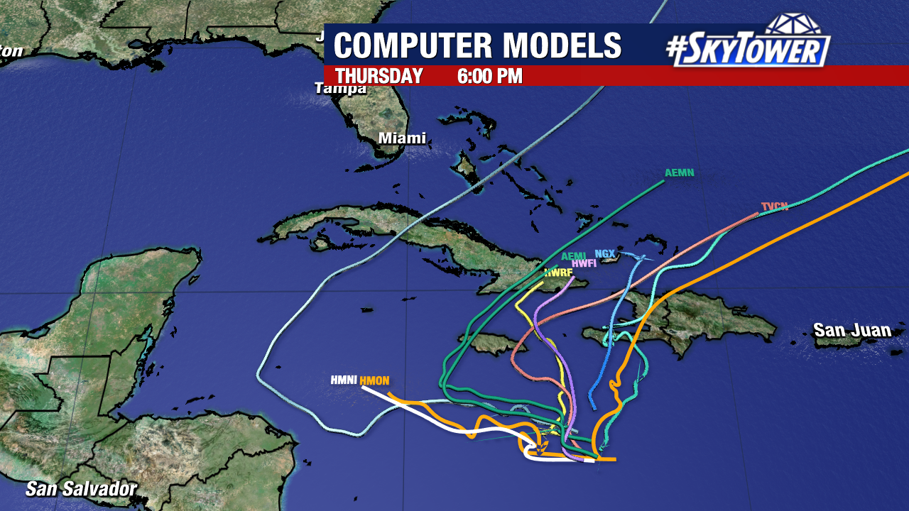
Weather models are slowly beginning to agree on an eventual north-northeast turn. Steering keeps Melissa south and east of Florida for now. From Tampa Bay’s view, it is something to watch, not to stress over.
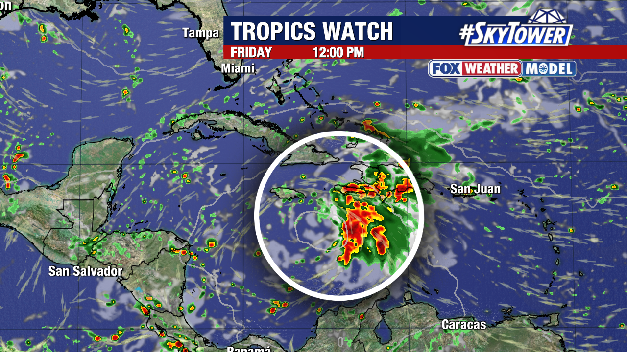
The big question is when will that turn come, and how close will this storm travel to the nearby islands.
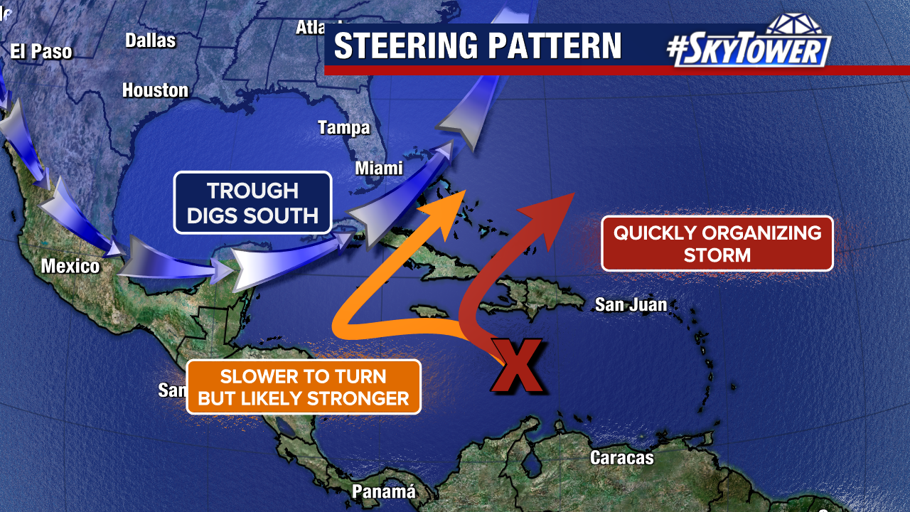
Two likely scenarios have emerged in the last day. Melissa could organize quickly and move northeast within the five days or so. Melissa could also move slowly west and strengthen, eventually leaving the Caribbean after a week or longer.
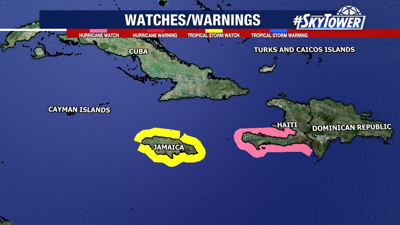
A Hurricane Watch is in effect for portions of Haiti and a Tropical Storm Watch is active for Jamaica.
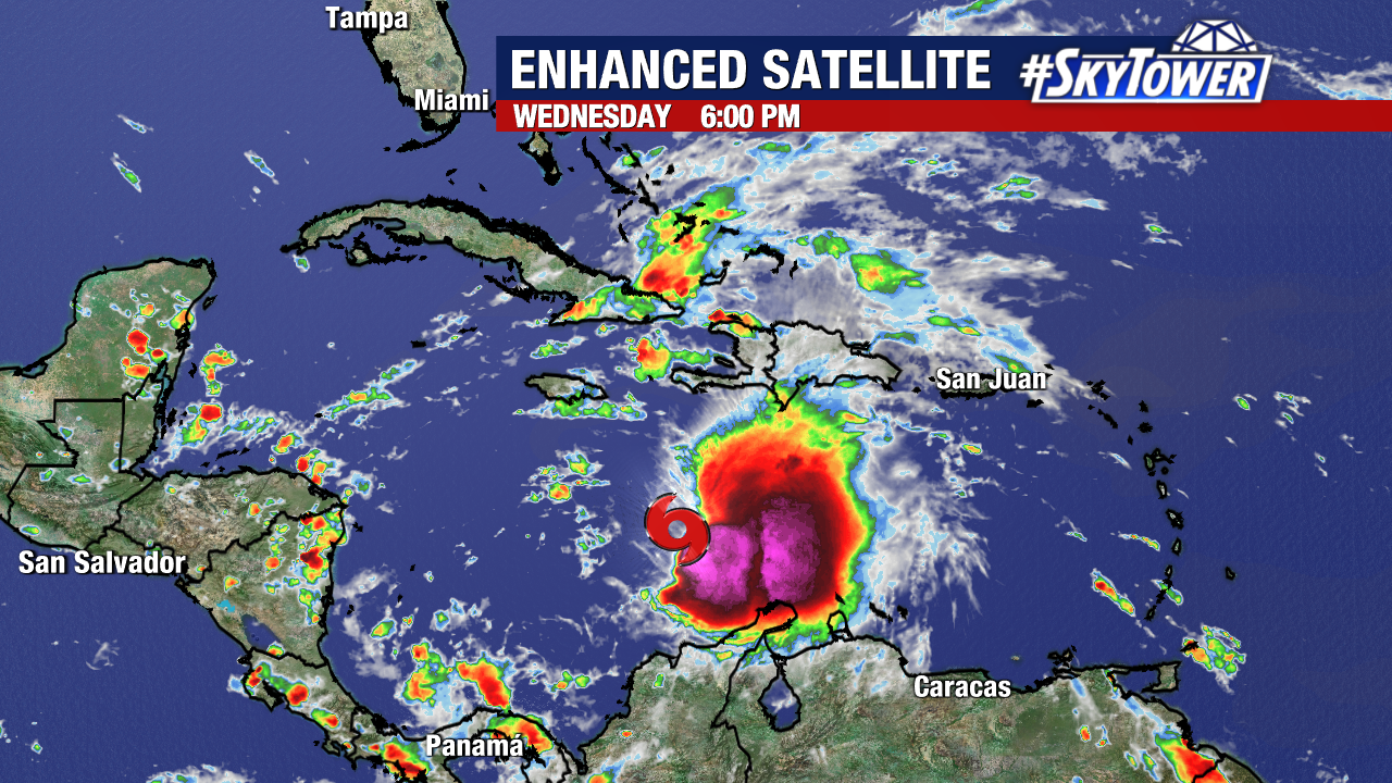
Melissa’s slow movement will provide these islands with an increased risk of flooding and mudslides in the days ahead.