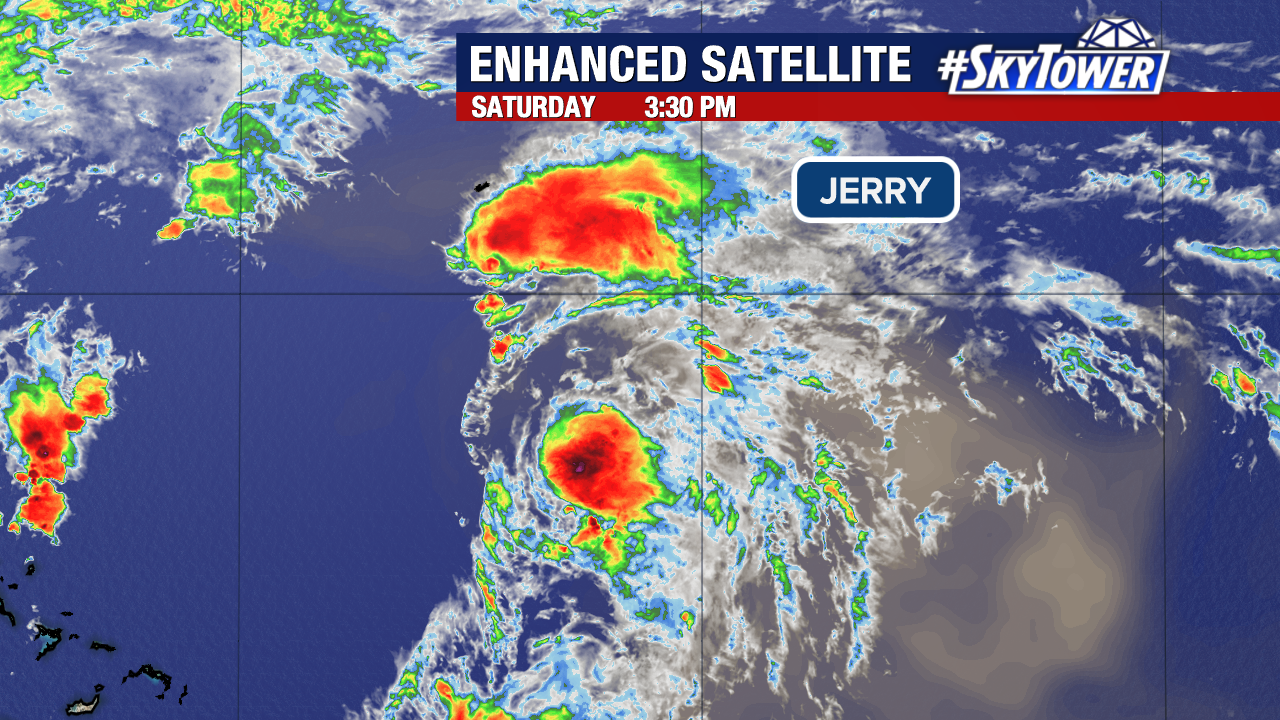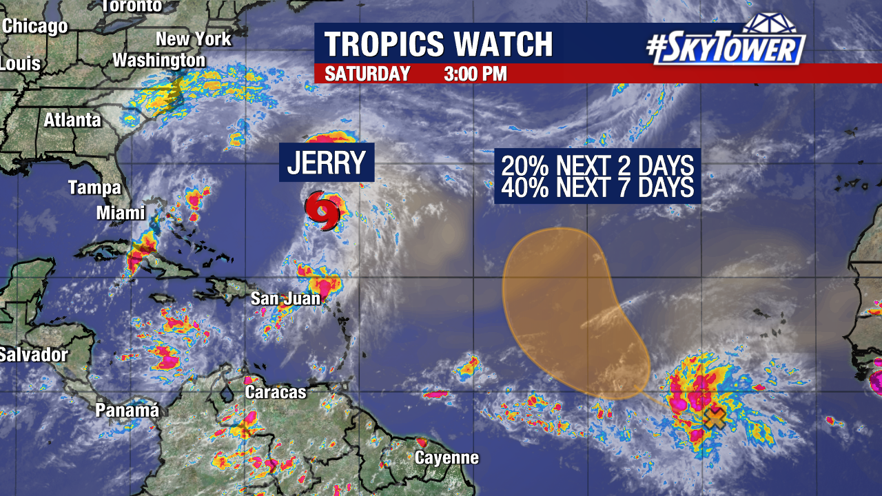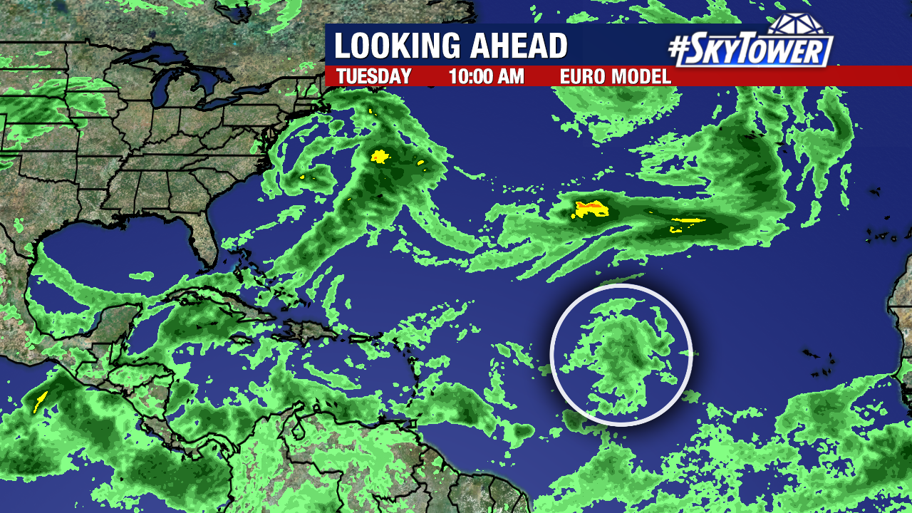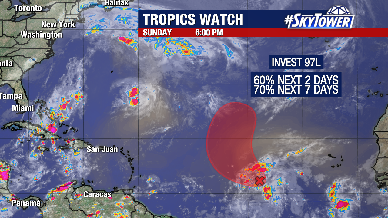
We are currently monitoring one Atlantic disturbance heading into the workweek. Invest 97L, a robust tropical wave in the central Atlantic, now has a high chance of development.
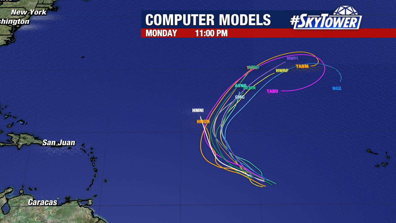
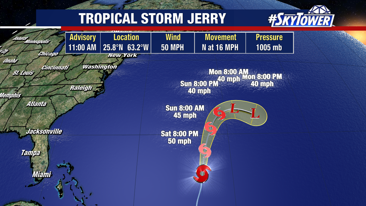
Many weather models now develop it into a tropical storm early this week. Regardless, there is high confidence that this will turn north and eventually away from the United States.
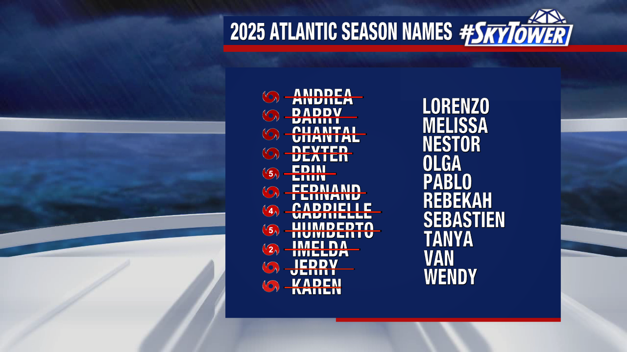
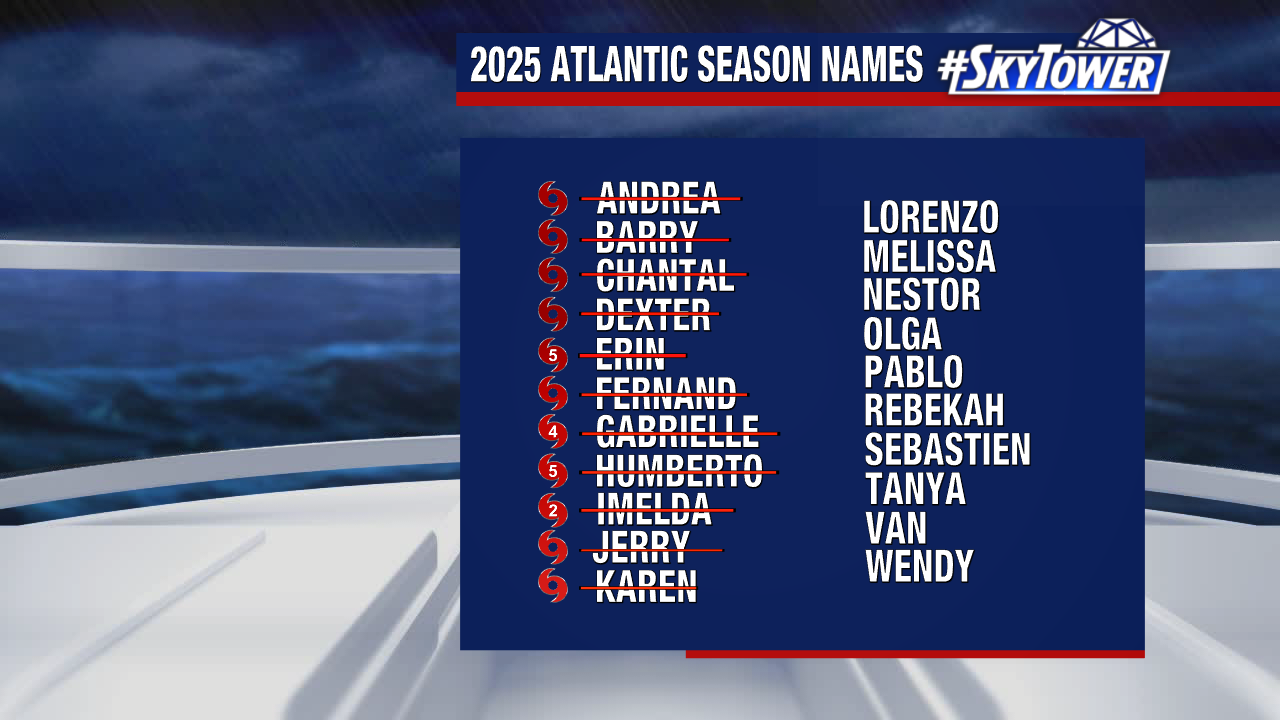
The next name on our list would be Lorenzo.