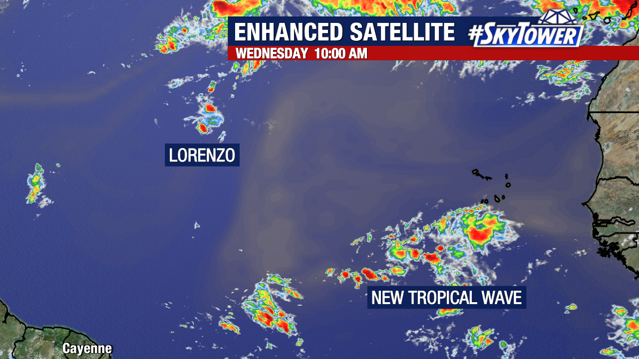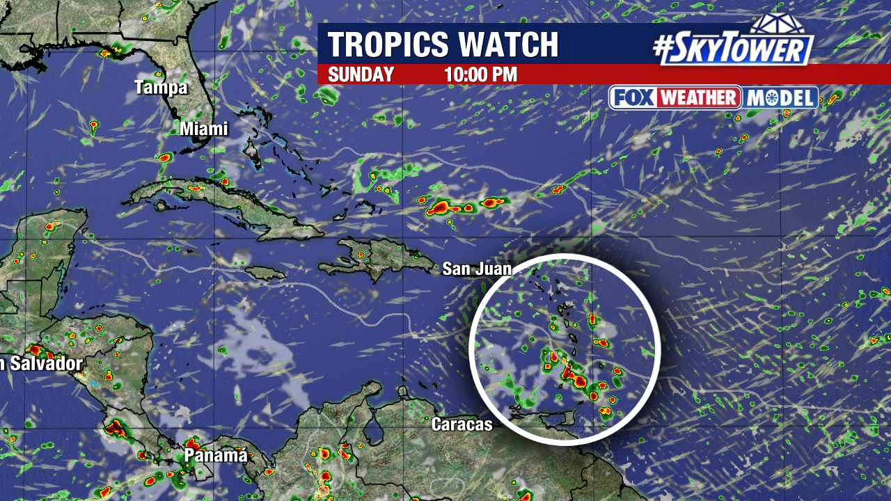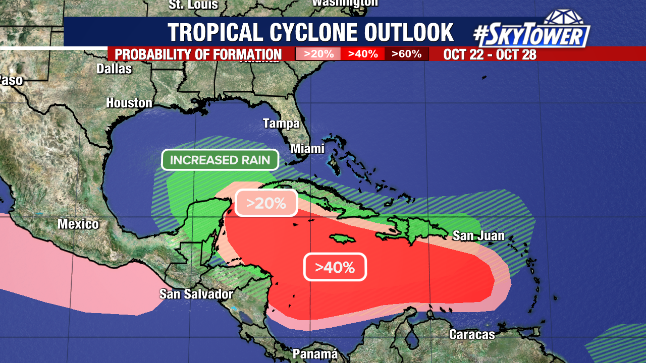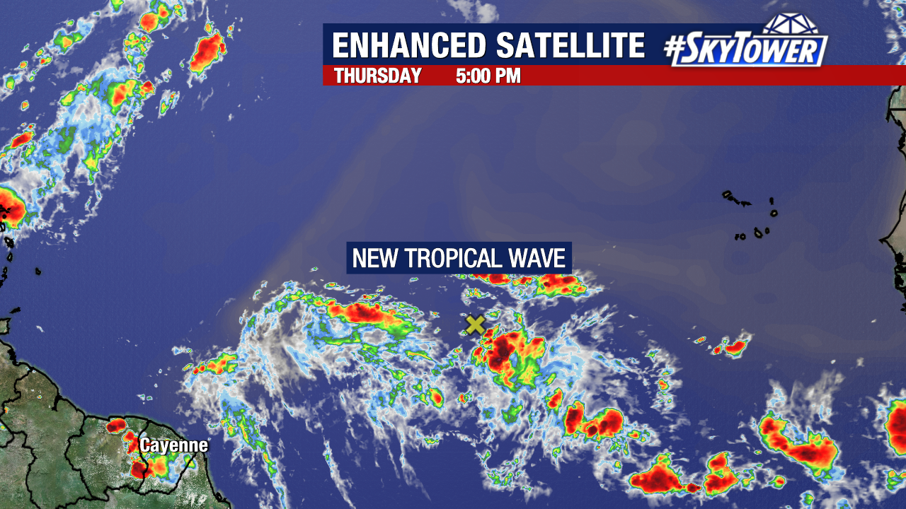
Over the next week or two we’ll monitor a tropical wave as it crosses the main development region and likely enters the Caribbean Sea early next week.
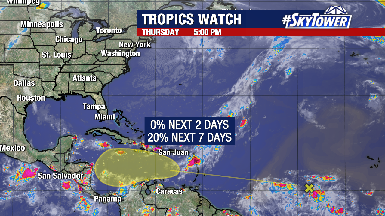
The National Hurricane Center has given the spot a low (20%) chance of formation within the next seven days.
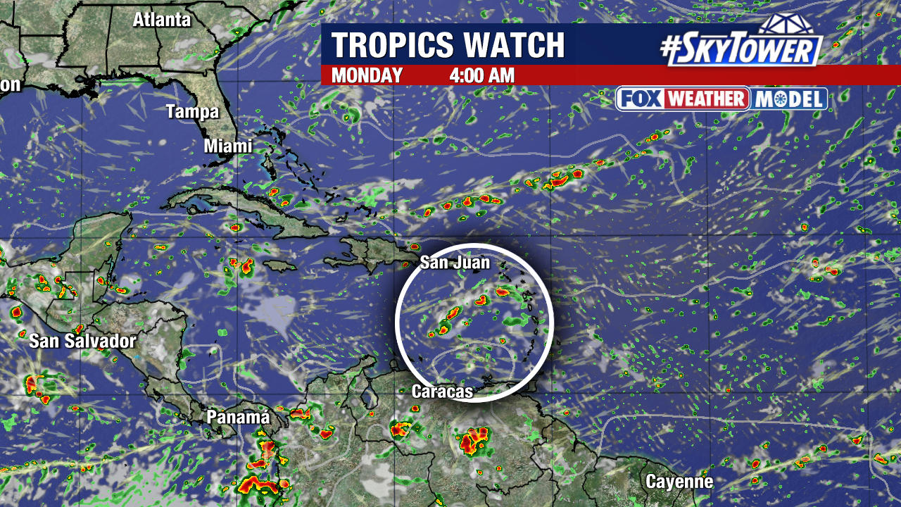
While short-term development is unlikely, conditions would become more favorable for formation if it makes it into the central and western Caribbean by the end of next week.
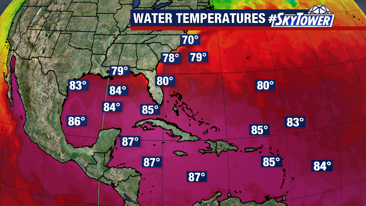
Waters are abnormally warm in this region and could support a tropical storm or hurricane.
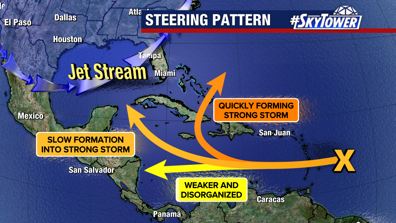
It’s far too early to accurately speculate on its exact path. The position of our jet stream, speed, and strength of the storm are still unknown at this time.
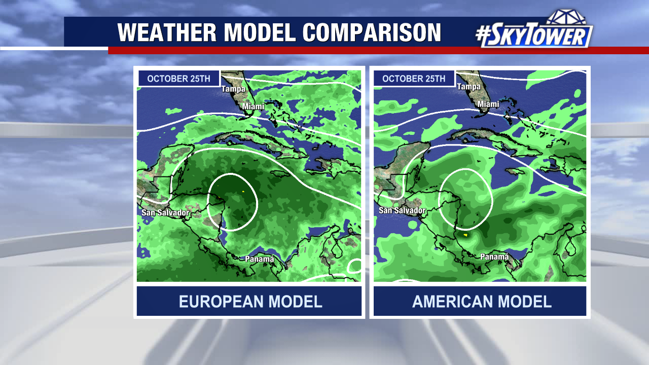
It should also be noted that even though there is a growing signal that something could form, many weather models still do not show anything developing. The mainland U.S. will have well over a week to monitor its progress.
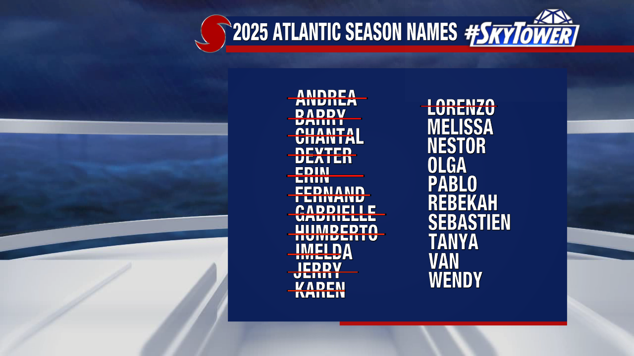
Melissa would be the next name up from our 2025 storm naming list.