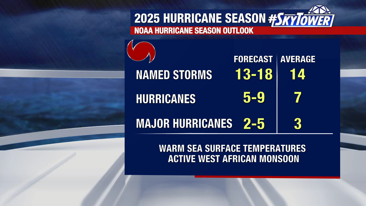
NOAA has released its latest 2025 hurricane season outlook. This update still calls for an active season, though the number of expected storms has been slightly lowered.
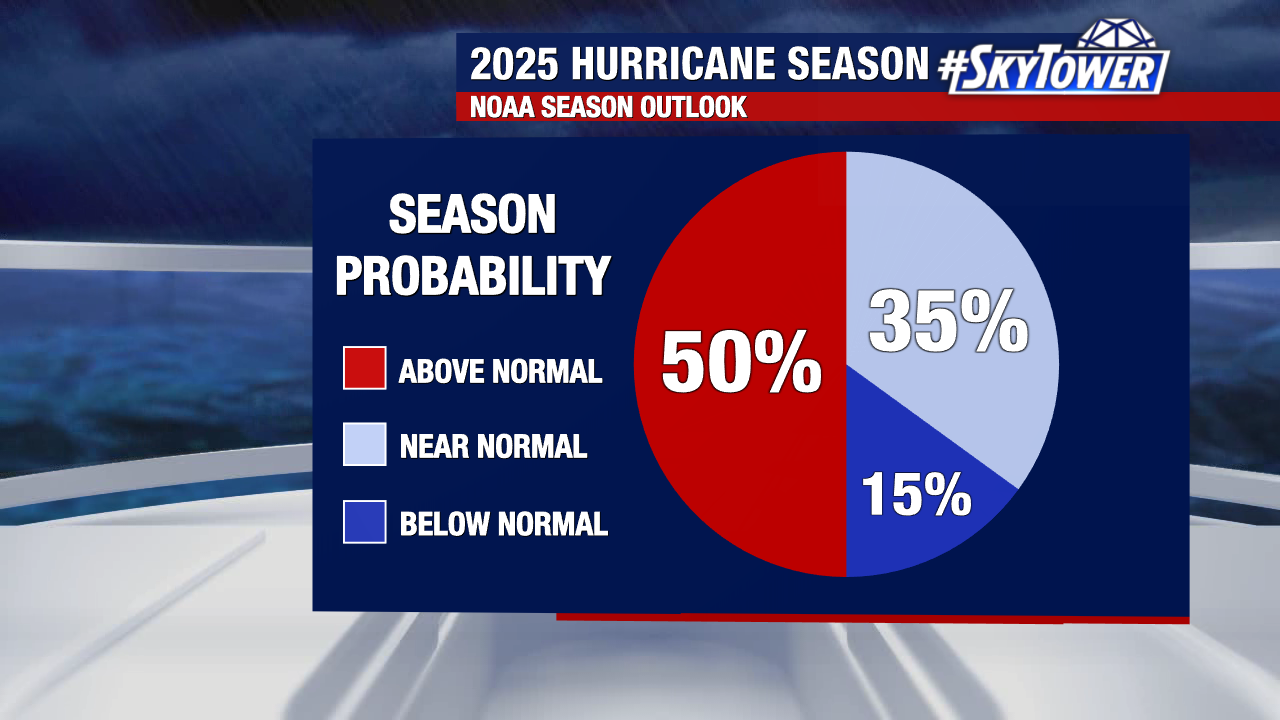
They now predict a 50% chance (down from 60% in their previous forecast) of an above-average season. It is important to remember that this forecast is not specific to Florida.
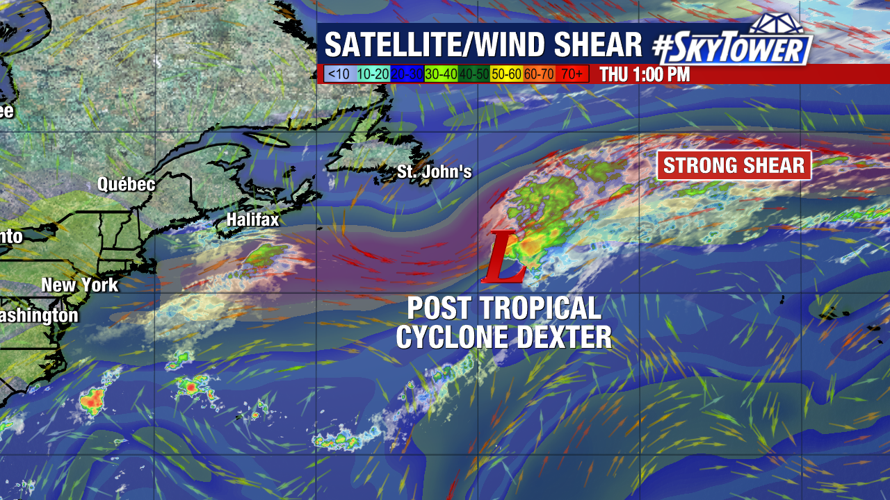
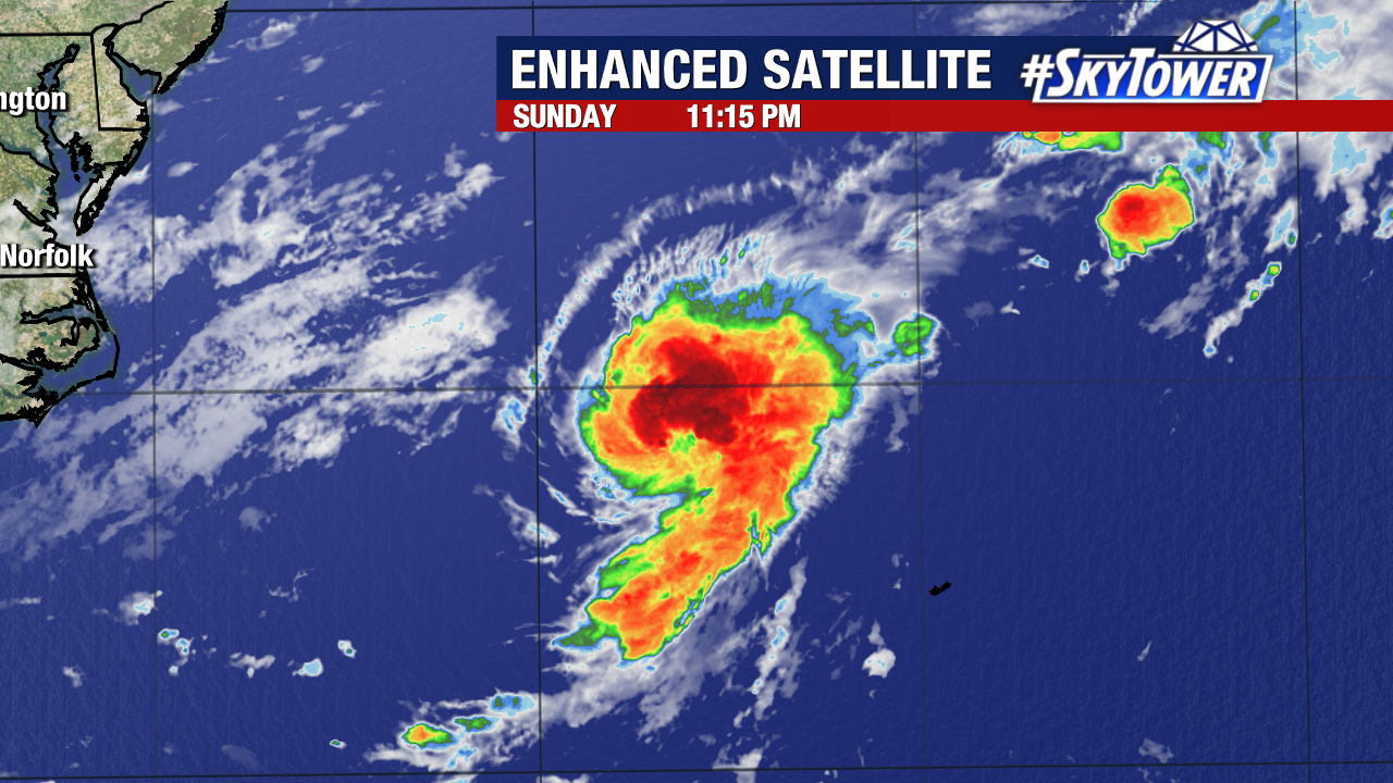
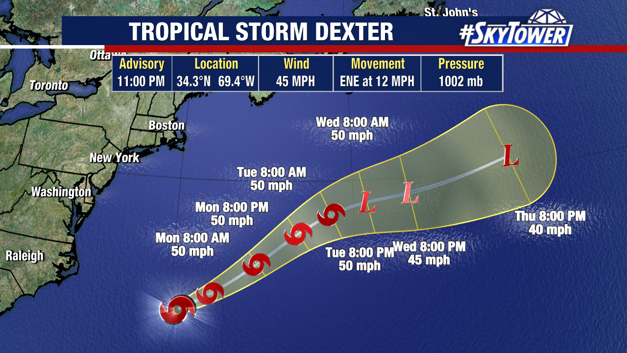
Dexter is now a post-tropical cyclone. It succumbed to powerful upper level winds in the north Atlantic, becoming an extratropical cyclone this morning.

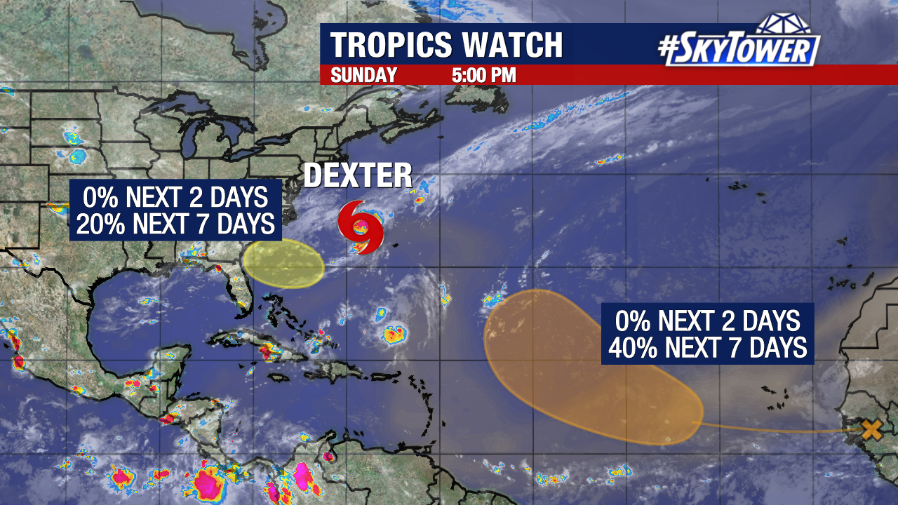
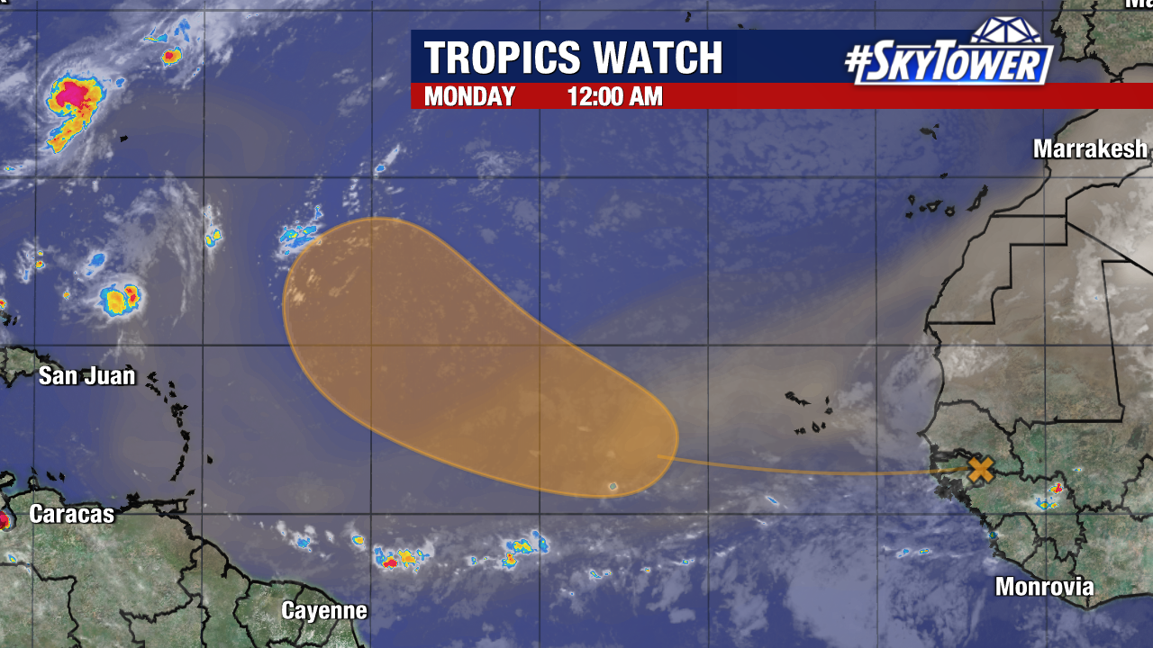
We are currently watching two areas for possible development in the tropics. Neither provide any immediate issues to the United States.
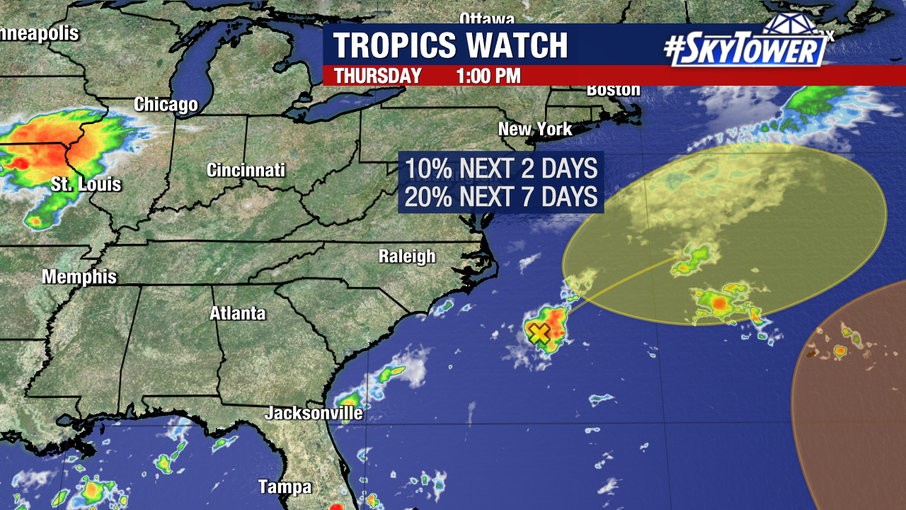
A weak area of low pressure still has a small chance of becoming a named storm as it pulls away from the U.S. on a similar path to Dexter.
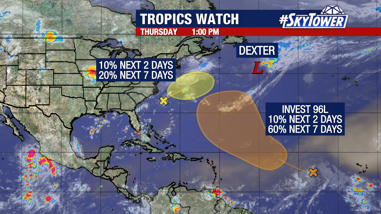
In the central tropical Atlantic we are still monitoring a tropical wave (Invest 96L) with increasing chances of development.
There is growing confidence that a weakness in high pressure to its north will help steer this system into the central or west Atlantic next week.
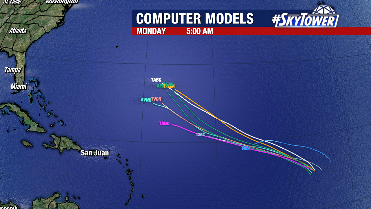
Early weather model plots also support this gradual turn north.