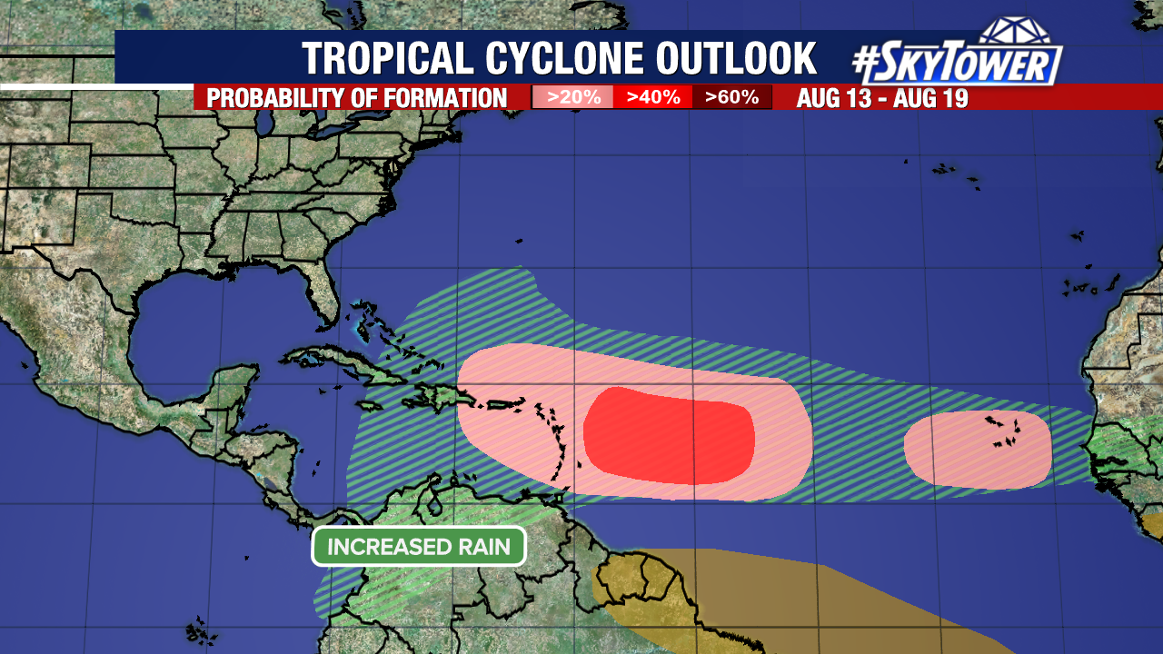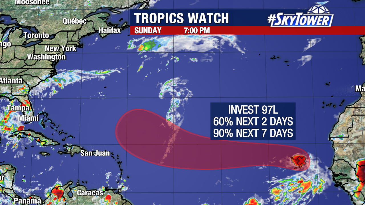
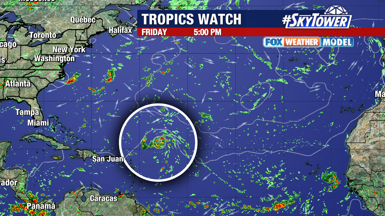
A robust tropical wave (Invest 97L) will likely develop into a tropical depression or storm within the next few days. The National Hurricane Center now gives it a high 90% chance to develop within the next week.
While there is growing confidence that this system will stay out of the Caribbean Sea, it’s too early to confidently predict where it may go from there.
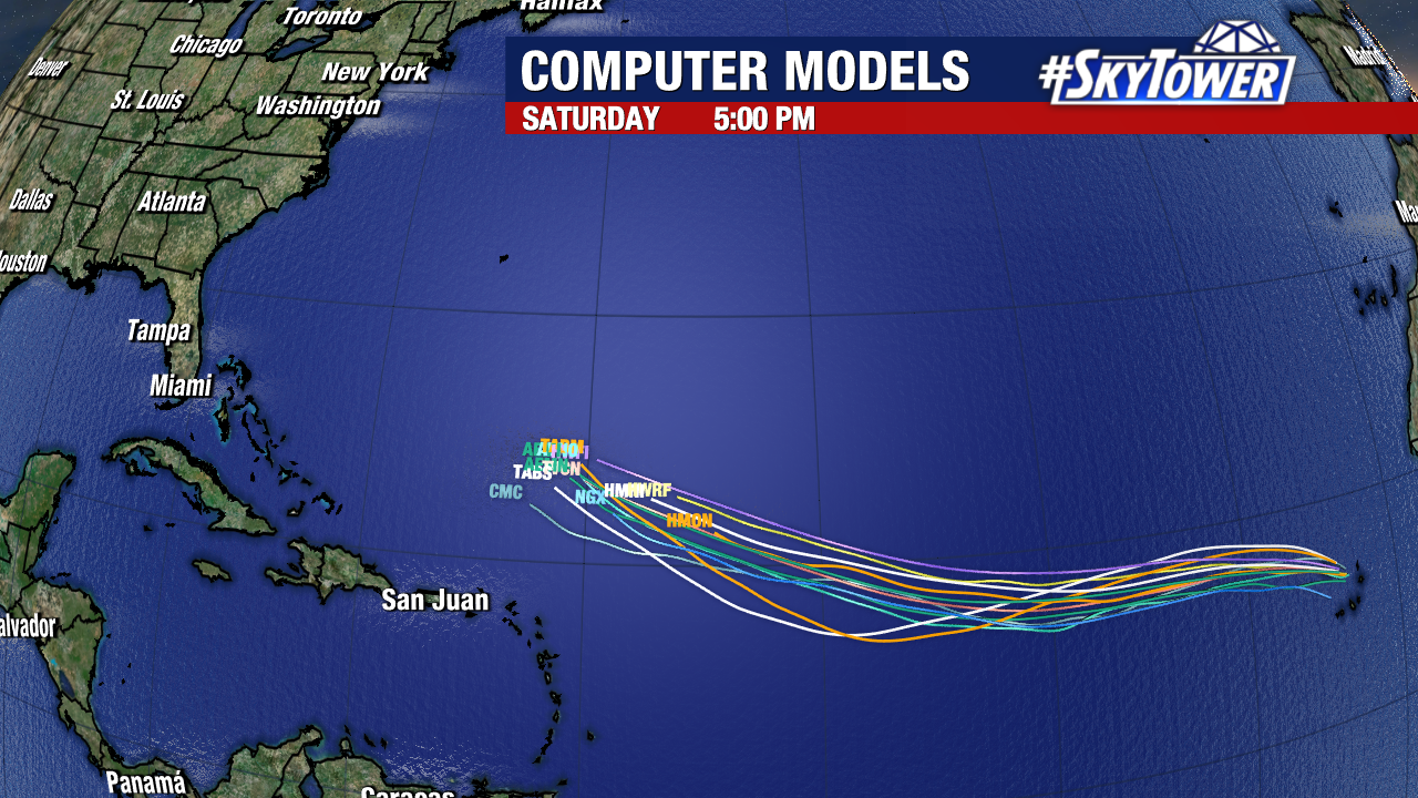
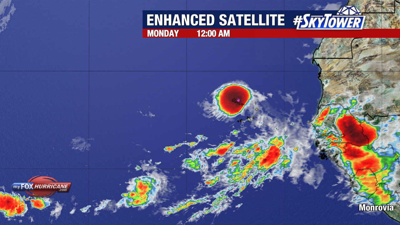
97L will be battling slightly cooler waters and pockets of Saharan dust over the next few days. By the time it nears the Lesser Antilles, it should move into a more favorable environment for strengthening.
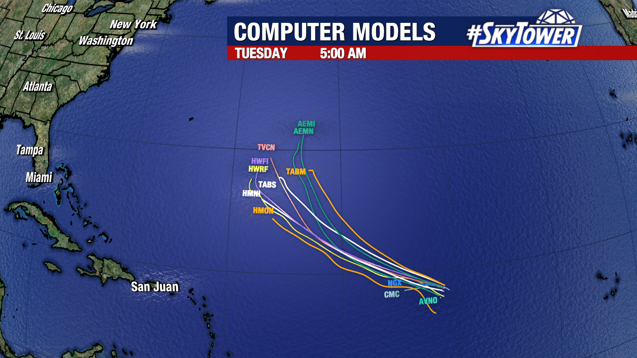
Questions remain regarding the storm’s future strength and upper level steering that would impact its ultimate track. Additionally, weather models will become significantly more reliable after a storm actually forms.
For now, this disturbance is roughly 4,000 miles away from the mainland United States, giving us plenty of time to monitor its progress. “Erin” is the next name up on our storm naming list.
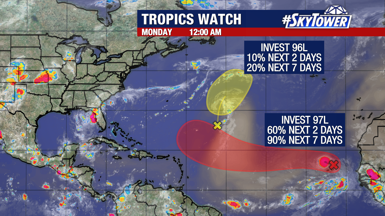
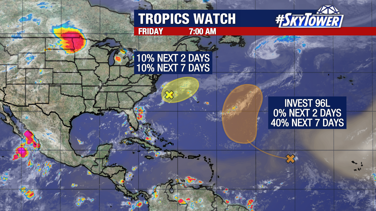
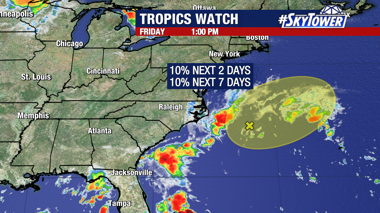
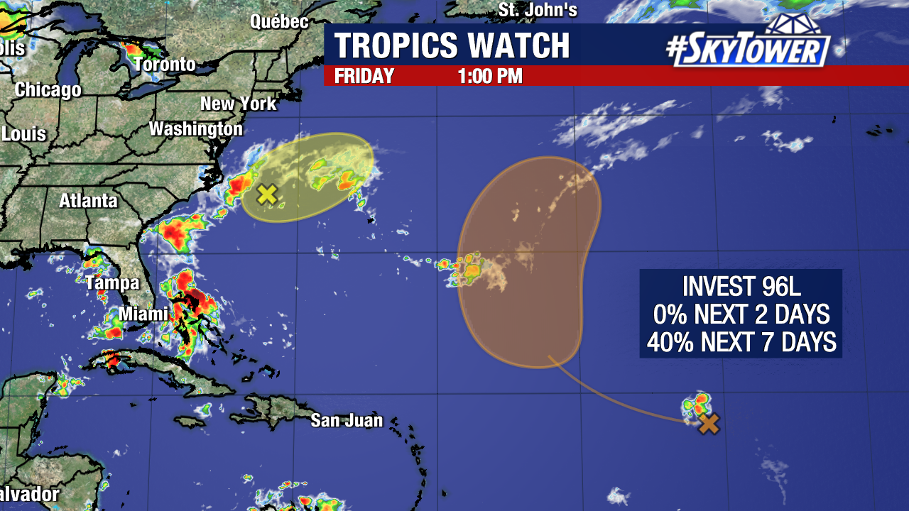
Meanwhile, a struggling Invest 96L (shown in yellow) in the central tropical Atlantic will have a low chance of developing within the next few days. Its formation would be inconsequential to the United States.