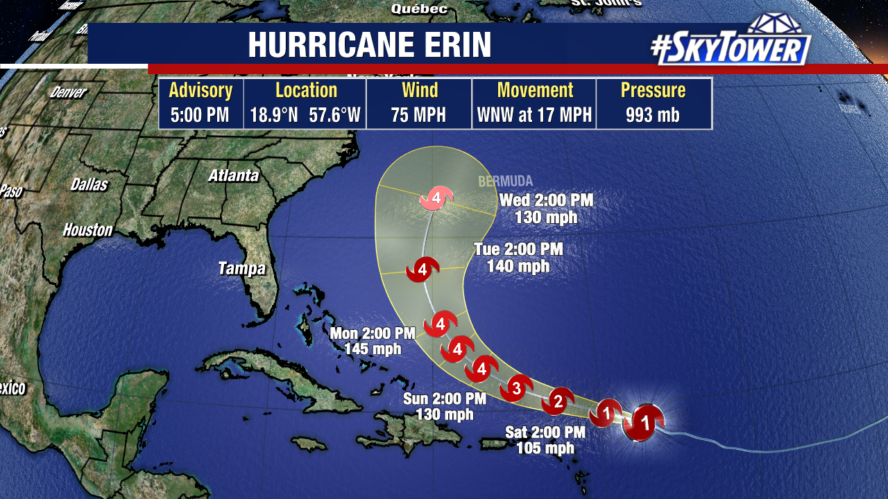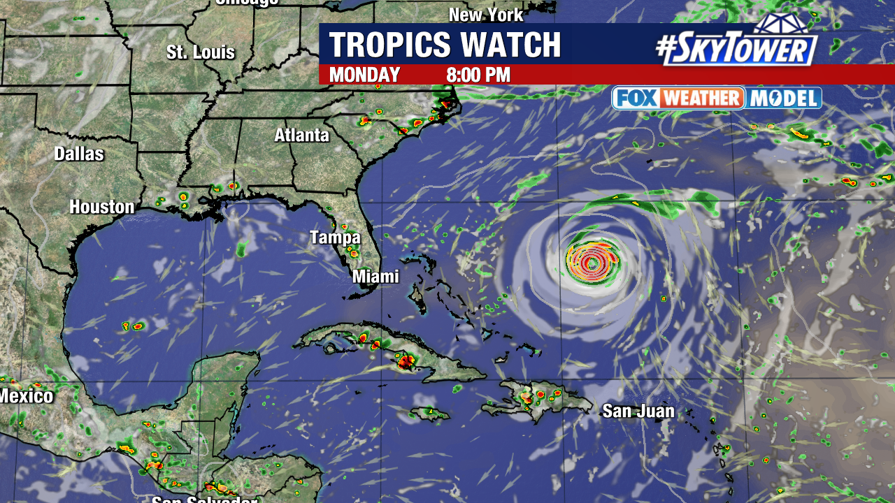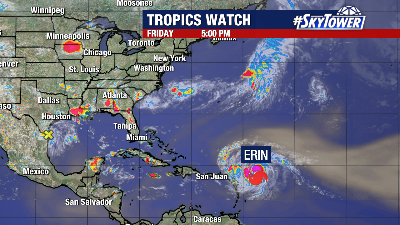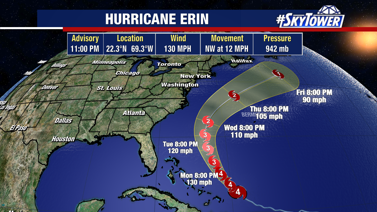
Hurricane Erin has reorganized into a Category 4 storm tonight and has gradually grown in size over the past few days.
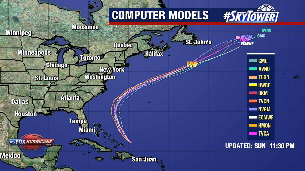
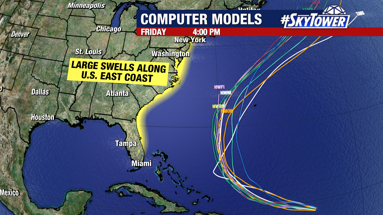
There has been no significant change to its projected path. The storm’s center is expected to pass several hundred miles east of Florida before curving northeast, keeping its core entirely offshore of the U.S. East Coast.
Even without a direct hit, Erin’s close pass will generate life-threatening rip currents and powerful swells along much of the Eastern Seaboard. Mandatory evacuations have been ordered for parts of Hatteras Island, North Carolina, where 15–20 foot breaking waves are anticipated.
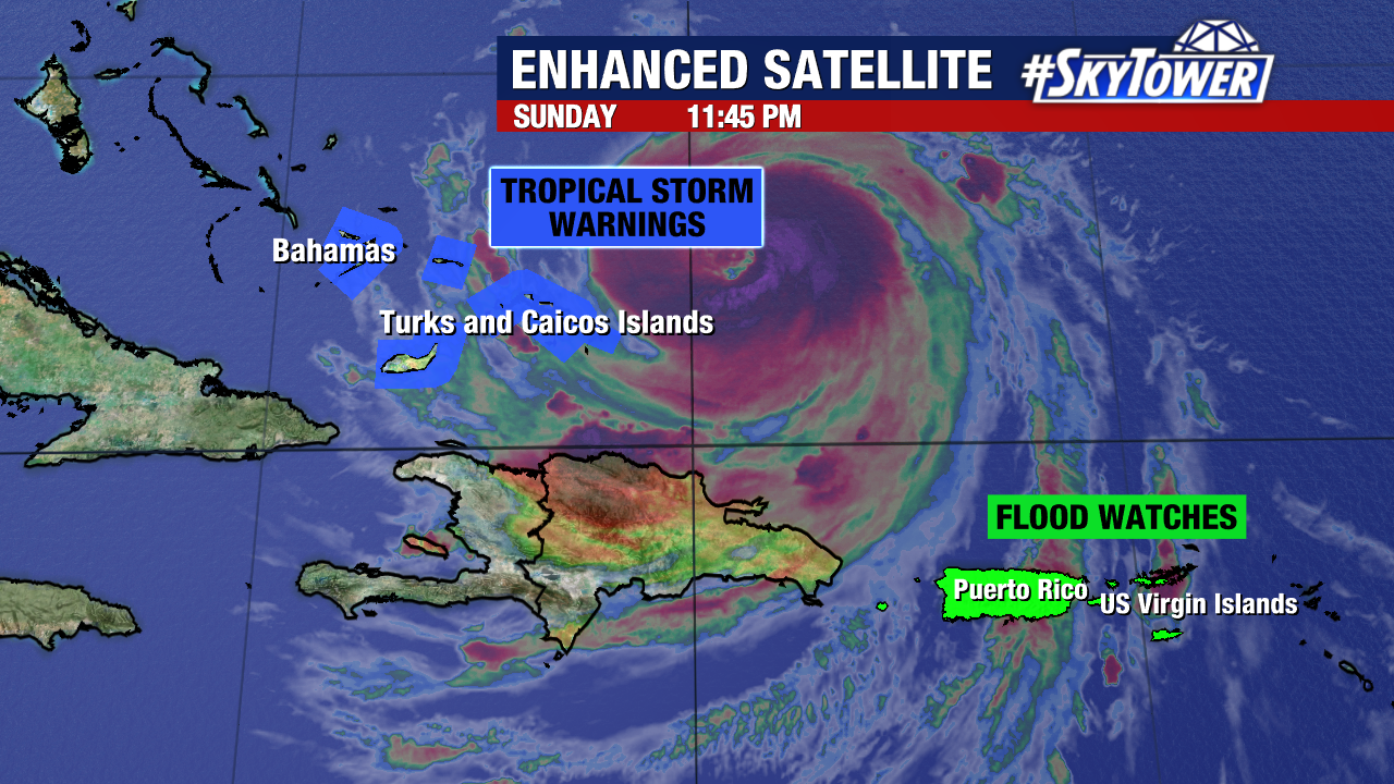
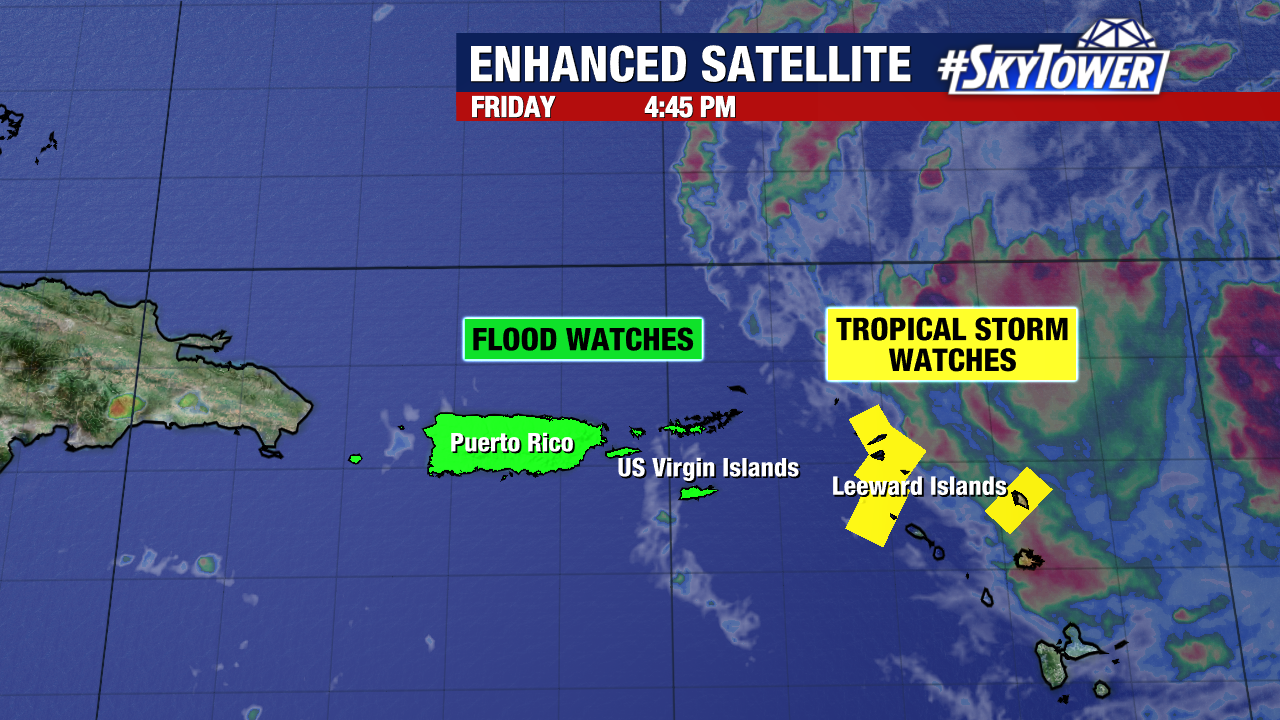
Tropical Storm Warnings remain in place for the Turks and Caicos Islands and parts of the Bahamas. Flood Watches also continue for Puerto Rico and the U.S. Virgin Islands.
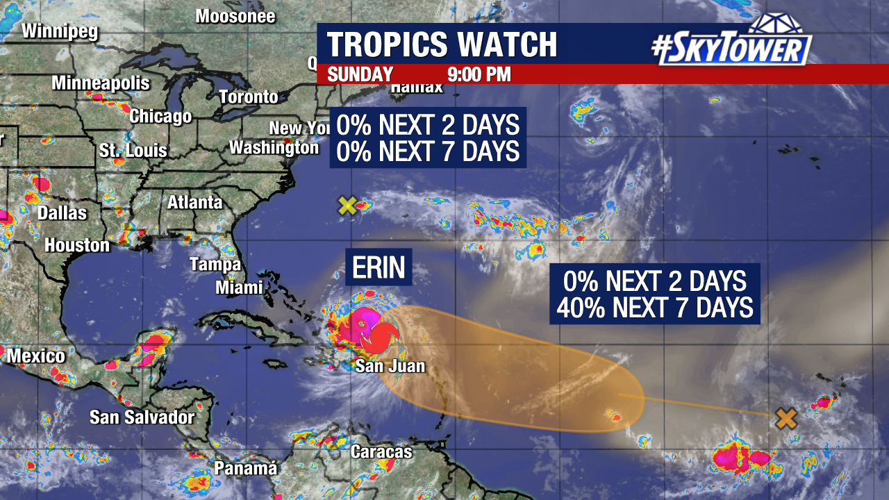
Meanwhile, a tropical wave in the central Atlantic is showing increasing signs of development. The National Hurricane Center now gives it a 40% chance of formation within the next 7 days.
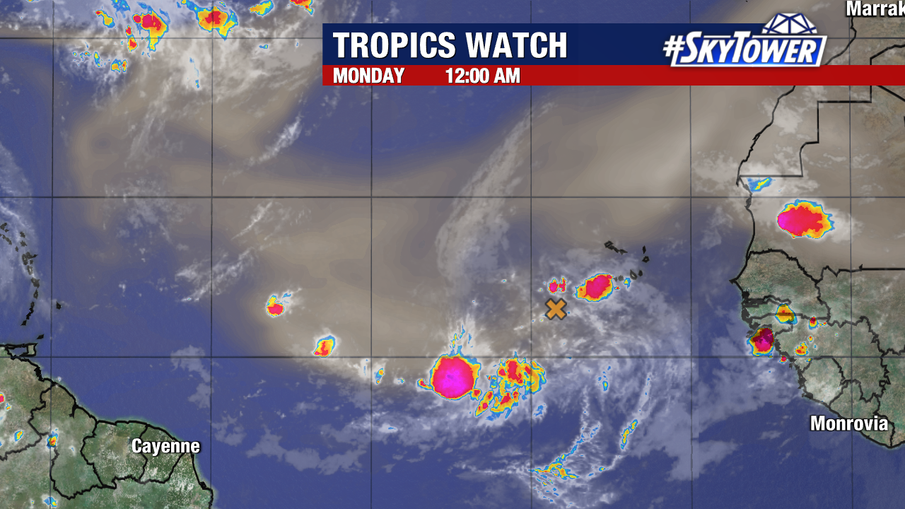
It is far too early to know its potential path. The disturbance is still more than 3,000 miles away, giving us plenty of time to monitor its progress.

The next name on this year’s Atlantic storm list is Fernand.