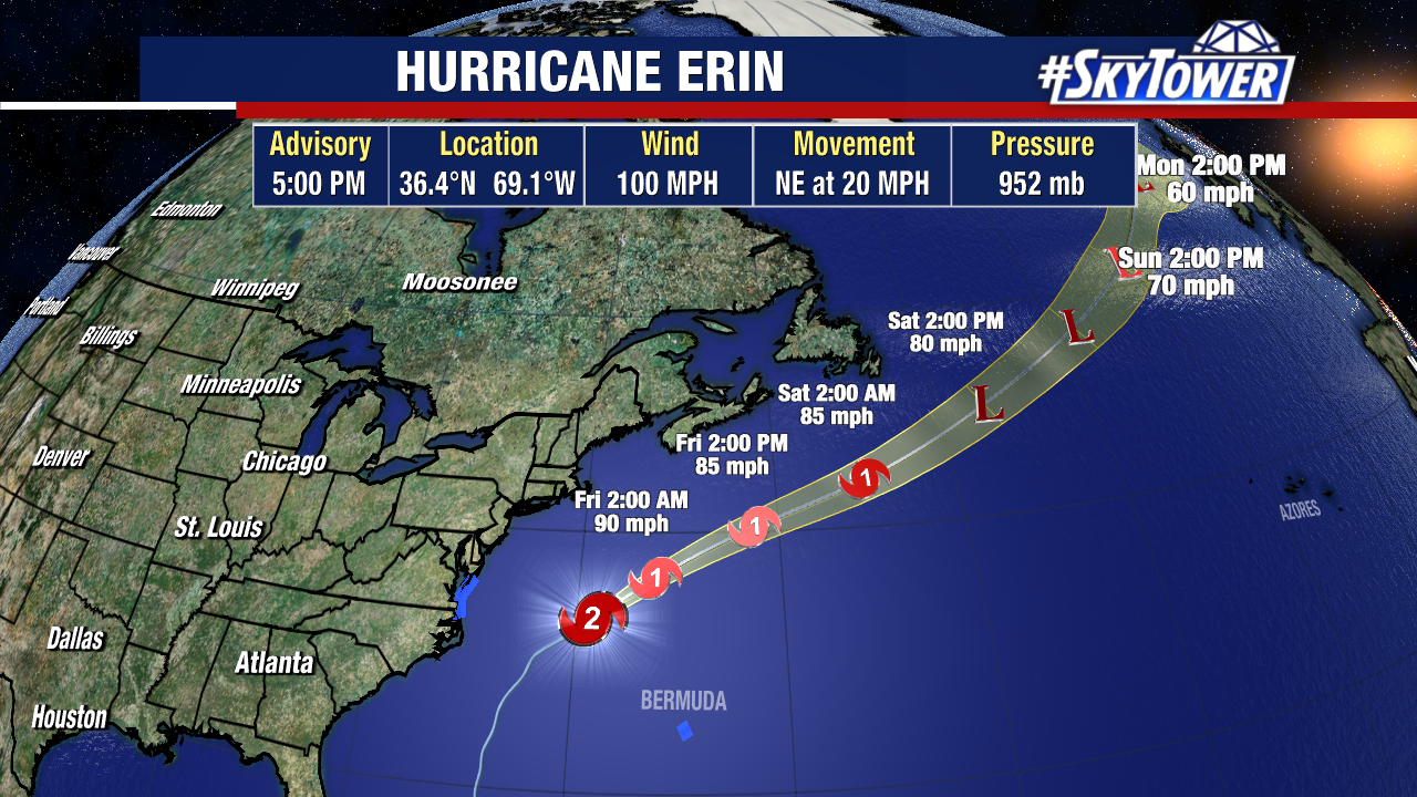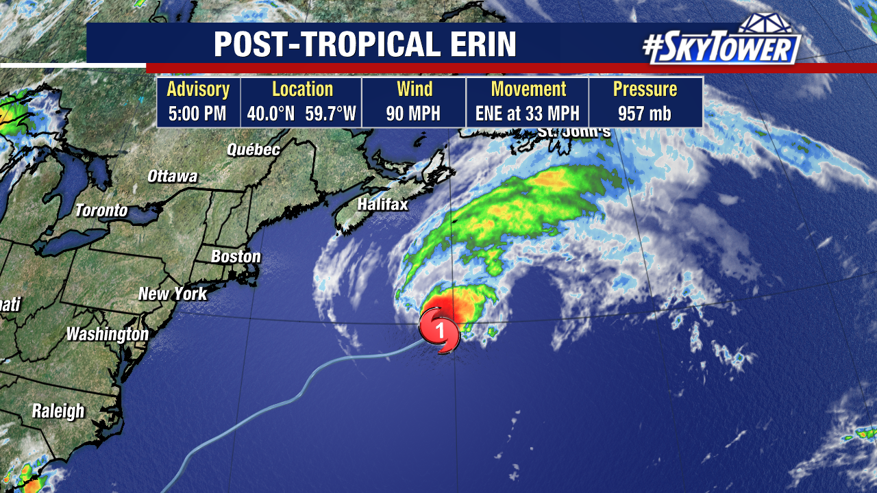
Erin is now a post-tropical cyclone, moving very quickly (forward at 33mph) away from the United States.
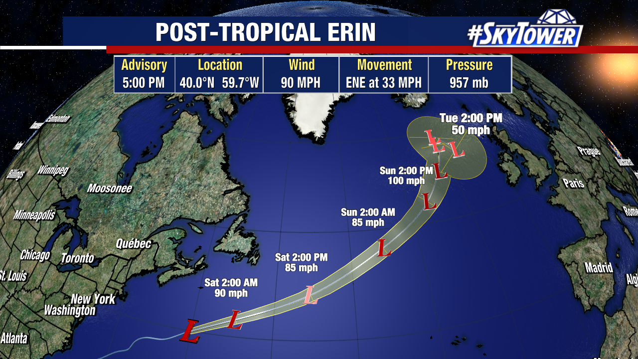
This is the last advisory for Erin. Its remnants may eventually become a player in Europe’s local forecast next week.
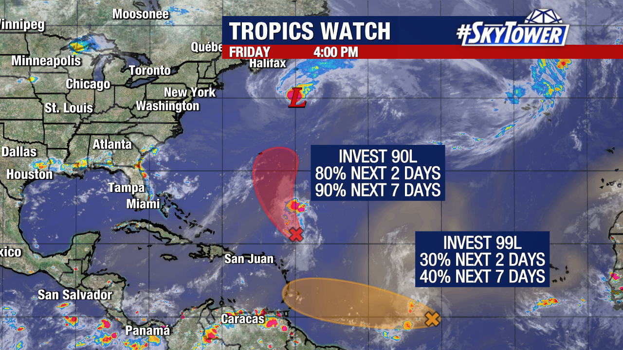
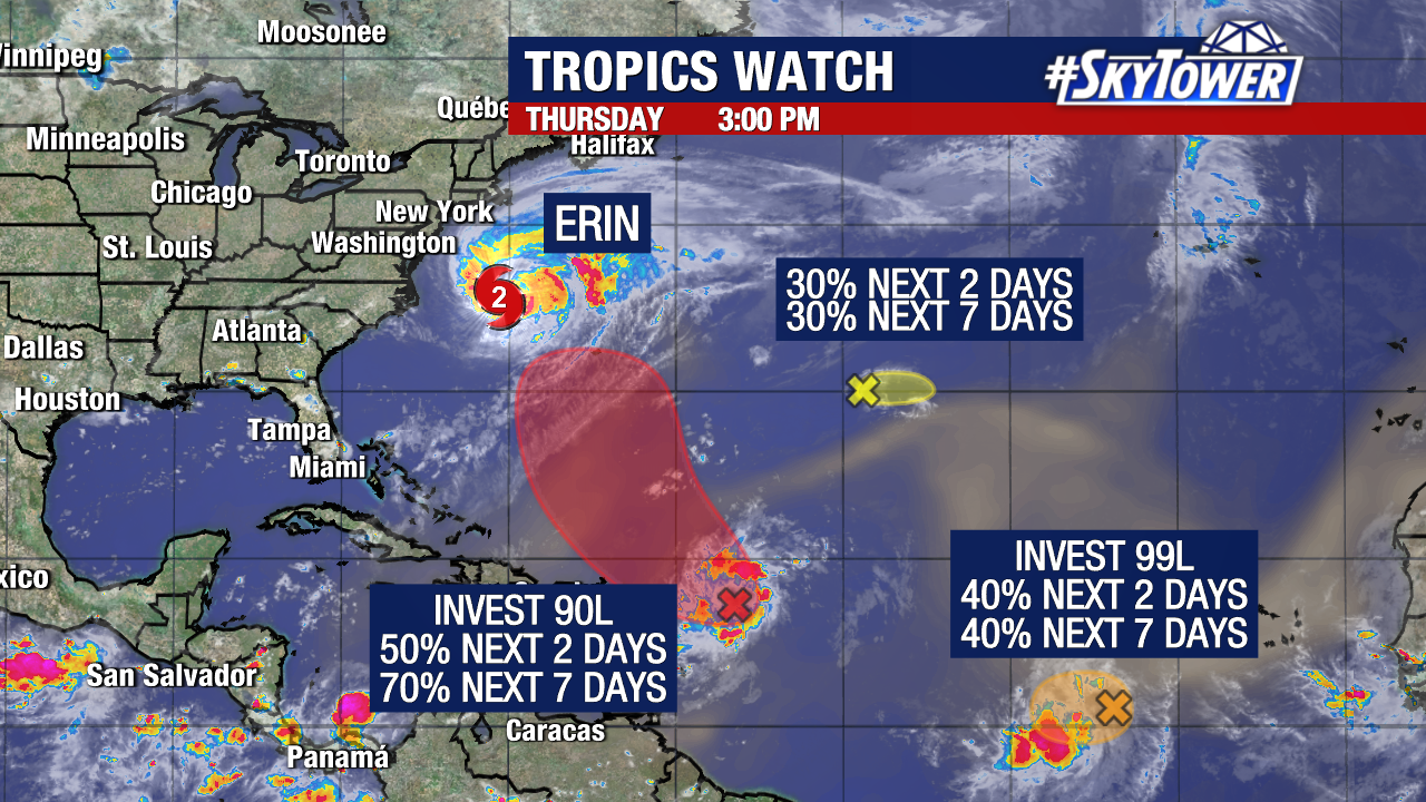
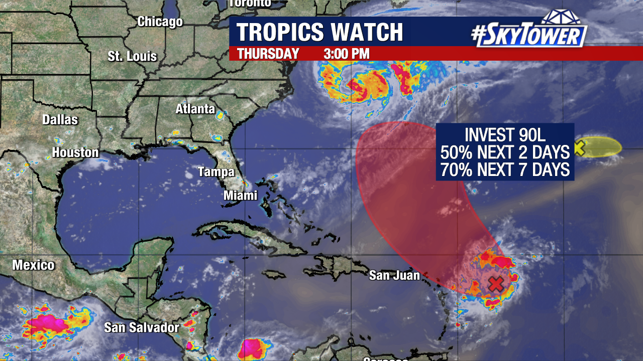
Meanwhile we are tracking two other disturbances in the Atlantic. Neither brings any immediate threat to Florida or the United States.
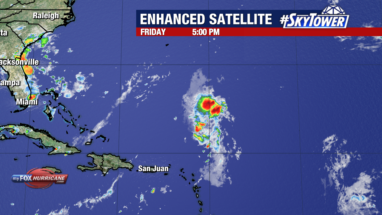
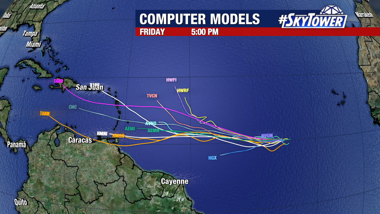
Invest 90L will likely become a named storm within the next day or so, and possibly a hurricane after that. Upper-level steering should pull this north and eventually recurve it away from the U.S.
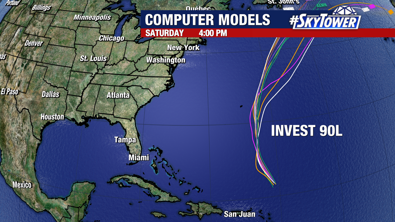
Residents of Bermuda should monitor the development of this system carefully.
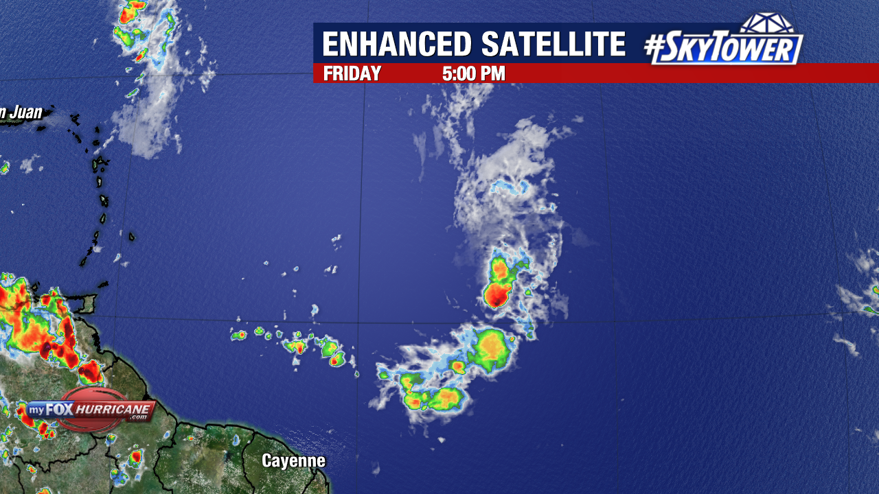
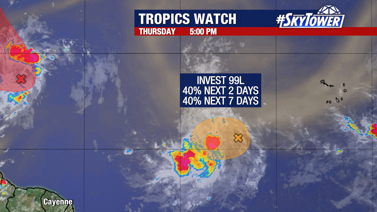
Meanwhile, Invest 99L now has a 40% chance of formation as it approaches the Windward Islands early next week. While a short-lived tropical depression could form from this disturbance in the short-term, it could enter into a favorable environment for development late this weekend into the start of next week.
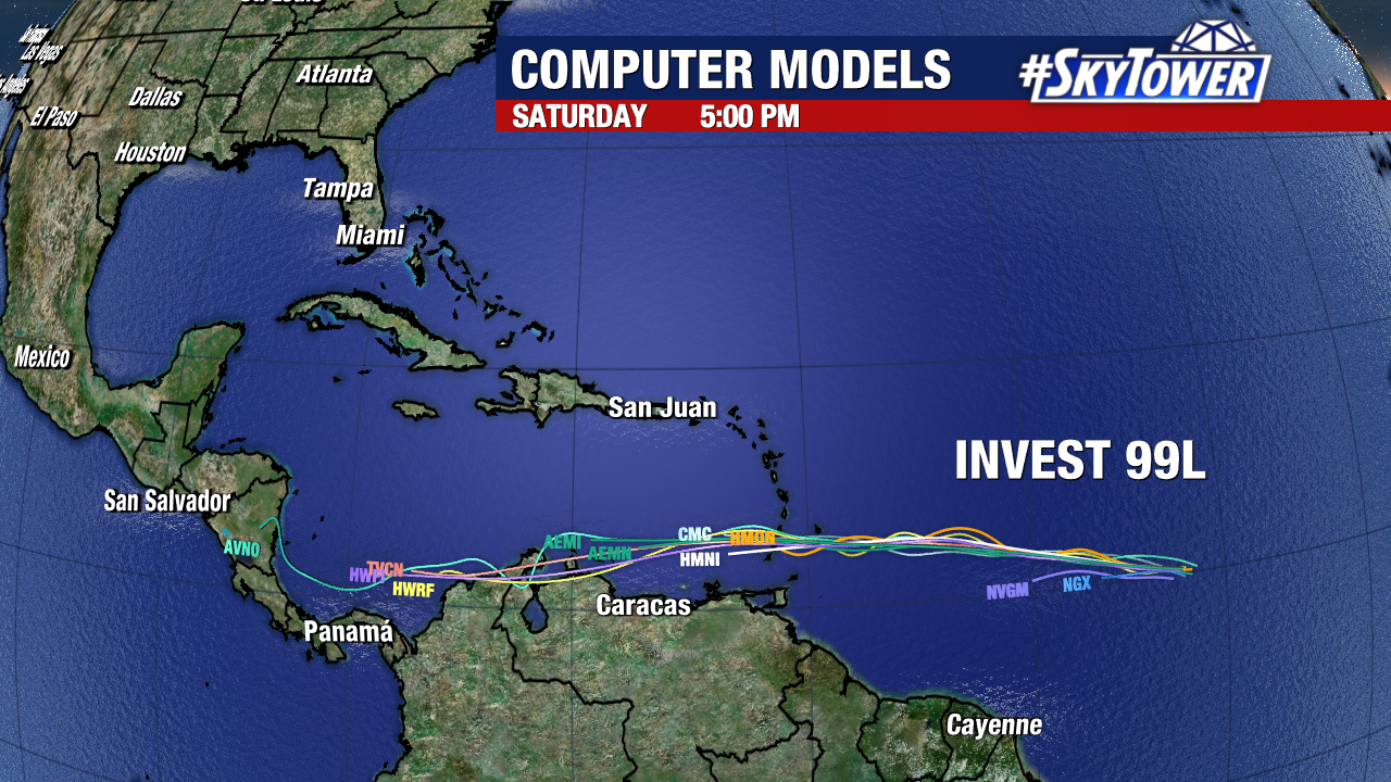
The Windward islands will need to keep an eye on 99L over the next few days.
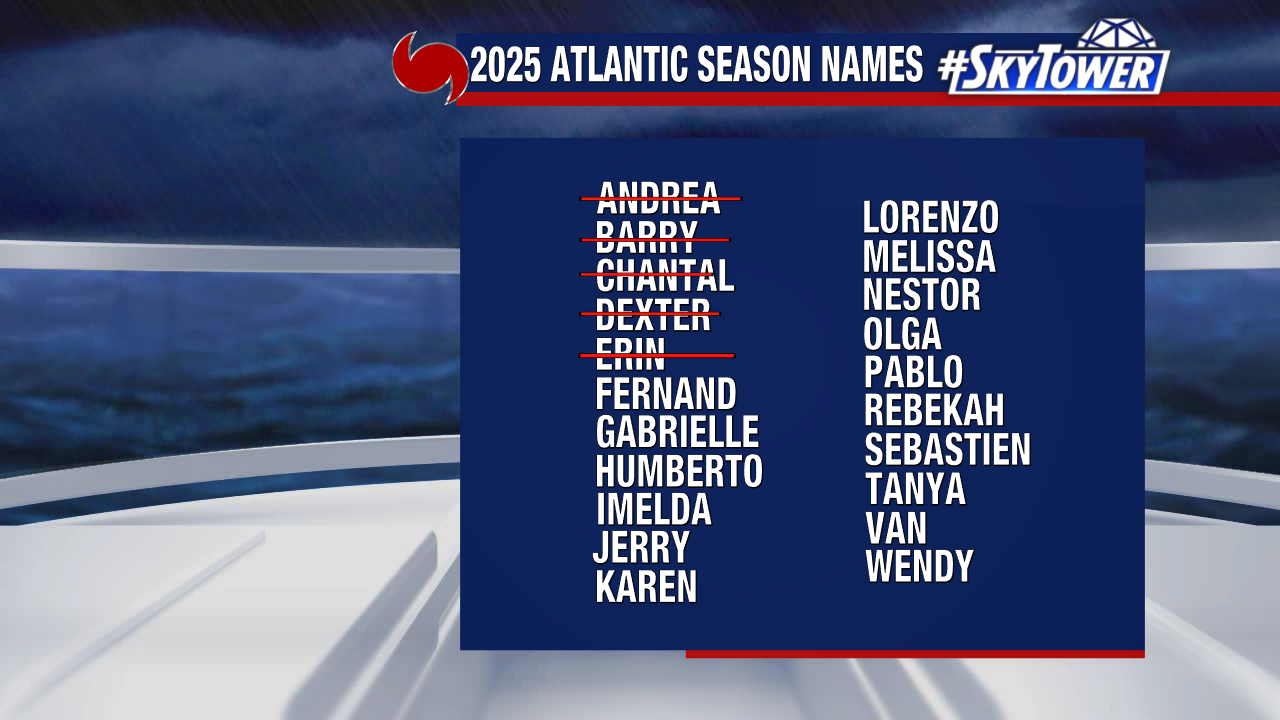
The next name on our 2025 storm naming list is Fernand.