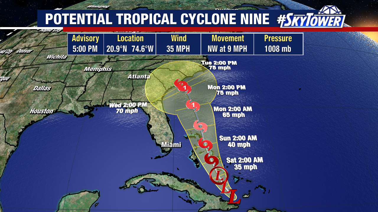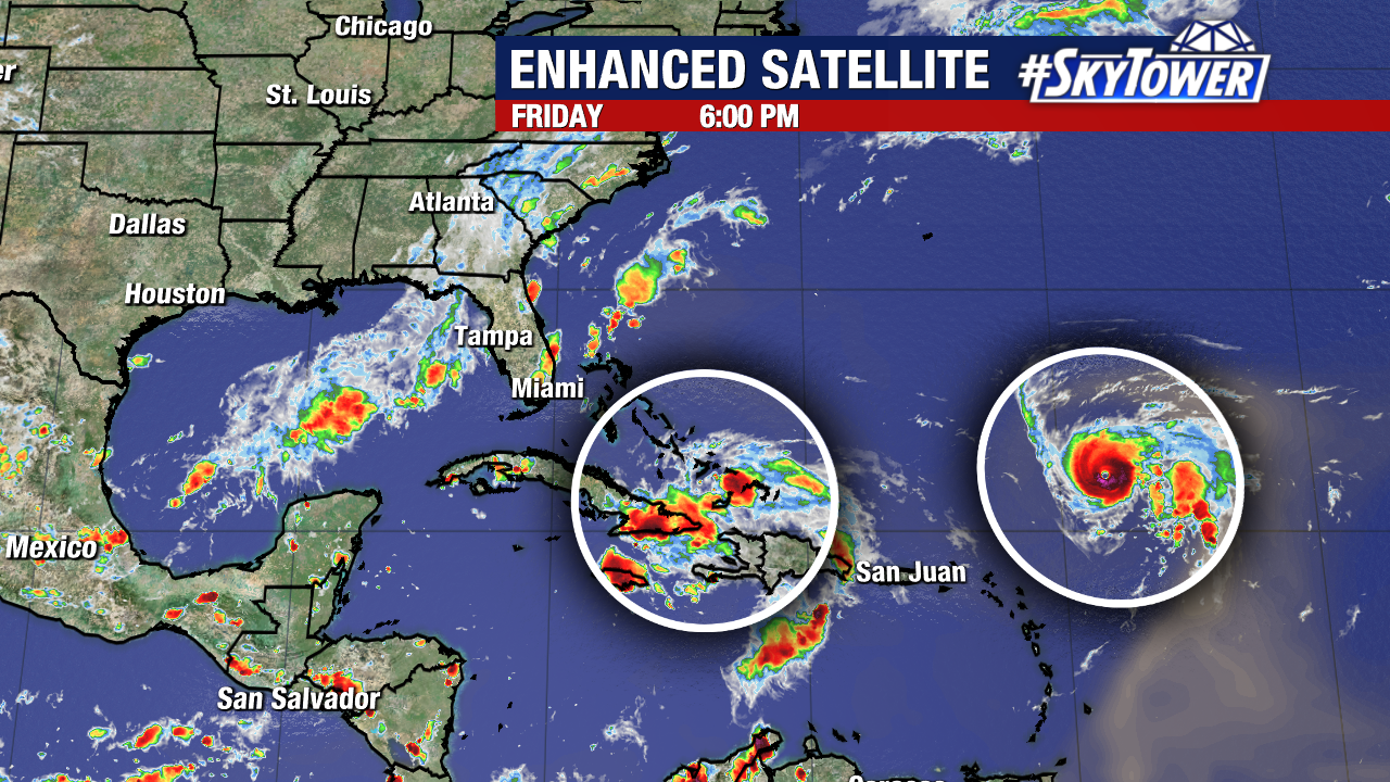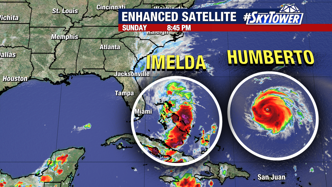
Imelda and Humberto are currently the only active named storms in the Atlantic.
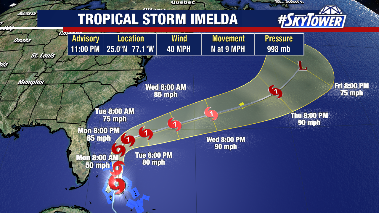
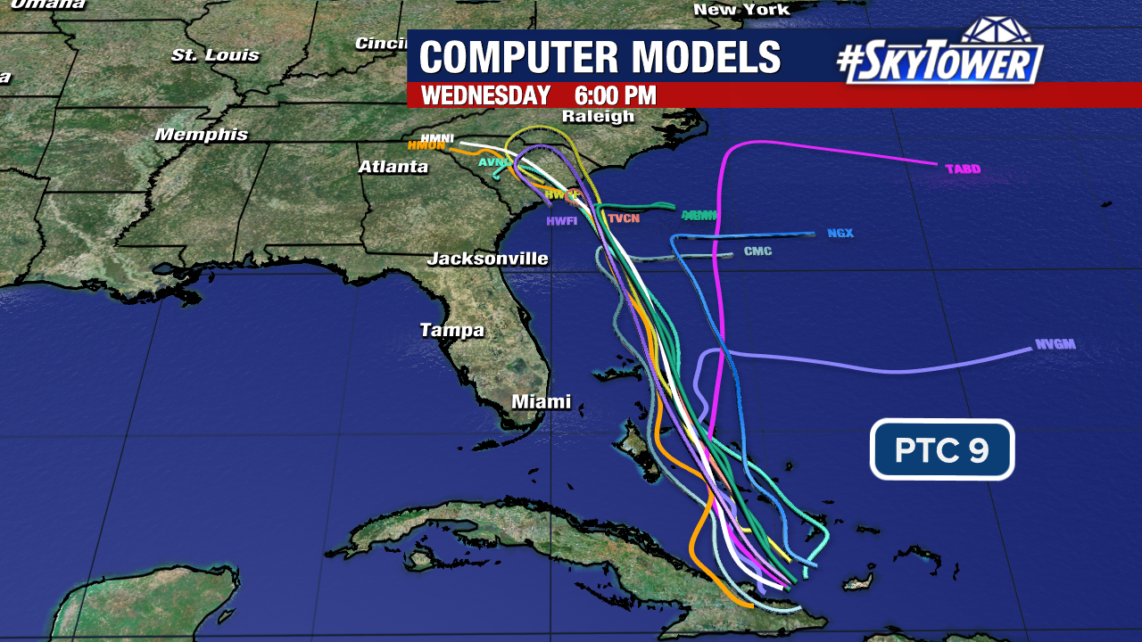
Tropical Storm Imelda is still expected to strengthen into a hurricane by early next week.
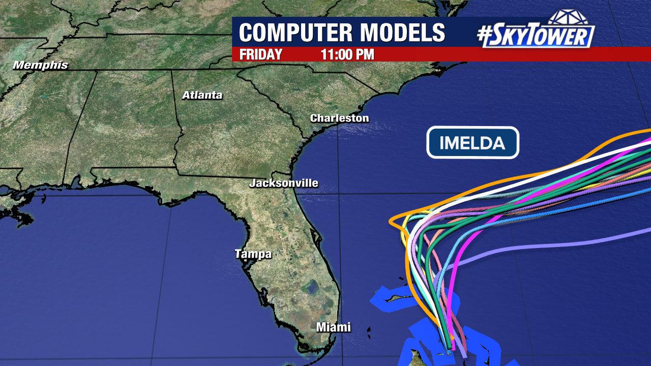
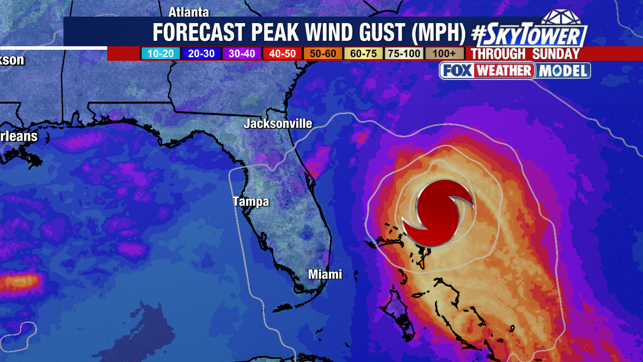
Weather models indicate with high confidence that it will stay well off the east coast of our state. As a result, tropical storm watches for Florida’s east coast were dropped this evening. Tropical storm warnings still remain in effect for parts of the Bahamas.
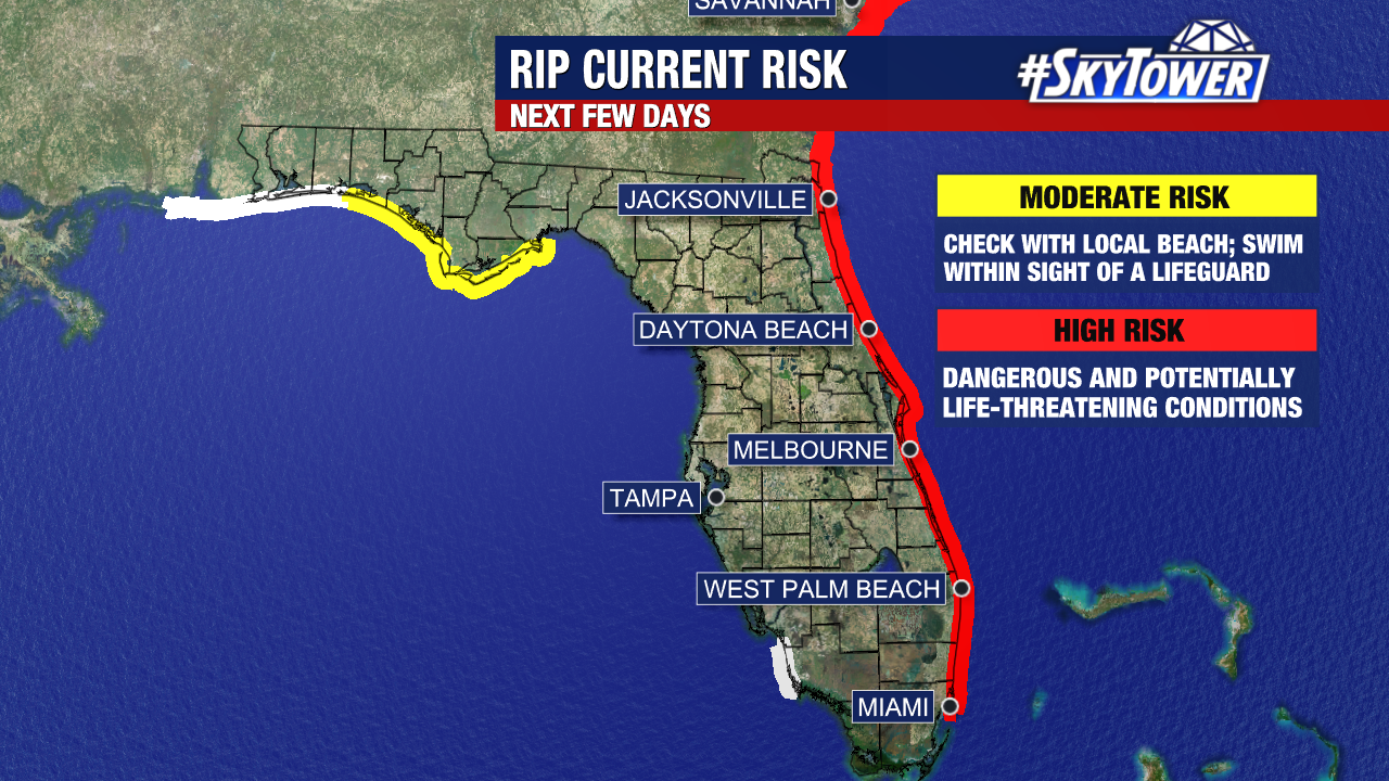
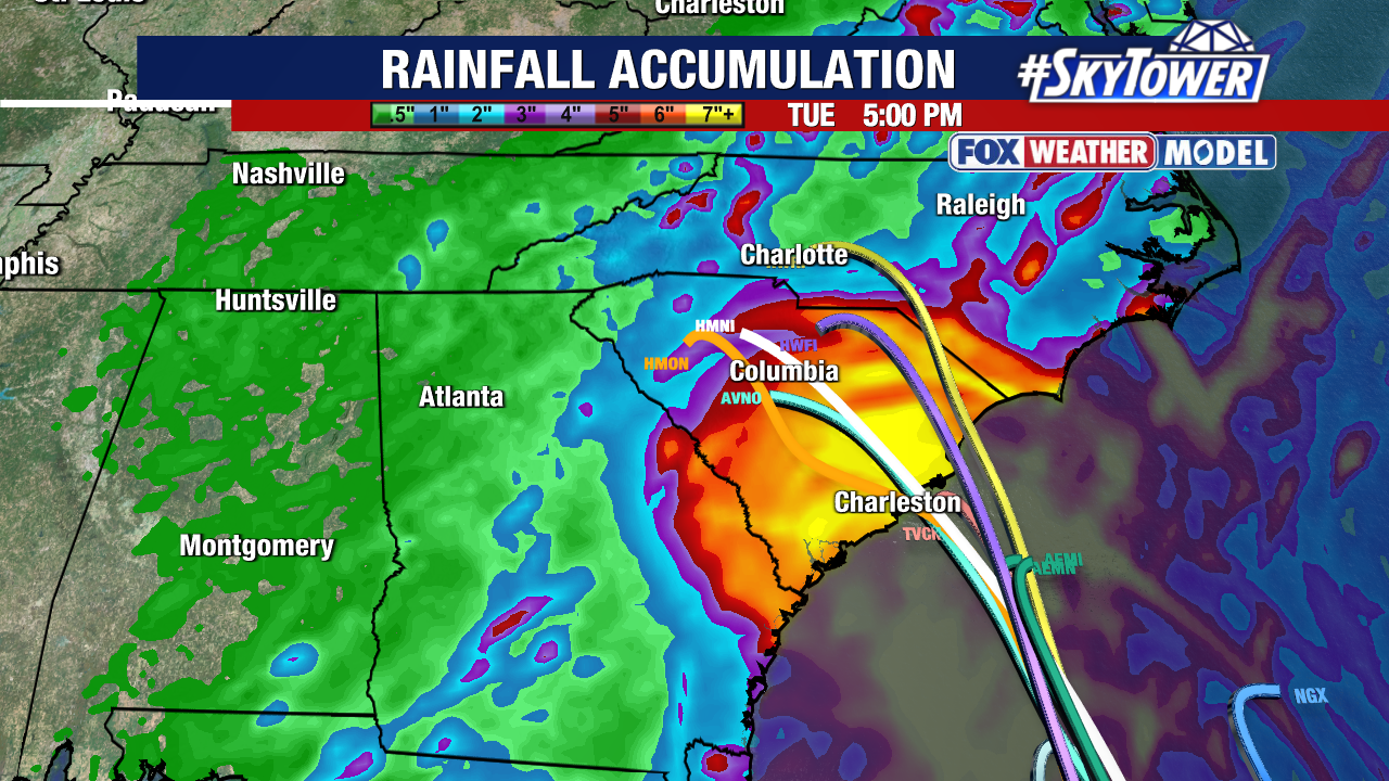
Rip currents and dangerous boating conditions are expected across the coasts of Florida, Georgia, and North/South Carolina.
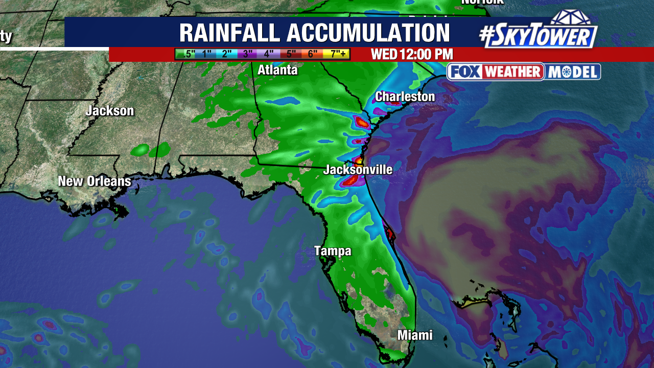
The majority of the damaging winds and excessive rainfall from Imelda should remain off the shoreline.
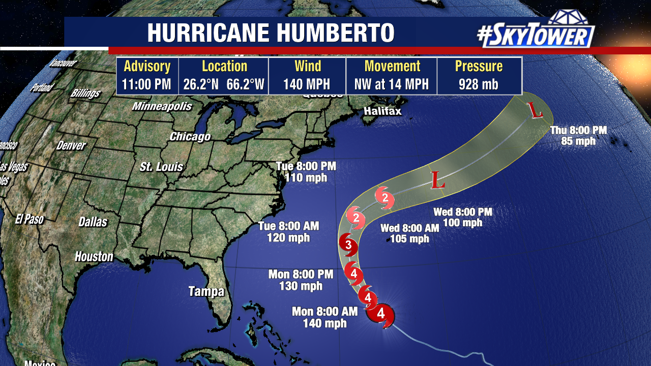
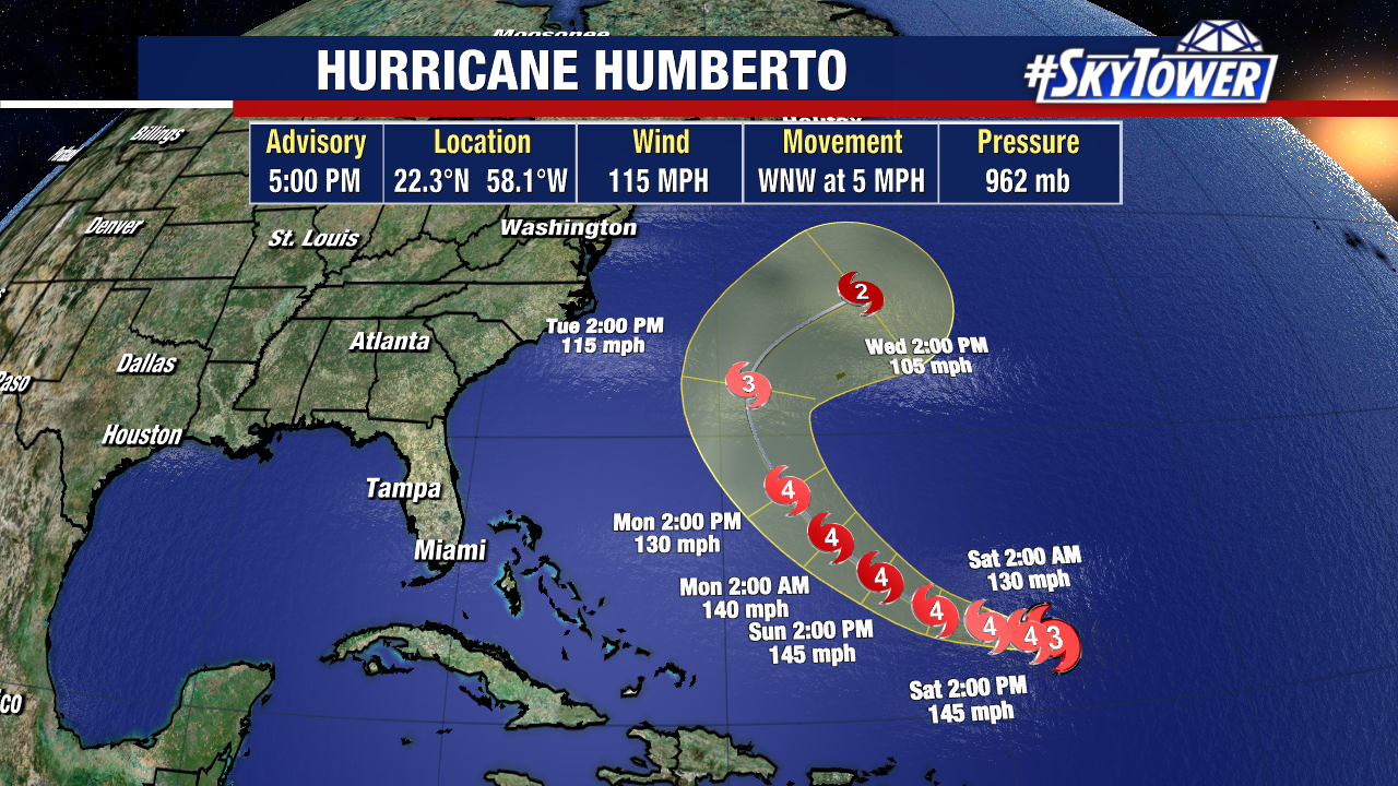
Major Hurricane Humberto poses no threat to the United States, but has prompted a tropical storm watch for Bermuda. The hurricane should slowly weaken over the next few days. The latest forecast for Humberto has it becoming a post-tropical system by the middle of next week.